July is Canada’s most active tornado month. What can we expect?
We’ve seen 30 tornadoes across Canada so far this year. Here’s what you can expect heading into Canada’s most tornadic month on average
A steady drumbeat of severe weather across the country in recent weeks has pushed Canada’s tornado count about halfway to its annual number by the beginning of July. Ontario and Saskatchewan are tied with 8 confirmed tornadoes each.
Now that we’re in Canada’s most active month for tornadic activity, what can we expect going forward?
JULY OUTLOOK: Will summer’s sputtering start turn around this month?
Halfway to average so far this year
But first, here’s a look back at the tornadoes we’ve seen so far this year.
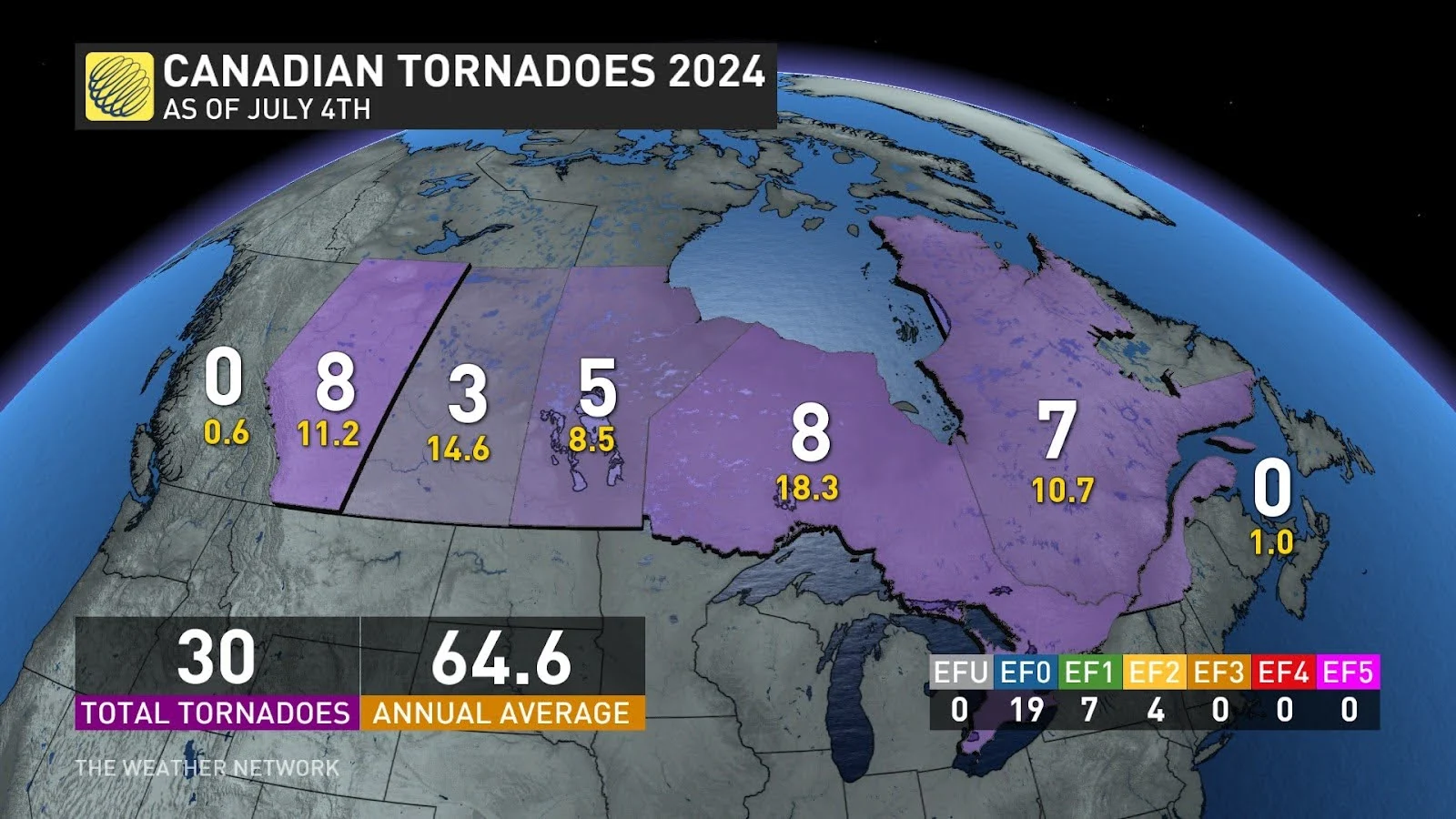
We’ve had 30 confirmed tornadoes across the country through the beginning of July. The first tornado of the year touched down in Malden Centre, Ontario, back on March 6.
Most of the tornadoes on the Prairies have been weak EF-0s so far, with the exception of two EF-1s in Manitoba on June 12. All of the highest-rated tornadoes so far this year were EF-2s, each of which occurred in Ontario and Quebec.
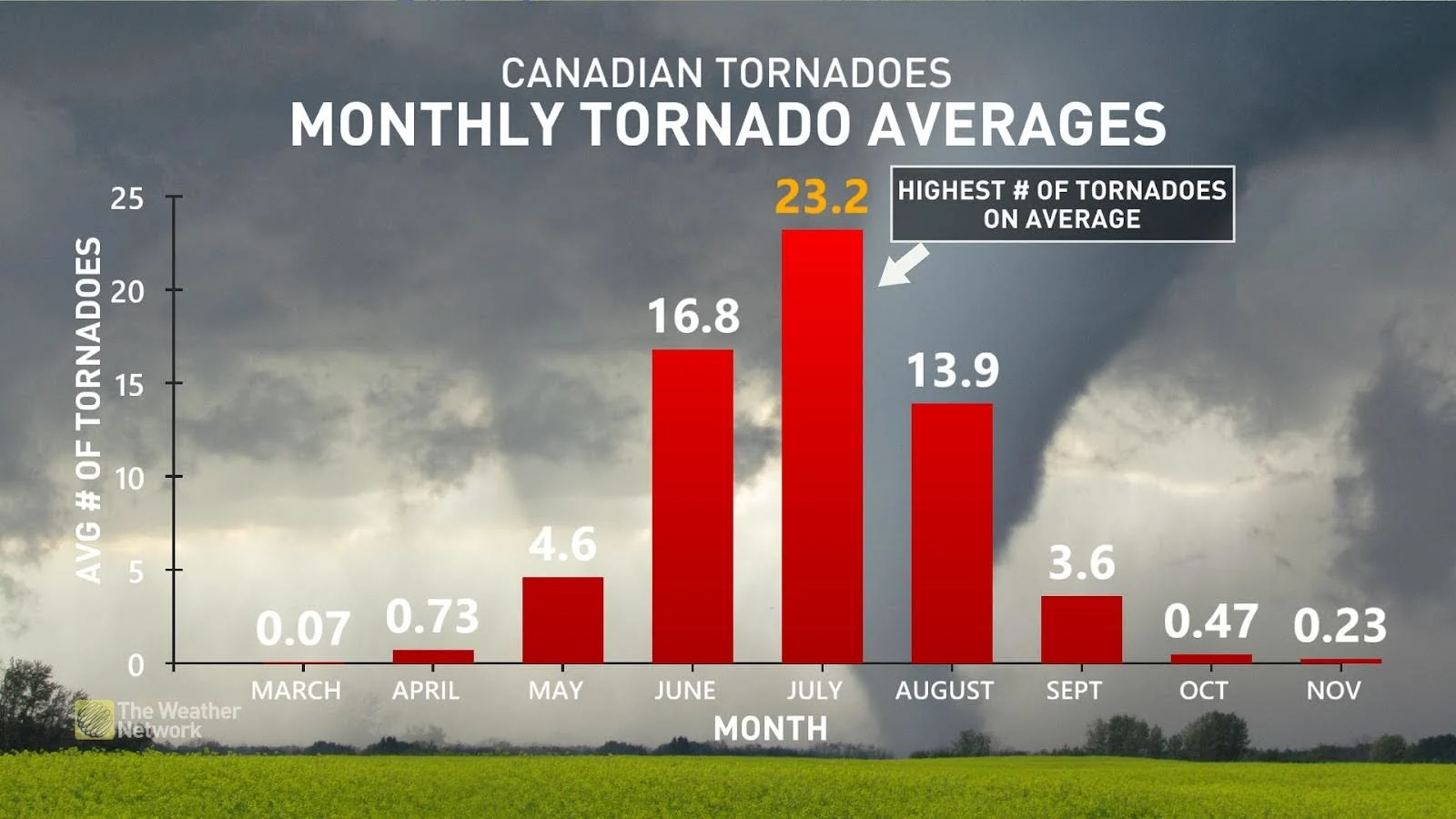
July is historically the most active month for tornadoes throughout Canada, with about 23 tornadoes touching down during an average month. Much of that activity is usually focused on the Prairies.
What we could expect through the rest of July
We can’t let our guard down over the next few weeks.
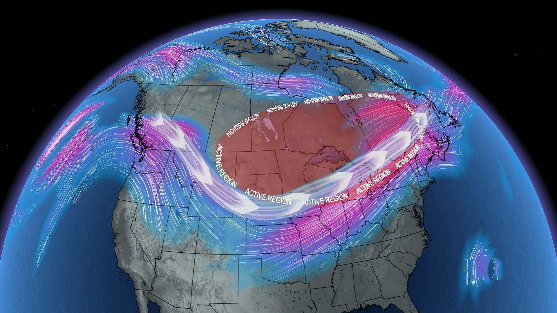
An active storm track spilled over into July. This pattern, alongside building summer heat and instability, could mean renewed thunderstorm and tornado chances across the country.
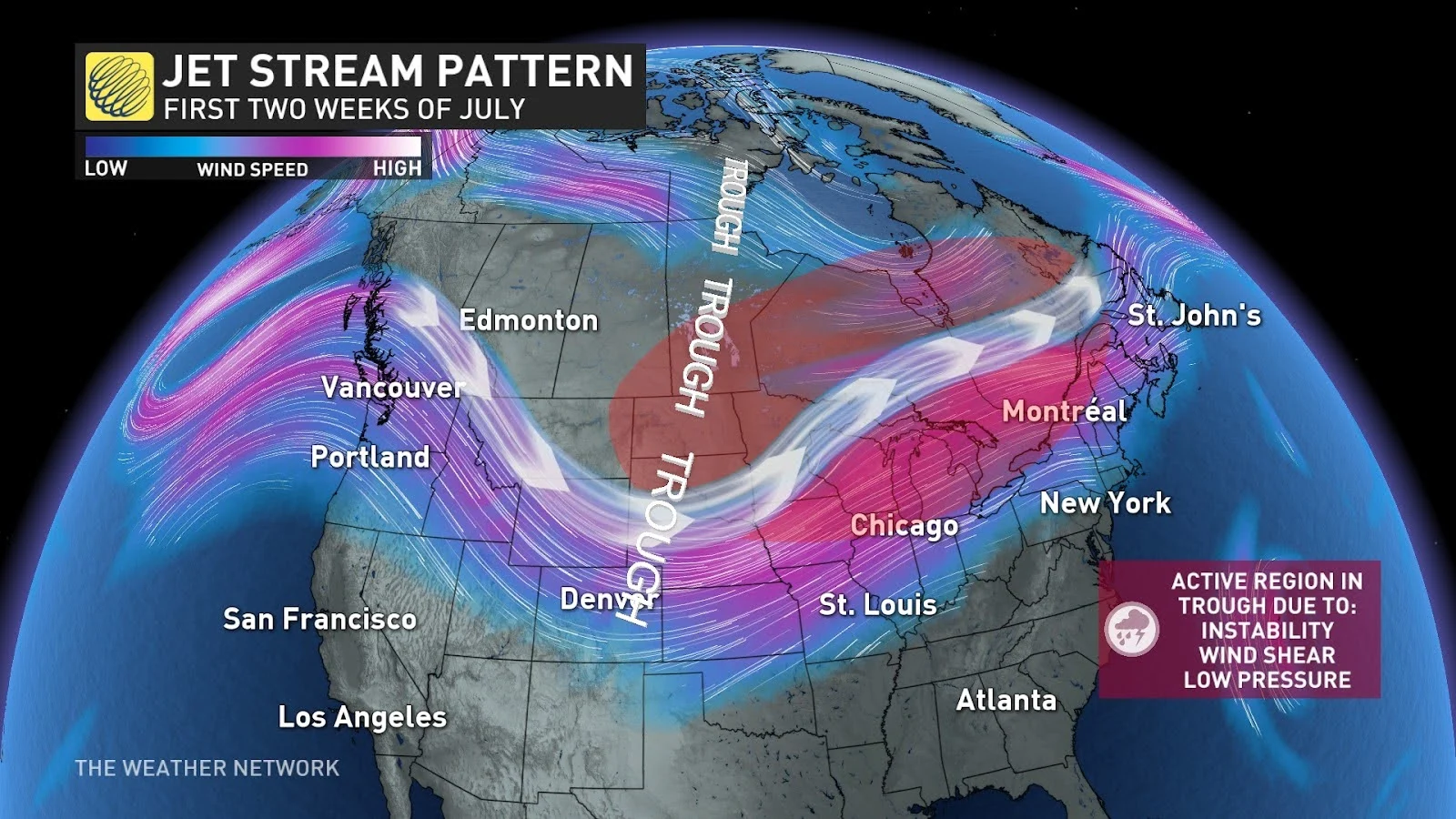
We are going to see an extended troughing pattern to begin the month, leading to instability in the atmosphere over Eastern Canada. This will bring active weather over Ontario and Quebec due to low pressure and high wind shear.
DON'T MISS: Tornadoes can happen anywhere—and cities aren't immune
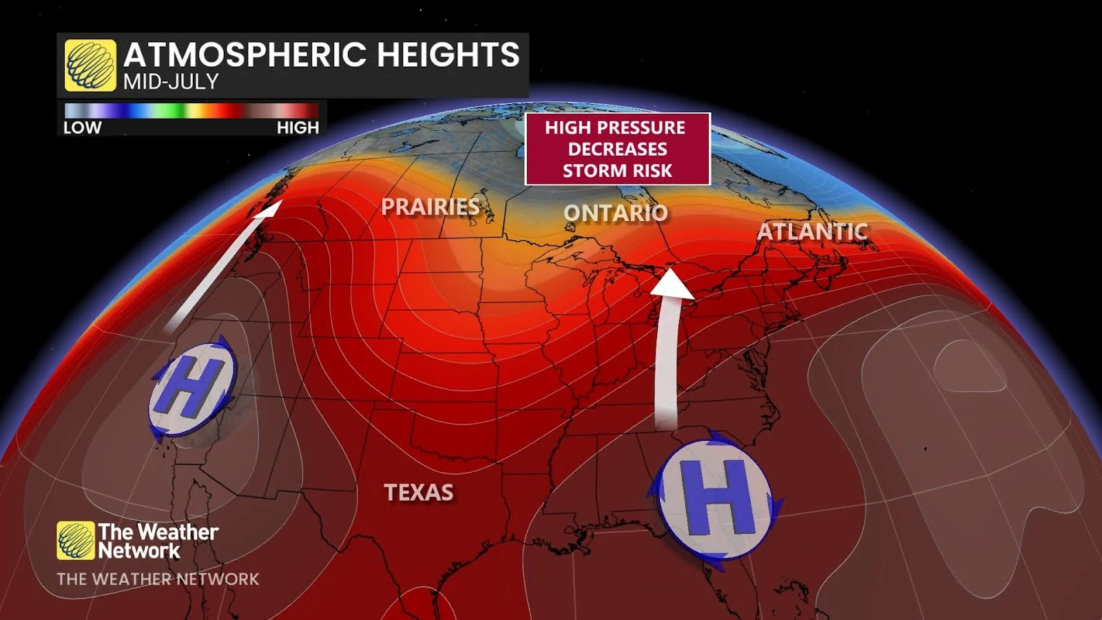
However, as we get deeper into July, we may expect fewer storms overall as drier and warmer patterns emerge. This could occasionally lower the risk for tornadoes through the middle and end of the month as ridges of high pressure develop.
High pressure during the summer months is usually associated with heat waves. Air sinks beneath a ridge, putting a lid on the atmosphere and halting thunderstorm development. But don’t count out these dangerous storms just yet.
We frequently see organized clusters of storms riding around the edge of these heat ridges, often lending them the nickname “the ring of fire.” These storms tend to cross north of the Great Lakes. Powerful storms may still track through the Great Lakes and Ontario at times during July, but their frequency is uncertain. Western Canada can expect a more typical summer pattern with scattered storms at times.
Tornadoes still frequently occur during the month of August, with Ontario recording 5 or 6 touchdowns during an average month. We’re still a ways away from the end of tornado season, so make sure you stay up to date with the latest forecast all summer long.