La Niña declared in the Pacific, here's what it means for hurricanes

The phenomenon typically results in less hurricane activity in the central and eastern Pacific, but more in the Atlantic basin.
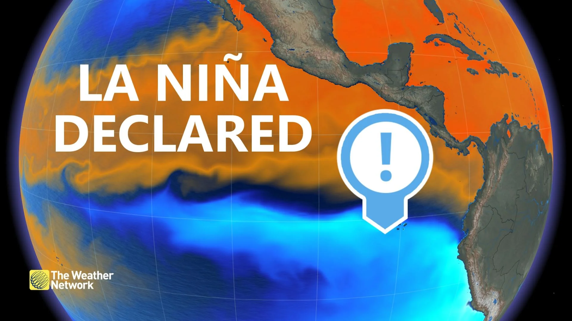
Well, it's official: La Niña conditions have been declared in the Pacific Ocean, with weather impacts far afield.
Specifically, the Climate Prediction Center, part of the U.S. National Oceanic and Atmospheric Administration (NOAA), has issued a La Niña Advisory, replacing a watch that had been in place since earlier in the summer.
La Niña conditions mean that ocean surface temperatures in the central and eastern Pacific are a few degrees cooler than normal, and NOAA has confirmed that is the case at the moment, and say this La Niña has a 75 per cent chance to last through much of the winter in the Northern Hemisphere.

La Niña is part of what meteorologists call the El Niño-Southern Oscillation (ENSO), and is the opposite of an El Niño, which is marked by above-average surface ocean temperatures in the same area.
What does it mean in practical terms? Foremost, the ENSO influences hurricane formation, even in places far away from the Pacific.
Locally, cooler ocean temperatures sap the energy from potential hurricanes, as does the associated stronger vertical wind shear, which suppresses hurricane formation -- good news for interests in Hawaii and the Pacific coasts of Mexico and the United States.
However, the phenomenon has a sinister counter-effect in the Atlantic: Weaker vertical shear, which removes a barrier to hurricane formation.
Coupled with trade winds and less atmospheric stability, that makes for a more active season and, indeed, there have been so many storms this season so far that we are in danger of running out of traditional hurricane names and will soon start using the Greek alphabet.


