Lake Ontario peaking, still high and hazardous

Forecasters say it could be weeks or months before water levels return to normal.
Lake Ontario's water levels remain high, such that the Toronto and Region Conservation Authority (TRCA) continued its shoreline hazard warning, which has been in place for weeks. The TRCA says although the lake levels are believed to have peaked, some further increase is possible, depending on the rain.
"It is likely that levels will remain at the same level for the next week before starting to decline gradually," the TRCA said in its latest bulletin. "However, lake level may still rise slightly in the next few days due to the forecasted rainfall and continued high flows from Lake Erie."
A cool, wetter than average spring has been the culprit behind these high water levels, which for the month of June have averaged 75.94 metres for Lake Ontario, slightly above the 2017 record of 75.93 metres. Even once lake levels begin to recede, they are now so high they will take a long time to return to more manageable levels (the TRCA says it will take months to return to normal seasonal levels).
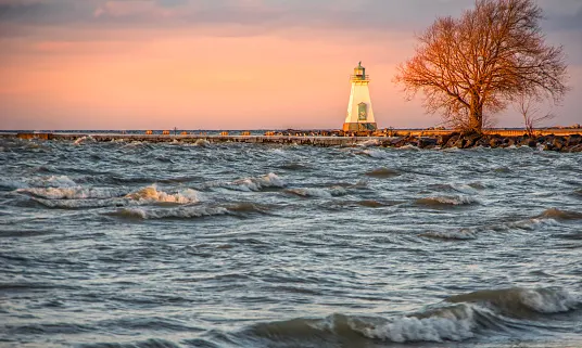
At the current lake levels, any high winds from any direction can result in significant wave action and lake surge," the TRCA says.

That much has been evident for the past few weeks for low-lying communities across the lake. On Toronto Island, industrial pumps are working to keep floodwaters at bay, and residents have had to lay down sandbags.
Strong winds on Thursday and Friday have made matters worse, raising the risk of storm surge and coastal flooding. On the U.S. shores of Lake Ontario, waves of more than four metres in some areas have had authorities warning people to stay away from the lakes.
Lake Ontario is not the only one of the Great Lakes to be experiencing higher water levels. In fact, all the other four are also above normal, and have been for weeks, with damaging effects on coastal infrastructure and shorelines.
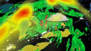
In the U.S., the National Weather Service issued flash flood watches for most communities on or slightly inland of Lake Erie, ahead of a late-weekend storm that will make for rough waters on the lake and an infusion of rain into an already still-waterlogged region.
"A moist airmass will support periods of torrential rain, heaviest in thunderstorms. After each round of rain the wet ground conditions will support more rapid runoff and increase the threat for flash flooding," the National Weather Service says.