Christmas snow lingers in B.C., dangerous cold persists for days

Arctic air and a well-timed storm brought much of southern B.C. a white Christmas to remember. The snow was a prelude to a prolonged and dangerous cold snap.
Saturday’s weather was a gift to residents of British Columbia dreaming of a white Christmas. A healthy storm brought a hefty coating of snow to the South Coast and Vancouver Island. While the snow is winding down, we could still see additional accumulations for much of the area through Boxing Day. We’re looking ahead at the prolonged and dangerous cold snap settling into the region. More on the remaining snow and impending freeze, below.
Hitting the slopes? Be sure to check conditions first with The Weather Network's Ski Report!
THIS WEEKEND: SNOW LINGERS INTO SUNDAY, DANGEROUS COLD ON THE WAY
Snow showers and bands of strait-enhanced snow will continue for parts of Vancouver Island and the South Coast through Boxing Day on Sunday.

While the bulk of the snow fell through the day on Saturday, we could see an additional 5-15 cm of snow across much of southern Vancouver Island.
SEE THE PHOTOS: British Columbia basks in a rare Christmas snowstorm
Another 10-15 cm is also possible along the international border near Abbotsford. Elsewhere, including Metro Vancouver, we should see less than 5 cm of additional accumulation.
NEXT WEEK: ARCTIC AIR STICKS AROUND AND GETS EVEN COLDER
The snow on the ground isn’t going anywhere in a hurry. Now that the storm is in the rearview mirror, B.C. has to contend with a prolonged spell of health-threatening Arctic air.
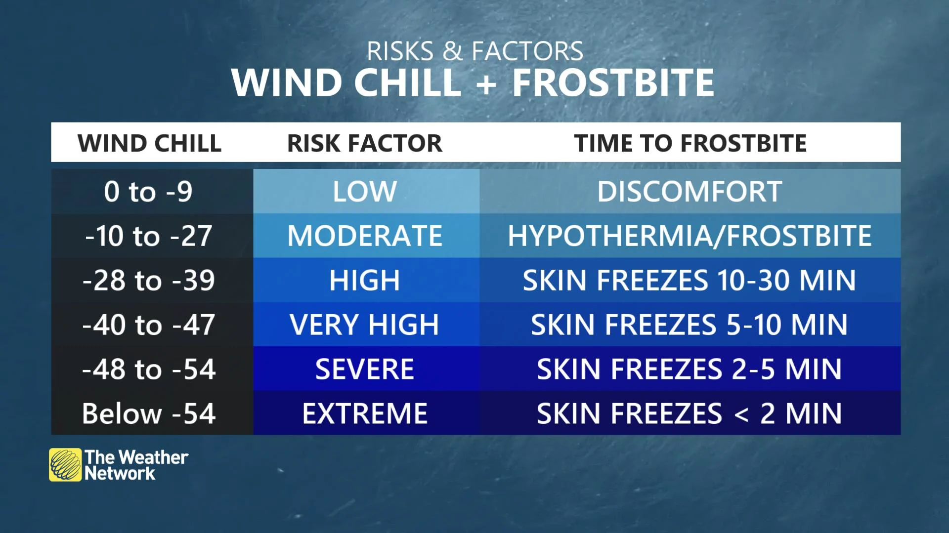
A ridge of high pressure over the B.C. Interior will spill bitterly cold outflow winds over coastal communities overnight Saturday into Sunday. The strong winds will lead to wind chill values dipping to -20 or lower in the coldest spots.
Mainland inlets and areas that are exposed to outflow winds are more likely to experience these very cold wind chill values.
Temperatures will remain at or below freezing through the last week of December, bottoming out near record-cold temperatures next week. Highs on Monday will struggle to climb out of the double-digit negatives across much of the Lower Mainland.

Winds will make the frigid conditions feel even colder. Wind chill values will pose a risk for hypothermia and frostbite on exposed skin if one spends too long outside.
"Any outdoor activity exposes you to an increased risk of frostbite. Minimize exposed skin with hats, scarves and mittens or gloves. Anyone who is not dressed warmly is at risk of frostbite and hypothermia in cold weather. Be prepared for unusually cold temperatures and strong winds," says Environment and Climate Change Canada (ECCC) in an Arctic outflow warning.
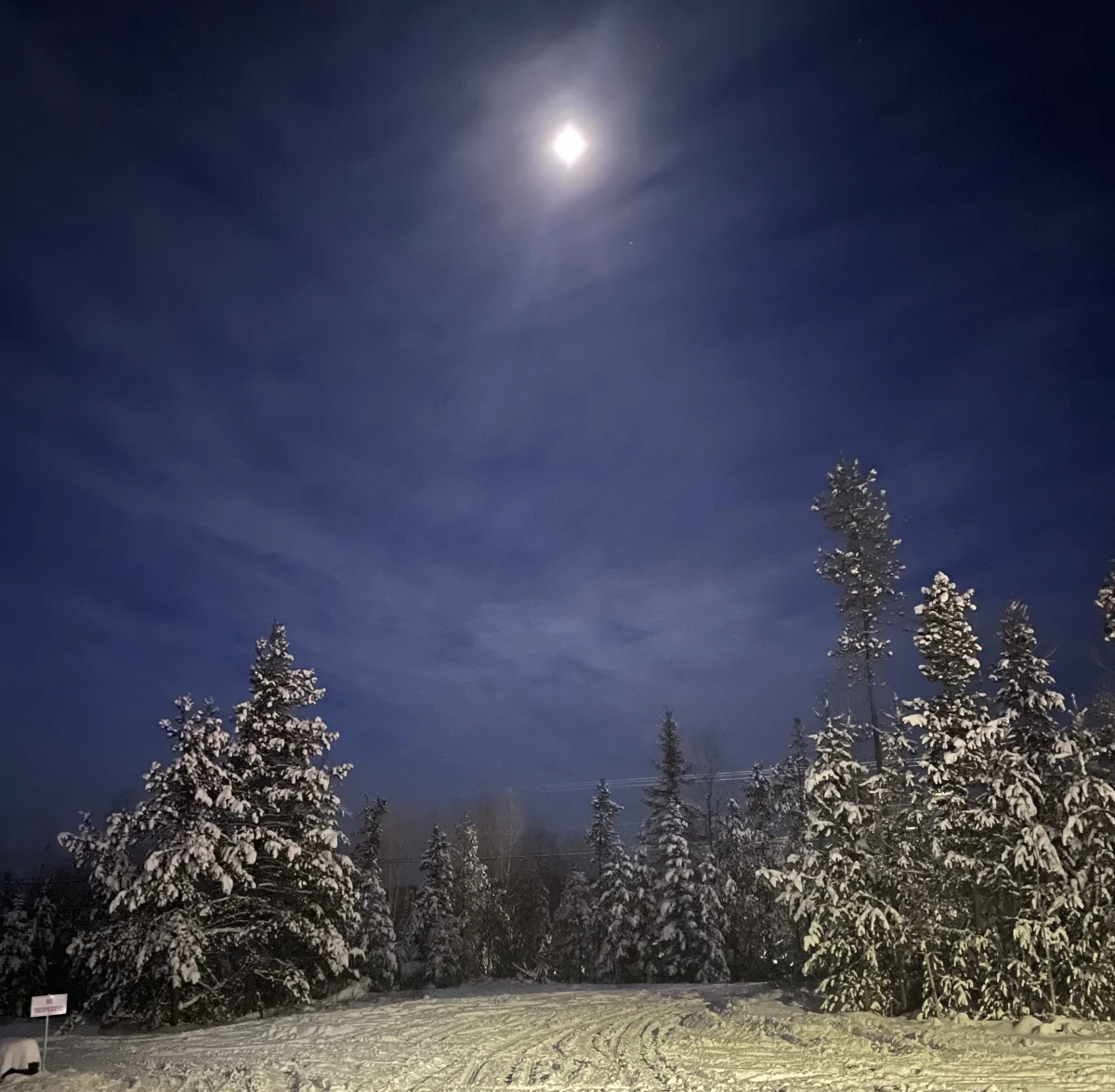
Thumbnail courtesy of Lisa Spetch
Stay tuned to The Weather Network as we track the bitter chill across British Columbia.