Favourable setup for storms could add more wildfires in B.C., Alberta

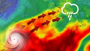
Western Canada's wildfire situation could go from bad to worse this week with a thunderstorm setup through Thursday, bringing the potential for new blazes with the ongoing risk of lightning strikes
A broad area of low pressure is expected to continue over the next couple of days, bringing unsettled weather and the chance of thunderstorms to the Prairies. While most thunderstorms look to remain non-severe in nature, the main concern is the risk of new wildfire ignition across B.C. and Alberta.
It's a dire circumstance the latter province is facing, especially, with tens of thousands forced to flee as out-of-control wildfires continue.
MUST SEE: Destroyed homes, infrastructure among wildfire losses in Alberta communities
The slow-moving nature of the thunderstorm activity, and steeper topography in British Columbia, also poses a risk of flooding. The province continues to deal with the aftermath of the flooding and landslides in the Interior.
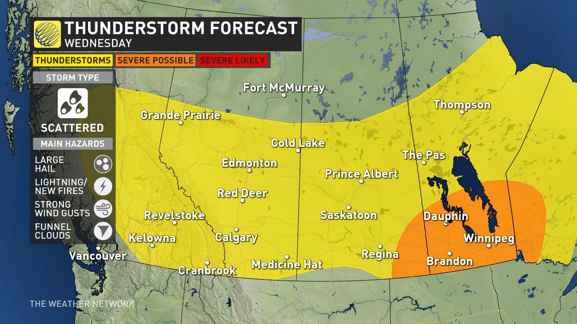
Wednesday
Areas: Much of British Columbia and the Prairies
Timing: Afternoon and evening
Weather: A series of troughs will continue to pinwheel into Western Canada on Wednesday, keeping the widespread, non-severe thunderstorm threat present through the afternoon and evening hours. Most of the thunderstorms will remain non-severe in nature.
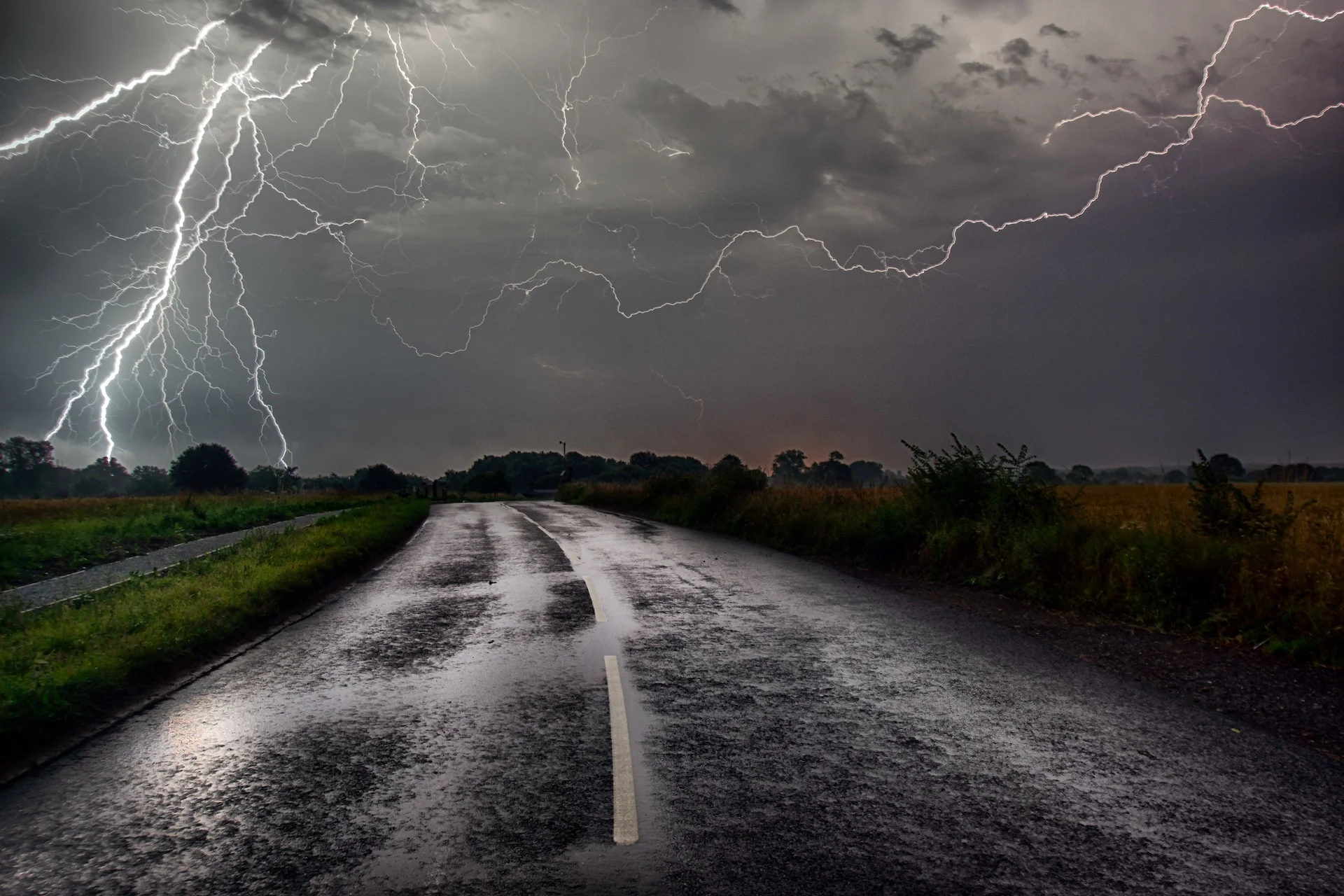
Threats: Small hail, strong wind gusts and lightning that could ignite new wildfires. We also can’t rule out the risk of funnel clouds.
RELATED: Smoky skies expected for swath of B.C. as fires burn in northeast and Alberta
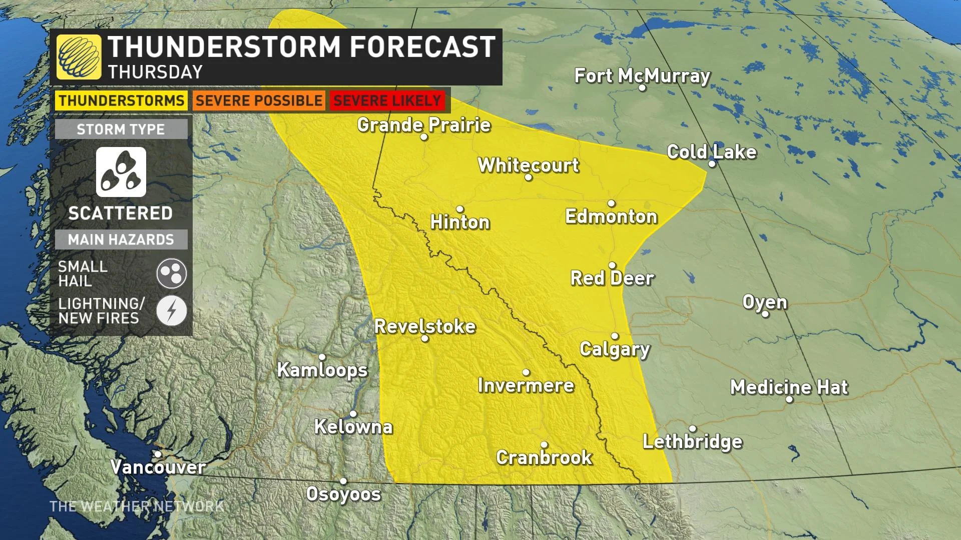
Thursday
Areas: Much of British Columbia and the Prairies
Timing: Afternoon and evening
Weather: A series of troughs will keep the widespread, non-severe thunderstorm threat present through the afternoon and evening hours. Most of the thunderstorms will remain non-severe in nature. Thursday is the last day for thunderstorms along the foothills in Alberta as the ridge starts to build.
Threats: Small hail and lightning that could ignite new wildfires.
WATCH BELOW: Military to assist if necessary as nearly 30,000 evacuate in Alberta
Prepare
Stay alert and monitor the forecast for updates. Have a plan and a place to head indoors if the weather changes.
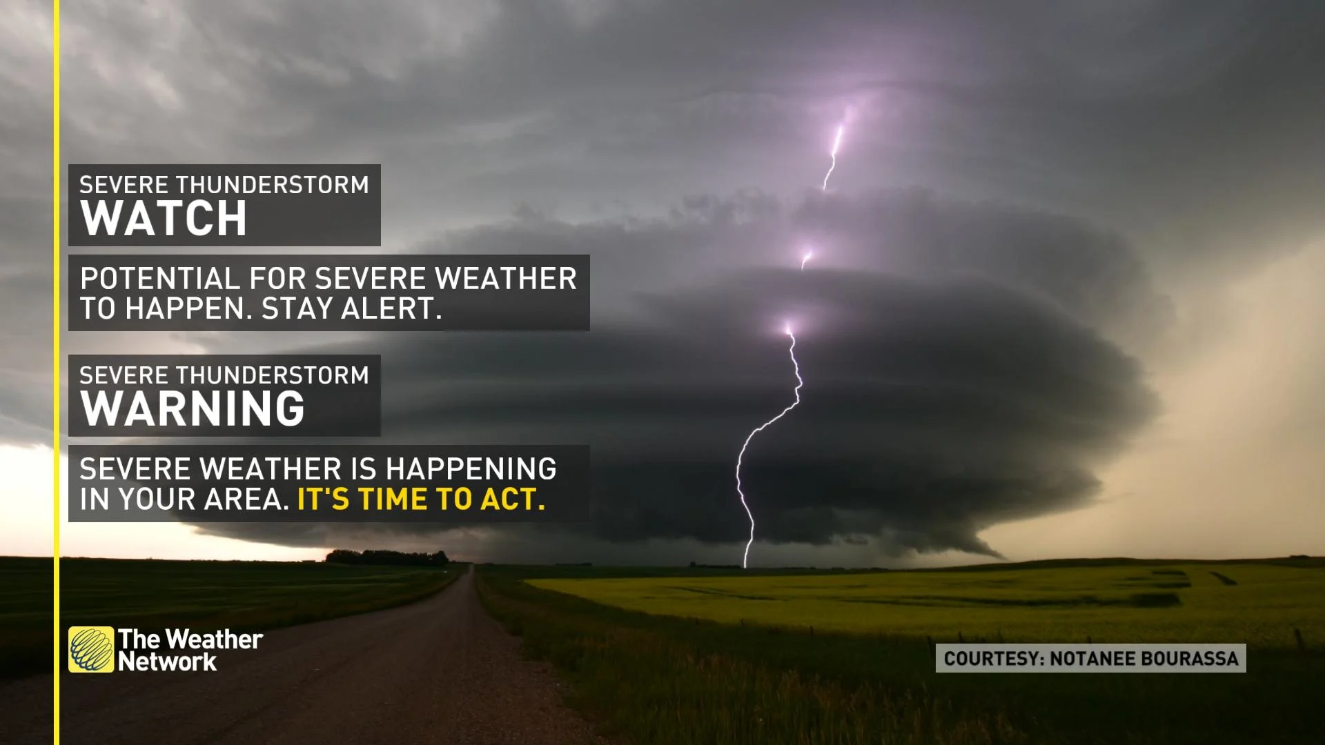
Watches mean conditions are favourable for the development of severe thunderstorms. Warnings mean they are imminent or are occurring in your area.
In communities with elevated or high wildfire danger ratings, or could be threatened by a blaze in the near future, residents should take time now to review emergency preparedness and evacuation plans in the event of a nearby fire. Individuals and families should be prepared to take care of themselves for at least 72 hours in case of evacuation due to wildfires.
Analysis
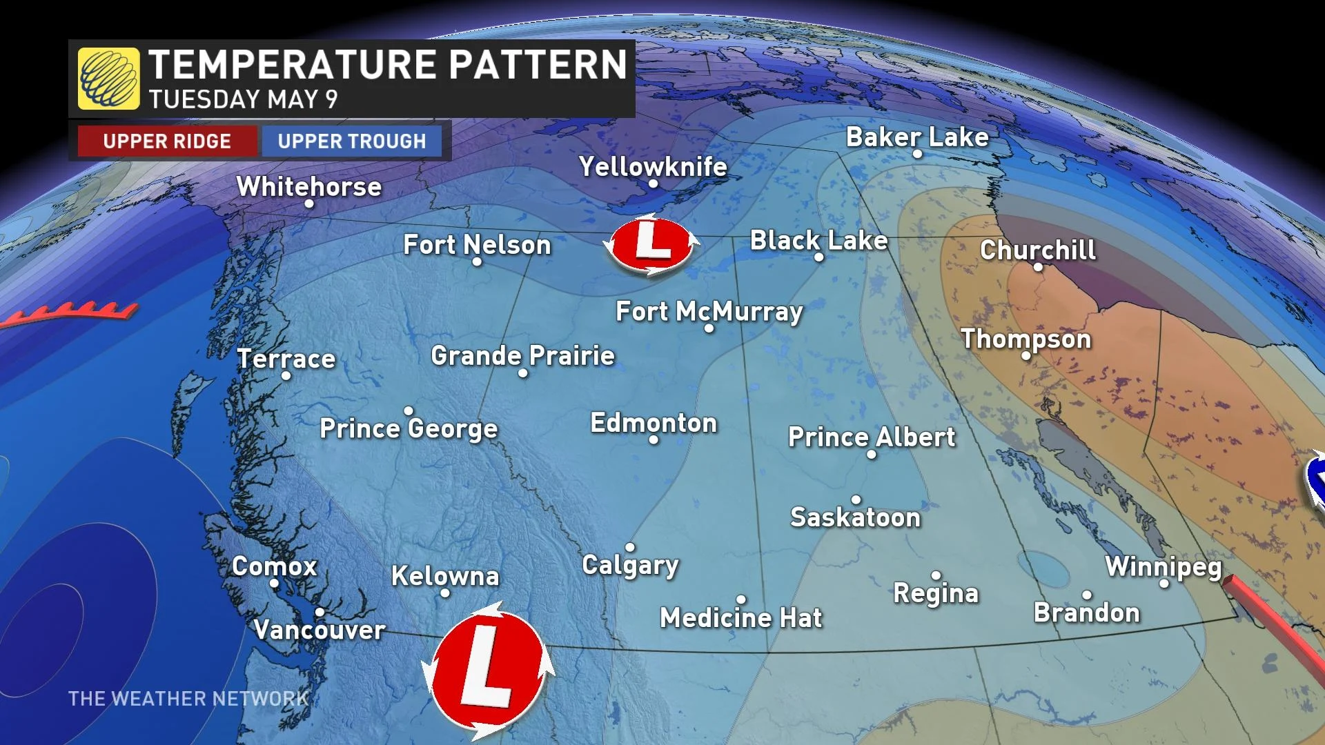
A broad upper-level trough is currently rotating over Western Canada, and with the aid of daytime heating, is destabilizing the atmosphere and allowing for unorganized, scattered thunderstorm activity. Due to weak steering flow and light winds aloft, these storms will move slowly, with limited organization, and pose little risk of strengthening to severe criteria.
The slow-moving nature of the thunderstorm activity and steeper topography in British Columbia pose a risk of flooding.
For Alberta, unfortunately, there will be minimal rain in some of the areas that need it the most such as northwester sections. A warm and dry pattern is expected to return late next week and dominate during the second half of May, so the wildfire danger will likely be a major concern once again.
Colder-than-seasonal temperatures with scattered showers will continue through the middle of this week, then trending warmer and drier by weekend. A warmer and drier pattern is expected for the mid- and late-May.
WATCH: Family 'shell-shocked' after losing home to wildfires
Thumbnail courtesy of Getty Images.
Stay with The Weather Network for the latest on conditions throughout the region.