Steamy or stormy: Dynamic weather spans Canada this long weekend

Summer has finally arrived and the first long weekend of the season is upon us. How will the weather impact outdoor plans?
WHERE'S THE HEAT?
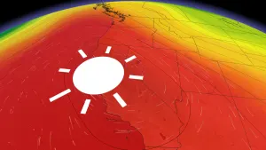
Summer has gotten off to a slow start, with most of Canada recording cooler than normal temperatures so far during the month of June. We will continue to see little truly hot weather across the country through the long weekend, but one region will experience hot and humid conditions.
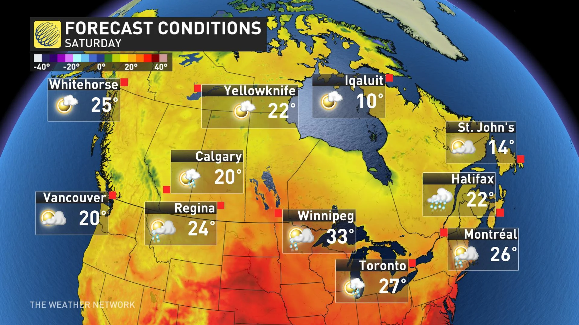
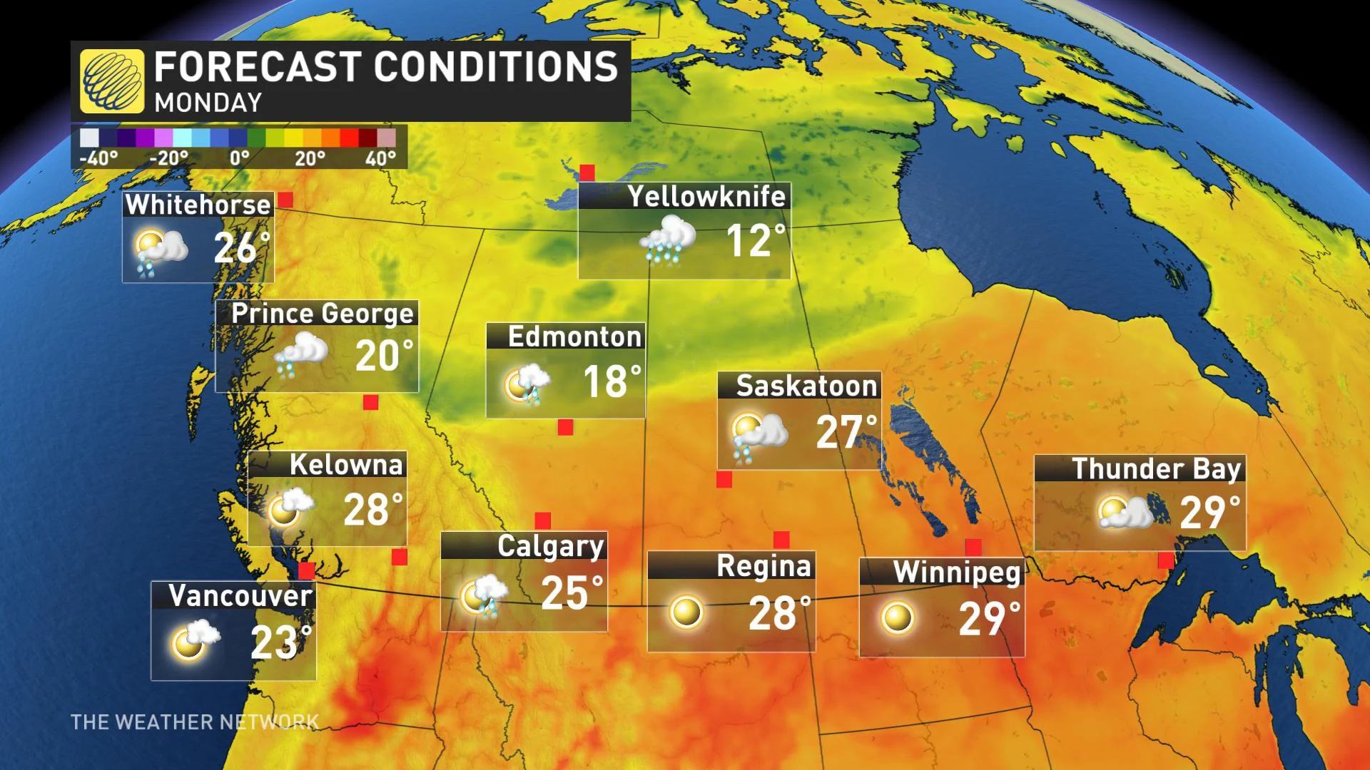
Southern Manitoba, including Winnipeg will see high temperatures reach the lower 30s on Saturday and the humidex will approach 40. However, this heat and humidity will also bring the threat for strong to severe thunderstorms on Saturday.
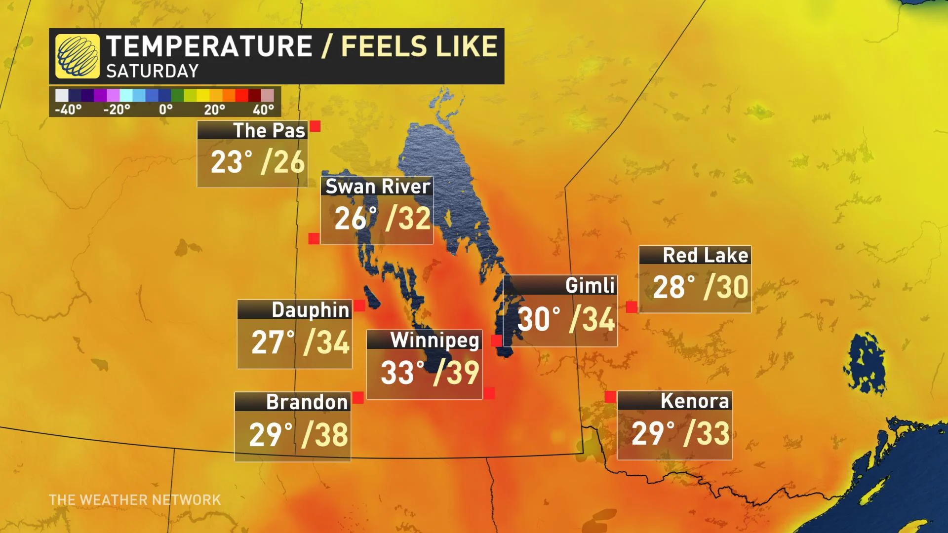
This heat and humidity will spread further east into northwestern Ontario for Sunday, but the muggy conditions will ease just a bit for Canada Day.
The Yukon will also see warmer than normal temperatures with highs reaching the mid to upper 20s in Dawson and Whitehorse.
MUST READ: What's the temperature 'sweet spot' for swimming in lakes and rivers?
STORMY START AND SPECTACULAR ENDING TO LONG WEEKEND FOR OTTAWA, MONTREAL AND TORONTO
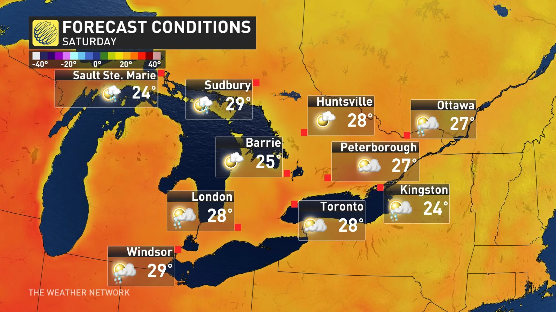
Across southern and eastern Ontario and southern Quebec, we have a threat for a period of thunderstorms with localized downpours for the start of the long weekend as a cold front slowly sinks south through the region during Friday afternoon and Saturday. Saturday will not be a total washout (especially across southern Ontario which will be mostly rain-free), but if you have outdoor plans we recommend that you have a back-up plan.
EXCLUSIVE: LONG WEEKEND: Beyond The Forecast
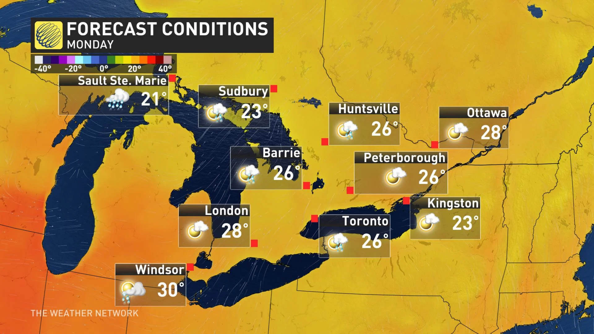
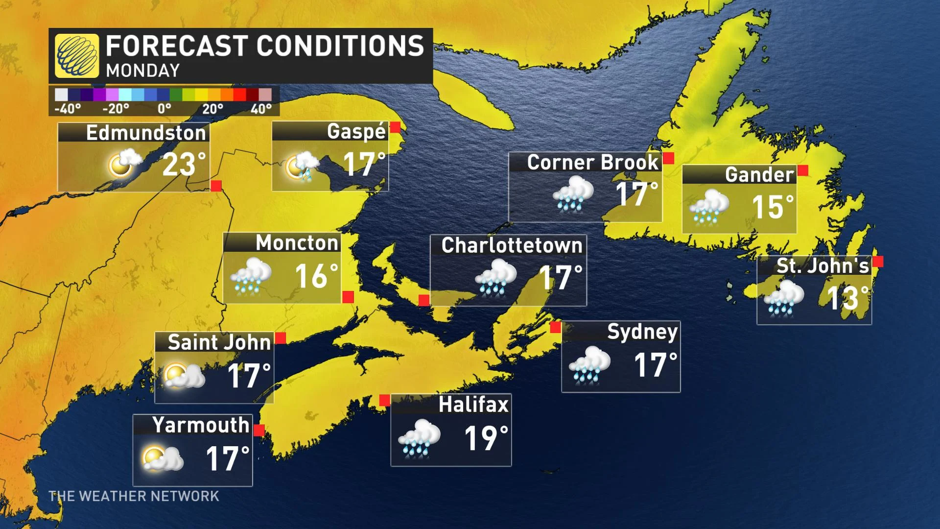
Behind the cold front, sunshine will return to the region for the end of the long weekend with lower humidity and comfortable temperatures. However, across southern and eastern Ontario we are closely watching the threat for showers late in the day on Monday with the potential to impact evening fireworks.
This cooler weather will be quite a contrast to the record breaking heat and humidity that this region endured through the Canada Day long weekend last year when temperatures reached the mid 30s and the humidex climbed into the mid to upper 40s.
COOL AND UNSETTLED FOR ATLANTIC CANADA
Cool weather will continue through the long weekend across Atlantic Canada. The coldest weather will be found along the east coast of Newfoundland with an east wind off of the chilly Atlantic Ocean. Temperatures across the rest of the region will be just a few degrees cooler than normal.
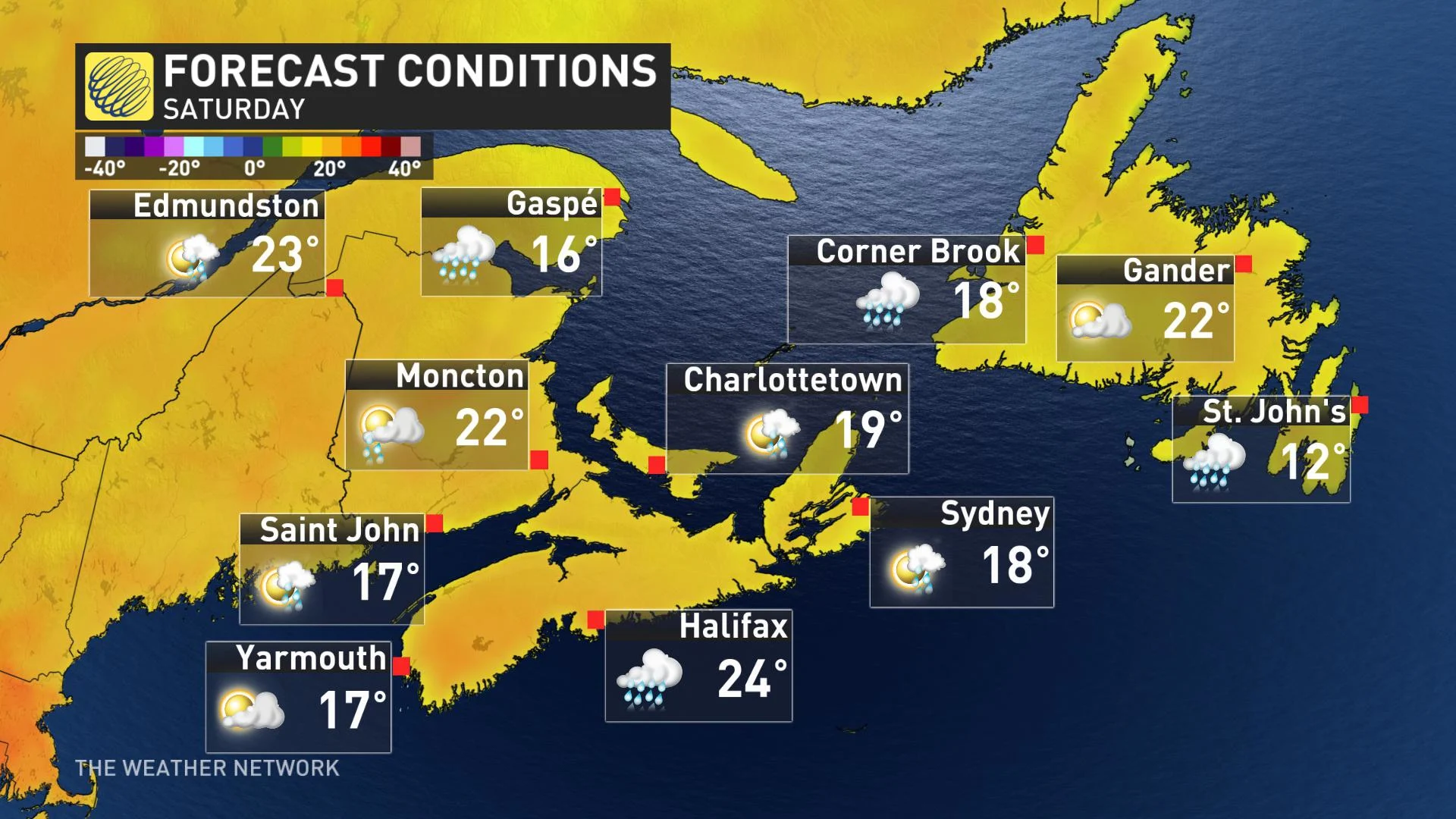
The wettest day of the weekend for the Maritimes will be late Saturday and into Sunday as a system tracks just south of the region. Rain will then spread into Newfoundland for Sunday night and Monday.
STAY ITCH FREE: Become an ultimate bug repeller this summer
SHOWERS AND THUNDERSTORMS ACROSS THE WEST
B.C. and Alberta have been in a cool and unsettled pattern for the past ten days. That pattern will relax somewhat during the weekend, with temperatures trending back to near seasonal for the end of the weekend.
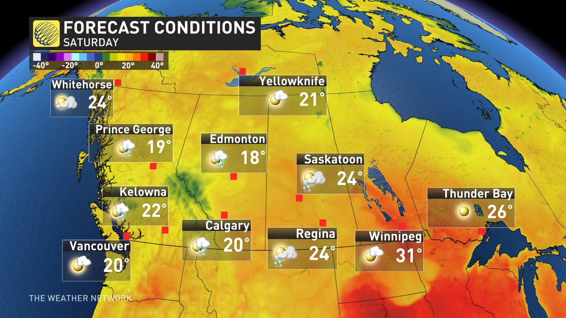
We will continue to see showers and thunderstorms for parts of the region on Friday and Saturday, but we will see more sunshine and less rain across the region for Sunday and Canada Day. However, a cold front dropping south from northern Alberta will bring an increasing threat for rain to the Edmonton area during Monday afternoon and evening.