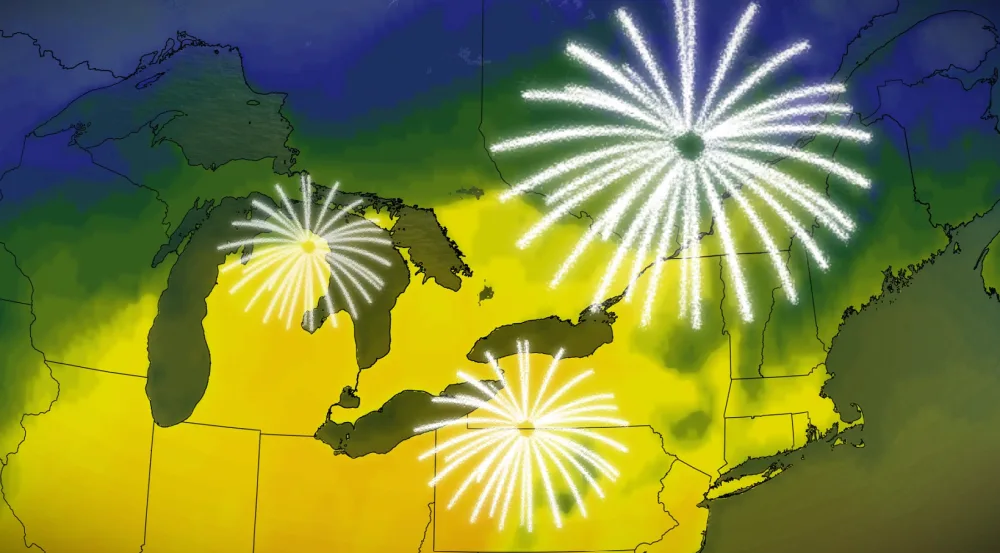
New year brings flood risk, unusual warmth for Ontario, Quebec

Get your umbrella handy! Rain and unseasonably warm temperatures are on deck.
The weather this week seems remarkably like nature is trying to do its own year-end wrap. We started the week in the throes of winter and we’re ending the week with temperatures mild enough to throw open the windows.
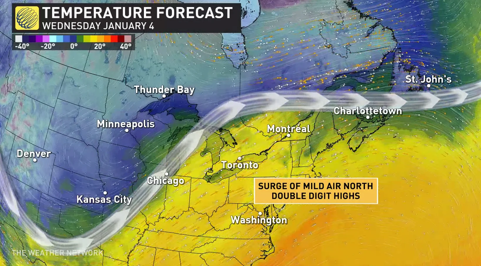
A significant pattern change across North America allowed a steep ridge to build over the eastern half of the continent. This ridge allowed for abnormally warm air to build over the region in time for New Year’s weekend.
DON’T MISS: Spiders and a deadly derecho: wrapping up 2022 across Canada
We’re seeing temperatures jump 5-10+ degrees above seasonal as we flip the calendar from 2022 to 2023.
Toronto’s seasonal high around this time of year is just a tick below the freezing mark, so daytime highs pushing into the teens isn’t anything to take for granted. This warmth will continue into the first week of January before a pattern change brings us closer to normal.
Warmer temperatures almost always come at a price in the heart of winter, however, and we’ll pay for the relative comfort with several rounds of rain heading into early next week.
WATCH: 2023 arrives with warmer temperatures across southern Ontario
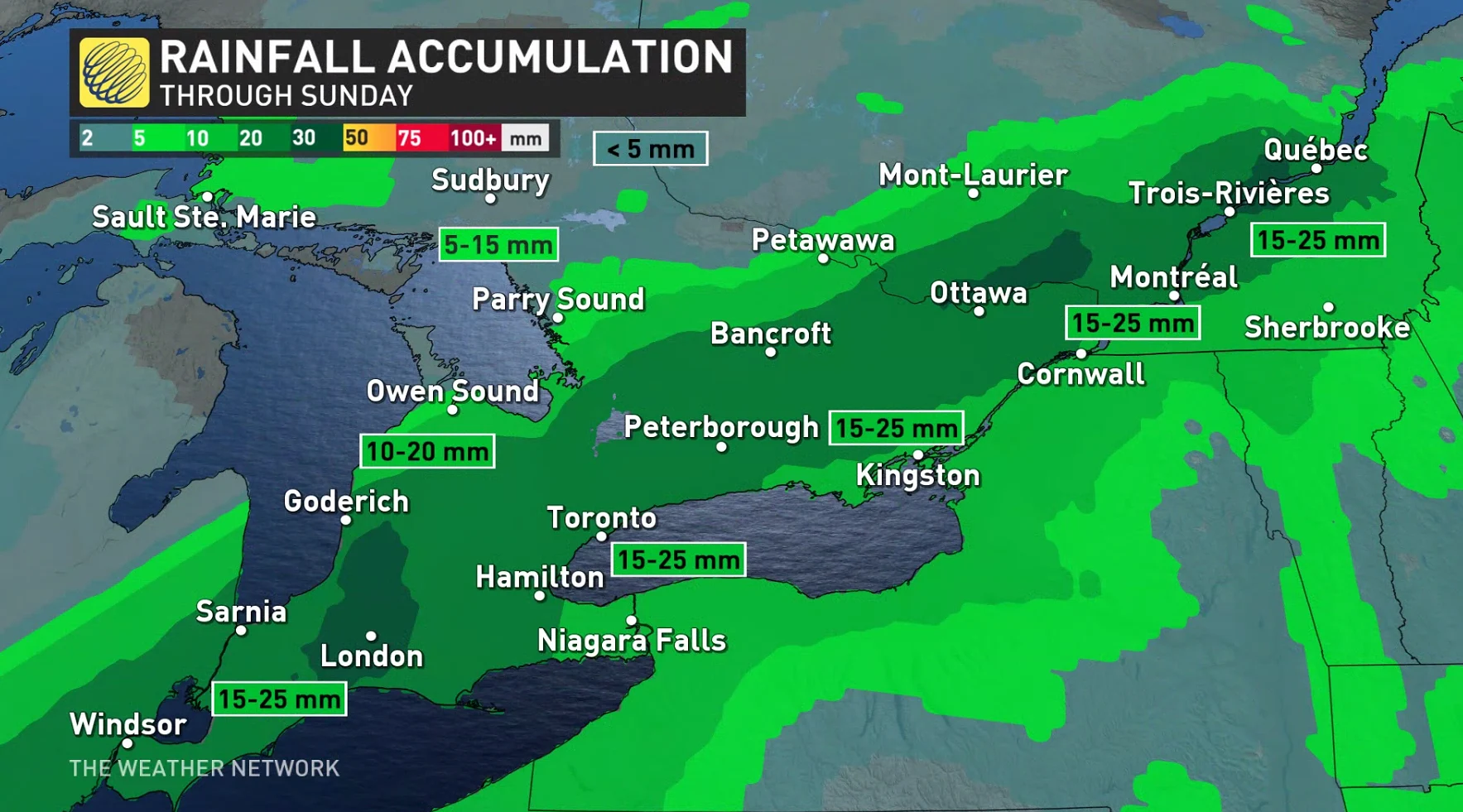
Environment and Climate Change Canada (ECCC) issued a handful of rainfall warnings for much of southern Ontario. Periods of rain are expected tonight and will become heavy at times Saturday afternoon, states ECCC.
Widespread rainfall totals of 15-25 mm are expected across southern Ontario through New Year’s Day on Sunday, with heavier totals of up to 30 mm possible across eastern Ontario toward the National Capital Region. Lower totals are expected into cottage country, with a relatively steep cutoff in rains heading toward the Nickel Belt.
The combination of sustained above-freezing temperatures and additional rainfall will lead to a risk for localized flooding across all of southern Ontario into next week.
Widespread flood watches are in effect for southern Ontario. The flood risk isn’t widespread, but typical flood-prone regions could deal with rising waters through next week.
Much of the region is still covered by a significant snowpack from the blizzards that raged through Christmas weekend.
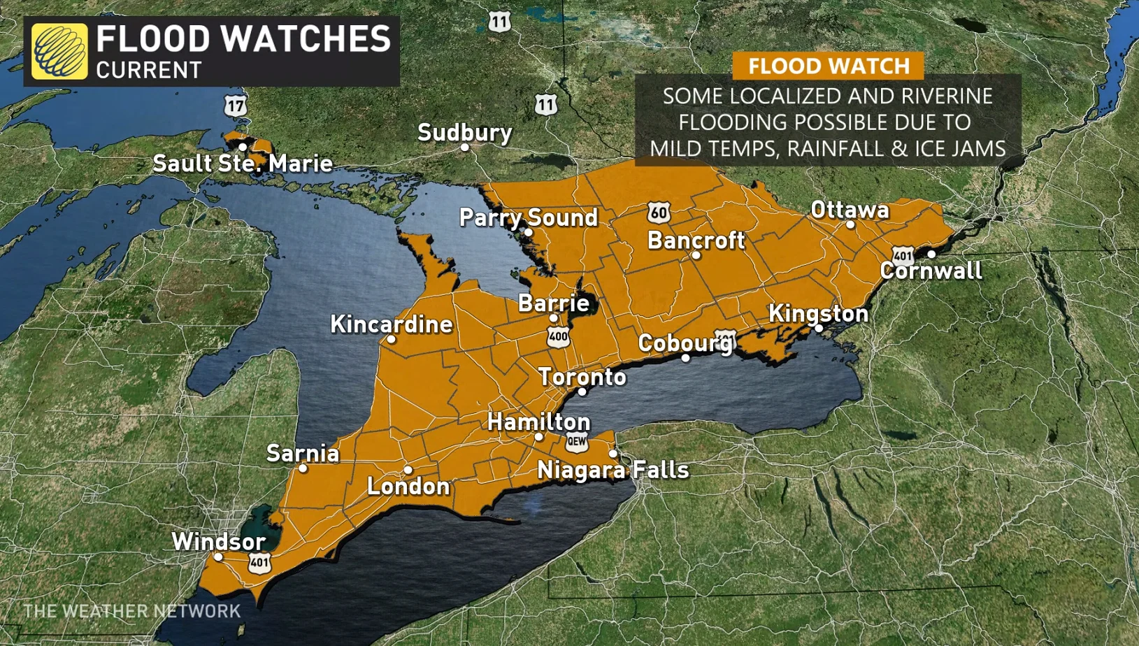
In addition to runoff and ice jams leading to rising waters on area waterways, snow blocking storm drains and downspouts will lead to localized flooding that could be hazardous to motorists and pedestrians alike.
The density of the melting snow, along with the weight of added water from the coming rains, could also pose a risk to roofs that are still covered with deep snow.
Be sure to check back for the latest forecast across Ontario and Quebec.