
Ontario: Gorgeous, but brief, stretch of comfortable summer weather

Cooler, drier days ahead in southern Ontario before things heat up for the weekend once again
Clearer and more comfortable conditions will lock in over southern Ontario for the next couple of days as an area of high pressure drifts over the Great Lakes region. It's a window opening, 'natural air conditioning' kind of pattern before the next round of muggy and stormy weather arrives back again as early as Thursday. We take a look at the gorgeous stretch of weather this week, and the next shot of humidity with thunderstorms that loom for the weekend, below.
Summer revealed! Visit our Complete Guide to Summer 2019 for an in-depth look at the Summer Forecast, tips to plan for it and much more
WEATHER HIGHLIGHTS:
Mostly sunshine, cooler temperatures through mid-week
Next chance of rain Thursday, temperatures increase
Humidity returns for the weekend
Stay up-to-date on the ALERTS in your area
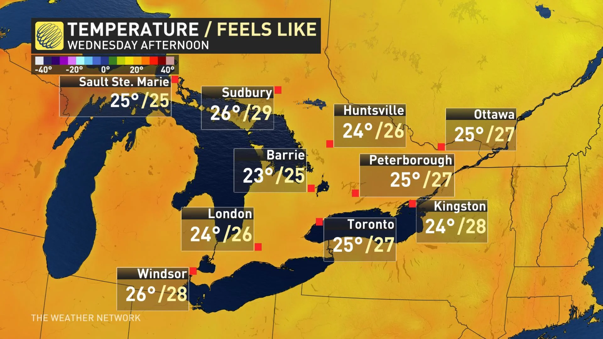
BELOW SEASONAL TEMPERATURES PERSIST THROUGH WEDNESDAY
After last week's heat wave and oppressive humidity, temperatures are trending cooler and whole lot more comfortable for much of this week. In fact, daytime highs through Wednesday will actually be a hair below average for some, particularly into cottage country where temperatures will struggle to reach the mid 20s. Partly sunny skies should make for some great outdoor play however, though still with a chance for an isolated passing shower as the day wears on.
SEE ALSO: What's a meteotsunami, and how can one form on the Great Lakes?
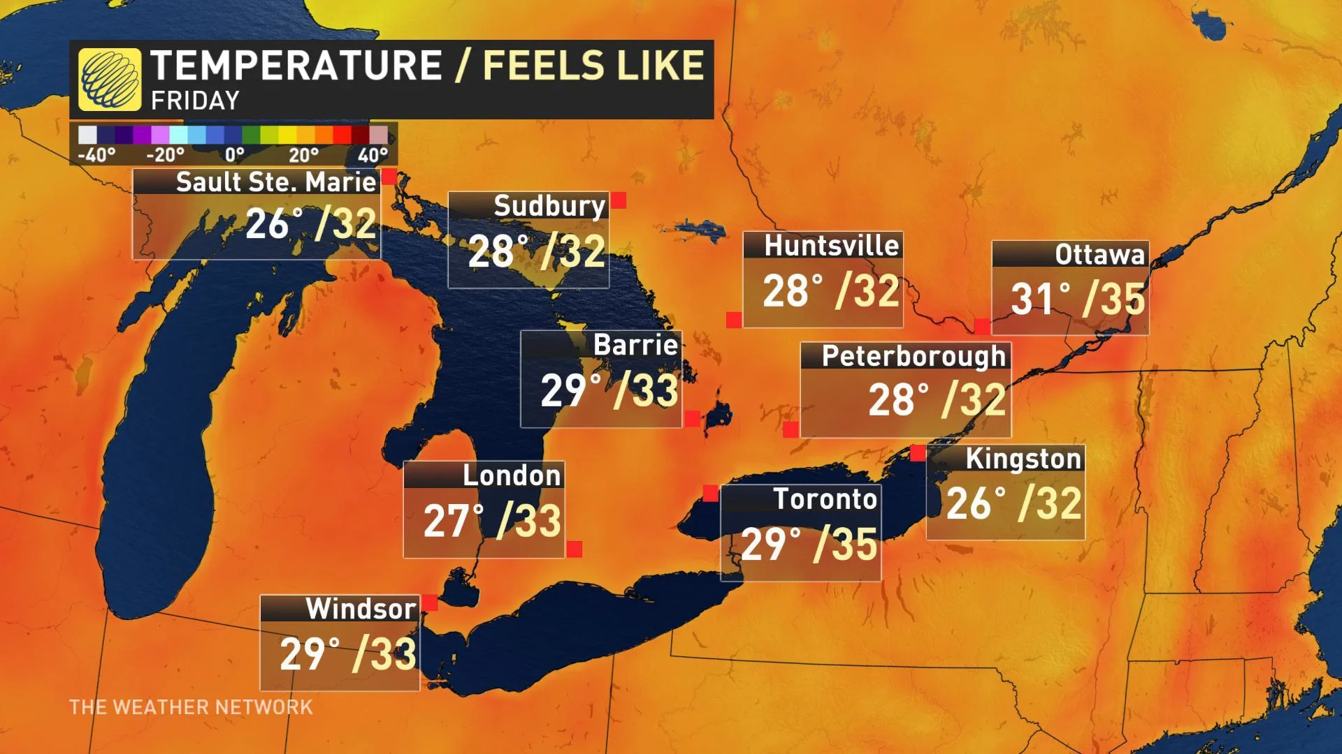
NEXT CHANCE OF RAIN THURSDAY, HUMIDITY BUILDS FOR THE WEEKEND
After a mostly dry first half of the week, the next substantial system will be a cold front moving in Thursday, bringing back the chance for showers and potential thunderstorms. Temperatures and humidity will also gradually increase and by Friday, humidex values will be in the low to mid-30s for areas across the south.
While it's not expected to be another surge of deep, tropical moisture for southern Ontario, signs point to more humid, sticky weekend weather across the region.
"Hot weather will return for the weekend, but the humidity will not be nearly as high as it was during our recent heat wave," says Weather Network meteorologist Dr. Doug Gillham, adding that there's a risk for a passing thunderstorm on both Saturday and Sunday of the weekend.
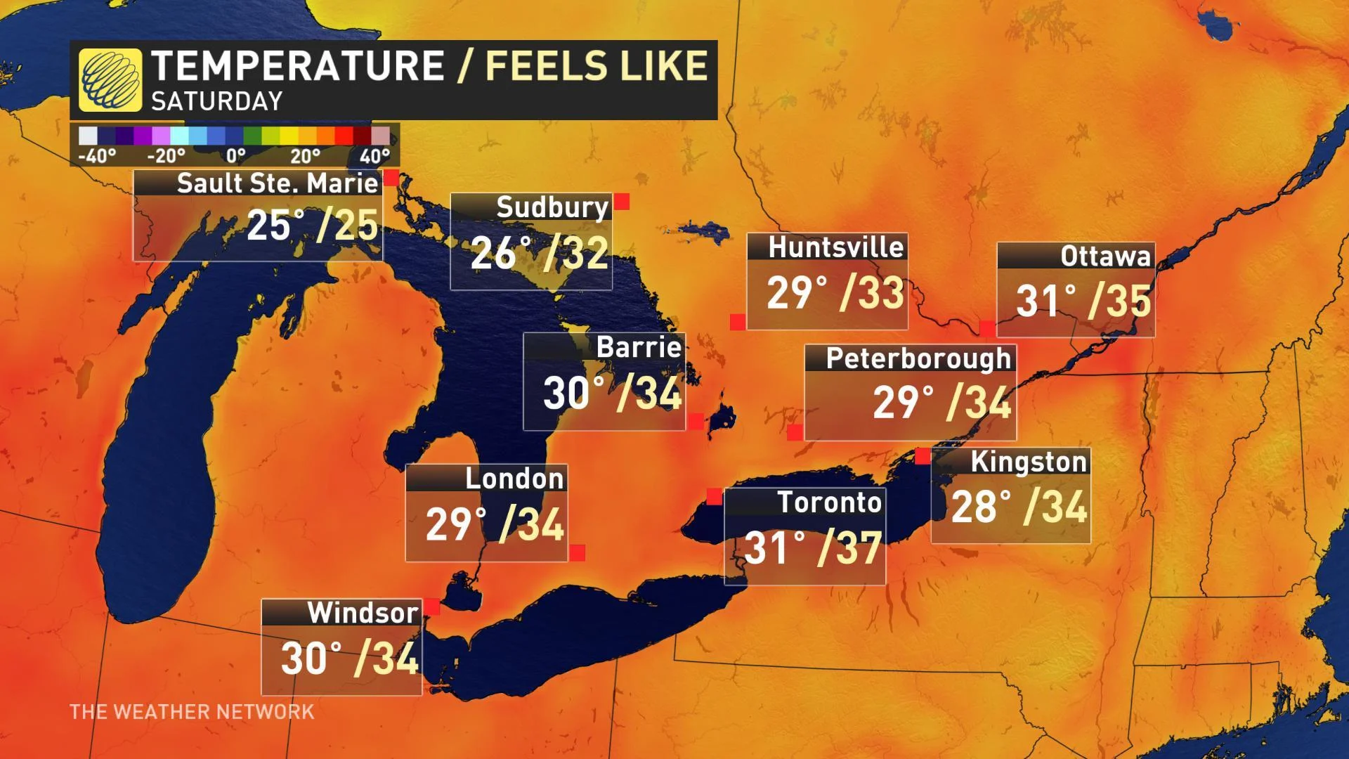
The warm and humid conditions are expected to spill into next week as well, with the threat for more active and unsettled weather likely throughout the region.
"Southern Ontario will remain the battle zone between cooler weather to the northwest and muggy weather attempting to surge north into the region from the Gulf of Mexico," Gillham says. "At this point, it's looking like the very warm and increasingly humid air from the Gulf will win out."