Ontario: Lake-effect streamers will tangle some Thursday commutes

Snow isn't done with you yet, southern Ontario, but some relief from this deep freeze is coming.
Temperatures recover, at least a little bit, as we round out the workweek in southern Ontario, but the snow isn't entirely done with the region yet. A weak clipper system will combine forces with lake-effect bands to tangle with Thursday commutes -- both morning and evening, in some cases. We track what's left of the snow, and when we break out of this deep freeze, below.
Time to prepare for the season ahead! The Weather Network's Winter Forecast launches Monday, November 18.
WEATHER HIGHLIGHTS:
Clipper system to bring scattered snow showers through Thursday
Lake-enhanced snows expected for traditional snow belts; streamers may have significant impact on commutes Thursday
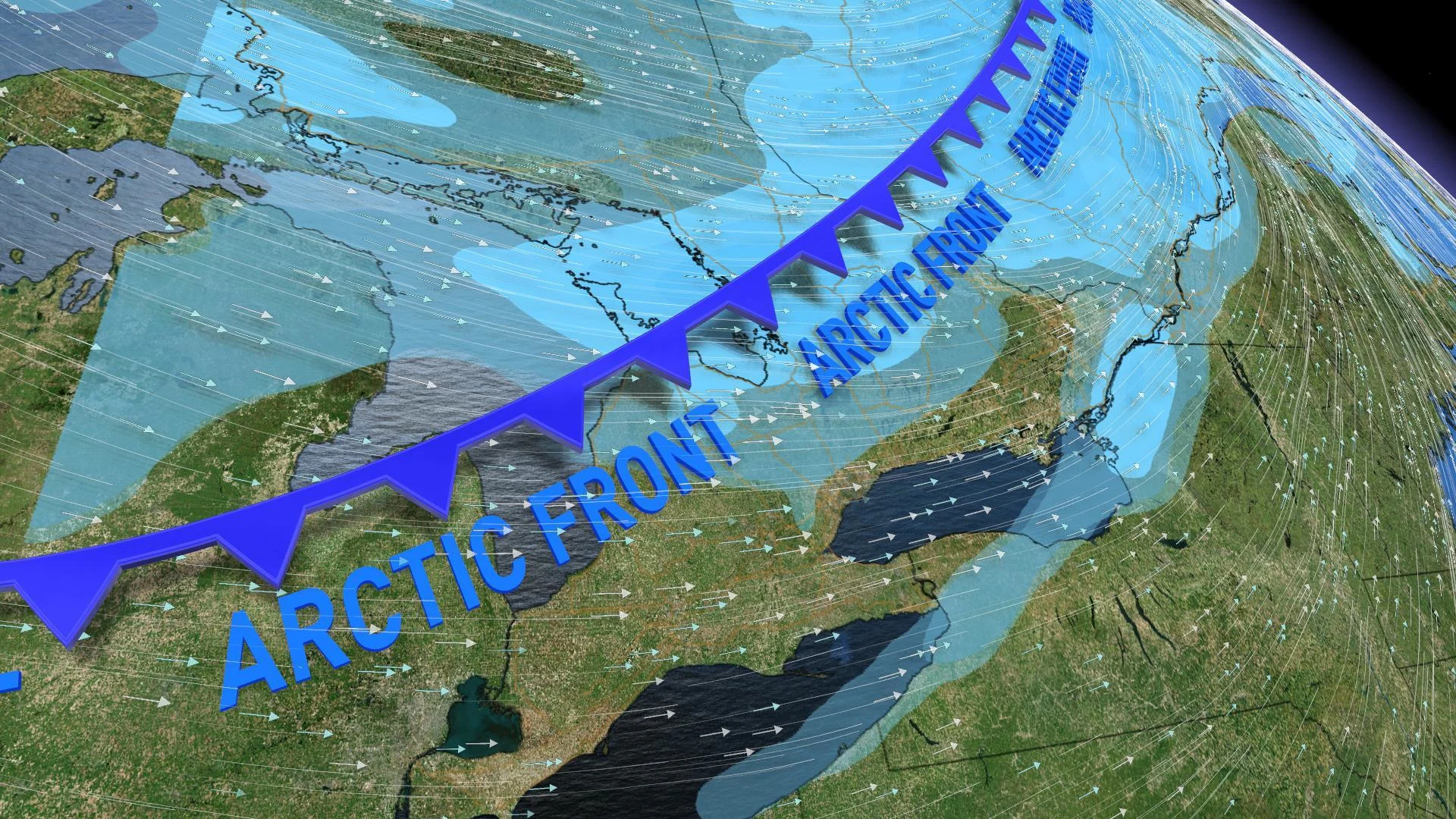
Next shot of arctic chill arrives for weekend
Stay up-to-date on the ALERTS in your area
TIMING OF THE SYSTEM SNOW AND SQUALLS ACROSS ONTARIO
LINGERING SNOW COULD SNARL COMMUTE TIMES
Light snow returned to parts of southern Ontario Wednesday evening, and this system -- an Alberta clipper -- isn't quite finished with the region. Additional snowfall of 2 to 5 cm is expected through Thursday across much of southern Ontario, from north of London to Ottawa, including parts of the GTA. But the heaviest of the snow will rely on a helping hand from the Great Lakes.
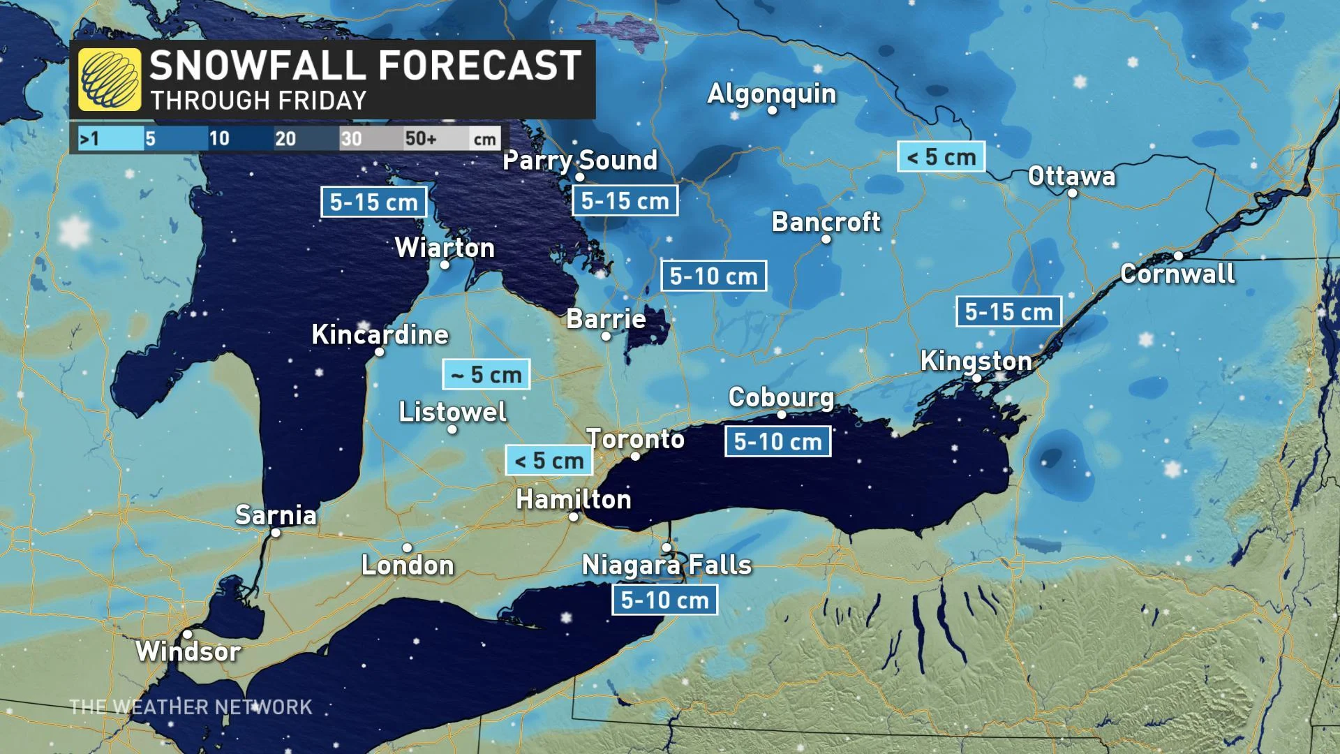
Points east of Georgian Bay, Grey-Bruce, and the Kawartha Highlands are in line for closer to 5 to 10 cm. 10+ cm are also possible along the Trans-Canada north of Parry Sound by Thursday afternoon.
The 401 corridor east of Toronto could also see some lake-enhancement, and that could make for more messy travel throughout the day Thursday.
SLIPPERY ROADS IN PERIODS OF SNOW, FREEZING RAIN
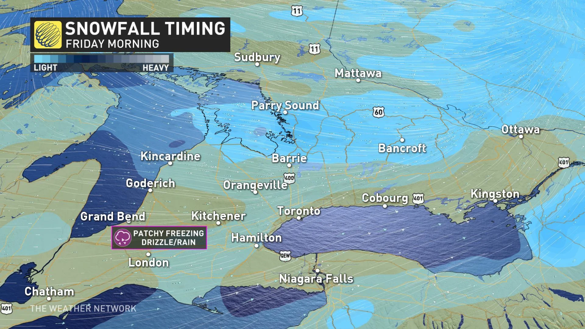
While the bulk of the snow will have moved out of southern Ontario -- except for the National Capital Region -- by Thursday evening, lingering streamers from the lakes and Georgian Bay will reduce visibility and make for slippery roads at times. As is usually the case with lake-effect bands, these will be highly localized and may mean sudden changes in road conditions.
SEE ALSO: 400+ collisions reported in GTA amid record early-season snow
With a pocket of warmer air aloft nosing its way into southwestern Ontario on Friday morning, some brief patchy freezing rain or drizzle is also possible in the London and Sarnia area, as well as along the 401 towards Chatham-Kent and even for western parts of the GTA. Precipitation rates will be light however, so no major ice accretion is likely.
RECORD-BREAKING COLD MATCHES THE HIGH ARCTIC
Much of southern Ontario woke up to bitter wind chills near -20 on Wednesday, making for another day of record-breaking cold temperatures across parts of the region.
Toronto Pearson Airport, for example, recorded a temperature of -13.7°C Wednesday morning, shattering the record for the day and making it the third coldest November temperature on record. Morning temperatures at CFB Borden were even tied with those in Alert, Nunavut -- both measuring about -24ºC.
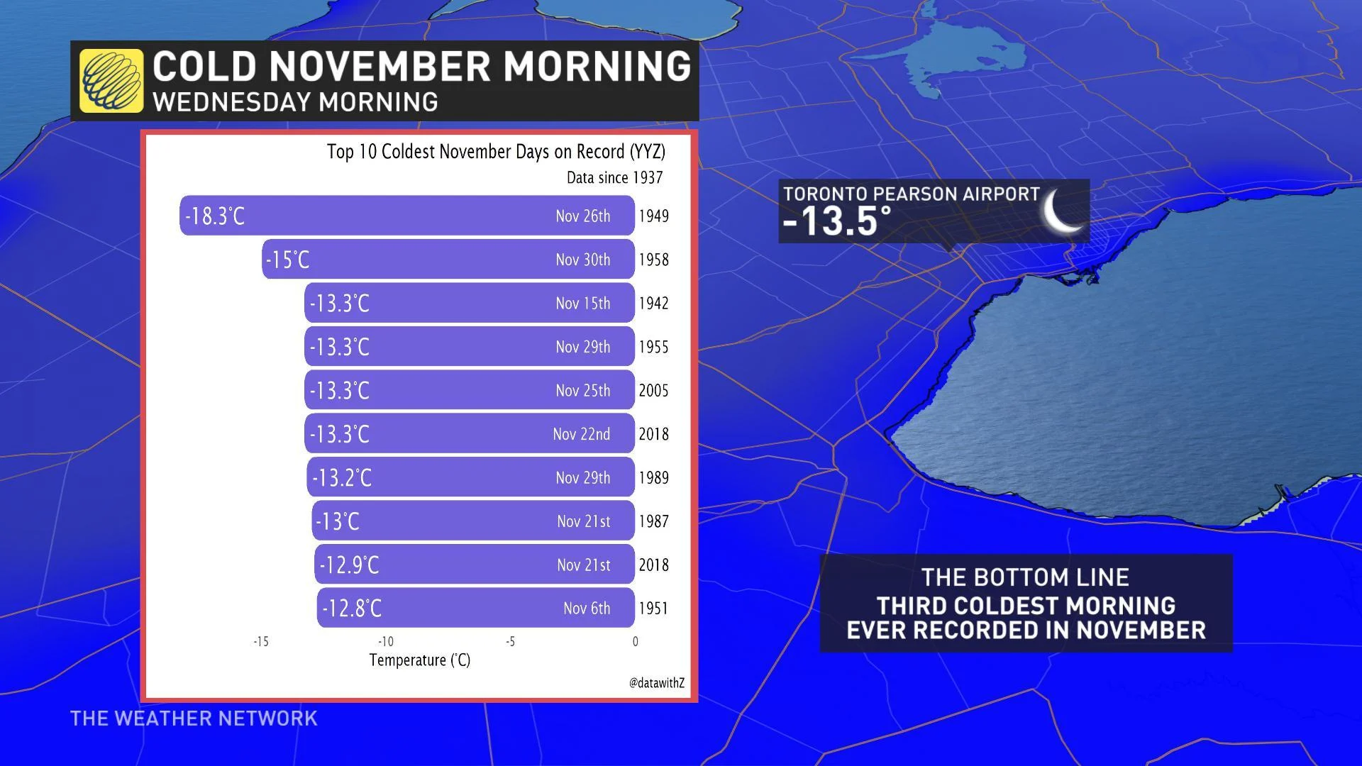
These brutal conditions also prompted the City of Toronto to issue its first extreme cold weather alert of the season on Tuesday evening. The alert dropped Wednesday afternoon, but at least one warming centre was set to remain open through early Thursday.
NOVEMBER THAW?
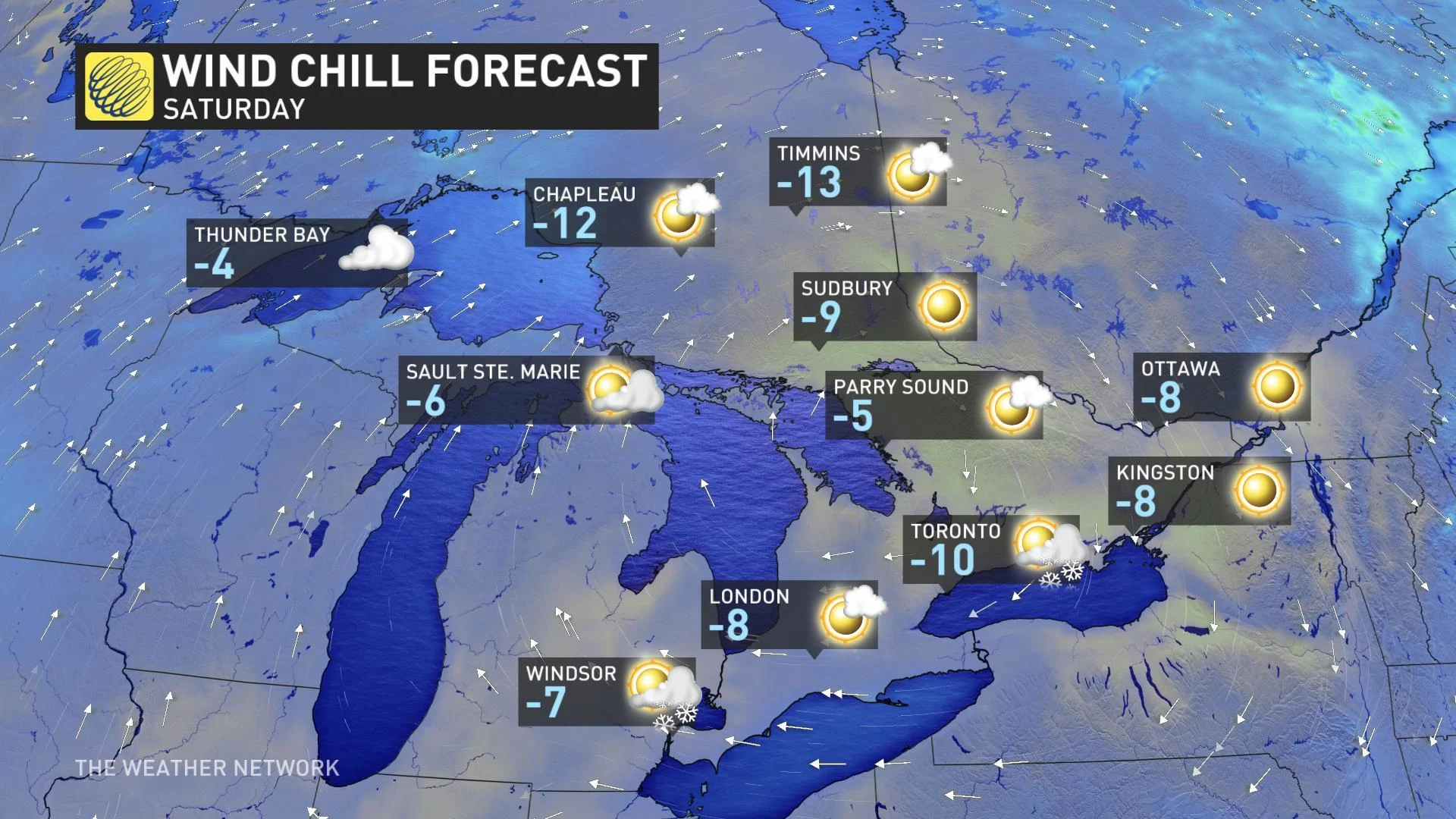
Temperatures will begin to recover somewhat as afternoon highs Thursday and Friday will edge above zero for most, but with another quick blast of arctic air as a cold front cross the region later Friday.
"Friday night will bring a return to frigid weather with near record cold temperatures," says Weather Network meteorologist Dr. Doug Gillham. "Temperatures will remain below freezing on Saturday despite abundant sunshine."
The frigid pattern will finally loosen its grip into next week as temperatures rebound to more seasonal -- and civil -- values.
"It does still look like temperatures will trend back to below seasonal for late November though," adds Gillham.