Ontario: Snowy top up this weekend after potent Halloween storm

Thursday's Halloween storm takes a heavy toll on southern Ontario as early winter conditions arrive with the start of November.
The start to November hasn't been the easiest for southern Ontarians as the remnants from the potent Halloween storm continue to impact the region through Friday. Power outages remain widespread amid damaging wind gusts, while lake-enhanced snow east of Georgian Bay and Lake Huron make for dangerous whiteout conditions in the season's first snowfall. More on what's left as we head into the first weekend of November, and how the start of this month will resemble more of early winter, below.
WEATHER HIGHLIGHTS
Strong cold front with damaging wind gusts persisting through Friday
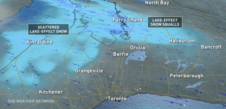
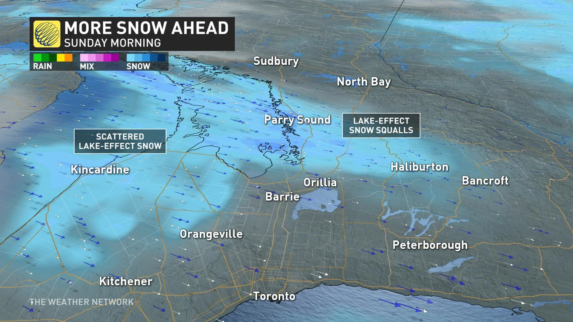
Lake-enhanced snow squalls off of Lake Huron and Georgian Bay continue into Friday afternoon
An additional 5-15 cm of snow expected for the Sudbury area and parts of central Ontario before snow pulls eastward late Friday afternoon
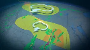
Chilly weekend weather and bands of lake-effect snow north of the GTA into Sunday
Stay up-to-date on the ALERTS in your area
The downpours that marked Halloween have ended across southern Ontario, but the powerful winds that reached peak intensities through the overnight will have some lingering impacts through the day Friday.
MUST READ: Nasty November cold set to span most of the country
By the early morning hours, Hydro One reported almost 900 outages, affecting more than 98,000 customers across the region. By the mid-afternoon, that was down to around 50,000 customers, though Hydro One said additional damage and outages were possible as winds move eastward.
A peak wind gust of 94 km/h was recorded at Toronto's Billy Bishop Airport, while Port Colborne saw winds clock in at 130 km/h through the overnight hours.
DELIVERY VAN PINNED BY TOPPLING DEBRIS IN TORONTO
Officials say a delivery driver is lucky to be alive after Thursday's howling winds blew a construction beam into his path along Elington Avenue Halloween night.
The male driver was trapped for an extended period of time as the debris pierced right through the windshield and pinned him to his seat. He was extricated from the vehicle and then rushed to a hospital trauma centre, where he was reported as conscious and alert.
The westbound lanes of Eglinton Avenue West were closed at Don Mills Road to allow for clean-up with ongoing clearing expected through Friday.
IT HAPPENED, SNOW ARRIVED IN SOUTHERN ONTARIO
As rain showers resumed during the overnight hours, falling temperatures allowed for a transition over to wet snow through early Friday, with dangerous driving conditions reported with the lake-enhanced flurries.
No accumulation has been recorded for most of the GTA, though a few centimetres have fallen for some southwestern regions, including for Orangeville and the Kitchener and Waterloo regions. Those squalls were all but ended by the mid-afternoon.
"So anyone without snow tires remember to practice safe, winter driving," Sonnenburg warns, adding that within narrow bands of snow squalls, reduced visibility and dangerous driving conditions can be expected.
SEE ALSO: Canada's got some freaky fall frost stats
STAYING CHILLY FOR THE WEEKEND AND BEYOND
Colder than average temperatures will lock in for at least the first week of November, with a threat more lake-effect snow in the traditional snowbelts this weekend.
"Temperatures will be several degrees colder by next Wednesday and a weak system crossing our region will bring a period of rain that could mix with wet snow for northern parts of the Golden Horseshoe," says meteorologist Dr. Doug Gillham.
A blast of even colder arctic air will round out the end of next week, as daytime highs struggle to reach the freezing mark.
"This will bring a high risk for substantial lake-effect snow in the traditional snowbelts," says Gillham.