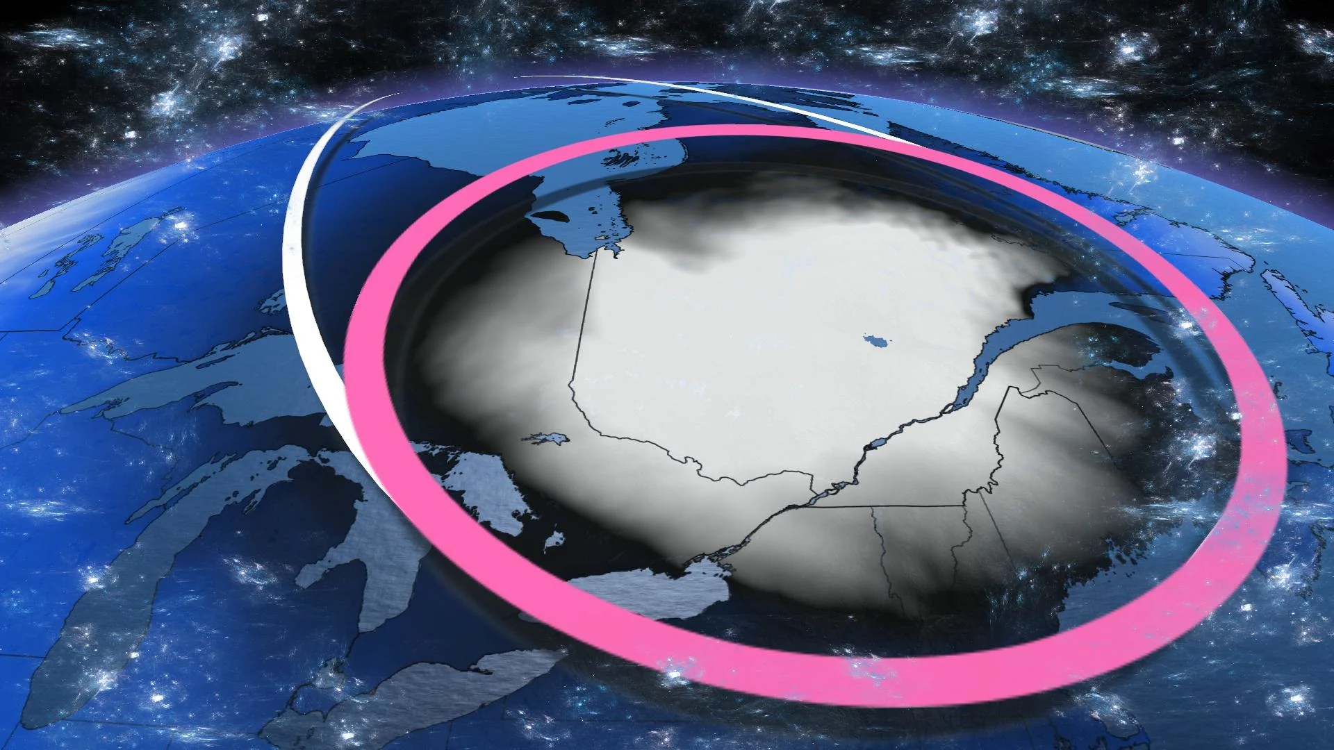
Polar vortex may bring Eastern Canada's coldest temperatures in years

It's been an incredibly mild stretch of weather across the country throughout January, but February will buck the trend in a big way, especially in Eastern Canada.
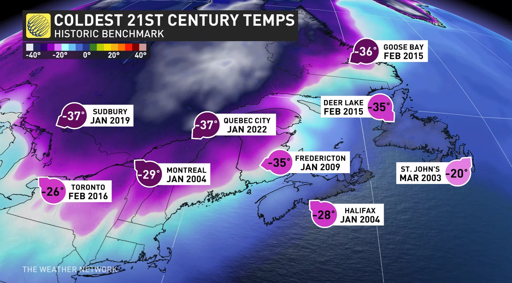
Eastern Canada has had a relatively easy winter so far, temperature-wise, but that's going to change in a hurry.
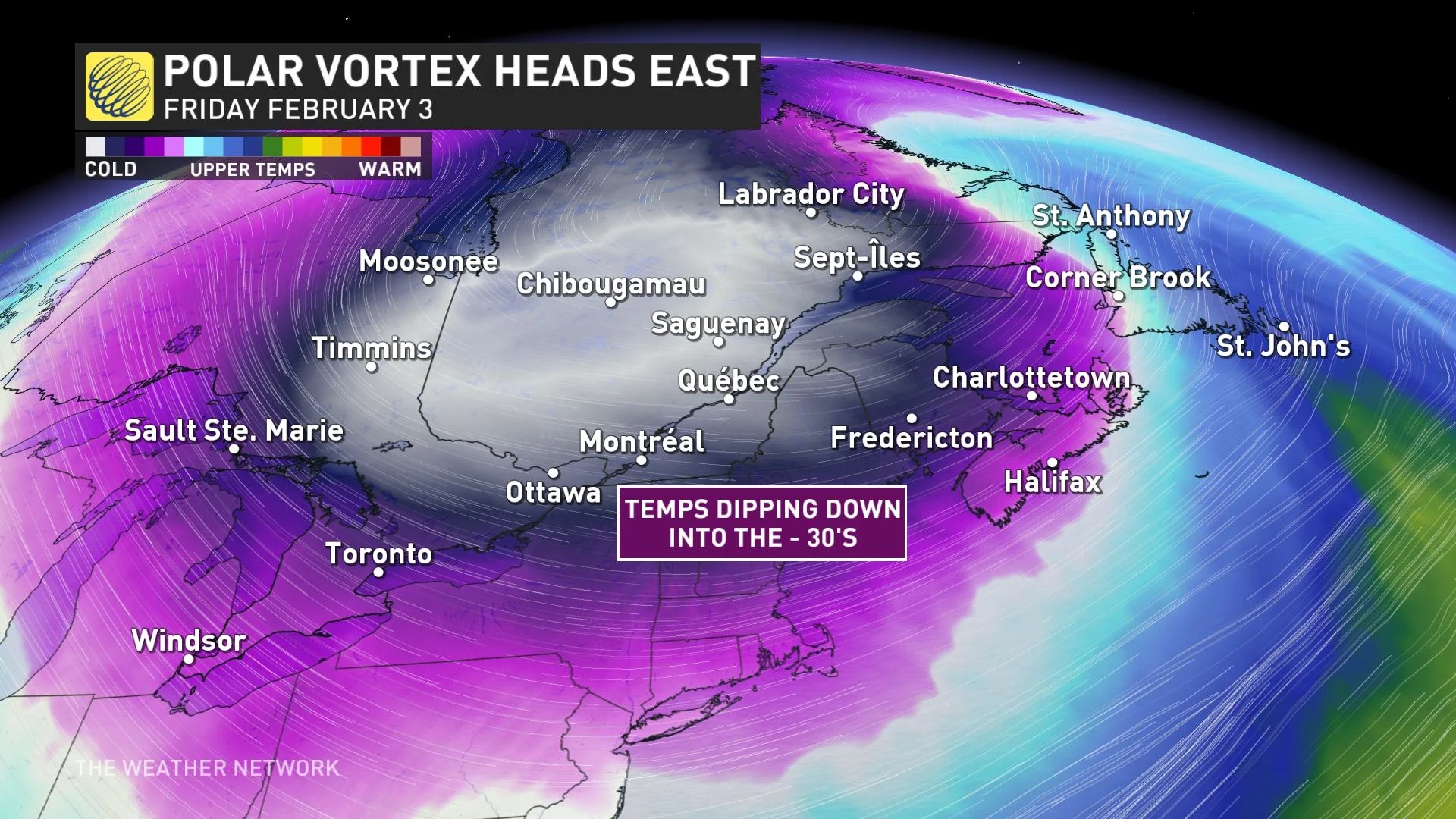
The most potent lobe of the polar vortex will descend across Canada late this week, and its short-lived stay will pack a punch. It's been an incredibly mild stretch of weather across the country throughout January, but February will buck the trend in a big way.
SEE ALSO: The deep freeze returns to Western Canada to end January
Early this week, the polar vortex is meandering across Hudson Bay, but some reinforcing shots of cold air will displace the polar vortex across Ontario, Quebec and Atlantic Canada.
When does this all begin?
A clipper system moves through on Thursday along the dividing line of Arctic air. Behind the low, the cold air is free to surge south. We'll have to watch intense lake-effect bands off Georgian Bay and Lake Huron as the lakes remain ice-free.
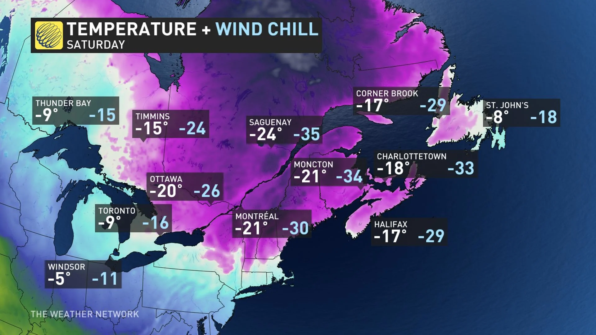
Here's the most likely scenario for temperatures early Saturday morning (Feb. 4). The Greater Toronto Area (GTA) will fall below -20°C, in areas away from the lake, and eastern Ontario will plunge below -30°C.
It's likely a few locations in northeastern Ontario and Quebec fall into the -40s into Saturday morning. A strong ridge quickly builds in behind, so temperatures moderate rapidly into Sunday, Feb. 5 and Monday, Feb. 6.
The peak cold is forecast to slide across the Maritimes late Friday into Saturday. Dangerous wind chills and sea-effect snow will be significant hazards through Saturday. Widespread temperatures of -30°C are possible across New Brunswick before a mild surge of southwest air shunts the cold north.
It's looking like the Halifax, N.S., area will see the coolest temperatures since January 2004. With such an abrupt drop in temperatures, frost quakes are a possibility with ample soil moisture from the fourth rainiest January on record.
WATCH: Three hidden dangers of extreme cold to look out for
Make sure to bundle up with extra layers for the foreseeable future. Southern Ontario won't see daytime highs reach above the freezing mark for approximately nine days (until Wednesday, Feb. 8).
Noteworthy statistics
The last time Montreal, Que., had a daytime high below -10°C was Feb. 28 2022
Last time Montreal had a daytime high below -20°C was Jan 6., 2018
Last time Montreal had a daytime high colder than -24°C was Jan. 3, 1981
With files from Tyler Hamilton and Melinda Singh, meteorologists at The Weather Network, and Nathan Howes, a digital journalist at The Weather Network.