Severe risk spans Prairies on Saturday before major storm Monday

A major storm system will threaten parts of the Prairies next week with widespread soaking rains for areas that could desperately use the moisture.
The Prairies are staring down a stormy stretch of weather as we look ahead toward this weekend and next week. A risk for severe thunderstorms will span the region for the day on Saturday. A major storm system will arrive on Monday and bring widespread heavy rain through midweek. More on what you can expect in the days to come, below.
Visit our Complete Guide to Summer 2022 for an in-depth look at the Summer Forecast, tips to plan for it and much more!
THIS WEEKEND: SEVERE STORMS POSSIBLE ACROSS THE PRAIRIES
The Prairies have an active weekend ahead before the main event arrives next week.
A low-pressure system moving across the region will bring a widespread risk for thunderstorms to all three provinces this weekend.

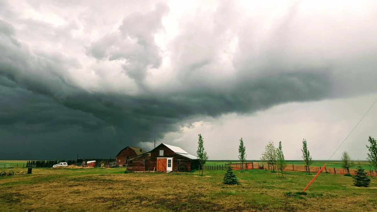
The most widespread risk for storms will fall on Saturday afternoon as the low brings plenty of instability and lift to the region. Some of the thunderstorms could reach severe limits.
We’re looking at two main areas at risk of severe thunderstorms. The largest area covers eastern Alberta and a small section of western Saskatchewan.
Another area at risk of severe storms stretches from east-central Saskatchewan through southern Manitoba, including the Winnipeg metro area.
Any storms that form in and around the risk areas on Saturday could produce large hail and strong wind gusts.
We’ll see a renewed chance for storms on Sunday, then we have to start looking ahead to the next major storm system arriving early next week.
DON'T MISS: Doctors say thunderstorms can trigger asthma. Here are some possible reasons
MONDAY THROUGH WEDNESDAY: MAJOR SYSTEM APPROACHES THE WEST
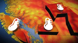
We’re mired in a pretty bad drought across the western Prairies.
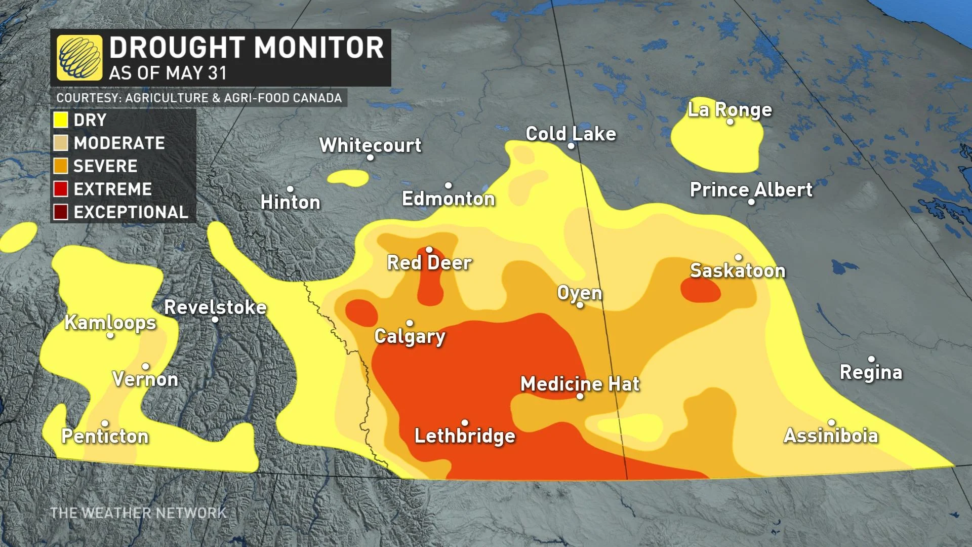
The latest update of the Canadian Drought Monitor, issued on May 31st, shows almost the entire southern half of Alberta struggling with severe or extreme drought. This intense drought also extends into portions of southern Saskatchewan.
Thankfully for growers, a storm is on the horizon that could bring beneficial rains to areas that need it the most.
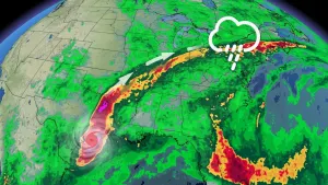
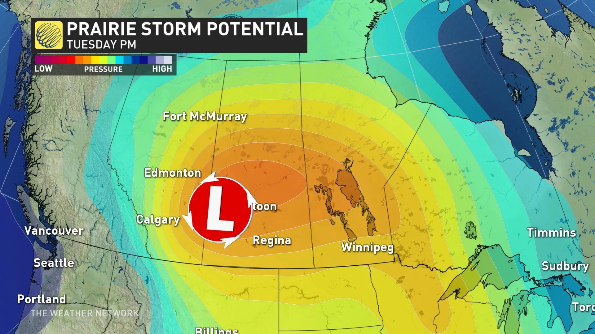
An upper-level low spiraling over the Gulf of Alaska has brought a long stretch of foul weather to the West Coast in recent days. This stubborn pattern will result in a trough swinging over the Pacific Northwest this weekend before lifting north toward the western Prairies.
SEE ALSO: Everyone needs a home emergency kit. Here's what to stock yours with
This trough will spawn a low-pressure system as it crests the Rockies, bringing several days of rainy weather to parts of Alberta and Saskatchewan. The low-pressure system may not move anywhere in a hurry, leading to several days of rainfall for the affected areas.
Precipitation is likely to begin in Alberta on Monday and last into Tuesday. The rainfall will last even longer in Saskatchewan, with precipitation pushing in later Monday and lasting into Wednesday.
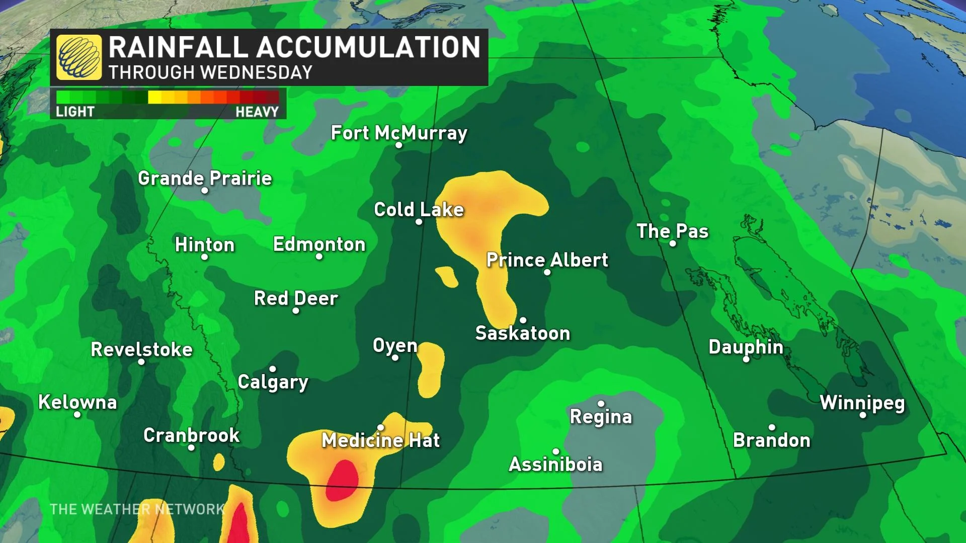
While it’s still too early for specific rainfall totals, it’s likely that significant rains will fall over areas that need it the most. Make sure to check back frequently as we get closer to the storm and forecasters refine their predictions for the region.
WATCH: PRAIRIE FARMERS BATTLE WITH BOTH DROUGHT AND FLOODING THIS SPRING
The approaching system will also send temperatures falling well below seasonal for the middle of June. After a seasonable weekend, daytime highs in Calgary will fall into the mid-teens through the middle of the week.
Thumbnail courtesy of Ela Thakore
Stay tuned to The Weather Network for the latest updates on conditions across the Prairies.