Severe storms sweeping the Prairies amid an active Canada Day

Another round of vigorous thunderstorms could sprout in the skies over the Prairies on Canada Day. Keep a close eye on watches and warnings through the day.
A renewed threat for severe thunderstorms will blanket much of the Prairies just in time for Canada Day celebrations through the afternoon and evening hours.
Severe weather is likely with this favourable setup, and the potential for tornadoes can’t be ruled out.
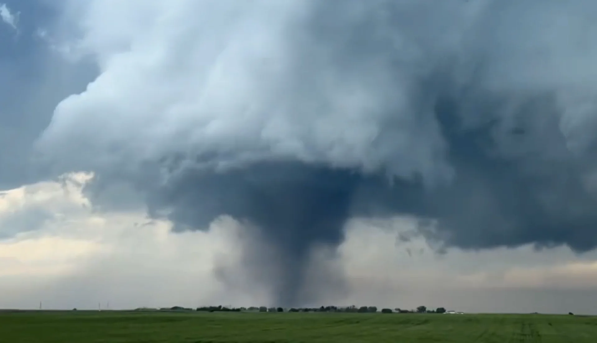
We've already seen tornado storms develop in Alberta through the early afternoon hours on Saturday.

A particularly damaging tornado struck near the town of Didsbury, north of Calgary.
Additional severe storms and tornadoes are possible through the evening.
Keep the radar handy on your phone if you’re under the threat of storms on Saturday, and make a plan to seek shelter in a hurry if hazardous weather approaches your location.
RELATED: Damage, injuries reported following 'large tornado' in central Alberta
Saturday
Areas: Alberta, Saskatchewan, and Manitoba
Timing: Afternoon and evening hours
Weather: We’re on alert for widespread severe weather across the Prairies once again on Saturday as a favourable environment builds over the region.
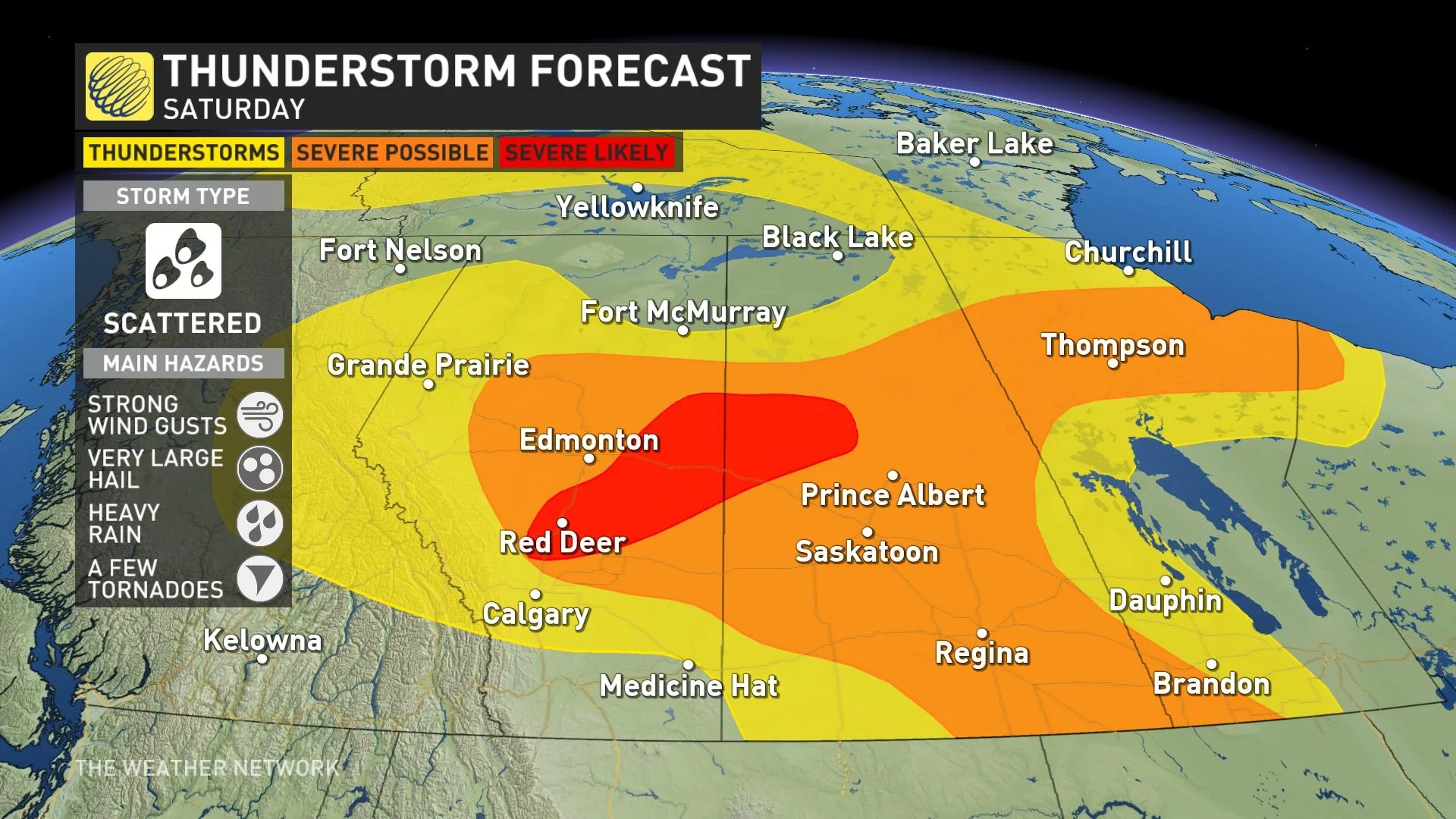
A low-pressure system moving through Alberta will serve as the trigger to scoop that unstable air skyward, giving storms the spark they need to develop and thrive.
Strong upper-level winds aloft will provide those storms with the ‘kick’ they need to organize and surpass severe limits.

The development of supercells is likely, especially in central Alberta extending east to parts of Saskatchewan. These regions should remain on high alert today as conditions can quickly change.
Given the factors at play, these storms will be capable of producing very large hail and possibly even a few tornadoes, alongside the risk for strong wind gusts and heavy rainfall.
The greatest threat will cover central Alberta and southern Saskatchewan. As the system progresses, areas around Edmonton and Red Deer will see the most considerable potential for severe storms.
Additional severe thunderstorms are possible through northern portions of Saskatchewan and Manitoba as well as northern Ontario.
WATCH: Lightning safety tips you need to know this summer
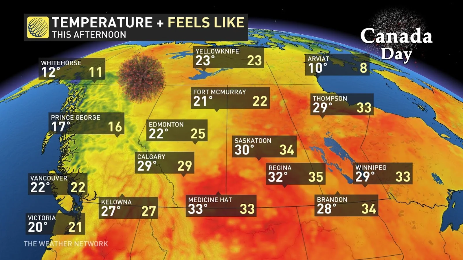
A threat for potent thunderstorms during the afternoon and evening hours on Canada Day is especially tricky given the number of outdoor plans and activities scheduled throughout the region.
DON'T MISS: Tornadoes can happen anywhere—and cities aren't immune
Keep The Weather Network’s app handy on your phone to peek at the radar and keep up with watches and warnings as the day progresses.
Stay close to a safe shelter in case storms threaten your location. And remember, the greatest danger in any thunderstorm is lightning. If you can hear thunder, you’re close enough to be struck by lightning.
One last day for temperatures in the low 30s for southern Alberta and Saskatchewan. As it moves east, this cold front will bring a temporary cool-down to those provinces, but the heat will be on for Manitoba on Sunday.
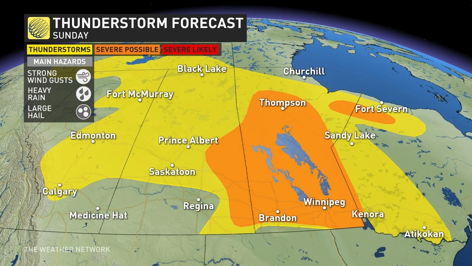
Sunday
Areas: Alberta, Saskatchewan, and Manitoba
Timing: Afternoon and evening
Weather: The heat and thunderstorm activity continues into Sunday, shifting focus to Manitoba.
The widespread system will once again bring the threat of heavy rainfall, large hail, and strong wind gusts. Much of Manitoba could see the potential for severe thunderstorm activity.
Thumbnail courtesy of Ryan Voutilainen.
Stay with The Weather Network for the latest on the severe storm threat across the Prairies.