
Rain-stricken Ontario will see more wet weather as soggy April presses on
Get ready for more rain, southern Ontario, as more systems make their way into the region this week, keeping the trend of a soggy April going strong
To say April has been a wet month in southern Ontario thus far is putting it mildly. And, we're about to get even soggier in the region this week.
A wet start to the month has pushed Toronto into a spot on its top 10 rainiest Aprils on record, but will the second half bring enough wet weather to make it the rainiest ever documented?
RELATED: Soggy April in southern Ontario could ease drought, wildfire concerns
The whole month hasn't been wet, but when it has rained, it has tended to pour. Just a handful of systems have been responsible for dumping more than 100 mm of rainfall this month for some locales, and we've just crossed the midway point of April.
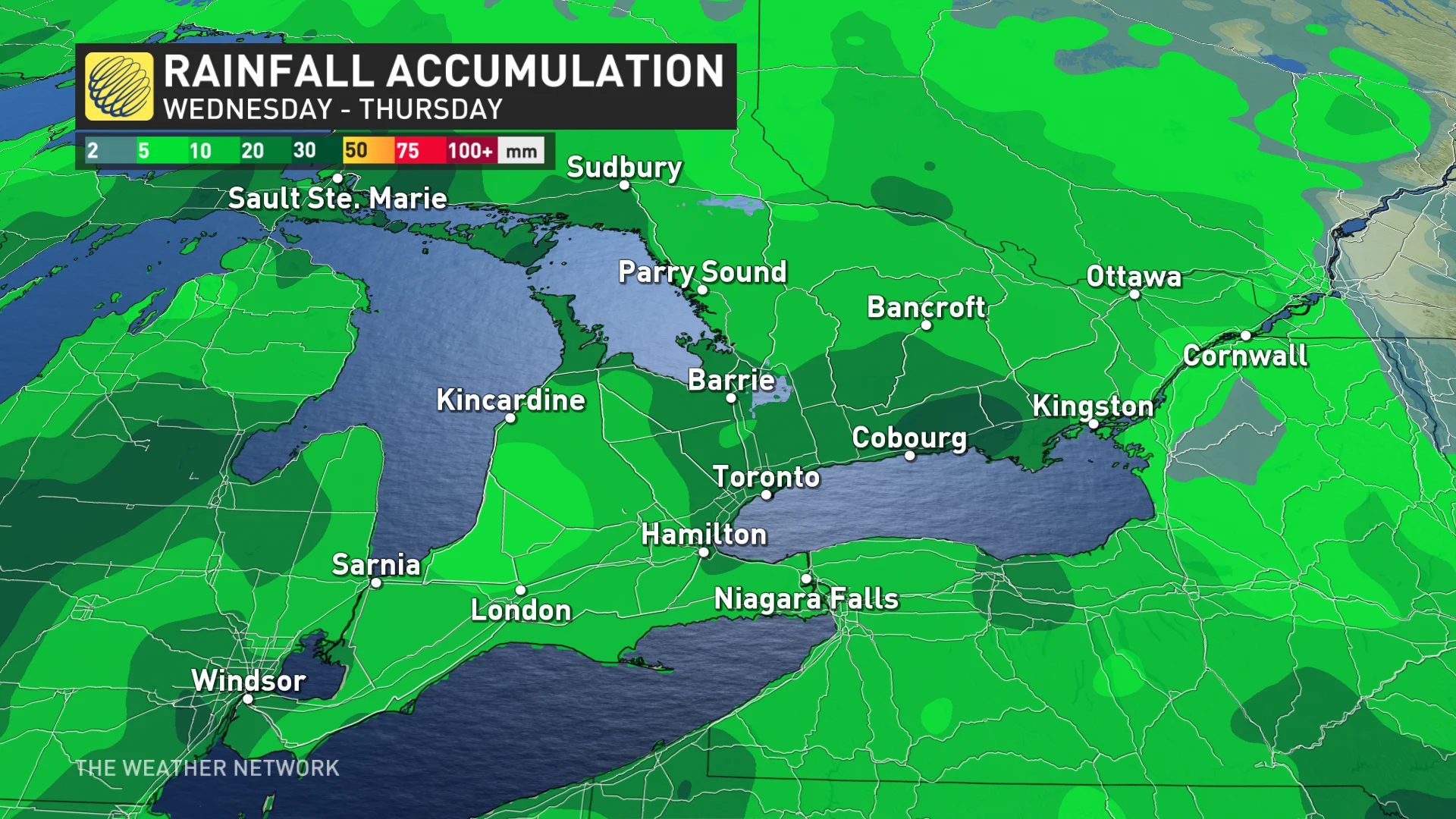
This week will see the monthly totals increase with the new rounds of rainfall, stretched out over multiple days.
Wednesday to Friday: More rounds of rain move in
Rain pushes into southwestern Ontario Wednesday morning and then tracks towards the Greater Toronto Area (GTA) and eastern Ontario by the evening.
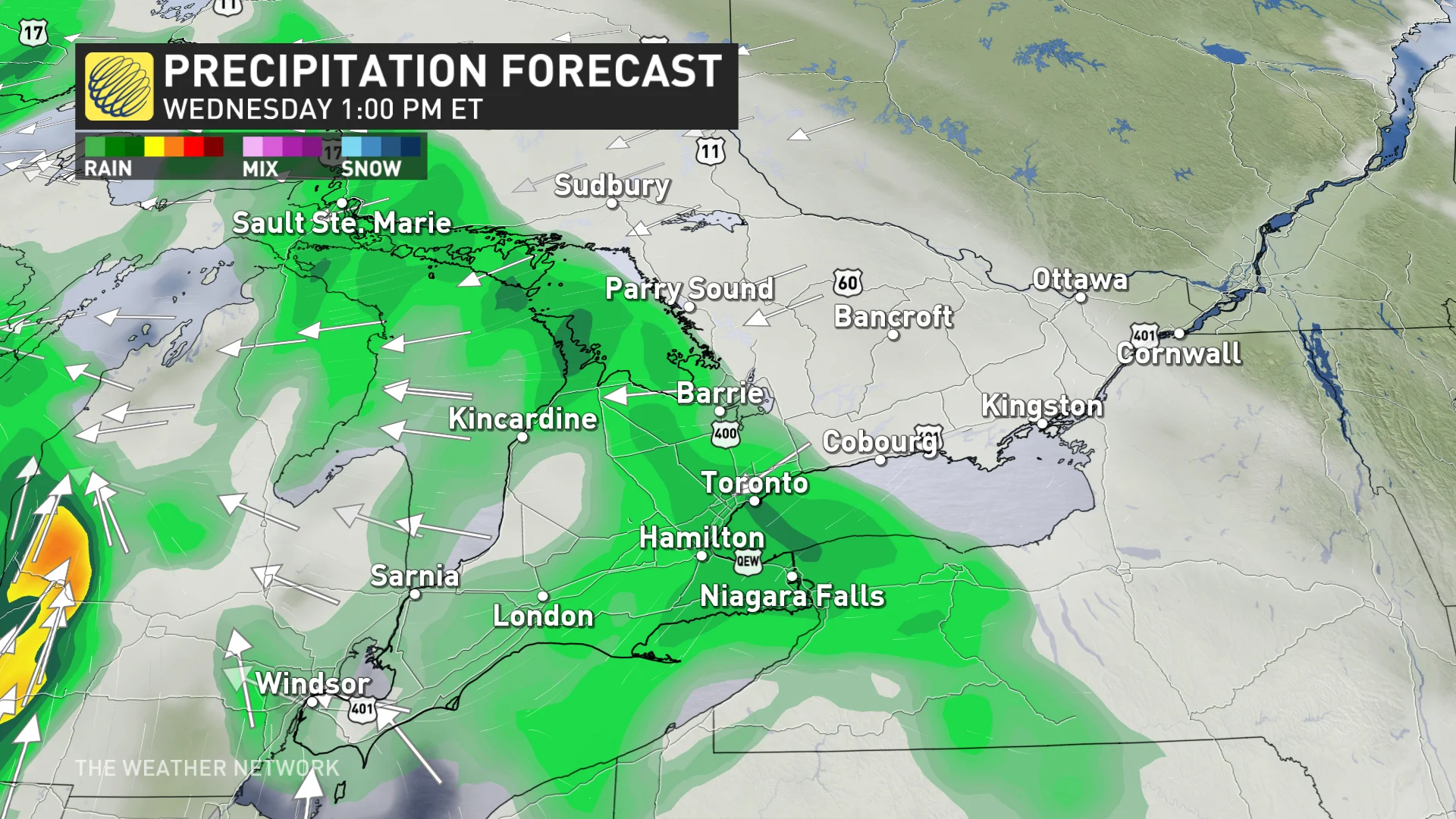
A second round of rain moves into the southwest on Wednesday evening, eventually catching up to the first round in the overnight period. Rain looks to stay west of Ottawa as high pressure keeps them dry on Wednesday.
However, the greatest uncertainty is how far east the rain moves.
While southwestern Ontario will see a relatively dry day on Thursday, rain continues to track east and move out of the GTA during the morning period, reaching Ottawa by the afternoon.
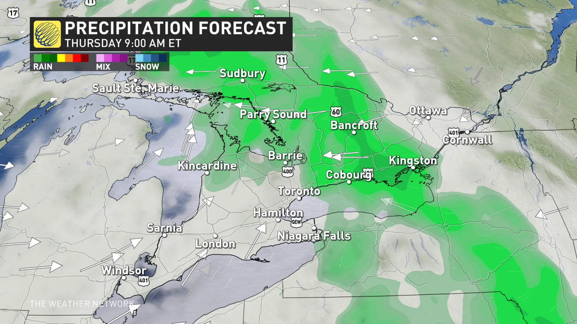
If that weren't enough, a third round of rainfall is forecast to move through southern Ontario on Friday.
While we expect multiple shots of rainfall, the exact amount over the course of multiple days is uncertain.
April rainfall totals so far are heavy, but signs indicate a drier second half of the month
Kirkland Lake, Ont.,recorded 62.6 mm of rain on Friday, April 12.
For Toronto, April has already been above normal for rainfall. A typical April sees 63 mm of rain at Pearson International Airport, but so far this month, as of April 15, the site has been hit with 93.7 mm –– approximately 150 per cent of its average and making it the 10th-rainiest month on record.
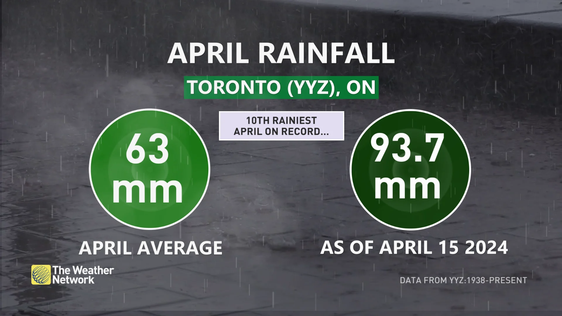
An additional 39.7 mm of rain this month will tie the record of 133.4 mm from April 1992.
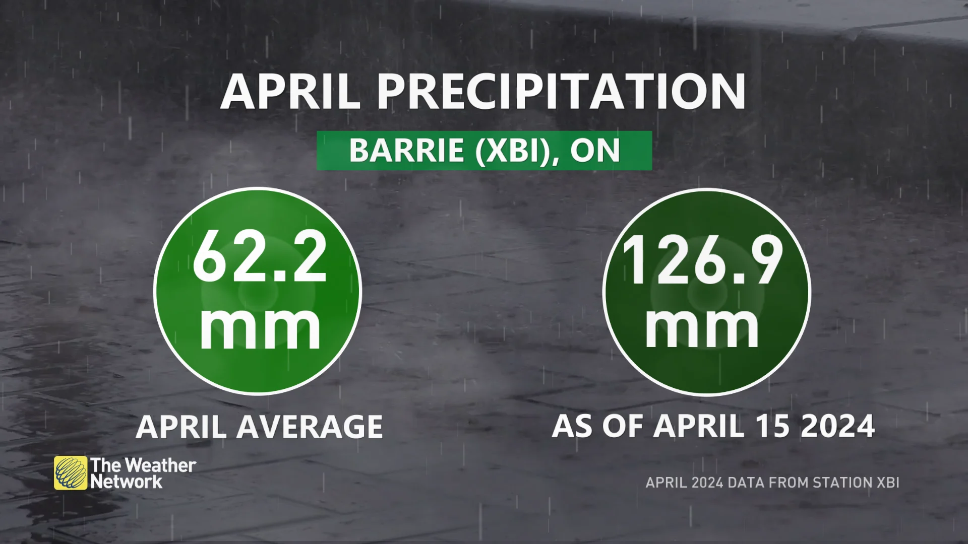
But, it's Barrie, Ont., that leads the way in precipitation anomaly this month. It is now at approximately 200 per cent of its average monthly precipitation through first two weeks of the month, as of April 15.
MUST SEE: No April fool: Almost every province could see snow next week
While this week will be quite wet, the second half of April is forecast to see normal or slightly drier-than-normal precipitation.
Forecasters are watching the potential for a stretch of very warm weather for the final few days of April and into the beginning of May. However, there will also be a chance for shots of cooler weather backing into the region from Quebec as the focus of the warmth is expected to be just west of the region.
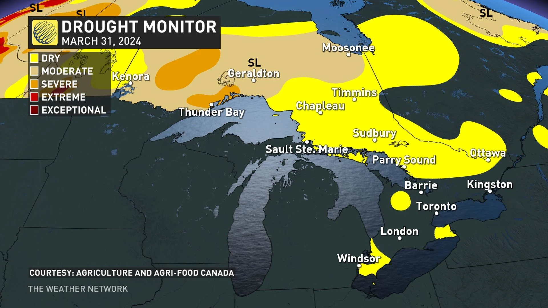
Rain helps ease wildfire, drought concerns
While many Ontario residents have been dismayed by the rainfall, the precipitation does mean a somewhat lessened threat for drought and wildfires leading up to the start of summer, both prevalent in northern parts of the province in summer 2023.
Thumbnail courtesy of Unsplash/Ajaykumar Kannan.
Stay tuned to The Weather Network for the latest forecast updates in southern Ontario.


