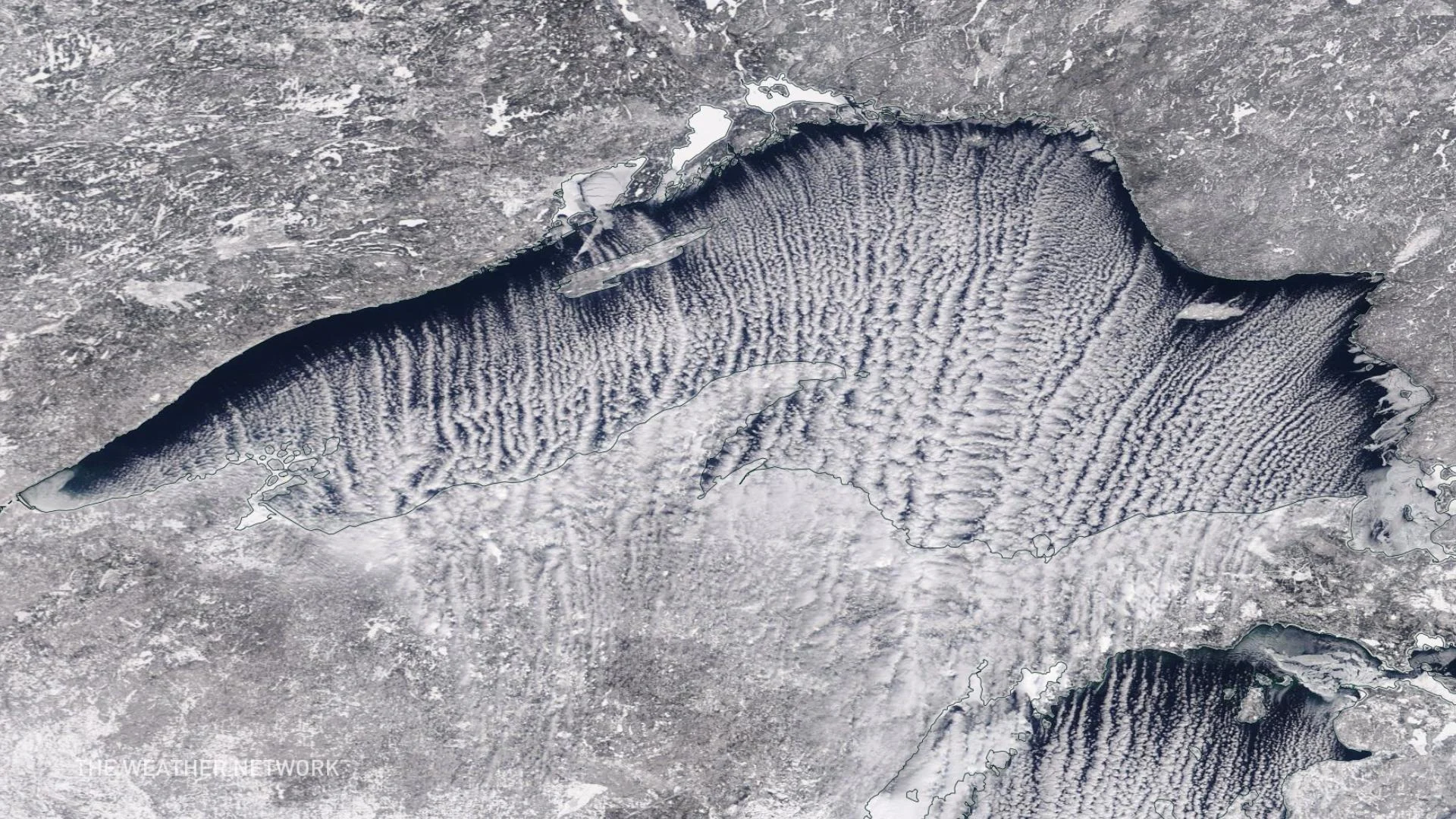
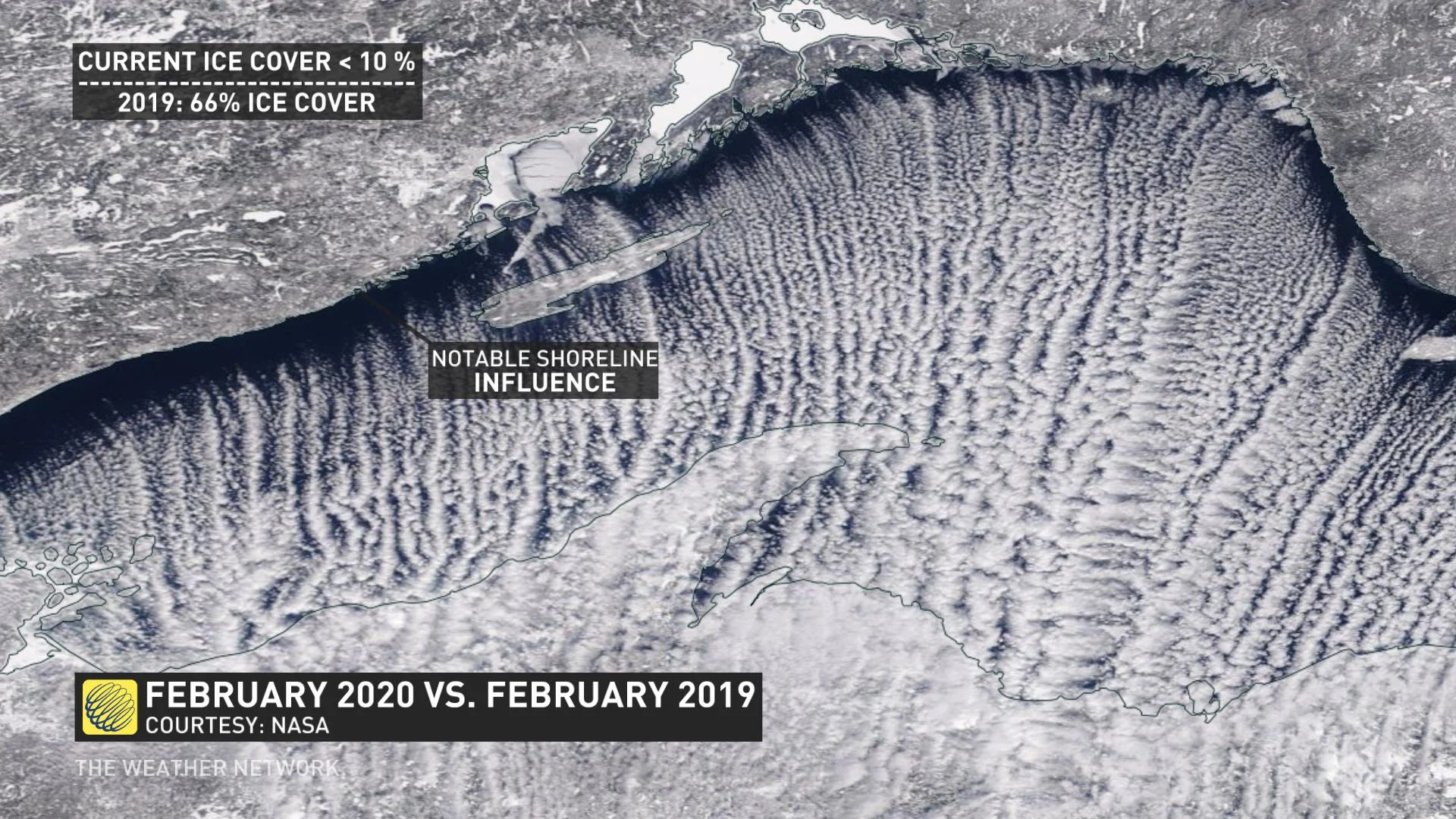
Rare 'cloud streets' stream across Lake Superior

The bursts of snow along an Arctic front transitioned Ontario into the coldest air mass of the season, but the effect on Lake Superior might just take your breath away.
Don't try to drive on these cloud streets. You won't get very far.
Weird stuff happens when it gets really cold. On Thursday, a sharp temperature plunge occurred within minutes in northern Ontario.
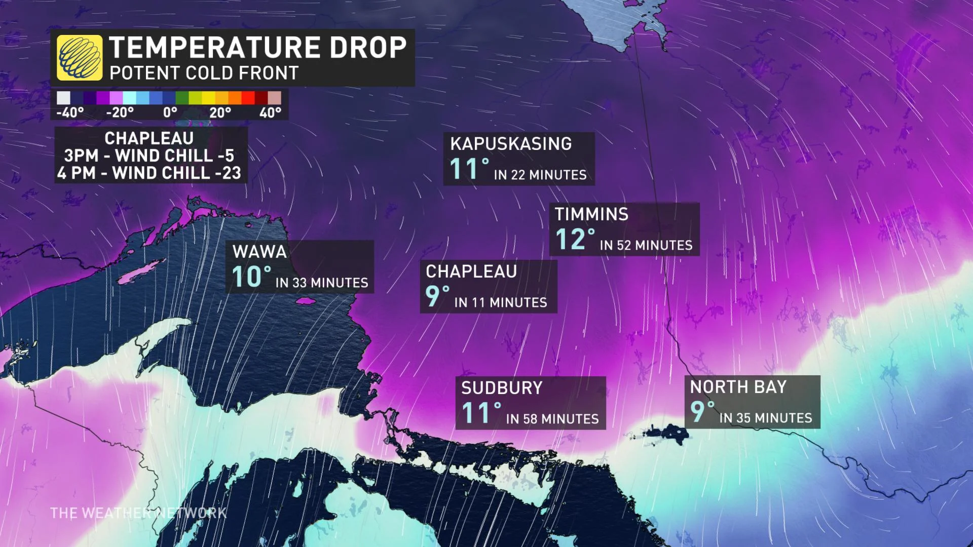
The bursts of snow along an Arctic front transitioned Ontario into the coldest air mass of the season, but the effect on Lake Superior might just take your breath away.
With less than 10 per cent of Lake Superior covered in ice, water temperatures hovered just above the freezing mark for mid-February. At this time last year, 66 per cent was covered by ice.
The physics is undeniably complicated with these funky cloud highways, but there are some theories.
What causes these strange formations?
Cloud streets are always aligned with the wind, gravity waves are not (perpendicular to wave crest)
Water vapour condensation happens on the upward side of the roll, and evaporation typically happens on the downward side
The thought is rotation and friction are the primary cause of these weird formations
A narrow part of the atmosphere allows these to form, unstable lower levels with daytime heating, but stable air aloft keeps these circulations organized
The Arctic air created an approximately 30°C difference between the water and the air temperature – a super unstable atmospheric profile.
Why the pronounced difference close to the shoreline? Meteorologist Kevin Mackay goes into more detail about how the topography influences each individual cloud street:
"Lake Superior is surrounded by high elevation, especially along the northern shore in Ontario and Minnesota. The rugged shoreline within the Canadian Shield can rise to 300-500 m above the lake surface within a few kilometres of the shore."
From Duluth, Minnesota, to Thunder Bay, the shore is relatively linear, which allows for more even and consistent convective bands to form. From Thunder Bay to Sault Ste. Marie, bays, peninsulas, and islands disturb the flow in the lower levels and allow fewer but more dominant bands to develop.