Record-breaking: El Niño stole winter from Ontario in December

Above-seasonal temperatures and lack of snowfall dominated the month of December for many locations across Ontario.
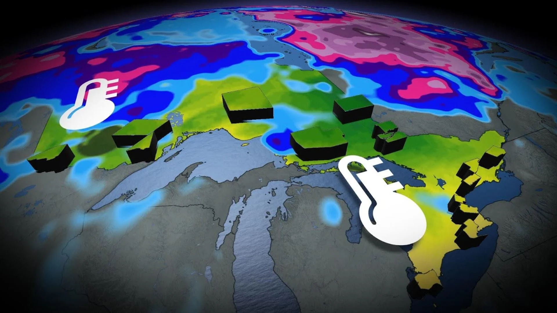
The month of December was anything but ordinary across Ontario. The further north you travelled, the more extreme the temperature anomaly grew, producing weird weather across the province.
Here's what you need to know:
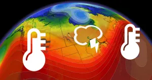
Temperature extremes
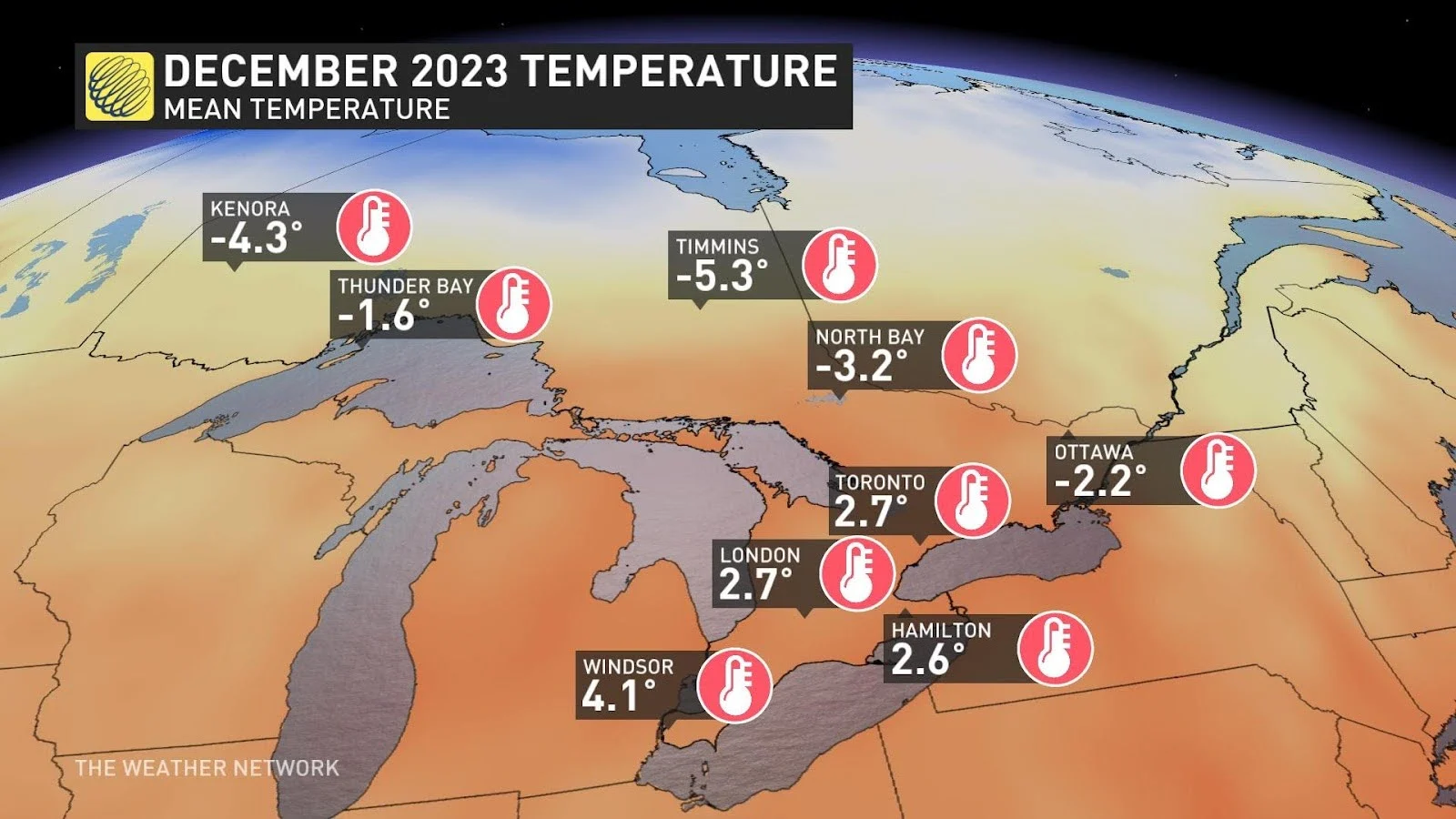
The entire province averaged above seasonal temperatures, using the calculated mean temperatures.
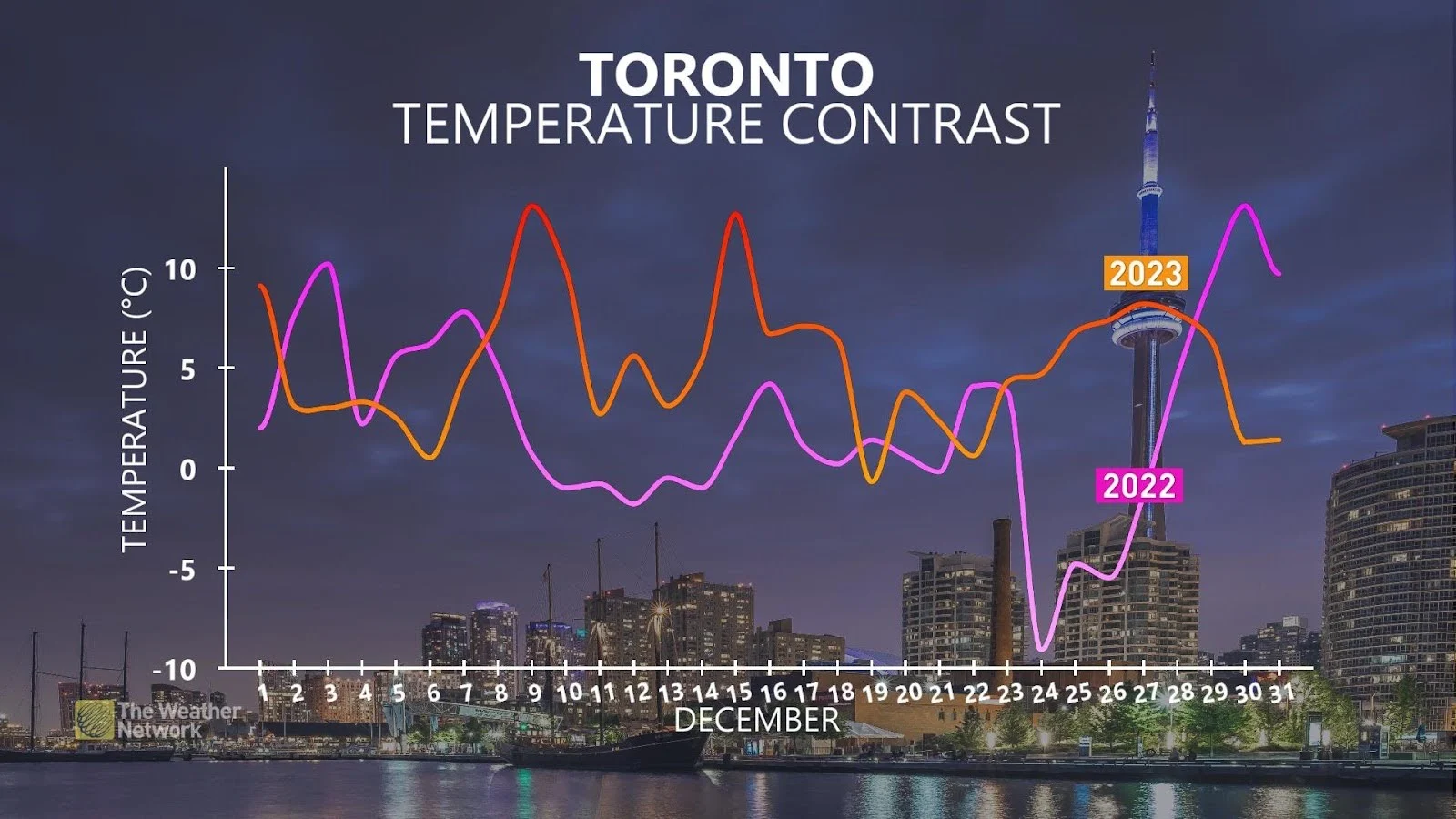
Above-freezing temperatures dominated the pattern in southern Ontario, and that becomes apparent when taking a look at the temperature recap for Toronto:
SEE ALSO: Where did December go? Canada's winter wonderland turned upside down
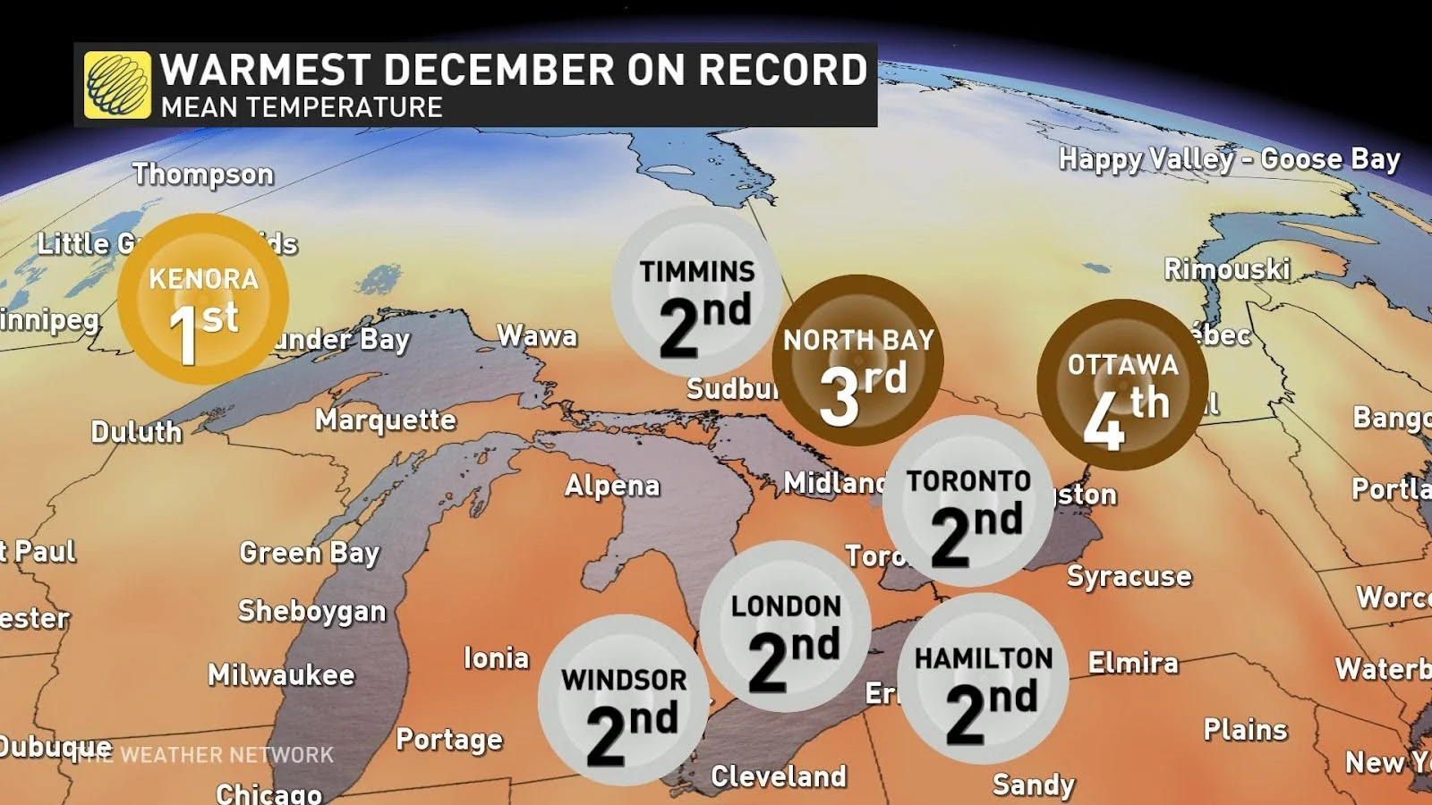
The most abnormal warmth was in Kenora, which shattered its warmest average temperature in December by 3°C.

Due to the incredibly mild conditions, many locations in the province had their second warmest December recorded: Hamilton, London, Timmins, Toronto, and Windsor.
Much like 2015, a strong El Niño has contributed to the lack of below freezing temperatures in much of southern Ontario.

Precipitation extremes
A couple of standout statistics include the amount of rainfall and lack of snow.
First, the rainfall amounts were noteworthy across southern Ontario, tipping well above average.

RELATED: From fires to floods: Canada's 2023 was a fury of record-breaking weather
Toronto received 200% of normal rainfall, making it the sixth rainiest December on record. Ottawa also received two times normal rainfall, meaning it was the fourth rainiest December on record.
Kenora, on the other hand, with 14 mm of rainfall, the region received nearly 13 times the normal rainfall amount, which is just 1.1 mm. That made it the rainiest December since 1959.
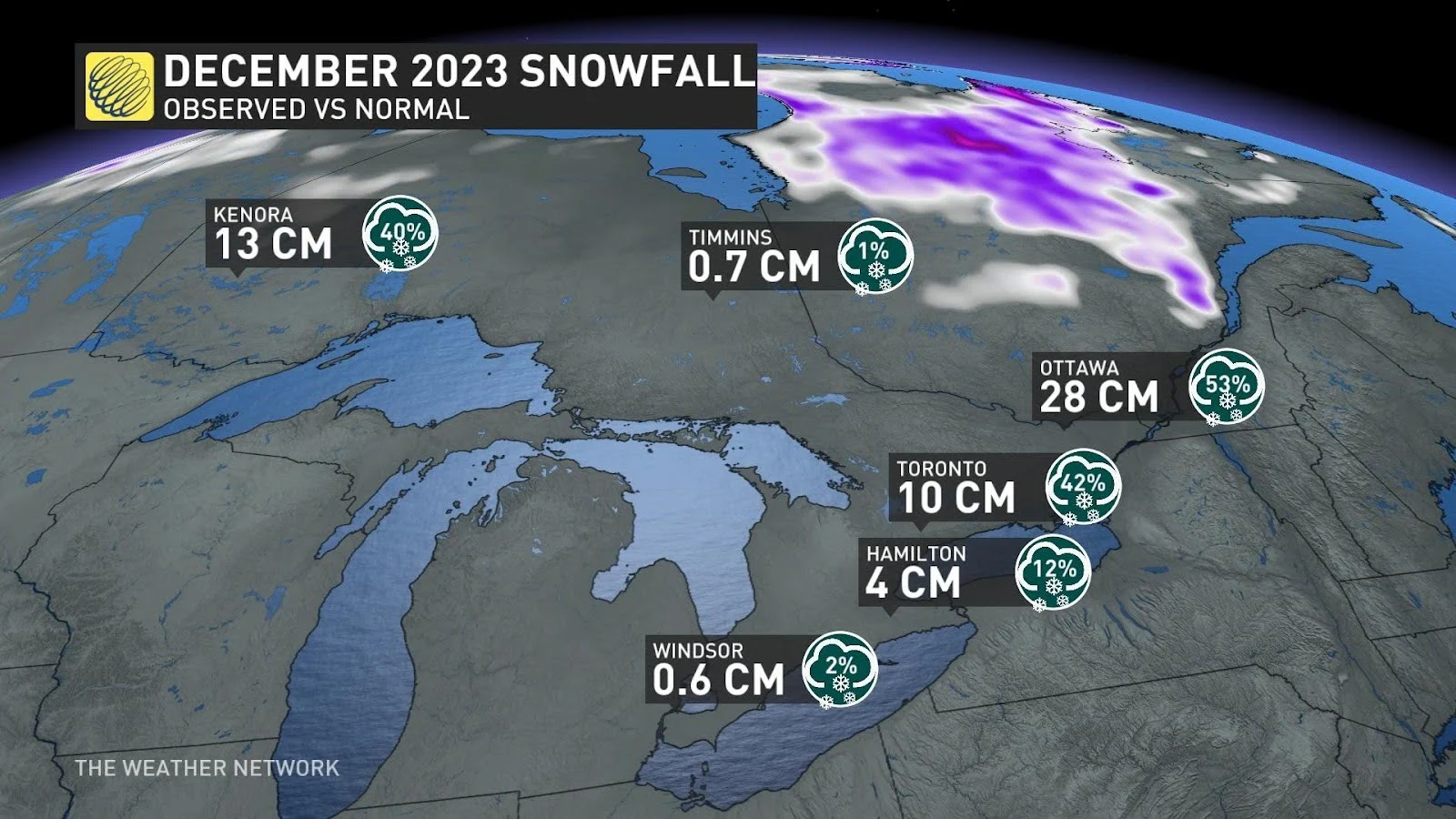
Snowfall was seriously lacking across all of Ontario, as ski hills struggled to find stability throughout the month.
Kenora and Timmins were extreme outliers, both just recording between 1-2% of normal December snowfall. The Timmins snowfall was the lowest ever recorded in December, and of all winter months will full data, it was the least snowiest winter month on record.
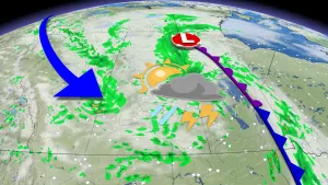
What's next?
As we ease into January, temperatures will progressively get closer to seasonal in northwestern Ontario, thanks to arctic air tracking across the Prairies.
There is still an above-average temperature signal existing across southern and eastern Ontario during the first 10 days of the year.
With cold air finally pushing across central North America, we'll have a better shot at developing deeper areas of low pressure that will tend to track toward the Great Lakes basin.
We're also carefully tracking a low next weekend that will develop southeast of the Great Lakes. It'll be cold enough to support snowfall, but there's major uncertainty on the storm's track, so be sure to check back in a couple of days as the system moves closer.