Severe storm threat creeps into southern Ontario with next bout of rain
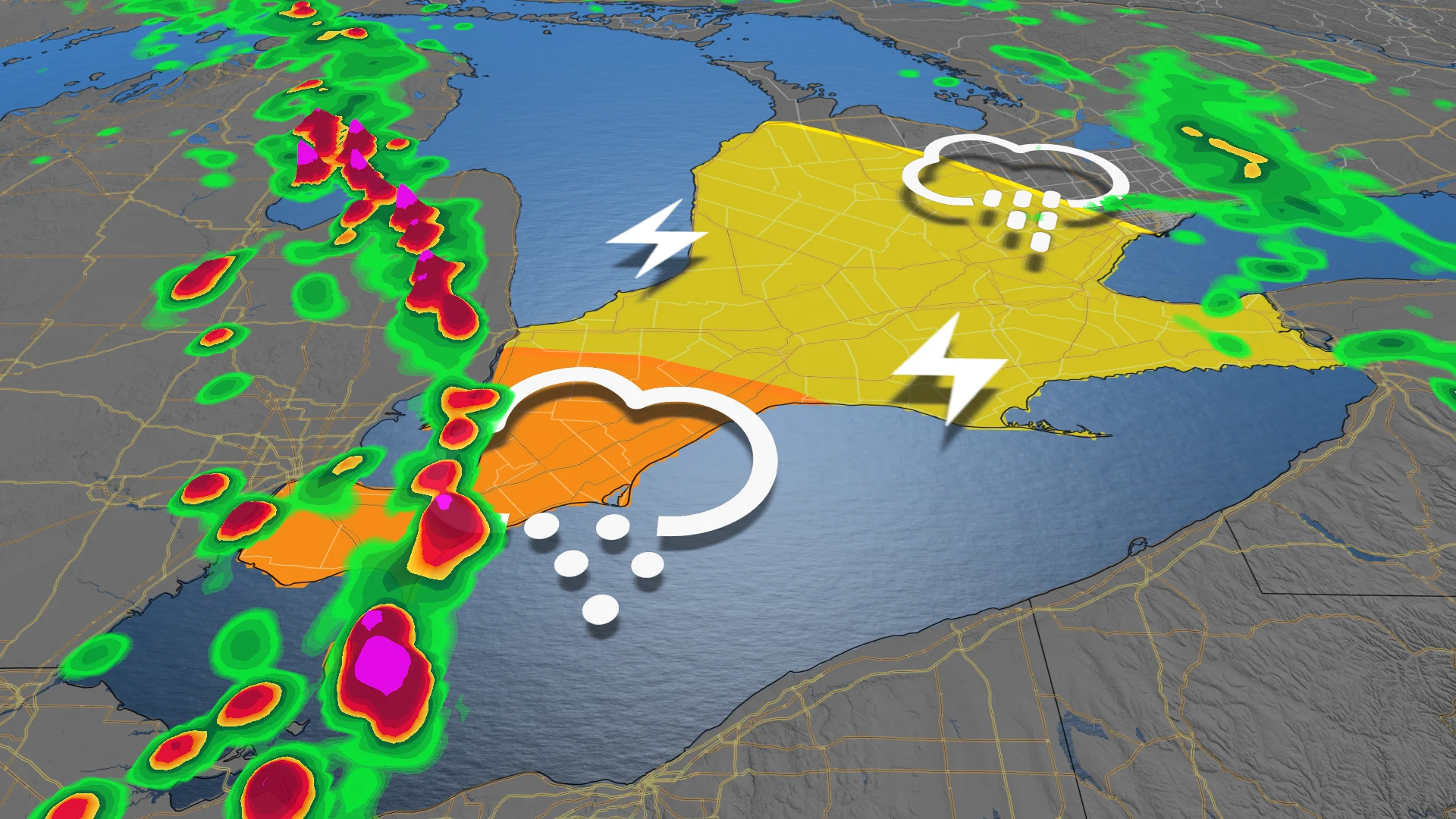
An opportunity for thunderstorms will push back into southern Ontario Wednesday, with a potential for some to reach severe limits in parts of the region.
Ontario scored Canada's first tornado of the year on March 16, confirmed on Monday by the Northern Tornadoes Project. It tied the provincial record for its earliest twister ever documented.
While we don't anticipate another tornado this week, severe weather will be possible in parts of southern Ontario on Wednesday, mainly from Windsor to Wallaceburg, but areas as far north as Port Stanley could see potent storms, as well.
RELATED: Canada's first tornado of the year ties Ontario's earliest on record
The main threats will be large hail, strong wind gusts and heavy rainfall. The latter of which has not been in short supply in southern Ontario this month. To say April has been a wet month in southern Ontario thus far is putting it mildly.
This week will see the monthly totals increase with the new rounds of rainfall and potential thunderstorms on Wednesday.
Wednesday to Friday: Thunderstorm risk and more rounds of rain
Rain pushes into southwestern Ontario Wednesday morning and then gradually tracks towards the Greater Toronto Area (GTA) during this time period.
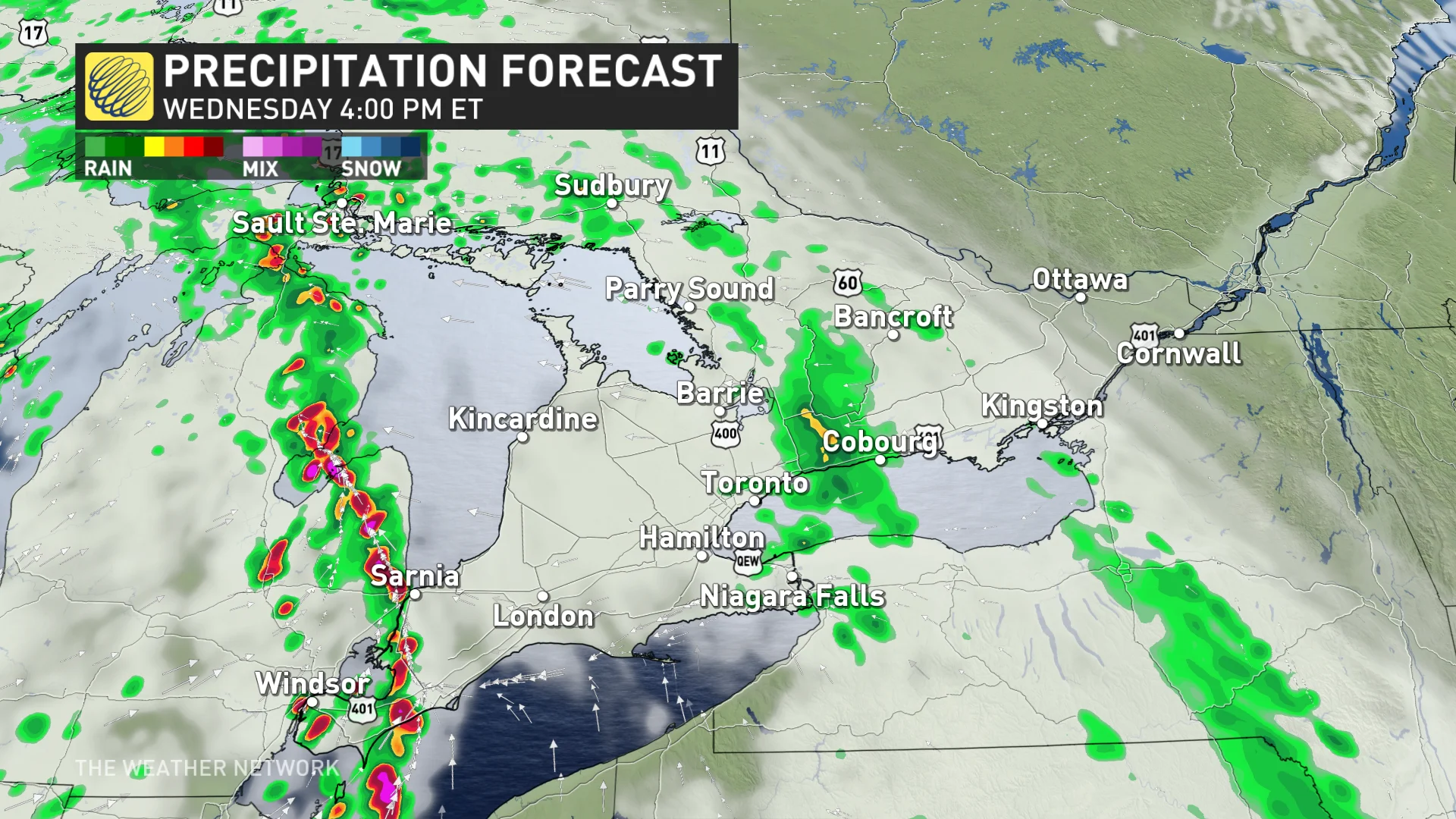
A second round of rain moves into the southwest on Wednesday evening, eventually catching up to the first round in the overnight period.
There is a reasonable risk for thunderstorms in a large area, stretching from southwestern Ontario to Georgian Bay and the Greater Toronto Area (GTA). The chance for severe-level storms exists for extreme southwestern Ontario, with loonie-size hail, strong wind gusts and heavy rainfall as the main hazards.
SEE ALSO:Soggy April in southern Ontario could ease drought, wildfire concerns
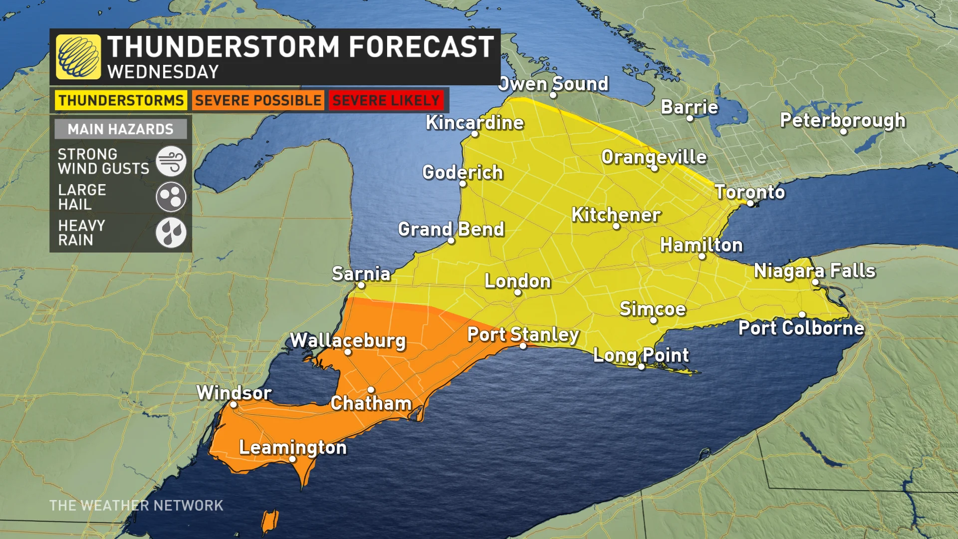
The severe chance is predicated on how quickly the second round of rain and thunderstorms moves into southwestern Ontario since it will determine how far east the severe storms will go.
Rain, meanwhile, looks to remain west of Ottawa as high pressure keeps it dry on Wednesday.
While southwestern Ontario will see a relatively dry day on Thursday, rain continues to track east and move out of the GTA during the morning period, reaching Ottawa during that time.
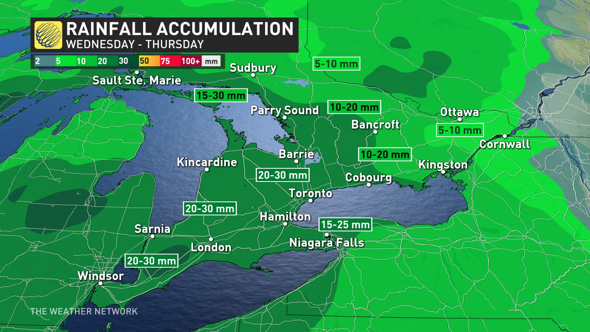
If that weren't enough, a third round of rainfall is forecast to move through southern Ontario on Friday.
While we expect multiple shots of rainfall, the exact amount over the course of multiple days is uncertain.
MUST SEE: No April fool: Almost every province could see snow next week
While this week will be quite wet, the second half of April is forecast to see normal or slightly drier-than-normal precipitation.
Temperatures should trend back to above seasonal for the final days of April, but there is also a risk for wet weather to return. Forecasters are watching the potential for an extended stretch of very warm weather in early May, possibly giving the region an early taste of summer.
Rain helps ease wildfire, drought concerns
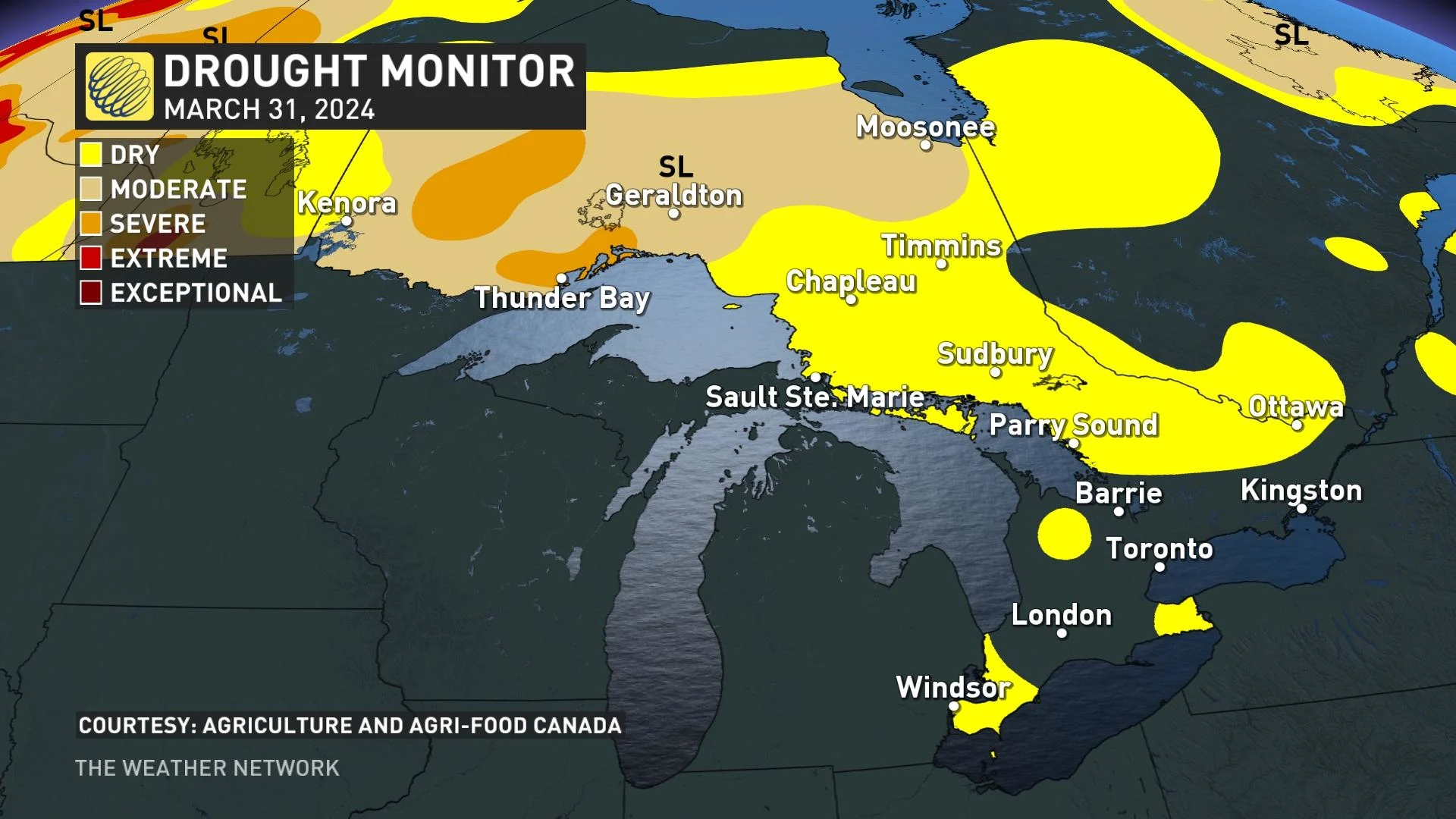
While many Ontario residents have been dismayed by the rainfall, the precipitation does mean a somewhat lessened threat for drought and wildfires leading up to the start of summer, both prevalent in northern parts of the province in summer 2023.
Stay tuned to The Weather Network for the latest forecast updates in southern Ontario.


