Parts of the Maritimes to see severe storms, tornado risk on Friday
Stay alert for rapidly changing conditions on Friday as severe thunderstorms arrive with a cold front on Friday afternoon
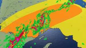
A risk for severe thunderstorms will bubble across portions of the Maritimes on Friday as a potent low-pressure system continues pushing across the country.
Plenty of instability and an advancing cold front will spark widespread thunderstorms through the day Friday. Some of the storms could turn severe through eastern Quebec and New Brunswick. One or two tornadoes can’t be ruled out.
Pay close attention to potential watches and warnings during the day Friday, and have a plan in place to seek safe shelter if severe weather threatens your area.

DON'T MISS: What to do if a tornado warning is issued
Friday: Cold front sparks strong storms
A low-pressure system making its way across the country has sparked several days of severe weather out west.
Numerous tornadoes touched down in Manitoba on Wednesday, with powerful thunderstorms erupting through the day Thursday across Ontario and western Quebec.

Round three will unfold over eastern Quebec and portions of the Maritimes on Friday as the low-pressure system moves toward the region.
Thunderstorms will likely develop across Quebec’s Gaspé Peninsula through the late morning hours, pushing east with the cold front through the day.
MUST SEE: CAPE is the potent fuel that powers a thriving thunderstorm

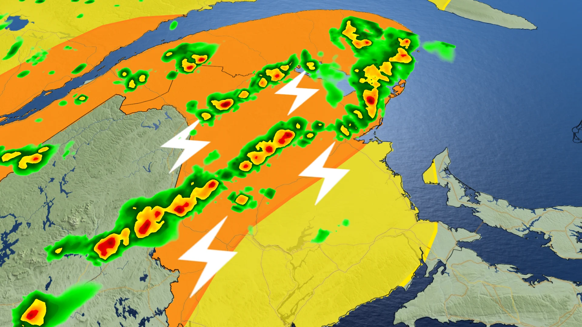
We’ll see a line of thunderstorms develop along the cold front as the boundary pushes through New Brunswick on Friday afternoon. Areas northwest of Frederiction such as Grand Falls and Perth-Andover will see the highest impact. These storms will become more widespread as we head into the late afternoon and evening hours.
Stronger thunderstorms will exceed severe limits and carry the potential for strong wind gusts, large hail, and heavy rainfall. One or two tornadoes can’t be ruled out.
The threat for severe weather will taper off through the evening hours as the line pushes east and more stable air arrives behind the cold front. Non-severe storms are likely across Nova Scotia during the overnight hours Friday.
The thunderstorm threat continues throughout Saturday for parts of Nova Scotia and parts of Newfoundland.
Heat builds into next week
Beyond Friday’s storm risk lies a very hot pattern for the eastern half of the country.
A strong ridge of high pressure will steadily build over the region heading into next week, bringing the hottest temperatures of the season to much of Eastern Canada.
RELATED: Why extreme heat is one of the world’s deadliest weather disasters
Record-breaking temperatures are possible for some areas next week, and humidex values in spots could push into the 40s at times.
Extreme heat isn’t as dramatic as severe thunderstorms, but it’s an exceptionally dangerous threat—especially for vulnerable people who don’t have reliable access to air conditioning. Start preparing now for an extended stretch of very warm daytime temperatures and muggy nights that won’t offer much relief from the heat.