Severe storms continue Thursday night in Ontario, Quebec
Stay alert for rapidly changing conditions on Thursday night as severe thunderstorms sweep through portions of southern Ontario and southern Quebec
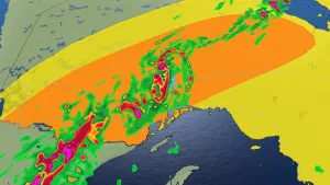
8:36 p.m. EDT - Tornado watches continue for southern Ontario and parts of Quebec as severe thunderstorms sweep across the area.
While all tornado warnings in southern Ontario have now expired, severe storms persist across the region and additional warnings are possible.
A tornado watch means that conditions are favourable for the development of tornadoes.
Pay close attention to the latest alerts in case the tornado watch is upgraded to a tornado warning in your area. Have a plan in place to seek safe shelter in case severe weather threatens your home, your office, or while you’re driving. It's wise to keep close eye on the radar and stay proactive about storms heading your direction.
CURRENT TORNADO WATCHES (ONTARIO):
Algonquin
Bancroft - Bon Echo Park
Barrie - Orillia - Midland
Burk's Falls - Bayfield Inlet
Dufferin - Innisfil
Haliburton
Halton - Peel
Parry Sound - Muskoka
Peterborough - Kawartha Lakes
Renfrew - Pembroke - Barry's Bay
Smiths Falls - Lanark - Sharbot Lake
York - Durham
CURRENT TORNADO WATCHES (QUEBEC):
Mont-Laurier
La Verendrye Wildlife Reserve
Upper Gatineau - Lievre - Papineau
Pontiac
Abitibi
Temiscamingue
Parent - Gouin Reservoir

The original article with the full forecast for Ontario and Quebec continues below.
Muggy air building back in across parts of Ontario and Quebec will bring the threat for severe weather to both provinces on Thursday.
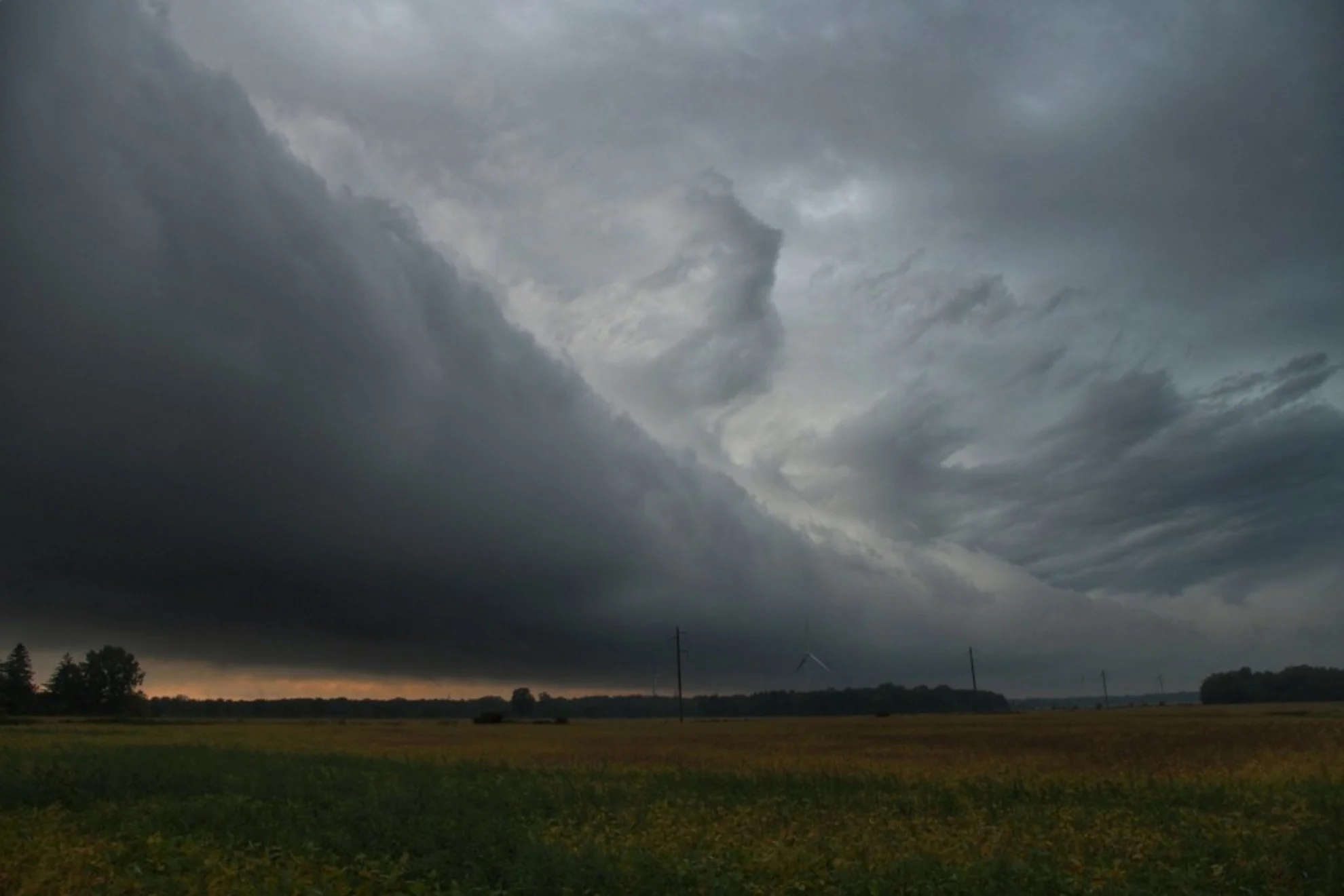
A cold front moving through Ontario on Thursday will trigger a risk for thunderstorms, with the likelihood for some to become severe.
In fact, Thursday has the potential to be the most severe weather day of the season so far for southern Ontario and western Quebec, so it will be important to stay on top of the weather watches and warnings in your area, as conditions can change quickly when severe weather hits.

DON'T MISS: What to do if a tornado warning is issued
WATCH: Severe storms hammer Ontario on Thursday
Thursday: Severe weather to bubble up across the province
A strong cold front pushing eastward through the lower Great Lakes region this week will clash with the warm, humid air in place, triggering widespread rain and embedded thunderstorms in its path.
Northern Ontario was the first area of the province to see the active weather as storms rolled through the region Wednesday night. The predominant risk comes to southern and eastern Ontario, and western Quebec later Thursday.
SEE ALSO: The Great Lakes may have a thunderous effect on your summer weather
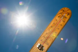
Temperatures in the mid- to high-20s will feel like the mid-30s with the humidity on Thursday. Folks in Toronto will be seeing an already scorching daytime high in the upper 20s, but the humidex will make it feel well into the 30s. This will create enough energy in the atmosphere for strong storms to develop upon the cold front's arrival later in the day.

There should be sufficient clearing in the afternoon to recharge the atmosphere ahead of the passage of the cold front. Most of southern Ontario should stay rain free the majority of the day
While there is still some uncertainty regarding the exact timing of the passage of storms, it’s likely that more intense storms will continue into the evening hours and potentially through the overnight as the cold front advances through the region.

Strong wind gusts, large hail, torrential rainfall, and even a few tornadoes are possible on Thursday. Stay weather-aware for watches and warnings in your area as this severe weather event unfolds.
With the likelihood of severe storms throughout the province, it is important to have a plan in place. Secure loose objects outdoors like patio furniture, ensure phones and electronics are charged, and have a plan to quickly seek safe shelter if warnings are issued.
The dreary, stormy weather will stick around through the overnight Thursday, giving Friday a less-than-ideal start. Things will turn around in a hurry however, with the region finally looking to pull off a dry weekend -- the first in the GTA since early April!
Saturday will be a gorgeous day with abundant sunshine, light wind and comfortable temperatures during the afternoon. A mix of sun and clouds is expected for Sunday.
MUST SEE: Will the streak finally end with a dry Father's Day weekend?
By next week, conditions will become hot and very humid for most of the week, with high temperatures soaring into the low to mid 30s for a few days, and a 40+ humidex. However, with the very muggy conditions will come a risk for thunderstorms, once again.
Warmer than normal temperatures are expected to dominate through the end of the month, but quick shots of cooler weather near seasonal, are also possible.
Stay with The Weather Network for more forecast information and updates on your weather across Ontario and Quebec.