Severe storms bubbling on the Prairies, more expected on Friday
Severe thunderstorms continue for portions of Alberta and Saskatchewan on Thursday, with the risk moving east into Manitoba on Friday
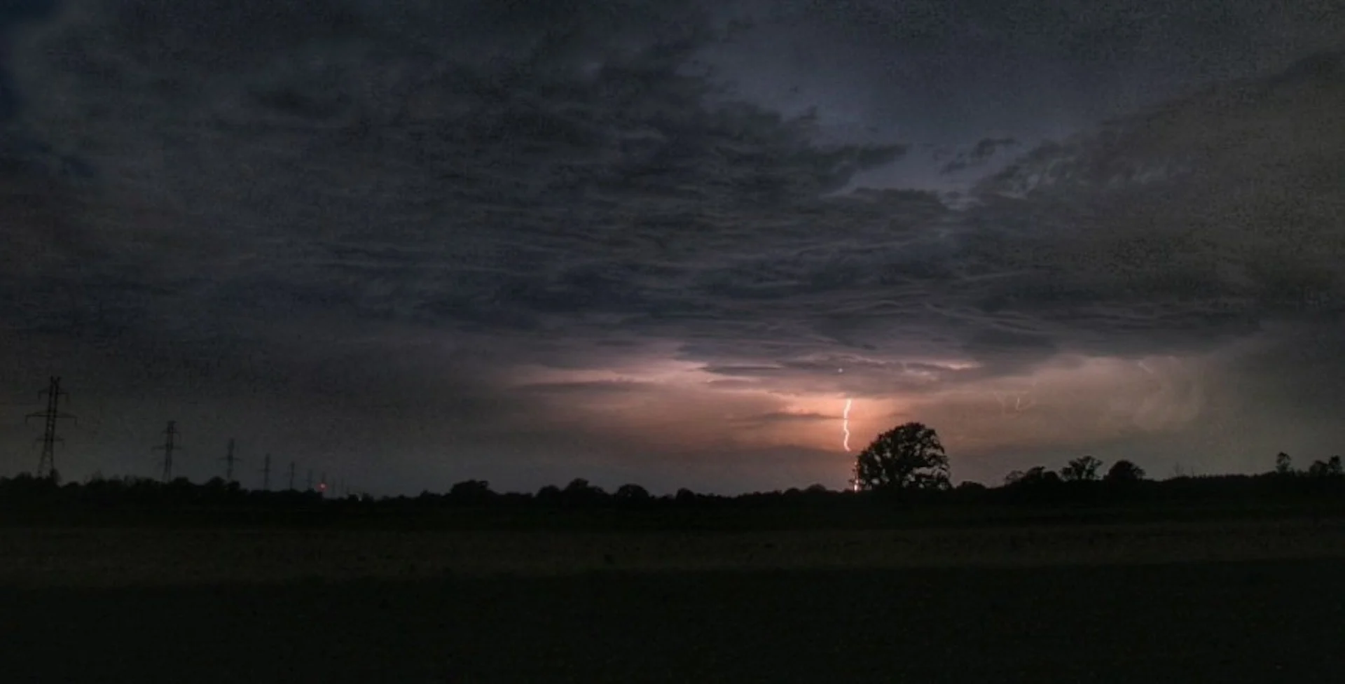
A very wet and active pattern has swept the Prairies, with back-to-back systems bringing rounds of rain, and heavy alpine snow ahead of the May long weekend. On Thursday, the chance for thunderstorms re-emerges, with the threat for storms to turn severe across parts of Alberta and Saskatchewan.
Supercells are possible along the Alberta and Saskatchewan border, which could rotate, and possibly produce a tornado Thursday afternoon or evening. Large hail and strong winds will also be a threat for storms that do develop.

Be sure to monitor watches and warnings in your area throughout the day. Severe thunderstorms are possible. Take shelter immediately if a warning is issued.
RELATED: Tornado 101: What you need to know about staying safe
By Friday, the risk for severe storms pushes into southern Manitoba, where the chance for damaging winds is on the table. Those in the affected risk areas are urged to stay alert and up-to-date on all weather warnings. Conditions can change quickly when severe weather hits.
Thursday: Severe thunderstorm chances bubble up over Alberta and Saskatchewan
Widespread rain will continue across Alberta on Thursday, greatly aiding in the wildfire situation for northern places like Fort McMurray. As of Wednesday morning, the fire there had consumed nearly 21,000 hectares of forest, nearly doubling in size in just one day's time.
SEE ALSO: Fear, anxiety as thousands flee their homes in Fort McMurray due wildfire threat
A developing low across the south, will spread showers and thunderstorms through the afternoon and evening hours, some storms which could turn severe in nature later in the day. Supercells are possible along the Alberta and Saskatchewan border, with the potential to rotate, and possibly produce a tornado.
Large hail, heavy rain, and strong winds will also be a threat for storms that develop across both provinces.

Friday: Lingering thunderstorm threat, with strong winds in southern Manitoba
By Friday, the low intensifies as it spins into central Saskatchewan. Wrap-around rain and snow showers are expected across northern Alberta, with 30-50 mm of rain expected.
The thunderstorm threat will once again bubble up across Saskatchewan and into southern Manitoba, where we'll closely watch the late evening storms stateside. There's the potential these storms could bring damaging winds into Winnipeg and areas further east, but there's still some uncertainty with the development and severity. This will be something you'll want to continue to check back for as the forecast evolves.

DON'T MISS: Canada's May long weekend has it all, except for the 'perfect' forecast
WATCH: Fort McMurray evacuation order in place until at least Tuesday
Heavy alpine snow ahead of the long weekend
In addition to the rain and storms, Thursday’s system threatens some substantial snow for the alpine regions of B.C., and into the central and southern Rockies of Alberta through Saturday. That's as temperatures sit about 5-10°C below normal.
We will closely watch to see if any snow will reach into the foothills and even localized areas east of the Rockies through the start of the May long weekend.

Temperatures will be well below seasonal across most of the region for the long weekend, with another significant system and the potential for more snow, early next week.
Stay with The Weather Network for all the latest on your forecast across the Prairies.