
Spectacular weekend coming to southern Ontario, but with a small catch

Get ready for an amazing weather weekend across southern Ontario, though there's signs of rain showers and thunderstorms that could pop up at times. Here's how to plan
Spectacular weather is expected for much of the weekend across southern Ontario, but once again, we do have a looming risk for showers and thunderstorms - this time on Sunday.
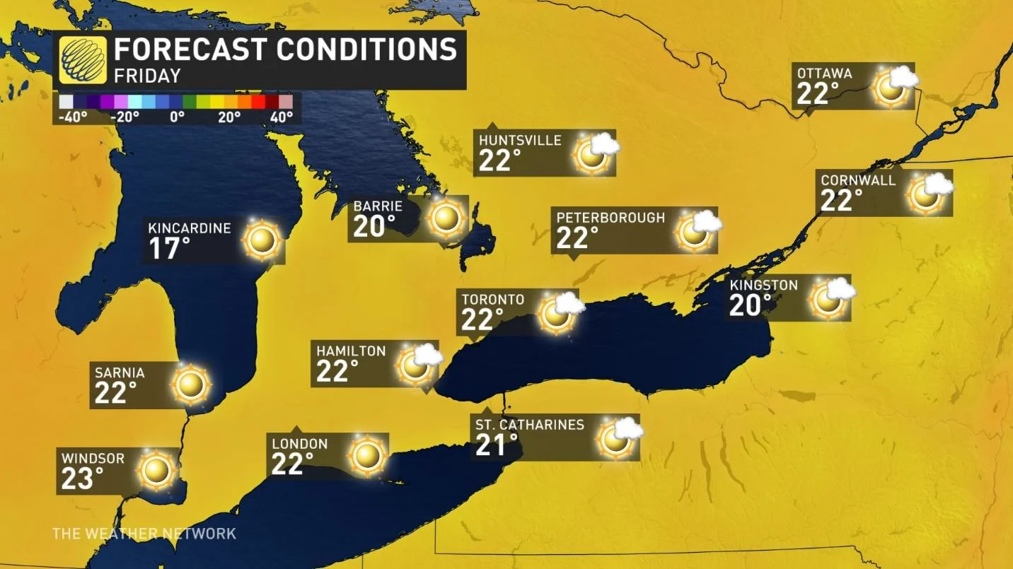
Gorgeous late spring weather is likely for the start of the weekend, with full sunshine Friday afternoon and evening, accompanied by comfortable temperatures, low humidity, and little wind.
SUMMER 2024: Get an in-depth look at the Summer Forecast, tips to plan for it, and much more!
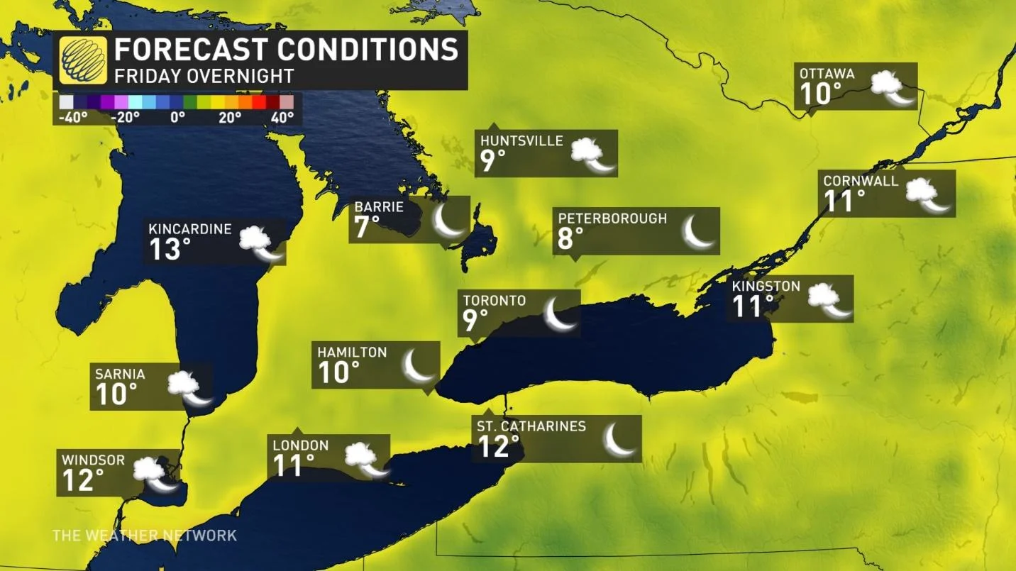
Be mindful, if you are heading north or planning to spend the evening on a patio, you will still definitely need a jacket as temperatures will drop through the teens, and into the single digits through the overnight hours.
Still quite cool to swim
Saturday's weather will be a pleasant day for most outdoor activities, with a mix of sun and clouds (becoming cloudy late in the day) and near seasonal temperatures.
However, these conditions are still just a bit cool if you are hoping for an early season swim.
The catch...Rain Saturday night lingers into early Sunday
For Saturday night, widespread showers (thunder possible) will track into southern Ontario. For the most part, the timing looks good with the threat of rain primarily being through the overnight hours. However, if the showers track into our region a few hours ahead of schedule, that would impact outdoor plans during Saturday evening, so please be sure to check back for the latest updates.
The region with the highest risk of seeing rain before sunset will be across southwestern Ontario, to the west of London, including the southern shores of Lake Huron.
Unfortunately, it now looks like the threat for showers will linger through Sunday morning. However, we should see some improvement during the afternoon with several hours of dry weather and the potential for some peeks of sun during the late afternoon and evening.

Beyond that, warmer weather is expected for next week with a few days of mid-summer like heat and humidity for the first week of June. With that warm up however, comes the risk of a few periods of rain and thunderstorms.
RELATED: 'Feel' miserable out? Humidex and wind chill are calibrated to your body
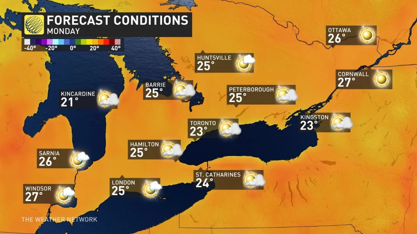
Monday will start cloudy and then become mostly sunny and warm.
Tuesday, Wednesday and Thursday will be very warm and humid, as well. Our high temperatures will depend on the timing of the showers and thunderstorms, but any day with several hours of sunshine will have the potential to reach the upper 20s and possibly even 30°C, with the humidex well into the 30s.
If showers and thunderstorms do roll through earlier in the day, then temperatures will stay in the low to mid 20s. Regardless, we will have rather muggy conditions for a few days next week.
MUST SEE: How to stop wildlife from becoming house guests this summer
A strong cold front is expected to track across southern Ontario next week, followed by much cooler temperatures for next weekend and continuing through the following week. It also looks like next weekend with include the familiar risk for showers and thunderstorms.
In the meantime, be sure to make plans to be outside this weekend to enjoy the spectacular and comfortable weather!
Check back this same time next week for more details on what you can expect during early June and beyond across southern Ontario.