What's behind this perfect steam devil spotted in B.C.?

Though it looks like a tornado, it's actually formed by a completely different set of atmospheric circumstances.
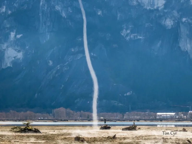
You might be forgiven for thinking the photo below (and featured in the video above) depicts a tornado.
The phenomenon, snapped on Monday in the Squamish Estuary in British Columbia by photographer Tim Cyr, has the appearance of one, certainly, although it's very much out of season, and in one of Canada's least tornado-prone provinces.
What it really is, however, is what forecasters call a 'steam devil,' which wouldn't look out of place over the Great Lakes, and occasionally over Lake Okanagan as well. It normally happens with extremely cold Arctic air moves over relatively warmer water – instability forms, air rises, and it can form a visible vortex.

Image courtesy Tim Cyr/Facebook, used with permission.
Though they resemble tornadoes, they are completely different from twisters, which are generated by the rotating part of a severe thunderstorm, known as the mesocyclone.
In the case of the steam devil snapped in Squamish, it likely formed the same way other steam devils form, though Weather Network meteorologist Jaclyn Whittal says the circumstances are slightly different.
"The grassy area near the water has abundant moisture and it has been heated by the sun all day. The air above it, while not as cold as January Arctic air, is still relatively colder than the grassy surface," she says. "This sets up the necessary instability and then the moisture, in the form of steam, is able to be drawn into a vortex like we see in the winter."
For a fuller explanation, see the video above.