Strong tornadoes, waterspout outbreaks, extreme heat made August stand out

Among August's weather headline-makers was a strong EF3 tornado that caused the deaths of two people in Manitoba.
As we head into September, we review the month of August, and there were plenty of severe weather events to look back on.
August delivered powerful tornadoes, one of which was responsible for the tragic death of two people, along with a peculiar world record, and extreme heat across pockets of this vast country.

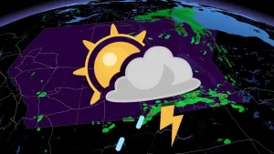
AUGUST 4TH: TORONTO'S TORNADO WATCH TUESDAY
Early afternoon on August 4th, a rotating storm developed near the town of Arthur. The thunderstorms northwest of Orangeville continued to migrate southwest.
A tornado watch issued by Environment Canada continued to expand eventually, encompassing millions of people. The storms interacted with Lake breeze boundaries and showed local rotation, until easing Tuesday evening.
Eventually, one EF-0 tornado was confirmed near Palmerston, with a track over one kilometre in length.
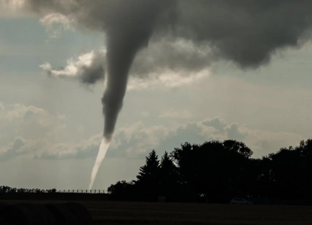
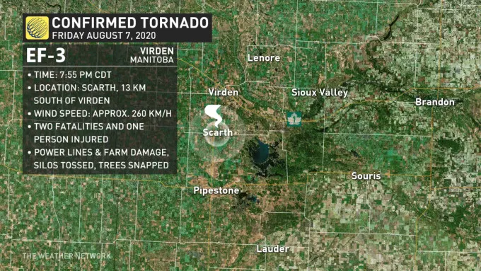
AUGUST 7TH: STRONGEST TORNADO IN CANADA FOR 2020
A powerful tornado developed near Virden, Man., eventually being given a final rating of EF-3, with maximum sustained winds of 260 km/h.
It's highly likely that this tornado will stand to be the strongest of the year in Canada, but for people in Melita, it will be remembered for causing the deaths of two people, as well as injuring a third.
AUGUST 16-19TH: A WEATHER WORLD-RECORD?
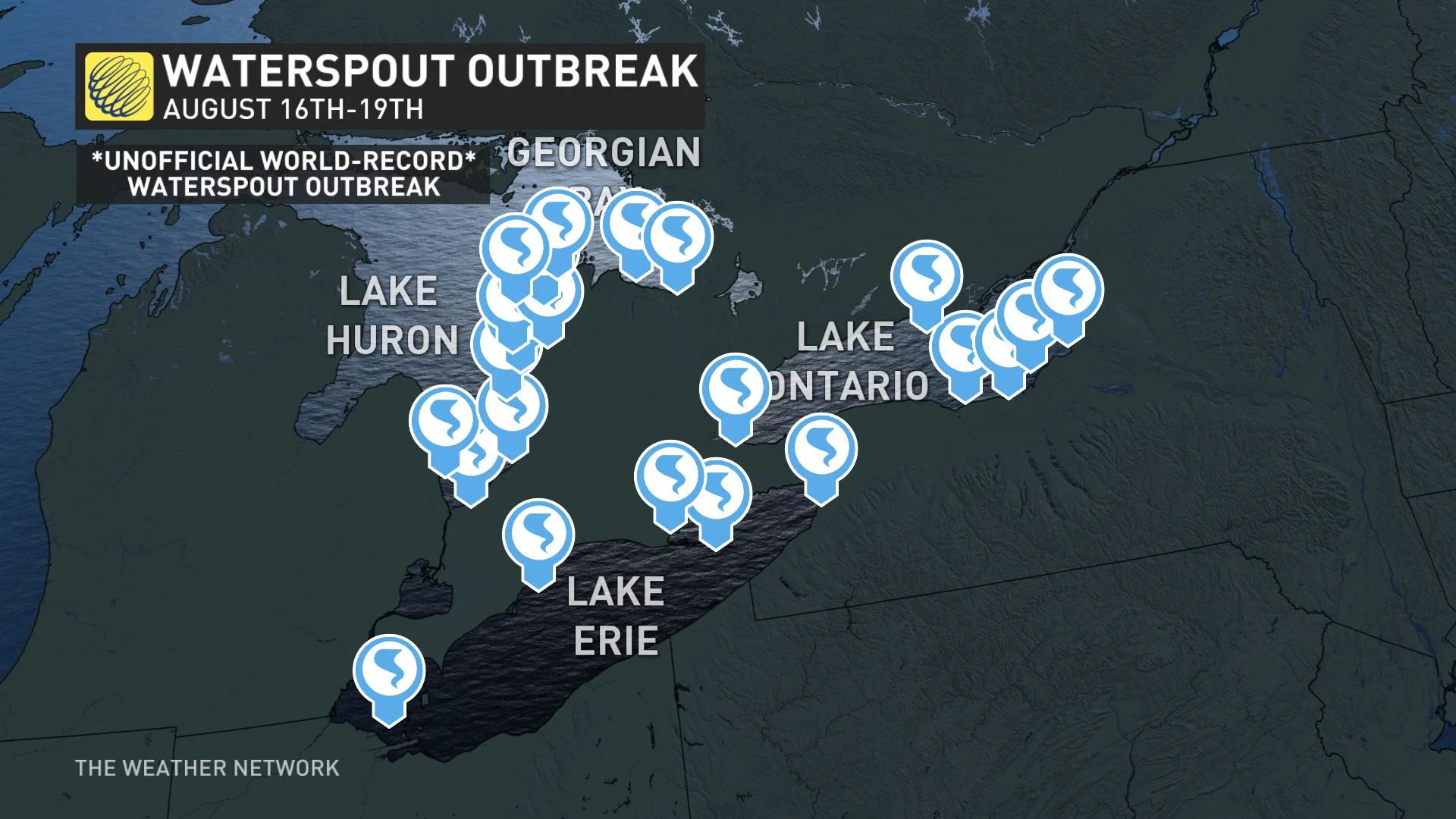
On August 16th, the atmosphere became favourable to develop waterspouts across the Great Lakes Basin. A chilly upper trough with low-level moisture and warm lake temperatures provided the recipe to spawn at least 88 waterspouts across the region over three days.
Unofficially, this is perhaps a world record, according to the International Centre for Waterspout Research.
AUGUST 17TH: RARE COASTAL THUNDERSTORM
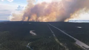
A rare coastal lightning storm lit up the sky in B.C. in the middle of August, capturing significant attention across parts of the Lower Mainland and Vancouver Island. This was the second thunderstorm event of this magnitude across the south coast, with an unstable southerly flow to blame. Unfortunately, numerous forest fire starts can be traced back to this event.
AUGUST 18TH: B.C.'S CHRISTIE MOUNTAIN FIRE
After a slow start to the forest fire season, several thunderstorms would change the situation for the worse. The numerous rounds of thunderstorms caused the most aggressive fires of the season to spread throughout mid-August, among them a fire near Penticton known as the Christie Mountain Fire, which destroyed at least one home and put some 4,000 people under evacuation alerts and orders.
Initially, the difficult terrain and weather challenged fire suppression efforts, but over the following days, firefighters gained control of the 2,000 hectare blaze.
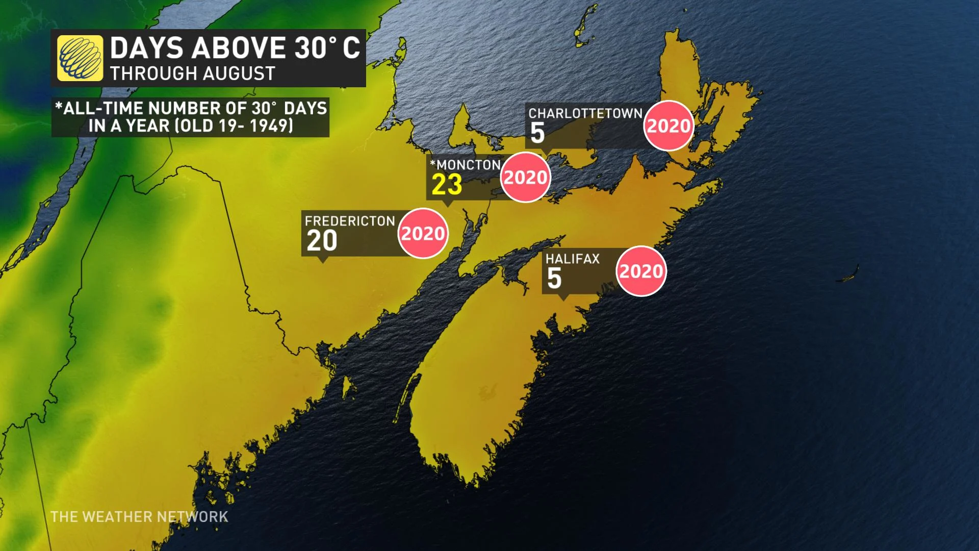
ATLANTIC CANADA: MONCTON EXTREME HEAT, 23 DAYS THIS SUMMER OVER 30°C
To put this particular spate of frequent extreme heat in perspective, this is roughly half a decade worth of 30°C days for Moncton. The old record was 19, set back in 1949.
Barring an unusual deviation from the forecast, the year will end at 23 days above 30°C for the city.
NORTHERN CANADA: WARMEST TEMPERATURE ANOMALIES IN CANADA FOR AUGUST
In some pockets of Northern Canada, the month finished more than four degrees above normal, while the northwestern sections of British Columbia had some of the coolest, cloudiest, and rainest weather in Canada -- just ask those living in Prince Rupert, B.C.!