Rain, storm threat is blessing and curse for B.C., Alberta fires

Rain has joined the battle against British Columbia and Alberta's persistent wildfires this week, but also in the fight is the storm and flood potential
At least some portions of B.C. and Alberta are going to get a helping hand from Mother Nature this week, as a soaking rain will help subdue some of the wildfires.
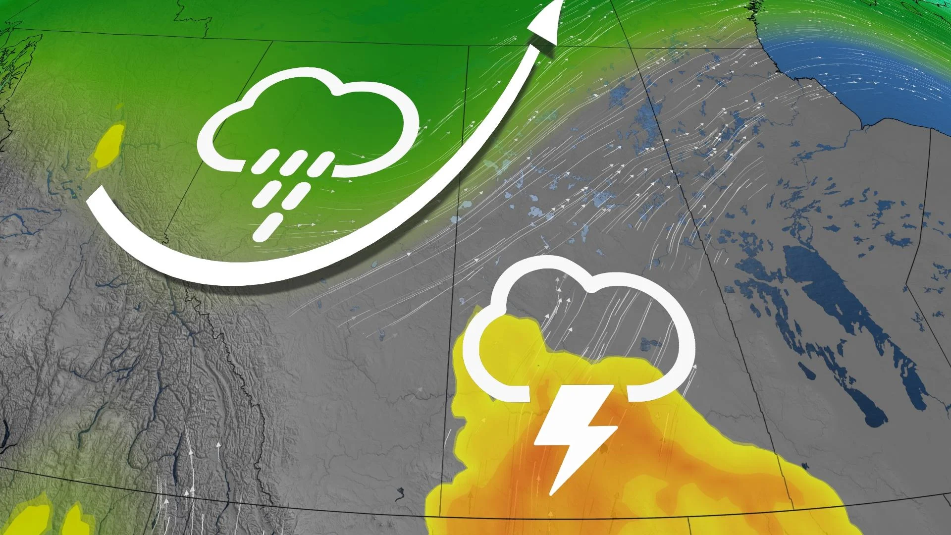
An upper-level trough pushing through is responsible for cooler temperatures across B.C. and Alberta, but associated with it is a moisture-filled, low-pressure system that is bringing significant rain to the Prairies this week.
RELATED: Rainy forecast offers hope to subdue Alberta wildfires
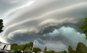
A long-duration rainfall event has set up up downwind of the Rockies. However, while the rain from the storms is welcome, the threat of storms with lightning Tuesday and Wednesday is sparking new wildfire concerns.
As well, the rain will pose serious flooding risks in parts of B.C., where watches are in effect.
Visit The Weather Network's wildfire hub to keep up with the latest on the active start to wildfire season across Western Canada.
Tuesday
Areas: Central Alberta and southern Saskatchewan
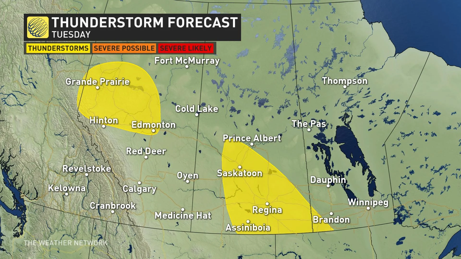
Timing: Peak thunderstorm activity is forecast around a stalled trough in Alberta Tuesday afternoon, with additional slow-moving storms across southern Saskatchewan
Confidence: Medium
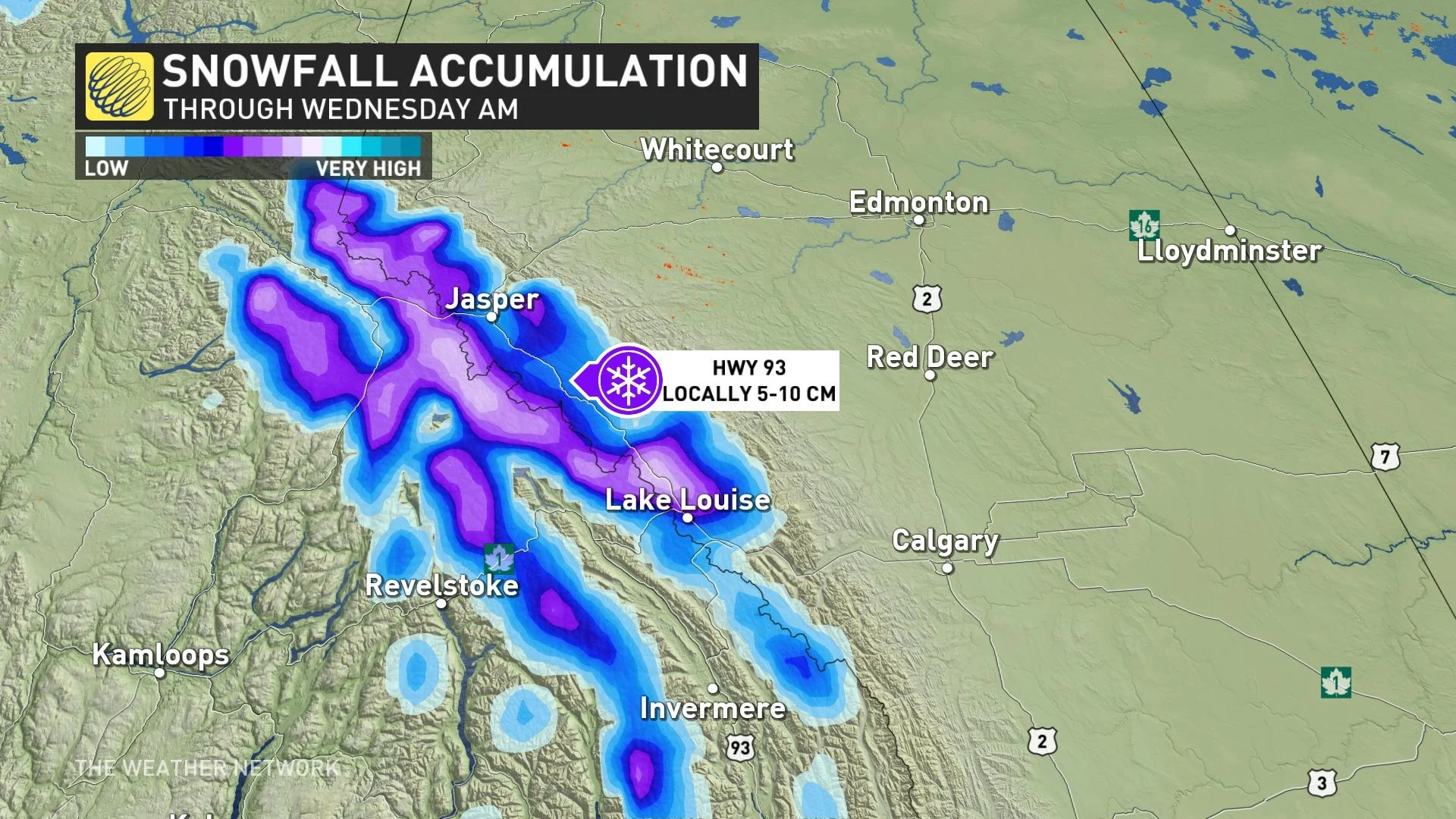
Amidst in the heavy rain, flood and thunderstorm potential is high-elevation snow. That's right...there’s even some high-elevation snow forecast across the Rocky Mountains Tuesday.
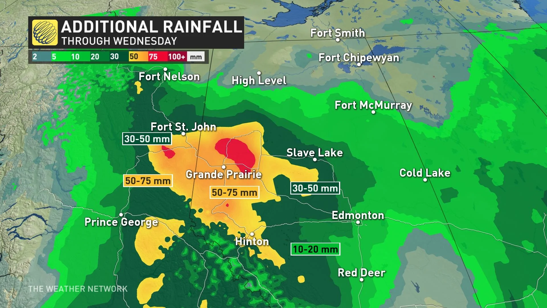
Additional rainfall forecast
Rainfall warnings remain in effect for parts of northeastern B.C. and northern Alberta.
The heaviest rainfall totals are falling in some sizable wildfires west of Edmonton, Alta., with regions near Grande Prairie accumulated close to 100 mm by Wednesday. As of Monday evening, Fort St. John, B.C., had picked up close to 50 mm of rainfall, while Edmonton, Alta., picked up near 20 mm.
Heavy downpours can cause flash floods and water pooling on roads. Localized flooding in low-lying areas is possible.
ALSO SEE: Governments match Red Cross donations for Alberta wildfire recovery
This rainfall substantially dampens Alberta wildfire activity, which is welcomed news, as the province is facing its worst wildfire season since 1981 in terms of area burned.
However, heavy rain over burn scars can create significant flooding risks. The burnt landscape can act as a water repellent, and the missing tree canopies increase the flooding threat as well. Mud and debris flows can also be a hazard with the recently burned landscape, even with a gently sloping terrain.
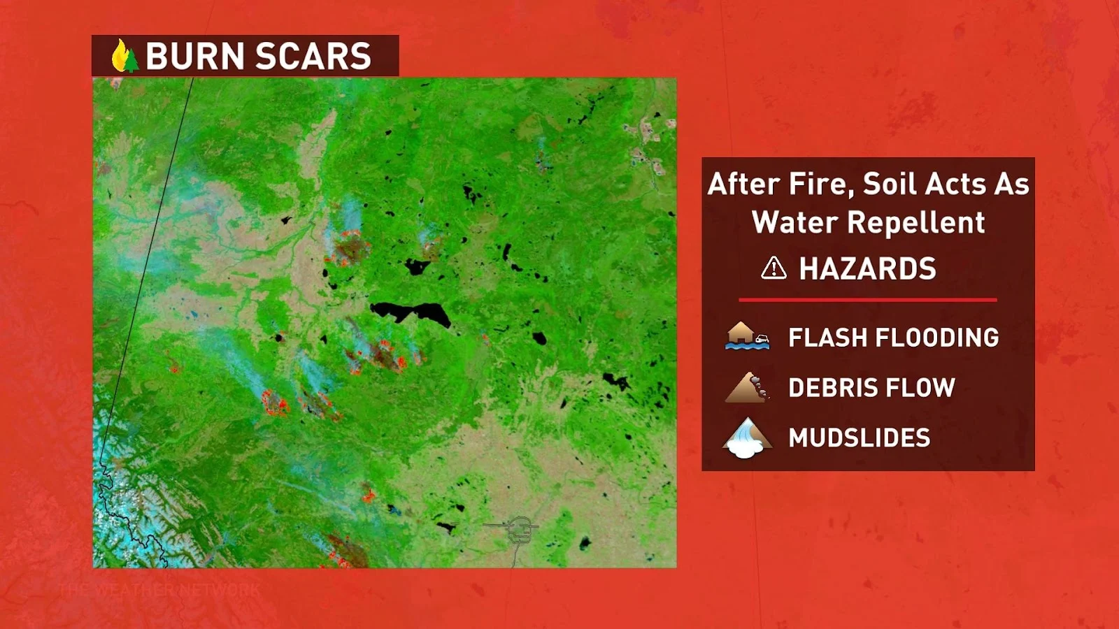
Continue monitoring news sources for the latest flood and mudslide threat updates and be prepared to take action if you are in a vulnerable area.
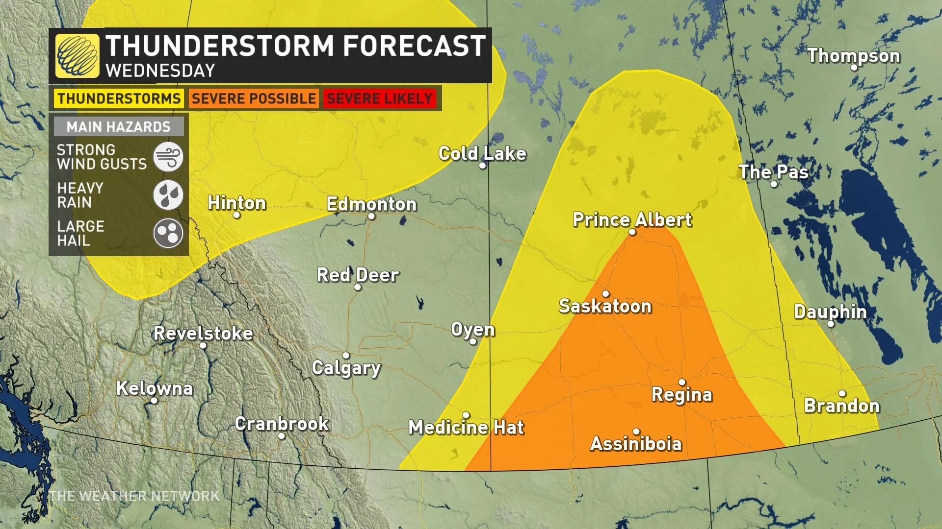
Wednesday
Areas: Central Alberta and southern Saskatchewan
Timing: Afternoon and evening
Weather: Risk of severe thunderstorms across Saskatchewan, with large hail and damaging winds being a primary threat
Confidence: Medium
Storm analysis
A low-pressure system will drift northward from eastern Montana. There will be an abnormally high amount of moisture available across Saskatchewan, increasing the flooding threat with developing storms.
It’s unlikely that the thunderstorms remain discrete, and they will quickly morph into thunderstorm complexes as they track northward in the evening time on Wednesday.
Also, keep checking back to The Weather Network for more forecast news and information across Western Canada.