Rare set-up with 'backwards' system impacts Eastern Canada

Most storms move west to east across Canada, but the Atlantic region is getting the reverse this week, with systems retrograding and moving in reverse flow.
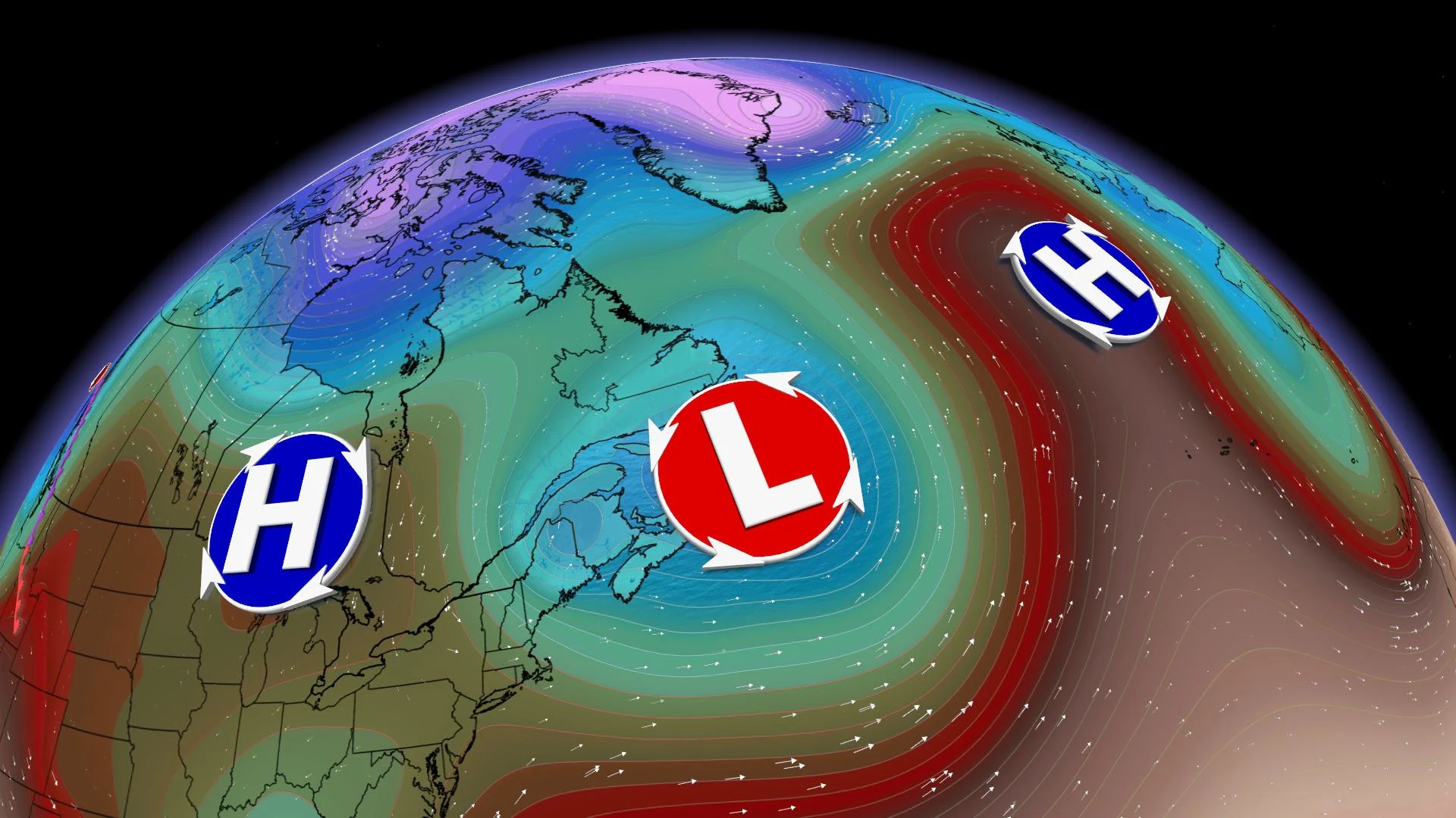
Atlantic Canada is currently in the midst of an uncommon weather pattern -- systems are retrograding and moving east to west.
Typically, storms in the mid-latitudes move from west to east like clockwork. The usual pattern pushes storms from the Pacific Ocean into B.C., across the Prairies, Ontario, Quebec, and finally Atlantic Canada, before exiting across the Atlantic Ocean.
However, occasionally a pattern develops that causes the clock to run backwards, setting up what we call retrograde or east-to-west storm motion.
This type of pattern has developed this week across Atlantic Canada, which is causing a series of weak low-pressure systems to backtrack through the region, in the opposite direction of the normal storm track.
This is all thanks to a massive high-pressure system over the North Atlantic, which is acting as a roadblock. This is preventing the storms from making their normal progress out to sea.
Though the impacts from these systems aren't very different from a typical winter storm, the unusual storm track is a good reminder that even in the atmosphere, sometimes rules are meant to be broken.
PERIOD OF PROLONGED FREEZING RAIN
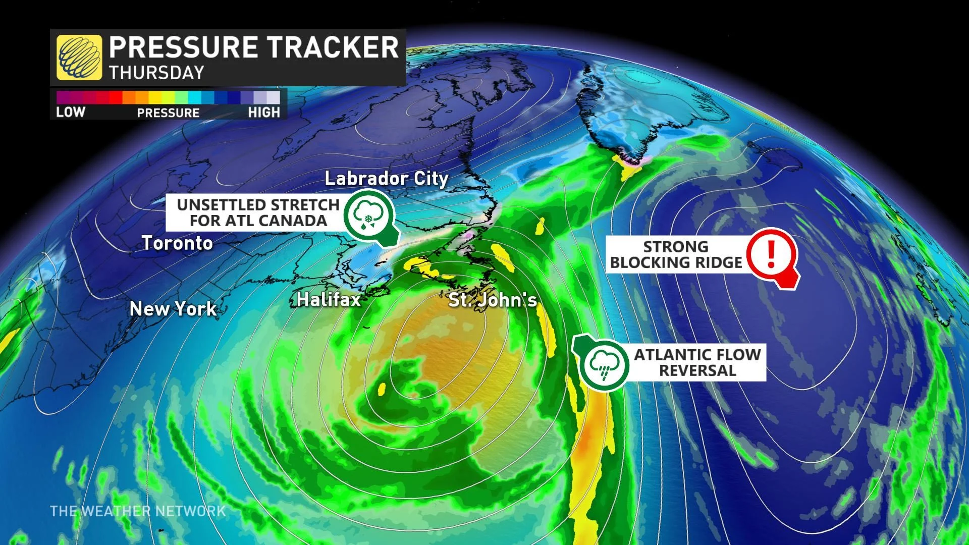
The retrograding cycle of precipitation will continue Thursday through Friday in Atlantic Canada, with more rain, snow and even the potential for prolonged freezing rain in southeastern Labrador, where a freezing rain warning was still in effect Wednesday night.
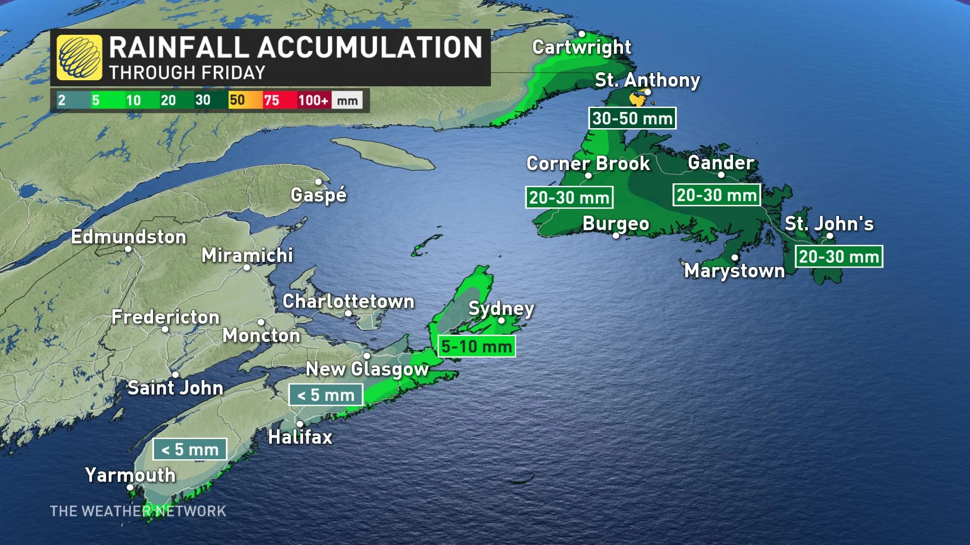
Beyond Labrador, Newfoundland itself looks to pick up the most amount of rain, with some 20-30 mm across most of the island, and as high as 50 mm for the Great Northern Peninsula.
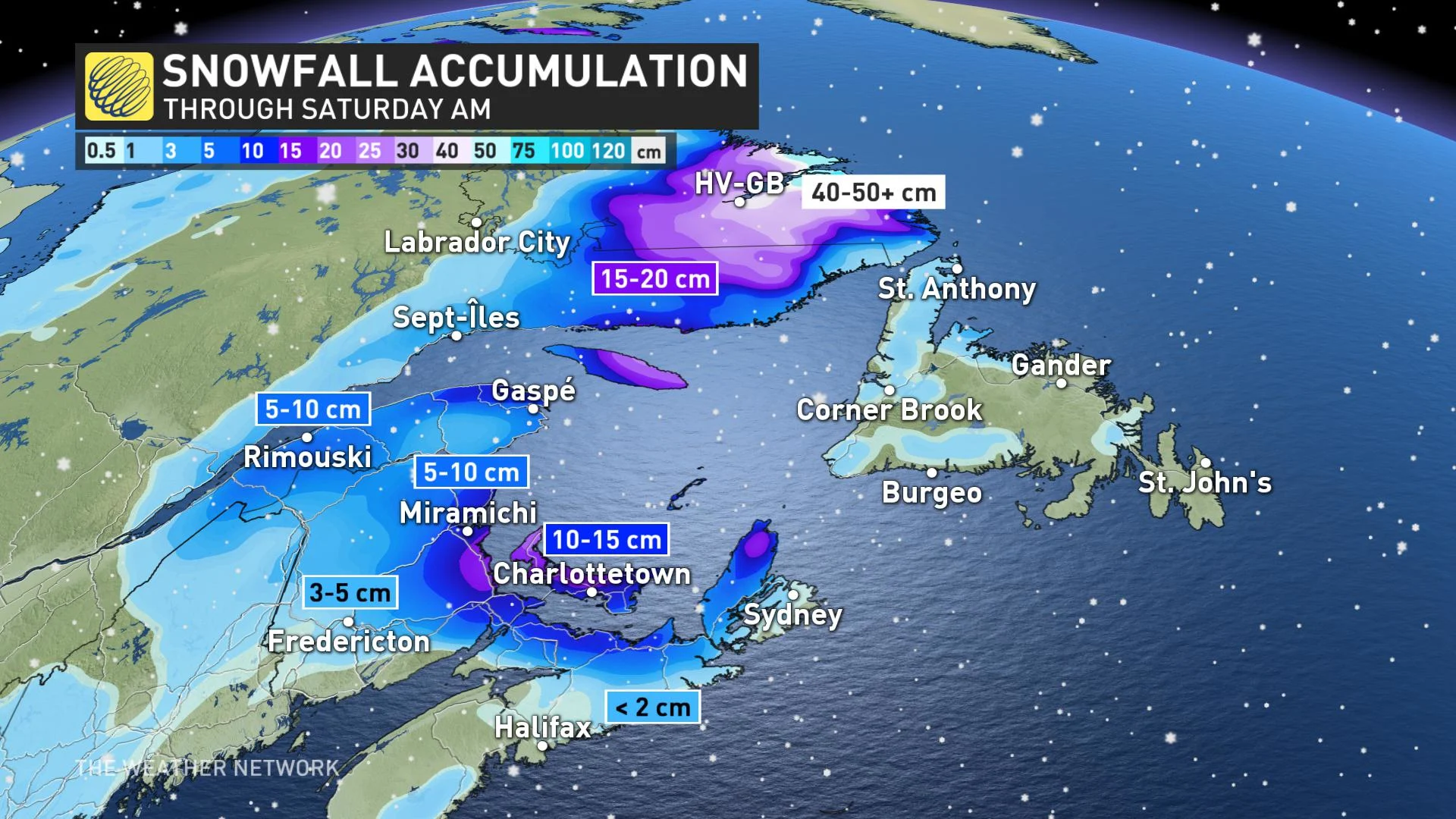
There's also a fair bit of snow to fall in some areas for the remainder of the week into the early part of Saturday. Parts of New Brunswick and Nova Scotia are in for 5-15 cm, but it is Labrador where the heaviest should be expected, in the 40-50 cm range by the weekend.
Stay tuned to The Weather Network for the latest updates on the retrograde pattern in the Atlantic region.