Tale of two seasons: Southern Ontario to see spring and winter clash
This week is going to feel like late April across southern Ontario, not late February. Mild temperatures will even bring an odd winter thunderstorm risk, as well
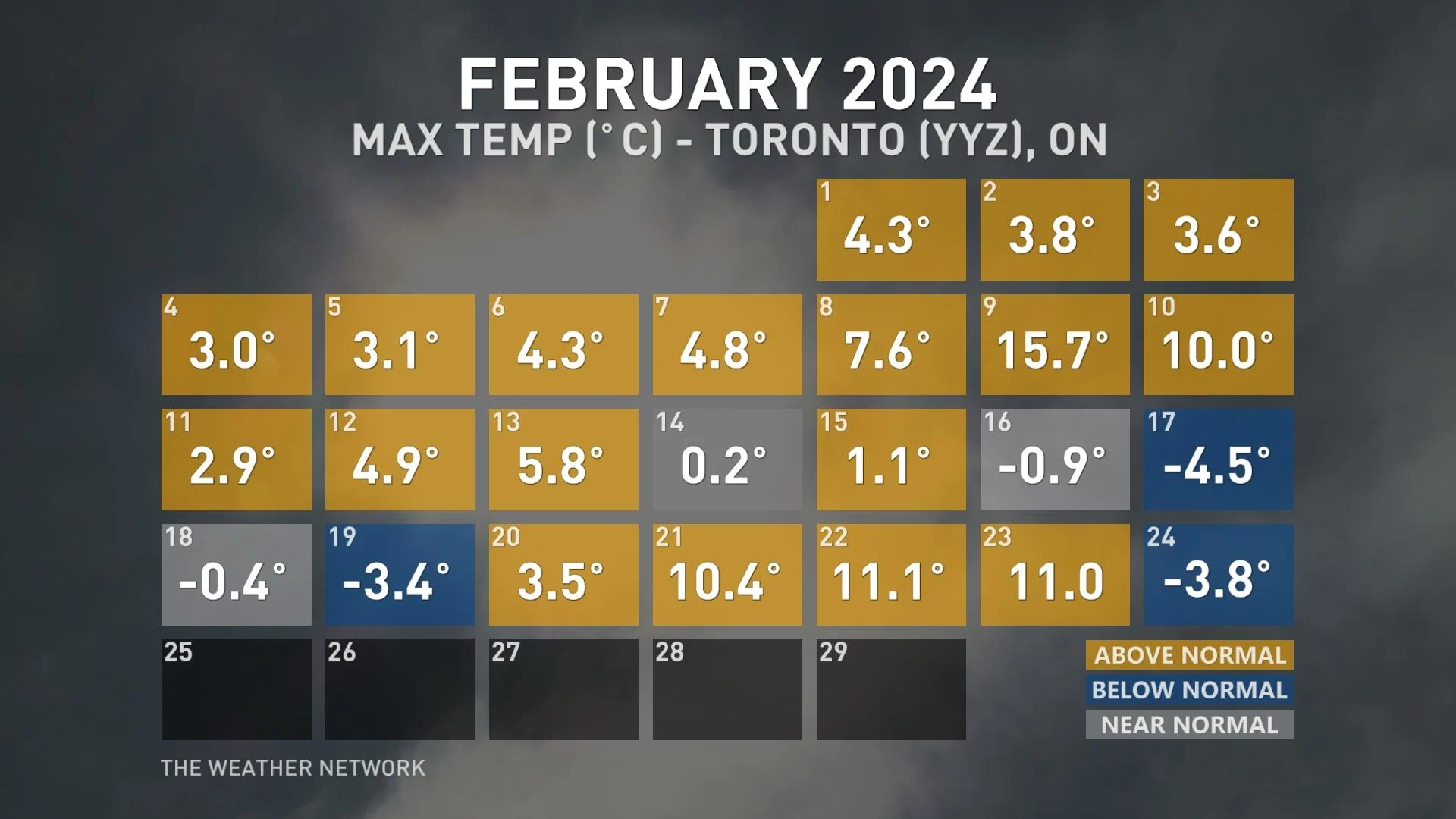
February has been a contrasting month for southern Ontario, with a period of mild weather followed by a brief shot of frigid air.
As we enter the final days of meteorological winter, we are switching back to mild again as spring-like temperatures will push across the border.
SEE ALSO: How global warming is reshaping winter life in Canada
Our sixth and seventh double-digit daytime high of the month will occur in a month that normally averages less than one day above 10 degrees.
Did we also mention the risk of thunderstorms? That's right. Read below to get the breakdown this week for the atypical late February weather for southern Ontario.
Monday
An upper-level ridge begins to build across southern Ontario, while a broad low-pressure system churns in the Northern Plains of the U.S.
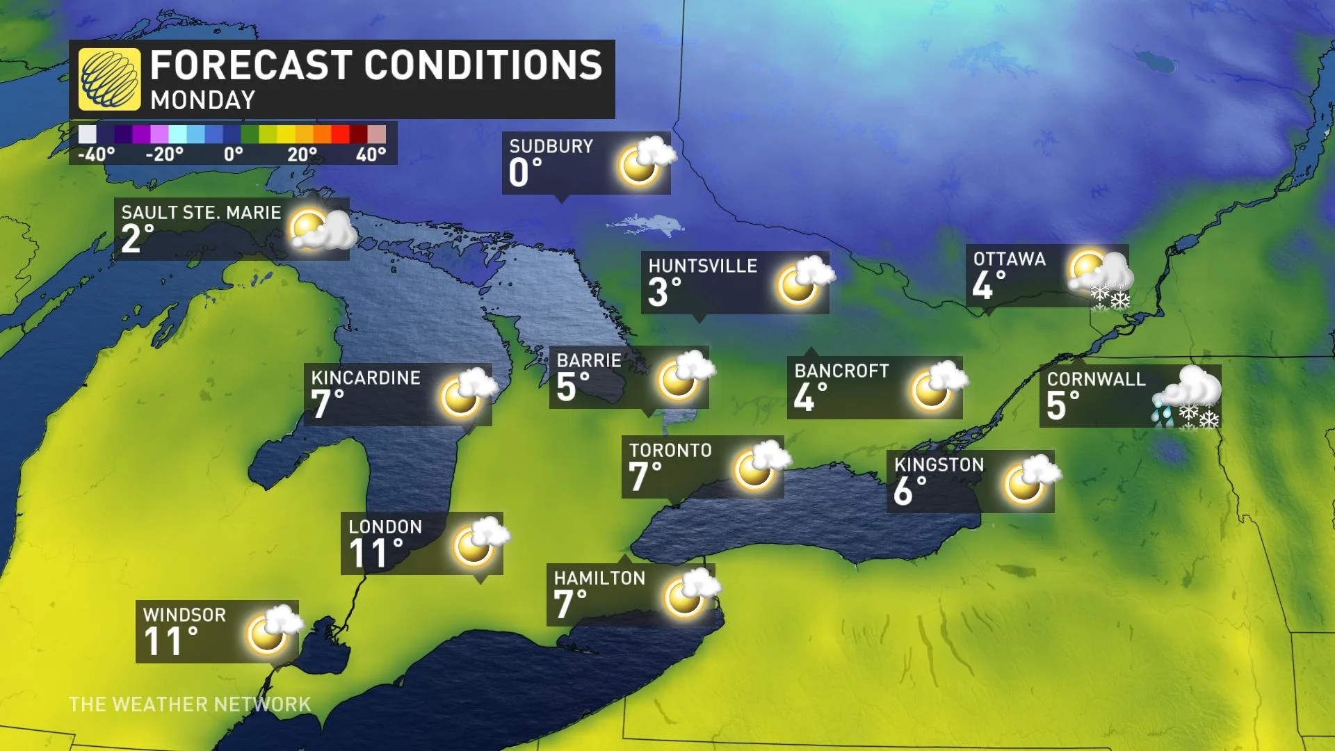
The first signs of double-digit temperatures spill across Minnesota and northwestern Ontario, where Fort Frances could challenge an all-time February temperature record (13.2°C set on Feb. 17, 2017).
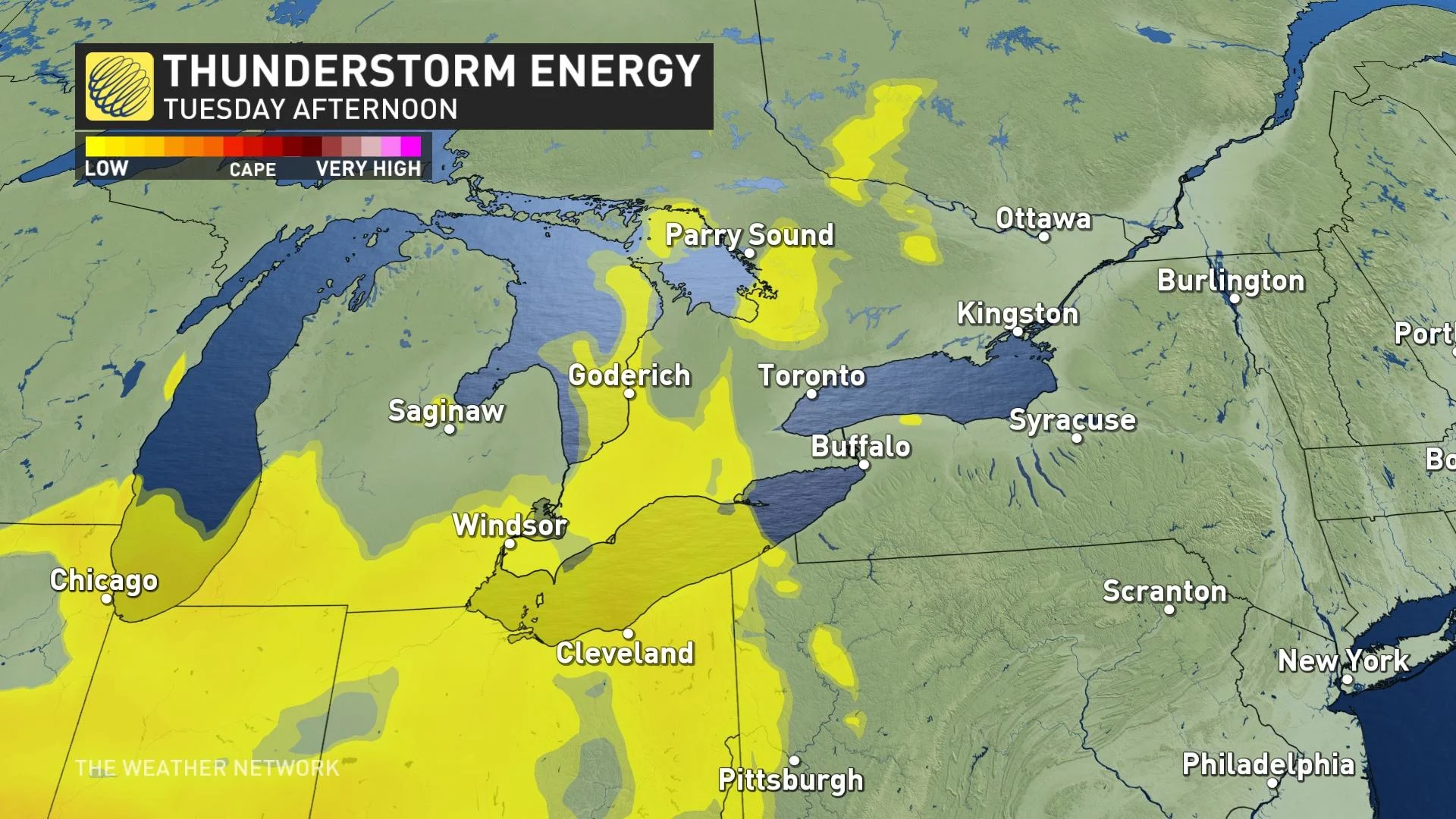
Tuesday
Temperatures soar even warmer on Tuesday, reaching all of southern and eastern Ontario. Regions downwind of a lake breeze will be significantly cooler, however, but others will push into the mid-teens.
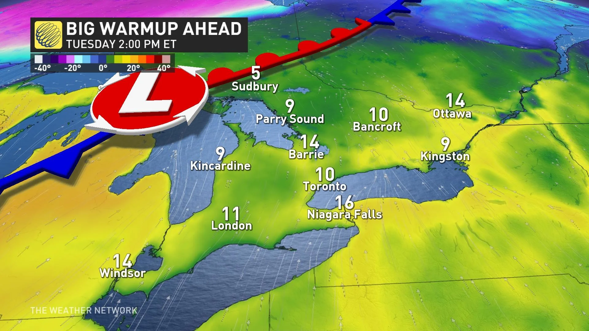
Watching the temperatures carefully across eastern Ontario for all-time February warmth values. The all-time February temperature record for Ottawa is 12.4°C, established on Feb. 27, 2000. As it stands, this likely will be broken this week.
Places like Cornwall, Brockville and those along the Highway 401 corridor that experience some downsloping winds from New York could be as warm as 17°C –– about 17 degrees above normal.
Another location that is set to soar is Niagara Falls and Buffalo, with temperatures in excess of 17°C by Tuesday.
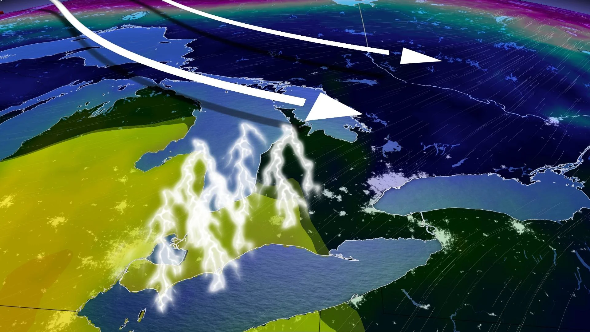
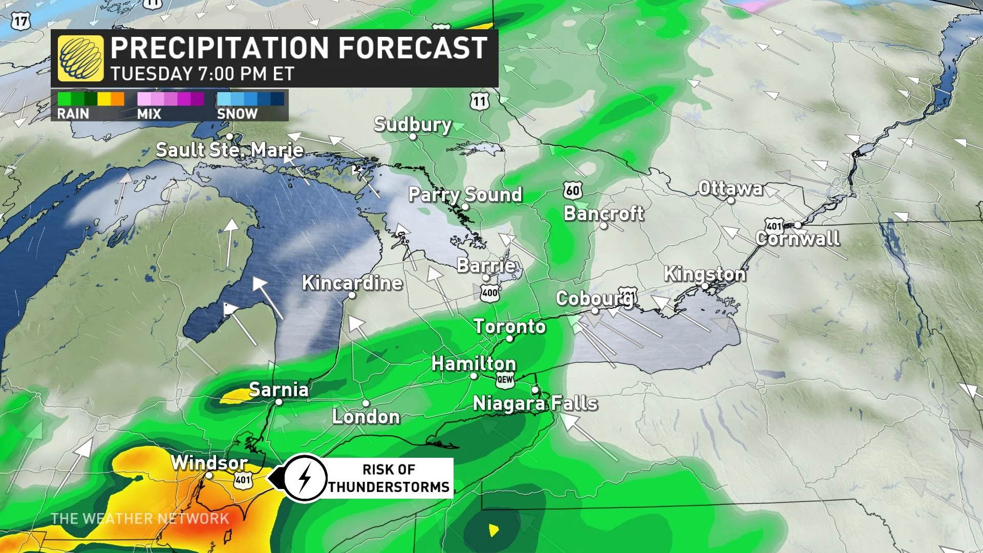
On Tuesday, our first risk of thunderstorms bubbles up across southern Ontario, as a warm front lifts across the area, so keep an eye out for a passing heavy shower and rumbles of thunder.
Wednesday

As you can see from the temperature profile above, a cold front is set to swing across the region later on Wednesday, not before another potentially record-breaking warm day.
The temperature swing behind the cold front will be massive, and by Wednesday night, the temperatures across southern and eastern Ontario will have fallen more than 20 degrees from the earlier Wednesday highs.
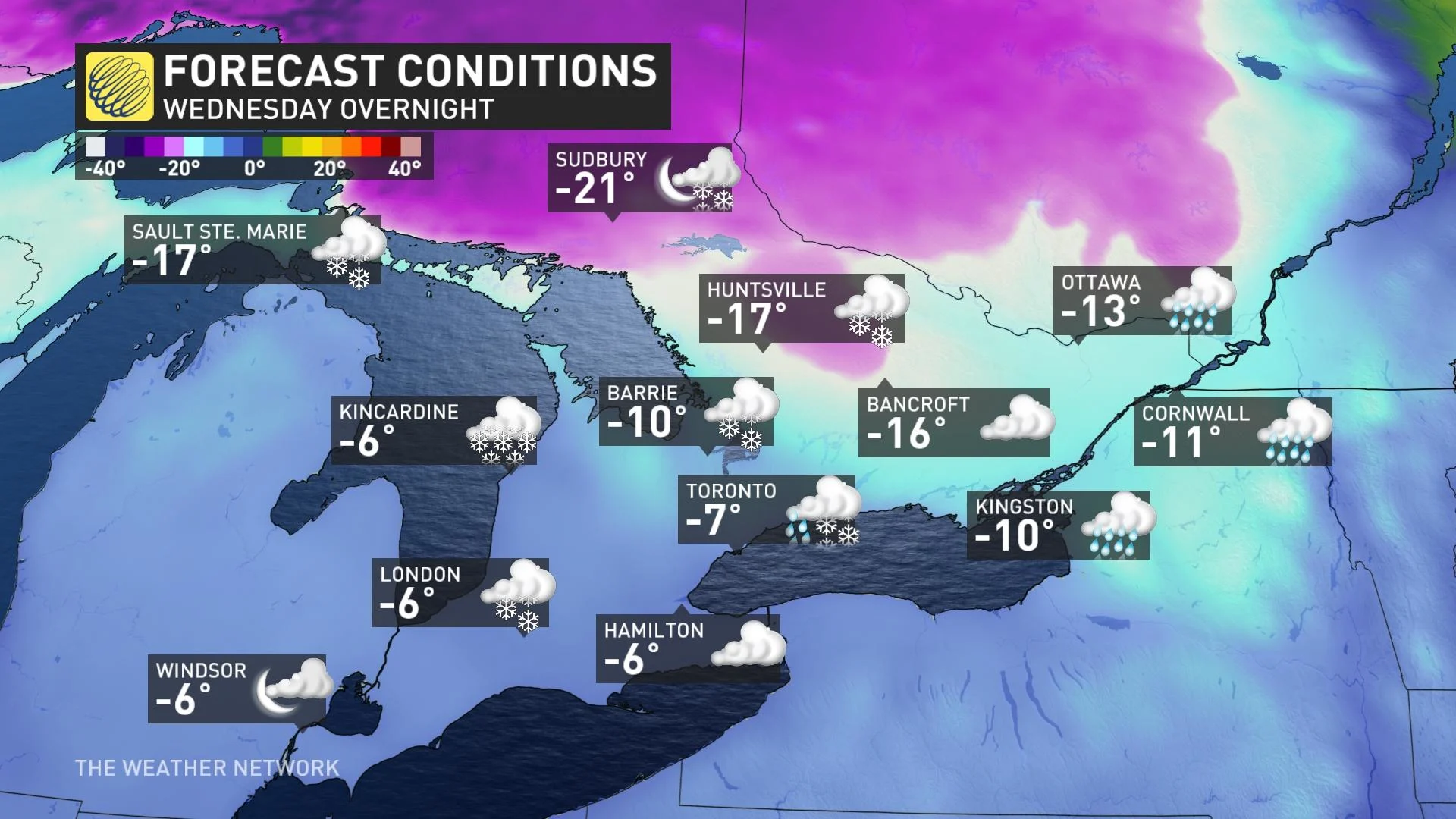
This is one of the more extreme temperature drops in recent memory, so we’ll have to monitor the risk of flash-freeze conditions. Precipitation will quickly change over to bursts of snow, including lake-effect snow, in the same regions that had the opportunity to experience thunderstorms on Wednesday.
While colder temperatures will return during the second half of this week, very mild air is expected to return as we progress through the first week of March.
Thumbnail courtesy of Getty Images.
Stay tuned to The Weather Network for the latest forecast updates for southern Ontario.