
Ontario will feel the sizzle as summer-like heat, humidity surges in

Southern Ontario will get a shot of summer-like warmth this week with daytime highs climbing well into the 20s, potentially approaching the 30-degree mark in some areas, accompanied by humidity.
After a chilly start to May in southern Ontario with an unseasonable chill, the region is now jumping ahead to summer this week, with temperatures reflective of the forthcoming season that is still a month away. Daytime highs will climb into the mid-to-upper 20s, even pushing near the 30-degree mark, by Wednesday. Along with the heat comes the humidity, with humidex values expected reaching the mid- to upper-30s by Saturday for some places. The long weekend may see some showers and thunderstorms, but most of it will be dry -- a growing concern for the region. Don't get used to the warmth, however, as there may be a quick shot of much cooler weather by the end of the long weekend. More on what we know for the unofficial kick off to summer this weekend, below.
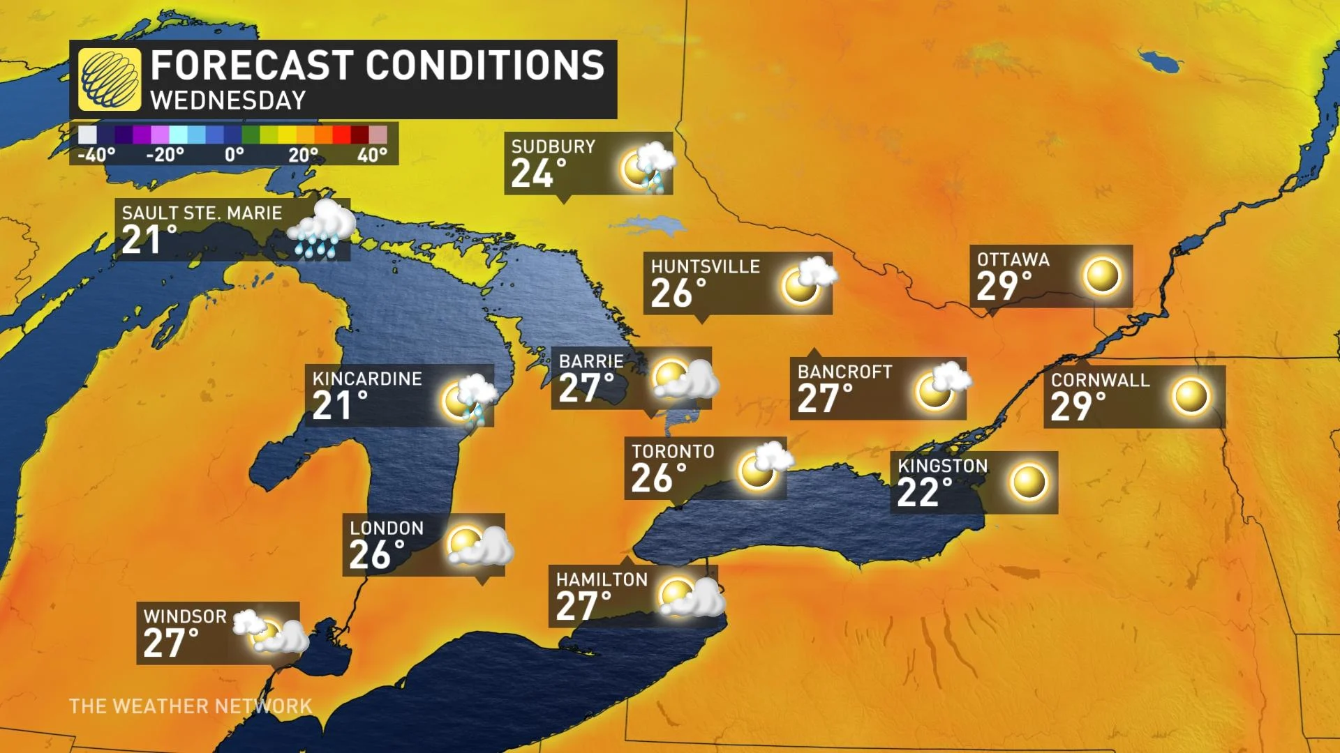
THIS WEEK: FAR-REACHING WARMTH GIVES ONTARIO A MID-SUMMER-LIKE FEEL
Early summer-like weather kicked off the week in southern Ontario and will continue through Wednesday -- featuring abundant sunshine and high temperatures in the mid-20s.
A stationary ridge will develop an arch of heat from southern Quebec to northwestern Ontario through Wednesday, pushing daytime highs to near 30°C from Ottawa to Kenora.
The warmth doesn't stop there, as mid-summer-like heat and humidity will start Thursday and continue through Sunday.
The eastern sections will be warmer than most of southern Ontario, thanks to the cooling influence of the southerly winds over the lakes for places like Toronto, Kingston, Sault Ste. Marie and Sudbury.
Despite the effect, far-reaching temperatures in the high 20s will be felt across the region, with many places hitting 30°C and the humidex reaching the mid- to upper-30s by Thursday and Friday.
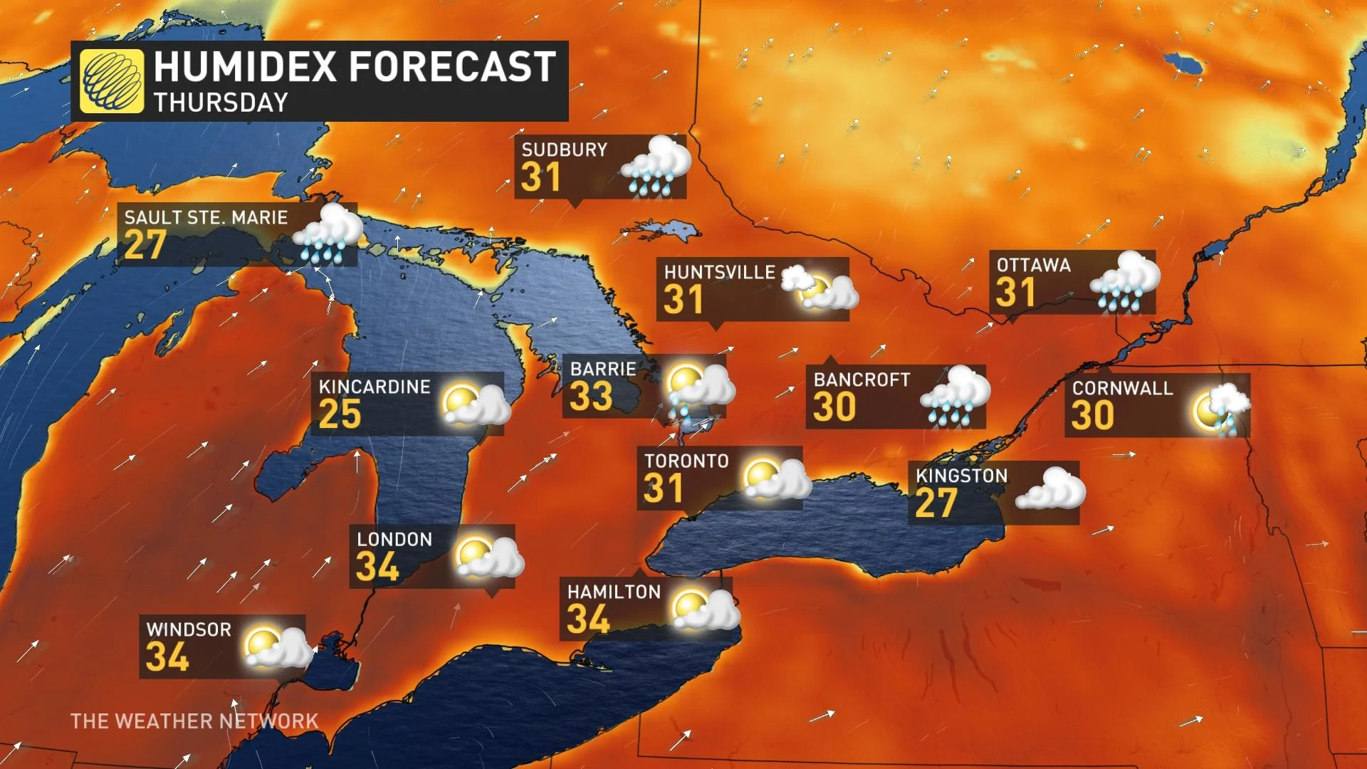
While most of the week will be dry, there is the chance for some scattered rain showers and thunderstorms near the boundary late week, but no need to be worried about any days being a washout.
"There are increasing concerns over how dry the region has become, with no widespread, soaking rain in sight," says Dr. Doug Gillham, a meteorologist at The Weather Network.
LOOK AHEAD: WILL THE HEAT HANG ON FOR THE MAY LONG WEEKEND?
For the end of the week and into the long weekend, the big question regarding the warmth is where will the ridge be sitting?
As of now, it's looking like the backside will be holding over southern Ontario, allowing a southwesterly flow to drive temps near 30°C to end the week and start the long weekend.
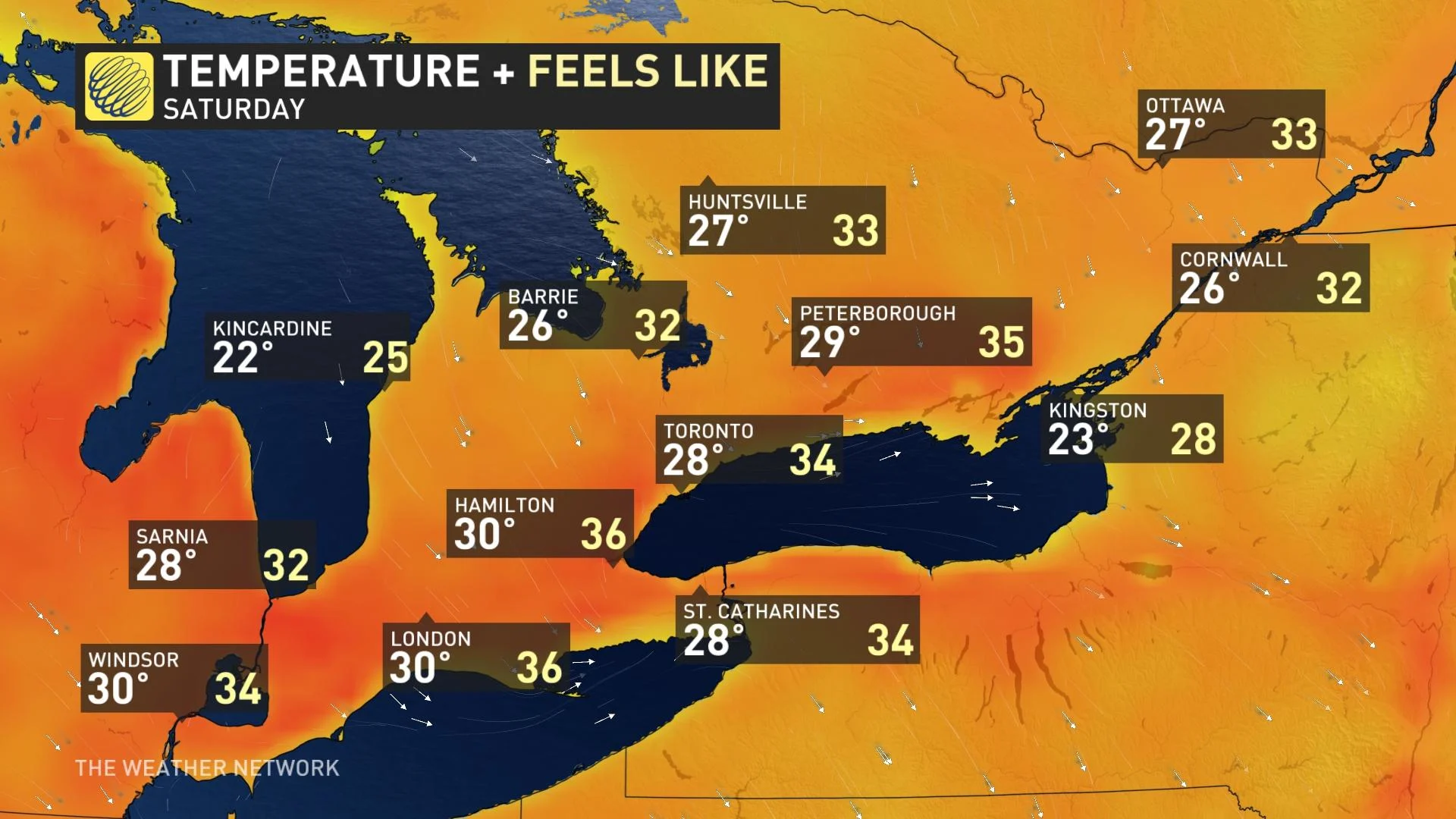
As well, scattered showers and thunderstorms are expected on the weekend for southern areas, but it will be mostly rain-free.
"We're watching the potential for a quick shot of much cooler weather to arrive Sunday night and Monday," Gillham says, adding that changeable temperatures will continue into next week as summer-like warmth attempts to return.
"There's also the potential for a period of cooler weather for early June."
Be sure to check back for the latest updates on the pattern change across Ontario.