The Great Lakes may have a thunderous effect on your summer weather

Warm winter temperatures could affect your summertime thunderstorm risks across Ontario this season
Canada’s warmest winter on record could have a stormy effect on your summertime weather across Ontario.
Lakes are all about moderation. Water takes longer to warm up and longer to cool down, allowing these vast bodies of water to temper our weather across the region.
SUMMER 2024: Get an in-depth look at the Summer Forecast, tips to plan for it, and much more!
But they can also help create the extreme weather we see at times. Here’s a look at how the lakes will play a role in your weather over the next few months.
Consequences of a mostly ice-free winter
Water temperatures across Lakes Erie, Ontario, and Huron all ranked among the warmest ever recorded for this time of year by the end of May.

DON'T MISS: CAPE is the potent fuel that powers a thunderstorm
This excessive warmth is a holdover from last winter’s conspicuous lack of ice. The region only peaked with 16 percent ice coverage last winter, which isn’t far off from the all-time record low of about 11 percent set back in 2002.
Holdover heat will allow the lakes to quickly warm up as we head into the summer months, which could affect your summertime temperatures and thunderstorm activity across southern and central Ontario.
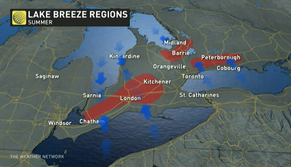
Lake breezes drive our daily storm threats
Lake breezes are a way of life around Ontario during the warmer months.
RELATED: Meet Hector, the massive thunderstorm that shows up every day
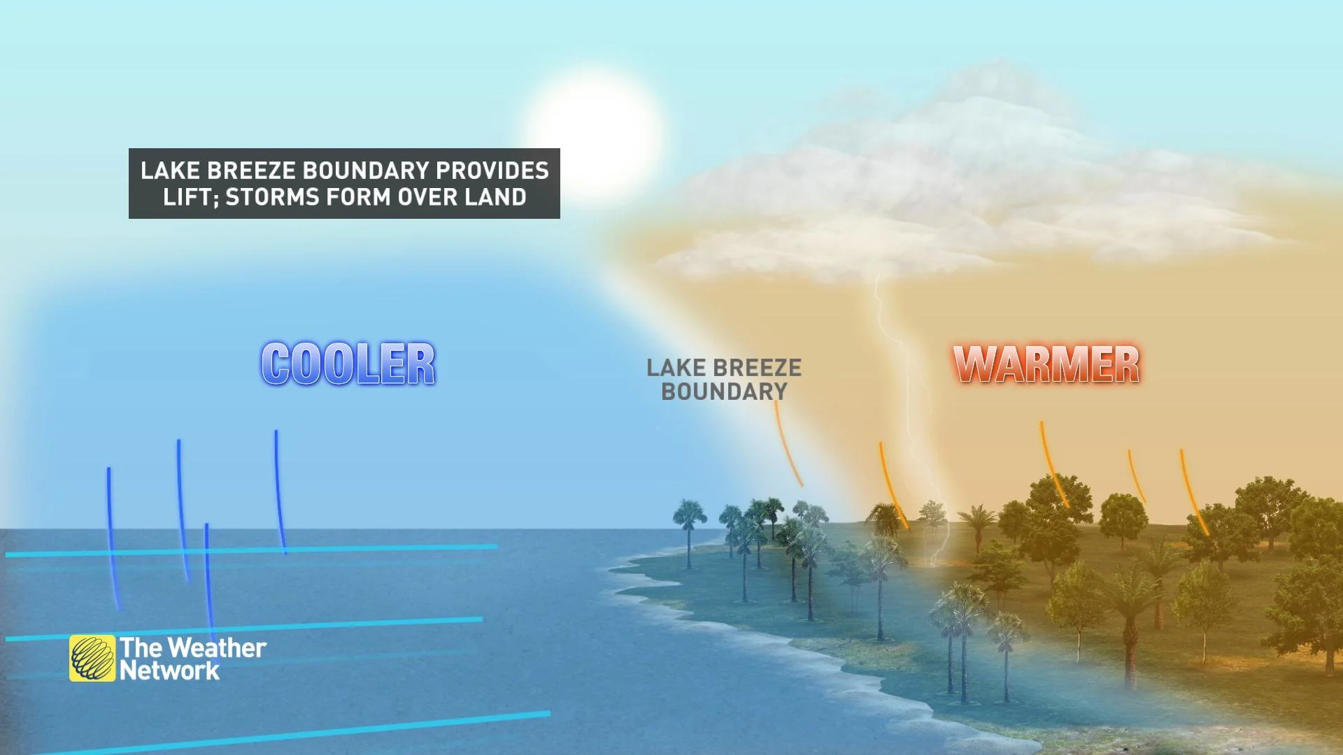
Air warms up faster over the land than it does over the water. This land-warmed air rises in a hurry, forcing a refreshing breeze of lake-cooled air to rush inland to take its place.
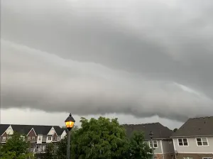
During the heart of summer, a lake breeze often acts like a miniature cold front that scoops up the warm and moist air along its path. This process triggers thunderstorms that can occasionally produce severe weather over communities near the water.
Given the lack of ice this winter and the warmer temperature of the lakes right now, though, we may not see as many lake-breeze storms as usual this summer.
The warmer water will create less of a temperature difference between the lake and the land, which will reduce the potency of lake breezes pushing ashore.
RELATED: Why nocturnal thunderstorms can be particularly dangerous
However, there is a flip side to this stormy equation.
The cooler lakes often protect us from nocturnal thunderstorms trying to scoot into southern Ontario from the U.S. side of the border.
Warmer lakes will help these storms sustain themselves as they move out of Michigan or Ohio, potentially setting us up to see more frequent nighttime thunderstorms than normal.
We’re heading firmly into storm season across Ontario now that it’s June. Stay aware of rapidly changing conditions even when skies are clear and sunny. Storms can pop up in a hurry, especially near the lakes.