Threat of early Tuesday morning storms looms over southwestern Ontario
Thunderstorms could rumble their way into parts of southwestern Ontario in the early-morning hours on Tuesday, with a chance of some turning severe, so make sure you stay alert and be weather-aware
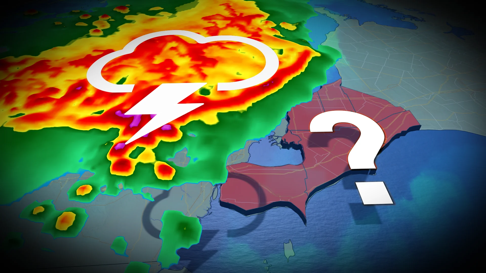
An early-morning thunderstorm risk is on the table for southwestern Ontario on Tuesday.
Whether it happens is dependent on what transpires on the other side of the border, and if storms that develop can sustain momentum as they move eastward.
RELATED: Why nocturnal thunderstorms can be particularly dangerous
Will a large cluster of storms sustain itself across the Upper Midwest? Or, will the storms fizzle before Tuesday morning and leave southwestern Ontario in the clear?
If you do live in the risk areas, be sure to plan ahead and be weather-alert throughout early Tuesday morning.
Early Tuesday morning: Thunderstorms could swing through the southwest
A mesoscale convective system (MCS) is forecast to initiate in the states into the evening hours Monday before possibility continuing into Tuesday morning.

It will roll through Green Bay and likely cross Lake Michigan, but confidence diminishes on the location and intensity as we approach dawn.
The biggest threats with the large storm complexes include damaging winds, frequent lightning and heavy, sustained rainfall.
There is high confidence that a cluster of storms known as a mesoscale convective system will develop in the Upper Midwest, churning towards the southeast through the overnight hours, but there is uncertainty on its impacts across southwestern Ontario.

Significant model discrepancy exists in the placement of the storms but communities bordering Michigan have higher odds of encountering a storm.
That won't be the only opportunity for thunderstorms in southern Ontario on Tuesday, either.
A risk of non-severe thunderstorms is draped across portions of southern Ontario, but the storm activity is expected to be widely scattered and non-severe in nature.

Gusty winds and brief, heavy downpours are possible.
Looking ahead to the long weekend, Saturday will be warm and very humid with occasional showers and thunderstorms. A cold front will track across the region Saturday night, followed by cooler weather for Sunday and Monday. Temperatures for the latter days will be on the cool side of seasonal. Showers could linger into Sunday, but Canada Day should be dry.
The first week of July will not be as warm as initially expected, with more changeable conditions are expected. Another cold front or two will prevent persistent heat and keep the threat for showers and thunderstorms at times. Expectation is that the consistent heat is delayed but not denied.
However, at this point, it looks like we won’t see another heat wave until after the first week of July, but we could still see a hot day or two.
Stay tuned to The Weather Network for the latest forecast updates for southern Ontario.


