Storm threat looms over parts of Ontario, small tornado chance in the northeast
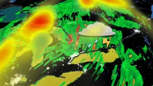
A large cluster of storms, extending for hundreds of kilometres, is forecast to track across southern Ontario through Tuesday. Some storms could turn severe with strong winds, heavy rain and large hail threatening parts of the region
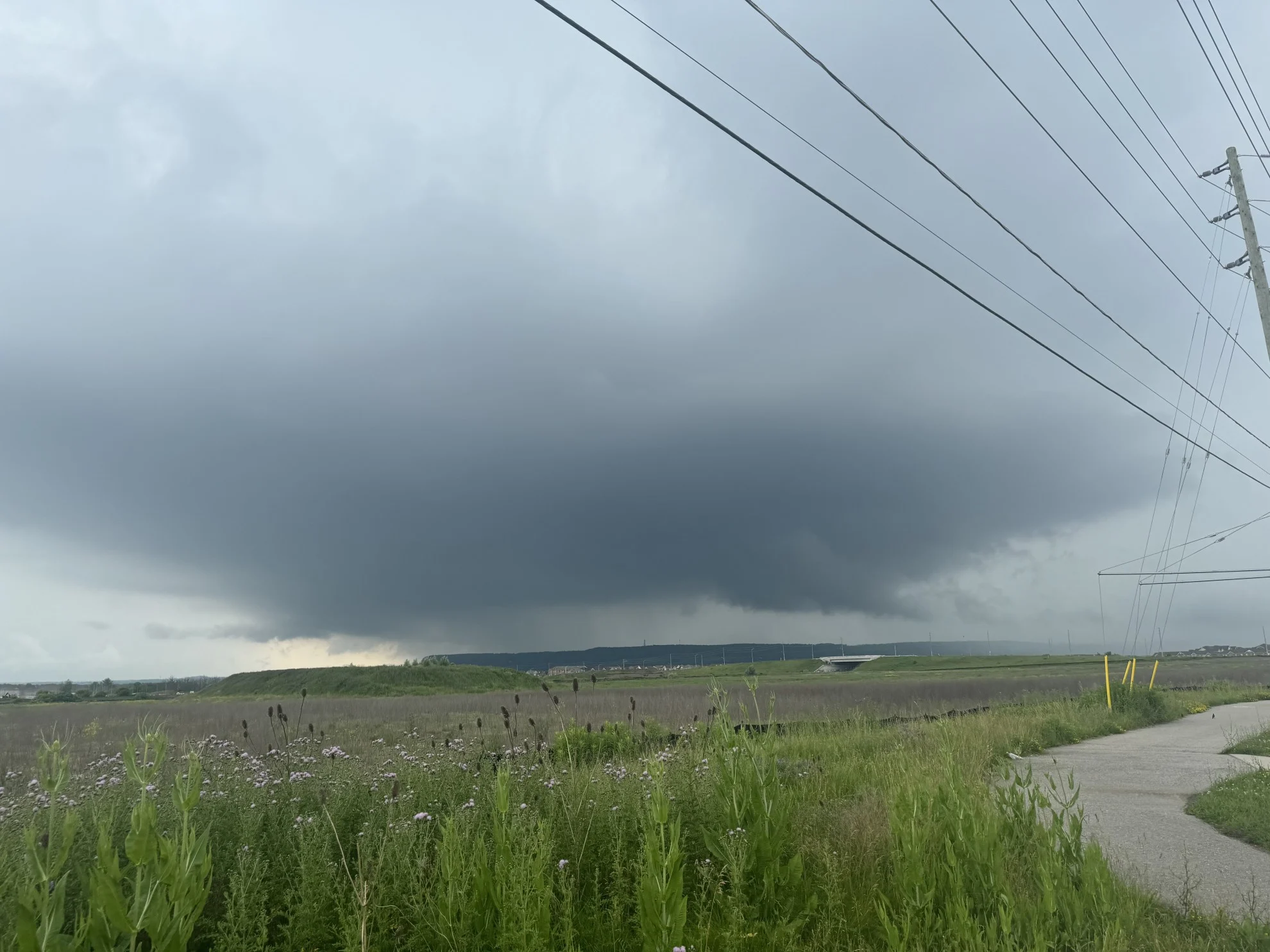
After a gorgeous start to this final week of June on Monday, the muggy weather has made a comeback, along with the threat for rain and thunderstorms across parts of Ontario Tuesday.
Confidence is lower on the severity of the storms this time around, but there is a small tornado threat across northeastern Ontario and northwestern Quebec through the late afternoon and evening hours.
It will be a day you'll want to keep your eye on the skies, with the risk for heavy rain, large hail, and strong winds in other areas where storms develop.
RELATED: Why nocturnal thunderstorms can be particularly dangerous
Beyond the early week thunderstorms, you'll notice quite the temperature dip as we kick off the Canada Day long weekend. Both Thursday and Friday will be on the cool side of seasonal, with parts of cottage country only making it to the upper teens and low 20s for daytime highs.
Tuesday: Thunderstorm risk spans much of Ontario
All eyes were on an early-morning thunderstorm risk across southwestern Ontario Tuesday, as a mesoscale convective system (MCS) developed through the overnight in the U.S. Midwest and tracked towards Ontario.
The worst of the MCS remains stateside, but there could be some strong wind gusts associated with it through the day. That won't be the only opportunity for thunderstorms across Ontario on Tuesday, either.
A risk of non-severe thunderstorms is draped across portions of southern Ontario, but the storm activity is expected to be widely scattered and non-severe in nature.

Due to the morning MCS, confidence is lower on the severity of the storms, as that will play a role in how much energy will develop.
WATCH: Damaging wind threats across the 401 corridor
In northeastern Ontario, there is higher confidence that storms will develop in the afternoon and evening, with some of them becoming severe with strong wind gusts and large hail. There is also a small tornado threat in sections of the northeast, as well as northwestern Quebec.

If you do live in the risk areas, be sure to plan ahead and be weather-alert throughout the day.
Changeable weather for the Canada Day long weekend
Looking ahead to the long weekend, Saturday will be warm and very humid with occasional showers and thunderstorms. A cold front will track across the region Saturday night, followed by cooler weather for Sunday and Monday. Temperatures for the latter days will be on the cool side of seasonal. Showers could linger into Sunday, but Canada Day should be dry.
SEE ALSO: Cross-country low rains on all provinces ahead of Canada Day long weekend
The first week of July will not be as warm as initially expected, with more changeable conditions are expected. Another cold front or two will prevent persistent heat and keep the threat for showers and thunderstorms at times. Expectation is that the consistent heat is delayed but not denied.
However, at this point, it looks like we won’t see another heat wave until after the first week of July, but we could still see a hot day or two.
WATCH: Are rain barrels worth the effort? Here are the benefits
Stay tuned to The Weather Network for the latest forecast updates for southern Ontario.