Weekend warmup brings rain, possible thunder into southern Ontario
Warm-weather lovers are in for a little treat this weekend as above-seasonal temperatures build over southern Ontario, but it comes with a rainy cost
We’re trading the wind chill for the humidex across Ontario this weekend as the season’s warmest air floods into the province.
Temperatures rising into the weekend could push the feels-like value close to 30 for communities in the far southwest.
This warmth will come at a cost, however. Keep the umbrella handy heading into next week as showers and possibly even some thunderstorms arrive with the rising temperatures.
DON’T MISS: Tropics are waking up with the first disturbance of 2024
Temperatures tick up Saturday
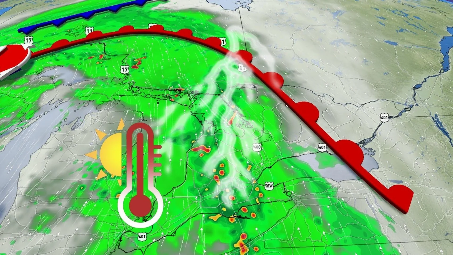
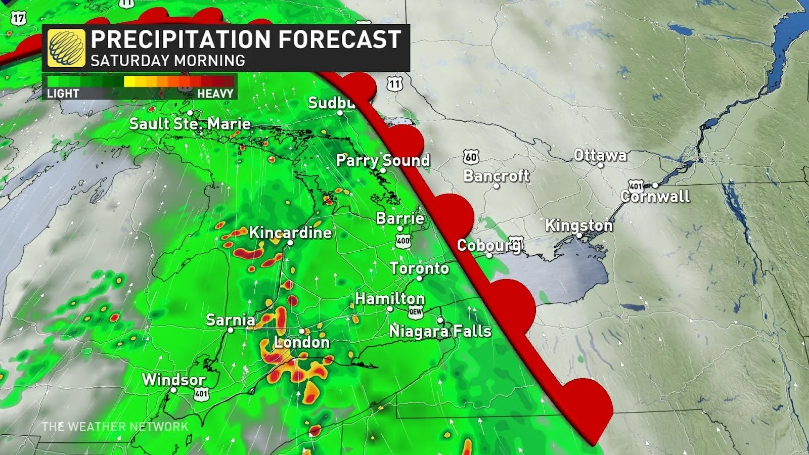
Friday morning’s chill will be a distant memory by the weekend. Temperatures will rise back up to normal as a warm front treks across the western Great Lakes on Saturday. This, however, will also allow southerly winds to spill warm and humid air across the border into southern Ontario.
Rain will build into the region beginning Saturday morning as mild temperatures inch into extreme southwestern Ontario. Folks may even hear a few rumbles of thunder as this warm front tracks through the region.
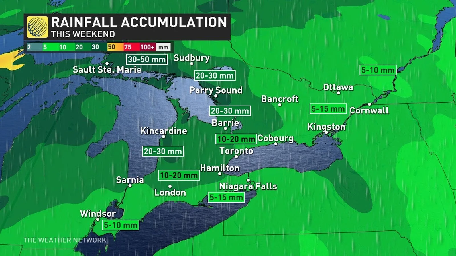
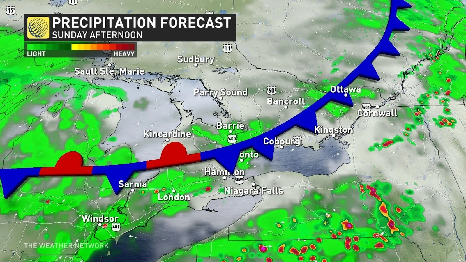
The rainy system will push up into Ottawa by Saturday evening, giving those between the Greater Toronto Area (GTA) and Windsor area a break from the soggy weather. Unfortunately, this break won't last for very long as an approaching cold front from the north will bring in another round of rain and scattered thunderstorms overnight Saturday and into Sunday. As this system tracks into southern Ontario, folks could see heavier rain and gusty winds than the morning system brought.
Readings soar on Sunday
Sunday could be the warmest day of the year for much of southern Ontario as this May-like pattern arrives to end the weekend, although scattered showers and a thunderstorm risk could put a brief damper on the afternoon.
The warmest readings we’ve seen so far this year include:
26.1°C in Windsor on April 14
23.8°C in Hamilton on April 9
20.6°C in Toronto on March 13
19.9°C in London on April 14
Daytime highs on Sunday will soar into the mid-20s for many communities, with humidex values possibly cracking 30 around Windsor and Hamilton.
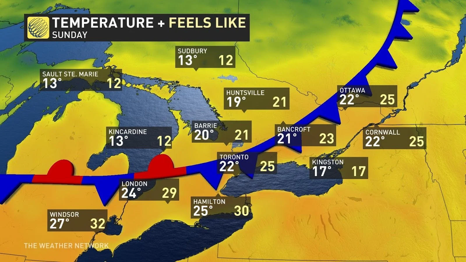
Given the warmth in the forecast, Toronto, Hamilton, and London are on track to beat 2024’s high-mercury mark by Sunday, while Windsor might fall short by just a hair.
It's important to note that warm, moist winds in the middle of spring is a recipe for possible thunderstorms. While the most favourable conditions for storms should remain stateside, we may have to dodge a few pop-up storms across southern Ontario on Sunday to enjoy the warm day.
Warmth sticks around into early next week
Another rainy system tracking into northern and central Ontario on Monday will keep the unseasonably warm air parked over the southern half of the province to start the week.
Afternoon temperatures will once again crack the 20-degree mark for much of southern Ontario, with slightly cooler readings possible around the Golden Horseshoe as the lake cools things off a bit.
We’ll see additional showers and possibly a risk for rumbles of thunder as that disturbance passes the region to the west.
Temperatures will likely start to moderate back toward seasonal as we head into the second half of the upcoming week. Warm-weather lovers may not have to wait long for above-seasonal conditions to return, as more unseasonable warmth could arrive in time for the beginning of May.
Stay with The Weather Network for all the latest on your forecast across Ontario.