Distant typhoon set to bring an early taste of fall to Canada

Before long, millions of Canadians may be reaching for their sweaters in the evenings sooner than they'd like. The reason why is half a world away.
People living in Central Canada and the eastern Prairies will feel a definite fall-like nip in the morning air next week, and they can look to a far distant typhoon for the cause.
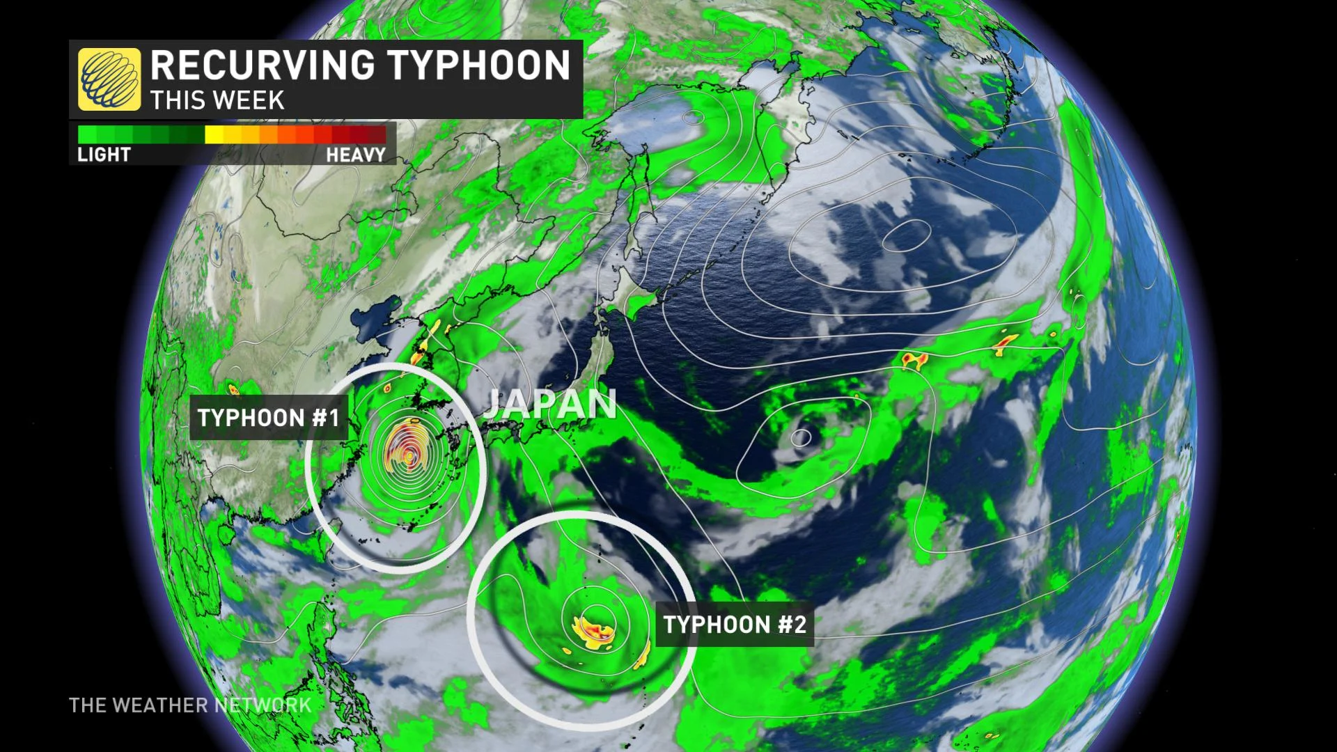
Although Typhoon Maysak's impact on the Koreas this week was significant, it's not on a path that will take it anywhere near Canada. So what does this have to do with us?
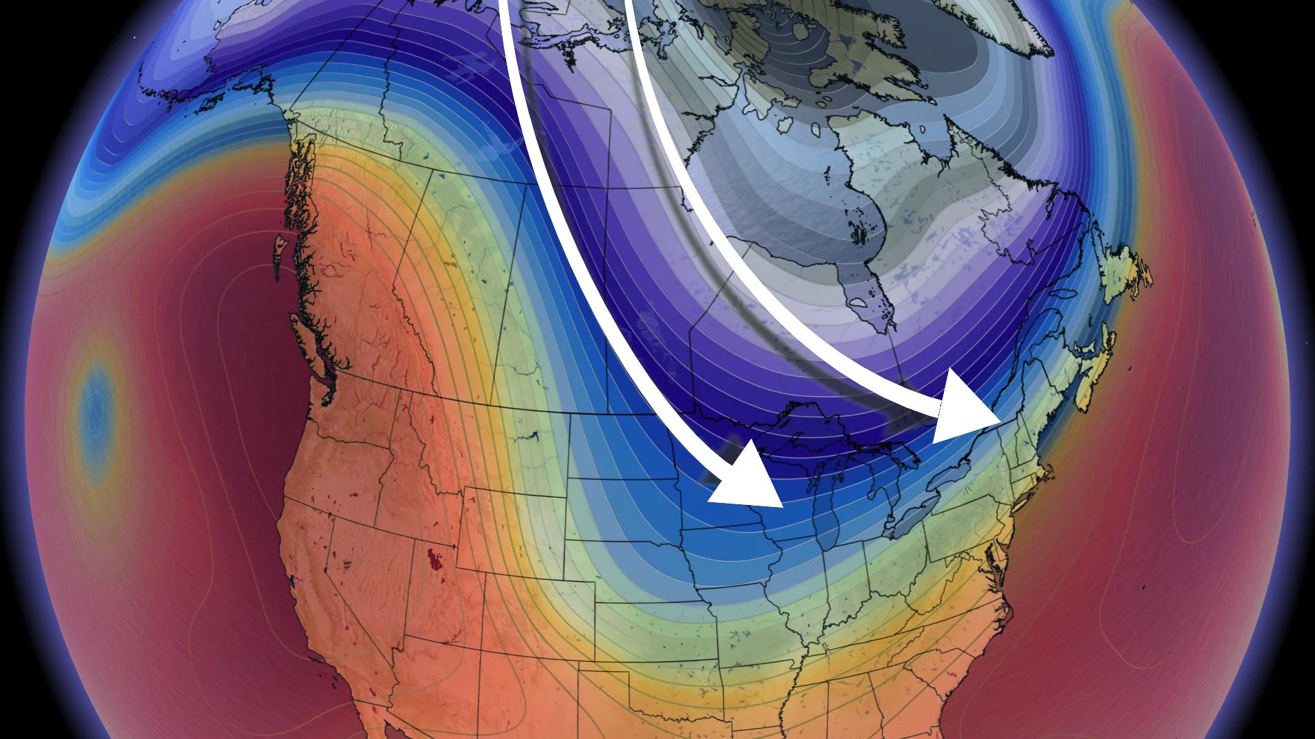
The answer is in Maysak's track: Though the storm itself has weakened and will dissipate after moving through northeastern China, a side effect of its northerly track out of the tropics will be a major amplification of the jet stream as it races across the Pacific.
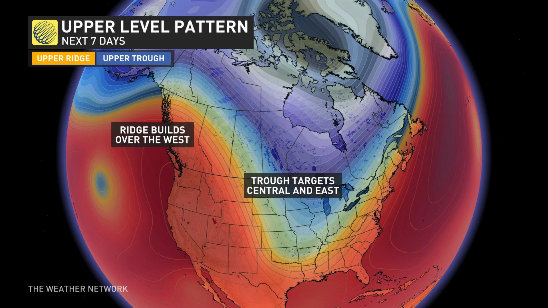
Another result of that jet stream amplification: A ridge of high pressure building off the coast of British Columbia that's set to usher in some of the warmest temperatures of the summer for the province.
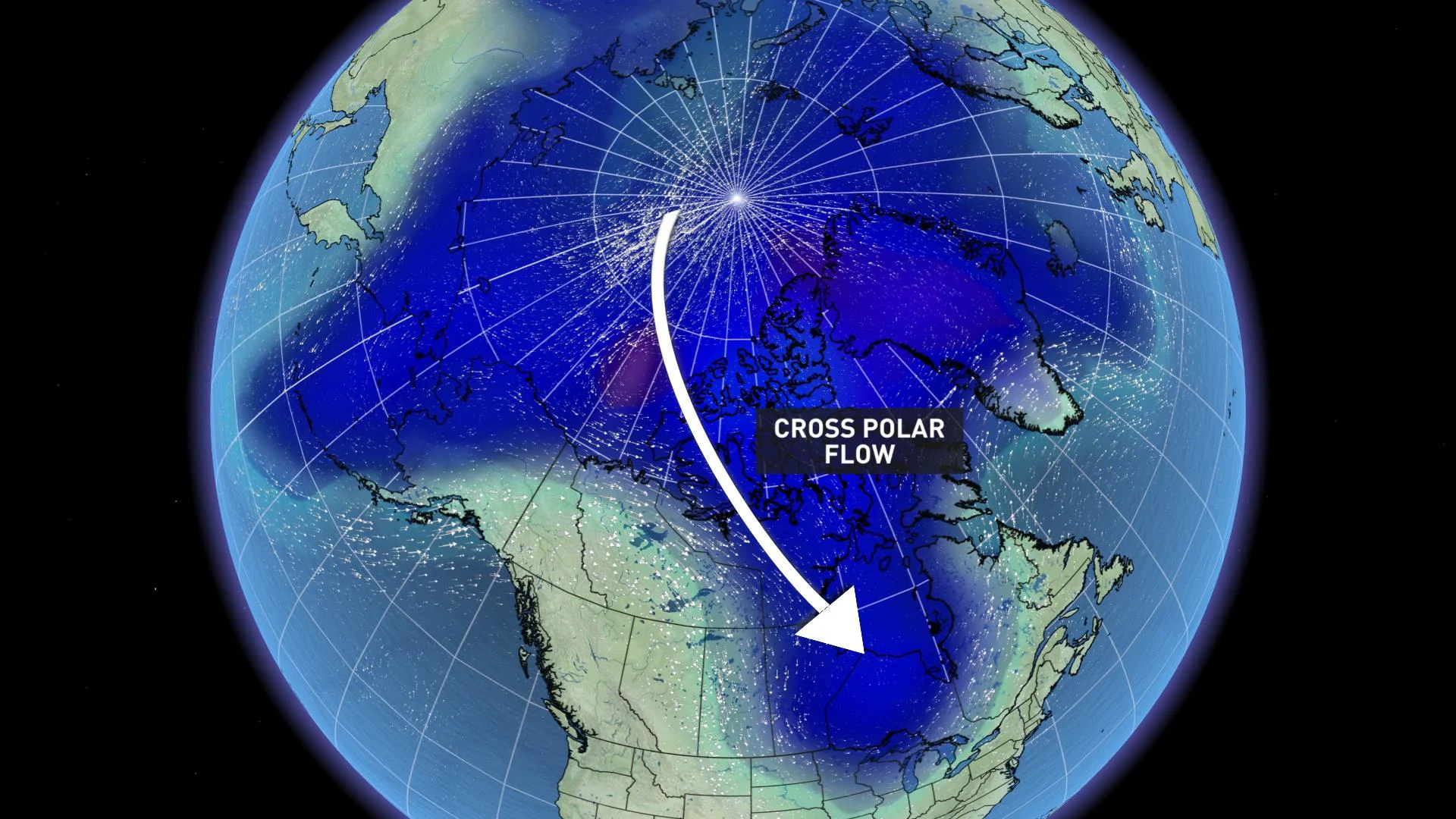
Aside from allowing warmth to build and keeping the skies clear, high pressure also helps shape the jet stream, which slides north and over it up into the Arctic -- then curves back down south, acting as a kind of atmospheric conveyor belt for cold polar air.
The Arctic will already be experiencing what meteorologists call "cross-polar flow," where cold air from Siberia is travelling over the pole into North America, so there will be plenty of chill on hand to be funnelled southward into central and eastern North America in the coming days.
That'll make for a serious contrast between east and west in Canada, with people in B.C. happy the last days of summer are living up to their name, and people from the eastern Saskatchewan through Manitoba and Ontario to Quebec wondering whether they've skipped ahead early to fall to make up for this season's long stretches of extreme heat.
By early next week, Vancouver, for example, will be looking at daytime highs in the upper 20s, possibly feeling higher than 30 with the humidity.
We should stress: As chilly as it may seem sometimes in southern parts of those provinces, northern areas will be even more frigid by comparison. A large area ranging from Saskatchewan through to northern Ontario may be in for their first frosts of the season for a couple of days next week, with daytime highs struggling to reach the 10°C mark.
While we expect that cooler than seasonal temperatures will continue to dominate through mid-September across much of central Canada, warmer summer weather will surge back into southern Ontario and southern Quebec at times during mid and late September.
With files from Kelly Sonnenburg and Doug Gillham.