Up to 15 cm of snow targets parts of Atlantic Canada, plan accordingly

A system tracking well offshore began bringing heavy snow to parts of the region Friday night, lasting through Saturday for much of Nova Scotia and parts of Newfoundland.
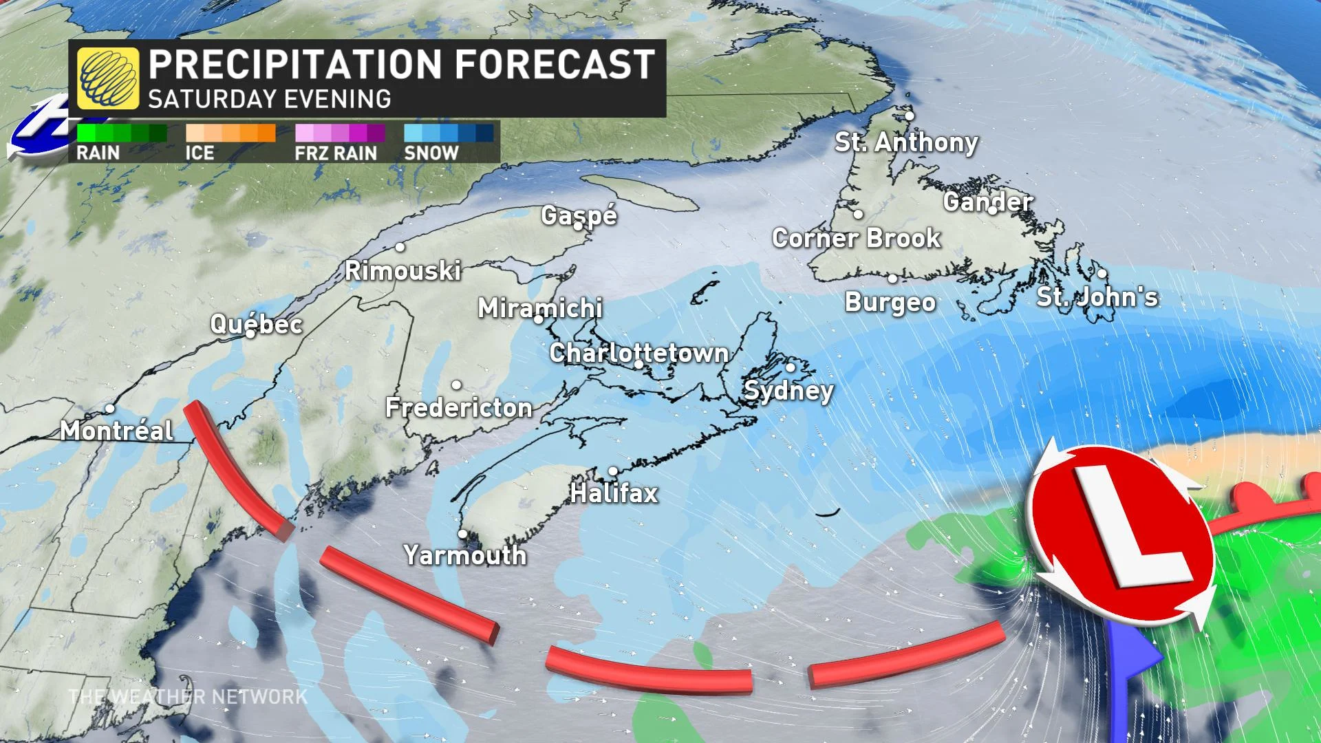
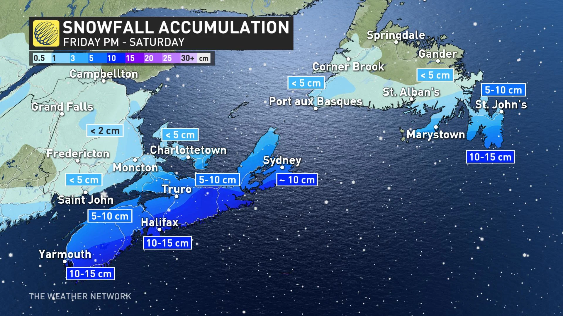
The same system that brought significant winter impact to the Eastern U.S. this week is tracking well offshore from Atlantic Canada, but still close enough to bring some accumulating snow to southern Nova Scotia and the Avalon for the start of the weekend, after an overnight start. A widespread 5-10 cm of snow is forecast into Saturday, though with some areas seeing the potential for locally higher amounts up to 15 cm. The exact track of the storm will play a significant role in the total snowfall accumulations. More on the impact and timing, below.
WEATHER HIGHLIGHTS
System moving south of the region, northern edge brings snow potential to Nova Scotia and Newfoundland from the overnight through Saturday
10-15 cm possible for Atlantic coastal Nova Scotia and parts of Newfoundland's Avalon peninsula
Forecasters monitoring potential system early next week
INTO SATURDAY: U.S. SYSTEM PASSES TO THE SOUTH, BUT STILL CLOSE ENOUGH FOR SNOW
An active storm track brought this latest brush with winter weather into Atlantic Canadian waters later Friday, a system which has brought uncommonly cold and wintry conditions to parts of the southern U.S.
MUST SEE: Texas is freezing beneath Arctic air. Is Canada to blame?
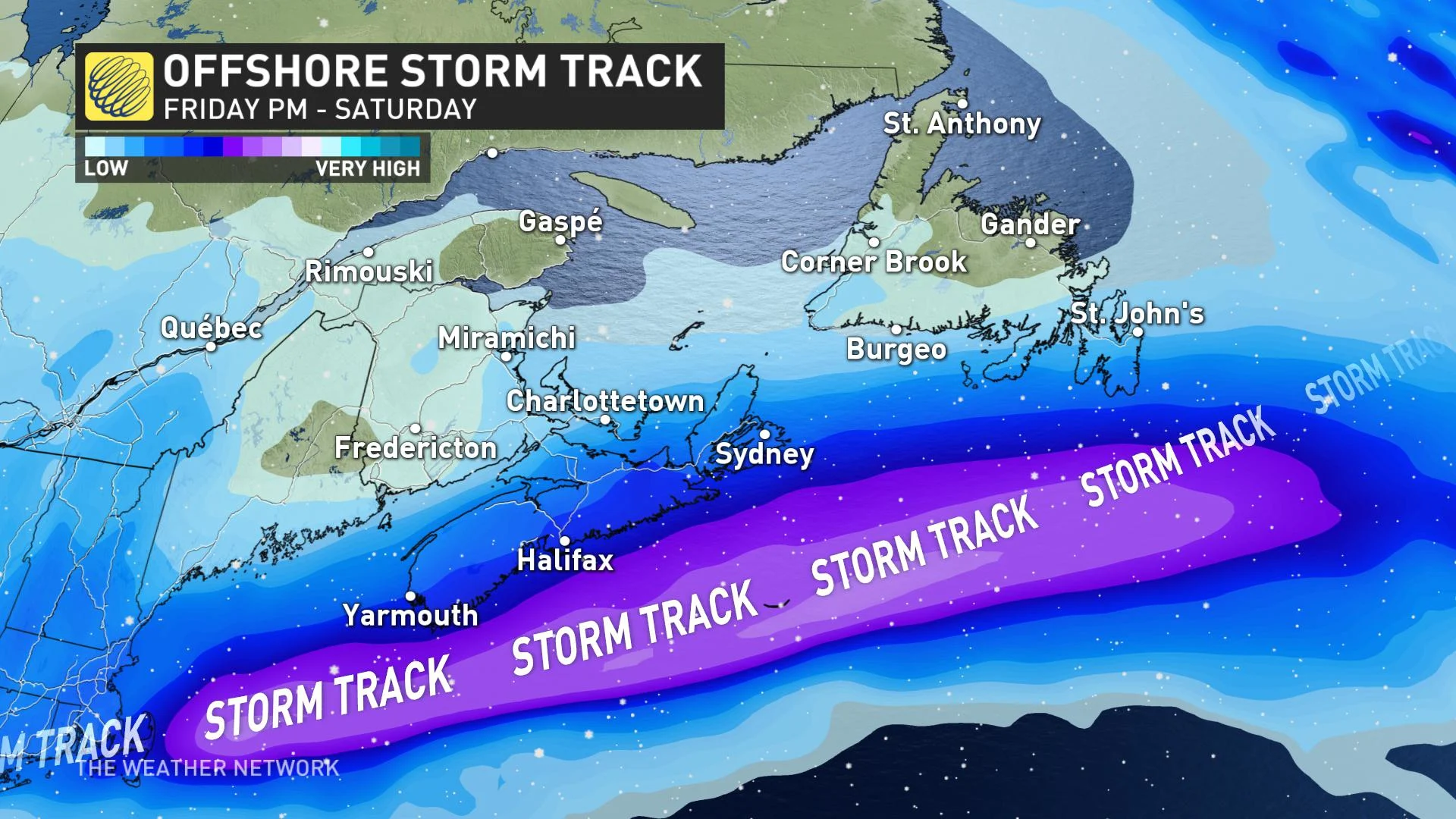
On the one hand, there will be more than enough Arctic air still in the mix to ensure that whatever this system brings will remain as all snow. On the other, its track is largely out to sea, so it will only deliver a glancing blow to parts of Atlantic Canada, rather than a wide-ranging hit.
Still, much of southern Nova Scotia and the Avalon should receive a decent helping from this storm.
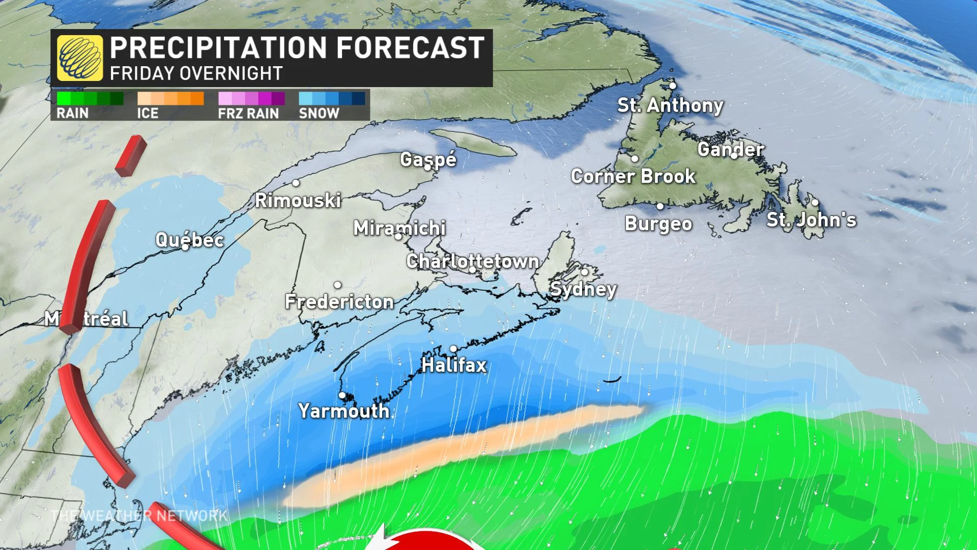
From overnight beginnings, the snow will be pushing across Nova Scotia into Saturday. Moisture may push far enough north to provide some light accumulations in southern New Brunswick and across PEI as well.
The Avalon Peninsula in Newfoundland will see the snow move in on Saturday afternoon and evening, continuing overnight and diminishing to flurries by Sunday morning.
Around 10-15 cm is possible for areas along and a bit inland of Nova Scotia's Atlantic shore, as well as the southern Avalon in Newfoundland.
"The storm's track will keep the strongest winds and heaviest precipitation out to sea, but enough moisture should push back into the Arctic air in place over the region to produce the 10-15 cm of snow for places like Halifax," says Weather Network meteorologist Michael Carter.
Special weather statements are already in effect for the southern half of Nova Scotia, warning of the potentially heavy snow.
As with many Atlantic storms, however, snowfall totals will depend heavily on the storm's exact track. A closer approach could lead to snowfall totals trending up a bit, and a track even further out to sea would reduce accumulations.
Beyond, another system is expected to intensify as it tracks into Atlantic Canada early next week. It is too early to have confidence in the track and impacts, but parts of the region should see significant snow and possibly a messy mix of precipitation, though continued monitoring will be needed.
Check back for updates as these next storms approach Atlantic Canada.