
Blustery winds continue to batter Newfoundland, 100+km/h gusts possible

Most of the impacts from the potent Colorado low have departed Atlantic Canada, with the exception of Newfoundland. Rain and blustery winds will continue to impact the island through the overnight hours Monday, easing off by Tuesday morning. Wind warnings are still in place, with gusts expected to hit up to 110 km/h along exposed areas and 80-100 km/h inland.
WEATHER HIGHLIGHTS
Strong winds, rain remain in Newfoundland Monday night
Wind warnings in place; gusts will hit 110 km/h in exposed areas, 80-100 km/h inland
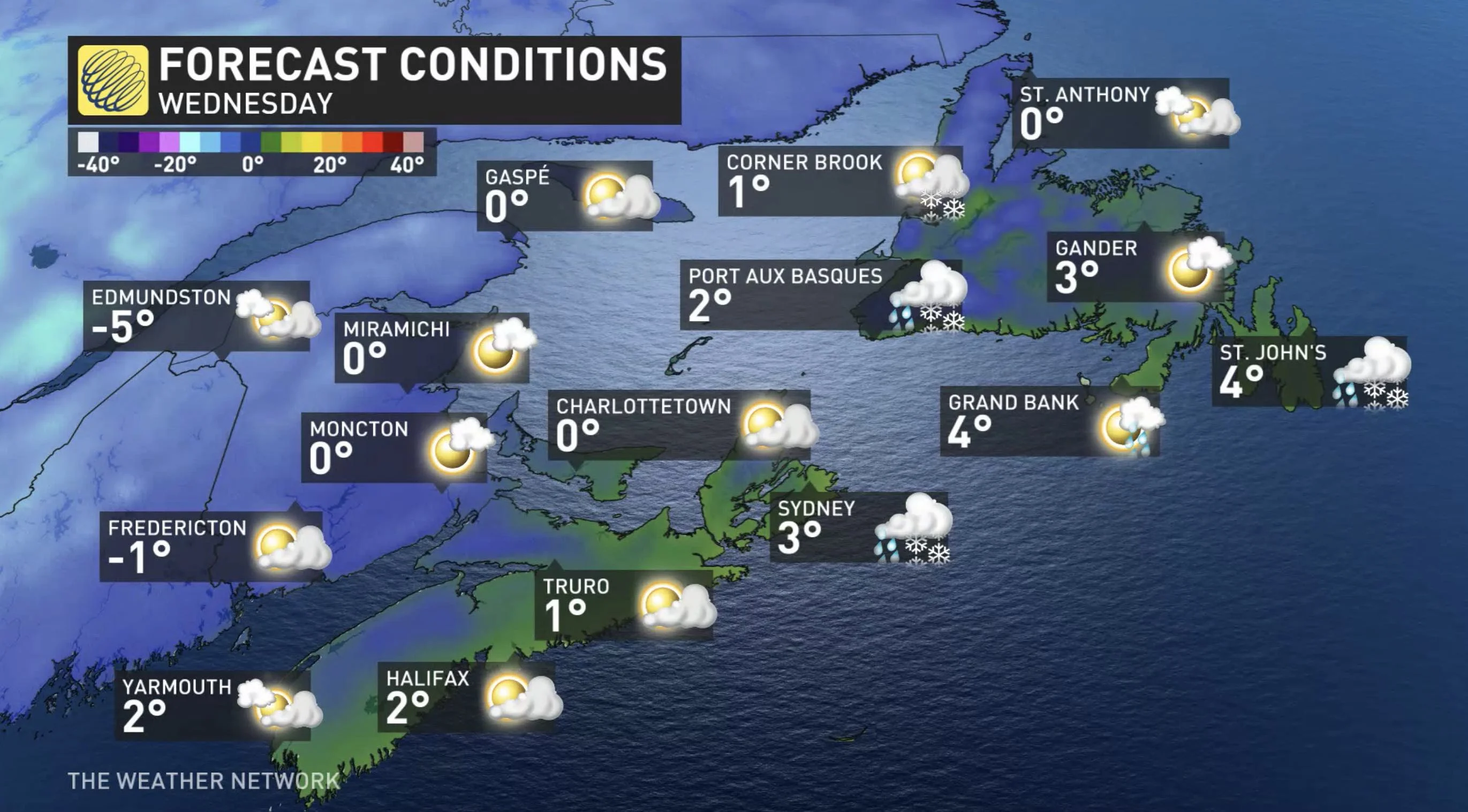
Temperatures gradually cooling, becoming well below seasonal by the mid-week mark
INTO TUESDAY MORNING: POTENT SYSTEM PUSHES EAST, THREAT FOR HIGH WINDS
A potent system that left a damaging mark on parts of southern Ontario and Quebec over the weekend has made its way through most of Atlantic Canada, leaving just lingering rain and wind effects on Newfoundland Monday night.
In addition to rainfall, the low-pressure system will bring strong, southeasterly winds to the island into early Tuesday morning before winding down. This has prompted Environment Canada to issue warnings. Gusts will hit 110 km/h in exposed areas and 80-100 km/h inland.
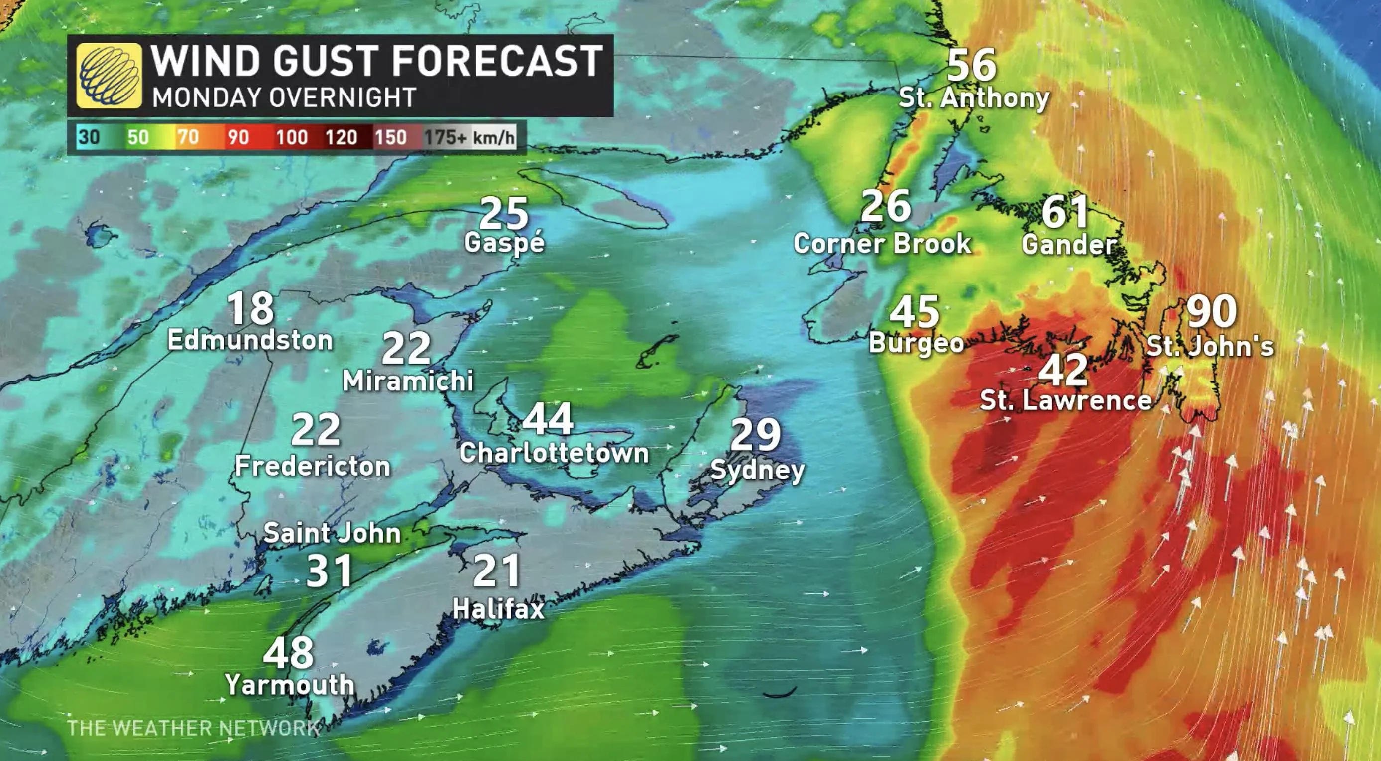
"Damage to buildings, such as to roof shingles and windows, may occur. Loose objects may be tossed by the wind and cause injury or damage," Environment Canada warns.
WEDNESDAY: COOLING TEMPERATURES WITH RISK FOR SEA-EFFECT SNOW
That brief gasp of milder weather will be short-lived as temperatures cool, becoming well below seasonal by the mid-week mark across the region.
The colder temperatures will allow for some sea-effect snow to develop, ahead of a weak system that brings more rain and snow showers to round out the work week.
Check back as we continue to monitor the approach of these systems