Records fall as B.C. soars into summer-like heat

You won't need to travel to the southwest to get some desert heat this week
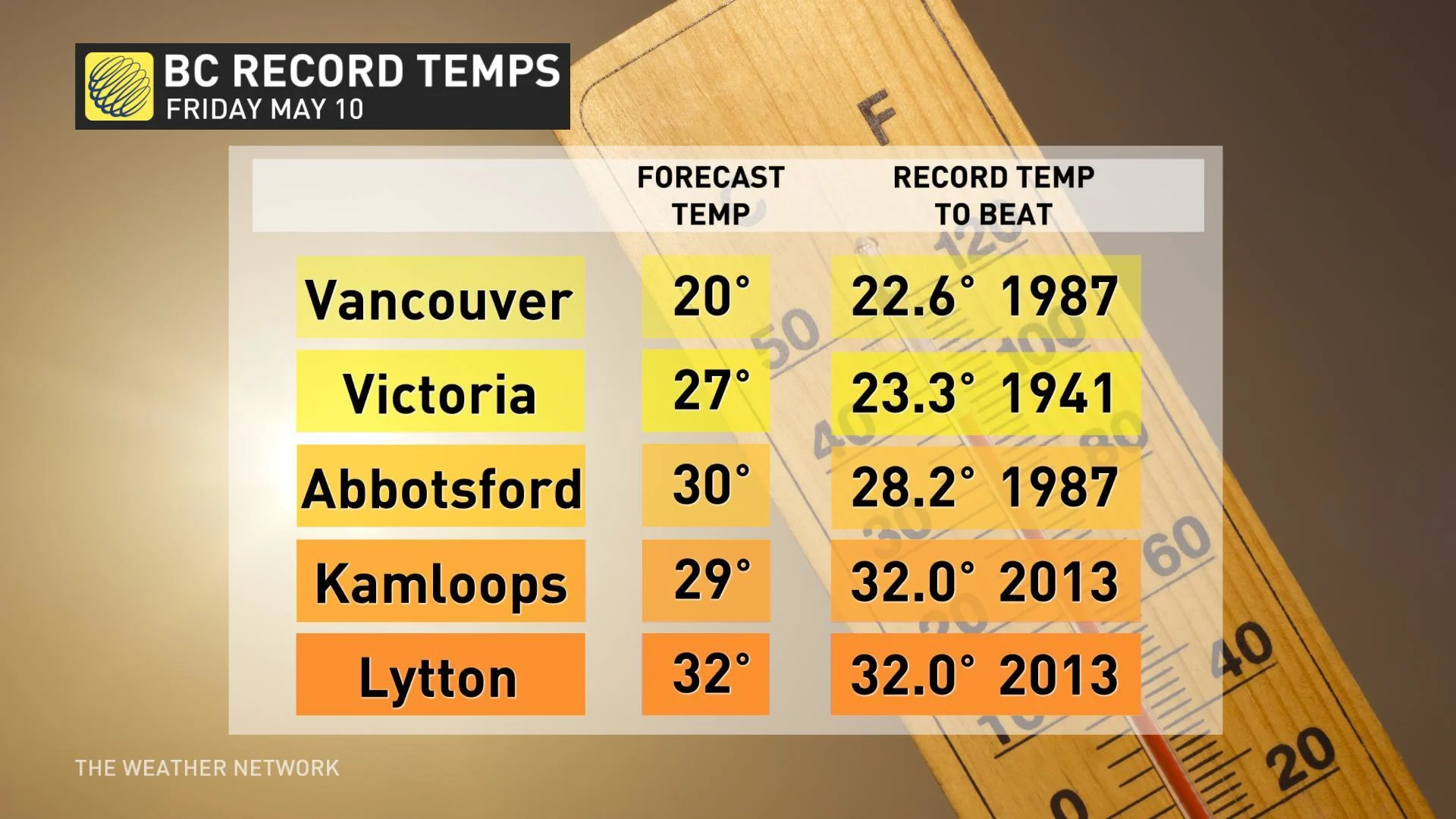
Southern B.C.'s warming trend will peak on Friday, after multiple new daily high temperature records have already been set. A strong ridge of high pressure off the coast has meant a stretch of sunny days this week with building afternoon highs flirting with the 30-degree mark for many -- temperatures more suited to mid-summer than mid-May. We take a look at who's in the running to hit that 30 degree mark on Friday, and where the records have already fallen, below.
Visit our Complete Guide to Spring 2019 for an in depth look at the Spring Forecast, tips to plan for it and much more
WEATHER HIGHLIGHTS
Highs near 30 for many spots on Friday, record temperatures threatened for some
Sunny streak continues into weekend, though highs will start to cool
Rain returns through the middle of next week
Latest watches and warnings [HERE]
Rain has been scarce for the typically-wet west coast this week as a ridge of high pressure has diverted incoming systems and extended Vancouver's unusual dry streak to 16 days.
Amid clear, dry conditions, temperatures have been on a steady climb through much of the week, particularly for southern B.C., where highs will approach -- or even top -- the 30-degree mark on Friday potentially making for another record breaking day. That's well above average for this time of year, and more suited to late June.
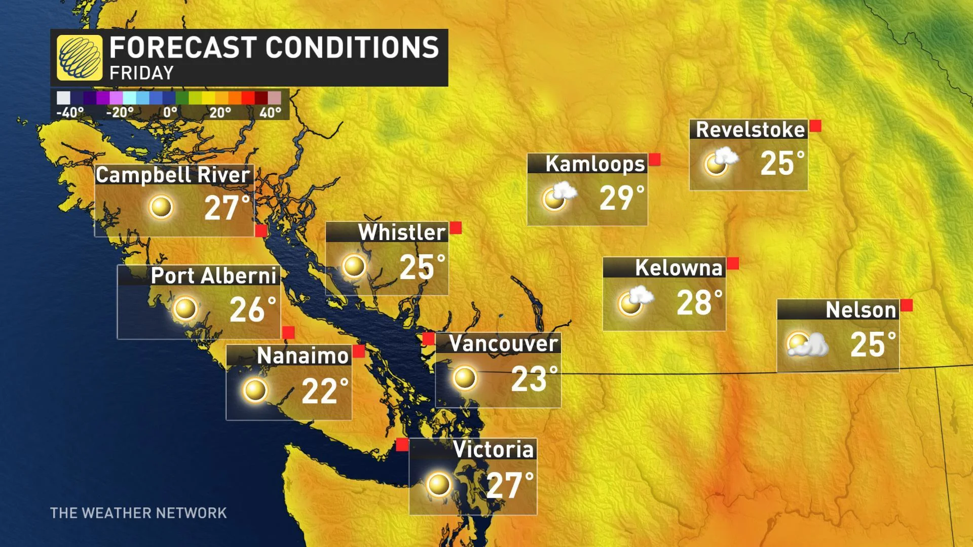
Even for those spots that don't have record-breaking temperatures in the forecast, afternoon highs could make for the warmest May 10 that some have seen in years.
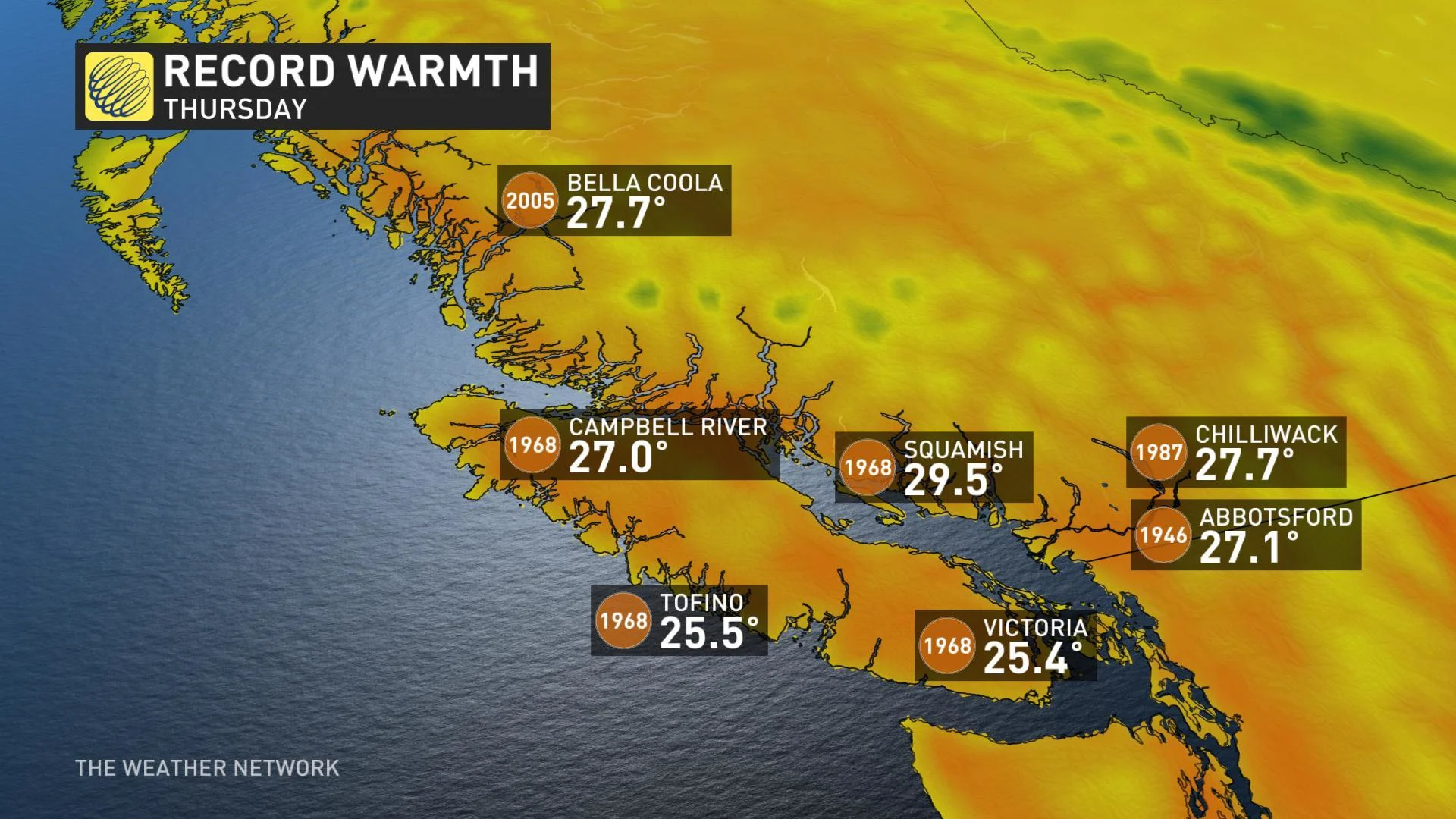
RECORD HIGH TEMPERATURES SMASHED ON THURSDAY
Multiple new daily high temperature records were set on Thursday as daytime highs soared above 25°C. The city of Victoria beat out an old record set back in 1968, while Squamish reached 29.5°C breaking the record of 26.1°C also set that same year.
While the ridge remains in place through the weekend and into early next week, the peak will shift somewhat to the southeast, turning the focus of the summery heat away from the Lower Mainland and allowing temperatures to decline to more seasonally-appropriate values.
Rain returns to the forecast through the middle of next week, as do afternoon highs closer to average for the middle of May.
FIRE WEATHER CONCERNS AMID WARM, DRY SPELL
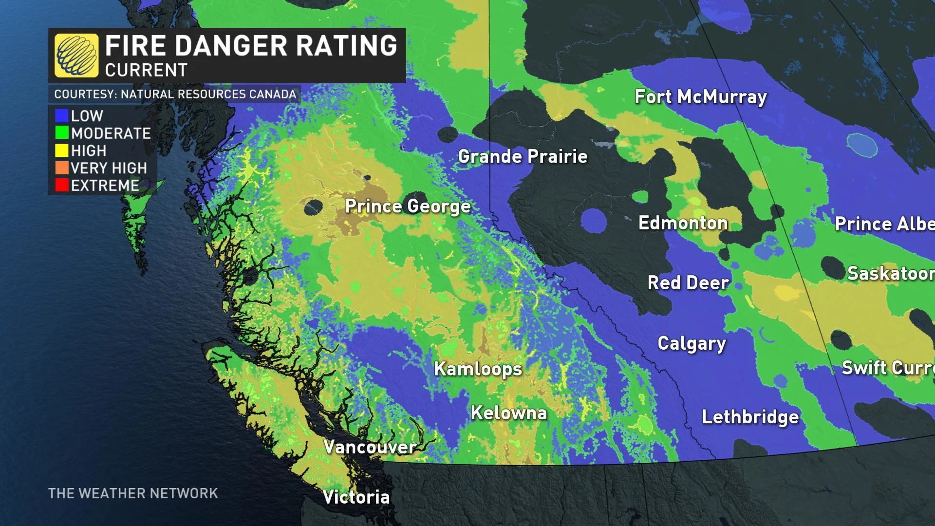
While the taste of early summer might be a welcome one, the warmth and dry conditions do raise concerns for the province's wildfire season. The current fire danger rating, issued by National Resources Canada, already lists high to very high ratings for parts of the Interior and Vancouver Island.
2018 set a new record for hectares burned in the province, topping the previous record set in 2017. The B.C. Wildfire Service has already implemented some open fire bans in the Northwest and Cariboo regions, both of which experienced an extremely dry winter and early spring.