Prairies: Significant system will "cook up" strong storms

Strong storm risk on one end of the Prairies, accumulating snow on the other.
Though Thursday carried some storm risk, Friday is looking like a real crackler, particularly for southern Manitoba where storms have the risk of turning severe. Meanwhile, a very different setup closes out the week on the other end of the Prairie provinces -- high elevation snow in the Rockies. For a more detailed look at timing and location, see below.
WEATHER HIGHLIGHTS:
Heat moves east Friday, strong storm energy in southern Manitoba
Chance of high-elevation snow in the Rockies, lasting into Friday morning, second round Friday night
Big drop in temperatures expected by end of week
Stay up-to-date on the ALERTS in your area
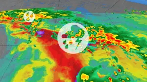
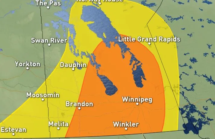
SEVERE THUNDERSTORM THREAT FOR FRIDAY
Friday's storms in southern Manitoba will, at least in part, be a function of the very high temperatures expected during the day, with daytime highs in the mid-30s and feeling close to 40 with the humidity.
As for the storms, they'll likely begin for some late day and linger into the evening and overnight, as the cold front cuts through. Much of southern Manitoba has a chance of storms, with a significant swath possibly seeing some isolated storms turn severe.
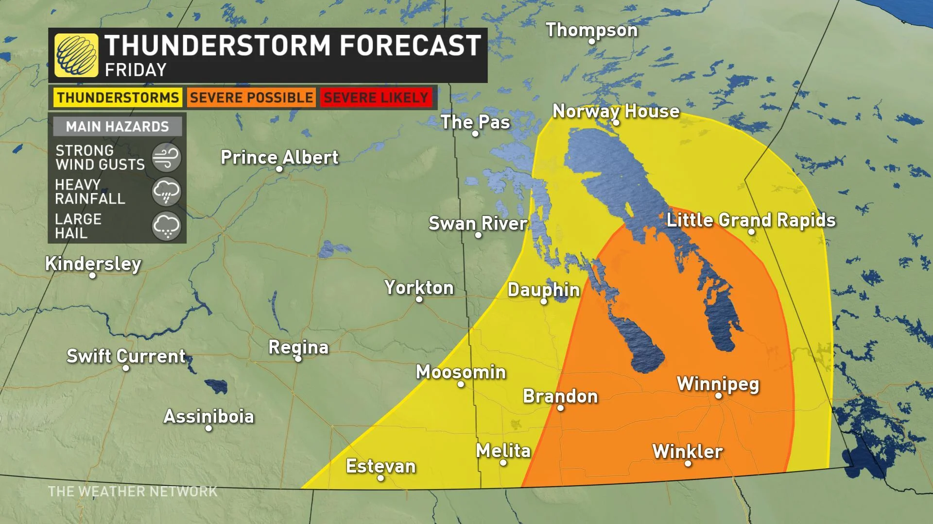
WATCH: 100 KM/H WINDS AND LARGE HAIL POSSIBLE ON FRIDAY, HOUR-BY-HOUR DETAILS BELOW
HUGE TEMPERATURE DIVIDE
The heat that will be fuelling Friday's severe weather threat will not, by any means, be uniform across the region. In fact, Manitoba and southern Saskatchewan will be separated from southern Alberta by a 25-30 degree temperature contrast Friday, with parts of the western Prairies struggling to even escape the single digits.
FROM SEVERE STORMS TO...SNOW?
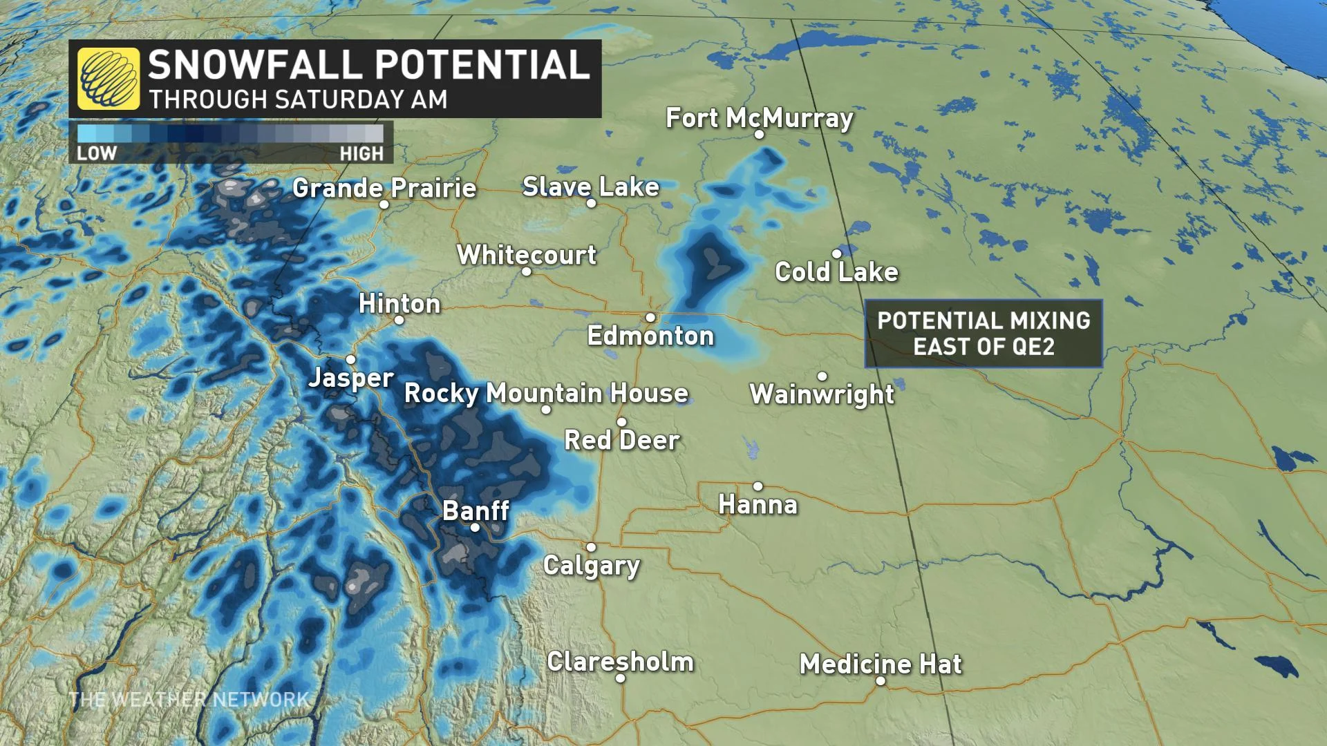
Though this system will bring its share of beneficial rain and storms, at the higher elevations of Alberta it will manifest as accumulating snow as cooler temperatures funnel in.
The first round will be wrapping up by Friday morning, having already triggered snowfall warnings for the Banff and Kananaskis regions, and the enduring cold will make a second shot likely Friday evening into Saturday morning.
Away from the higher elevations, some guidance is also hinting at light snow as far east as the QE2 -- or perhaps even east of the route -- but this activity would be unlikely to result in any meaningful accumulation given how warm the region has been lately. A few flakes in the sky around Edmonton aren't out of the question through early Saturday, however.
That cold air will gradually spread across the rest of the region, though given the slow progress of the front, it will take awhile for the cooldown to reach the southernmost parts of the Prairies, with southern Manitoba holding out the longest.
Much warmer weather will quickly spread from west to east once again next week, as an unsettled pattern shapes up for the second half of the week.
WATCH BELOW: EXTREME DROUGHT CONDITIONS PLAGUING THE PRAIRIES, RECORD DRY SPRING FOR SOME
Stay tuned to the Weather Network for the latest updates.