Where is fall, Canada? Cold, snow befalls West as warmth rises in the East

Fall is a season transitioning us away from the long, hot summer days into cooler winter ones. This change isn't always a smooth one, however. This week is a perfect example of that in Canada
While one side of Canada shivers and shovels out of a wintry blast, the other revels in sunny, summer-like temperatures that are soaring into the 20s. That begs the question: Where has fall gone in Canada?
Fall is a season transitioning us away from long, hot summer days into cooler winter ones. This change isn't always a smooth one. Fall opens the doors of Arctic air to battle warm air, lending to active weather and temperature roller-coasters. We can experience weather extremes on both ends of the spectrum, just like what is unfolding across Canada this week.
SEE ALSO: Roller-coaster event: Fredericton wakes up to frost, but summer set to return
But that doesn’t mean we can’t experience weather extremes at both ends of the spectrum from time to time during the season. This change isn't always a smooth one.
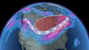
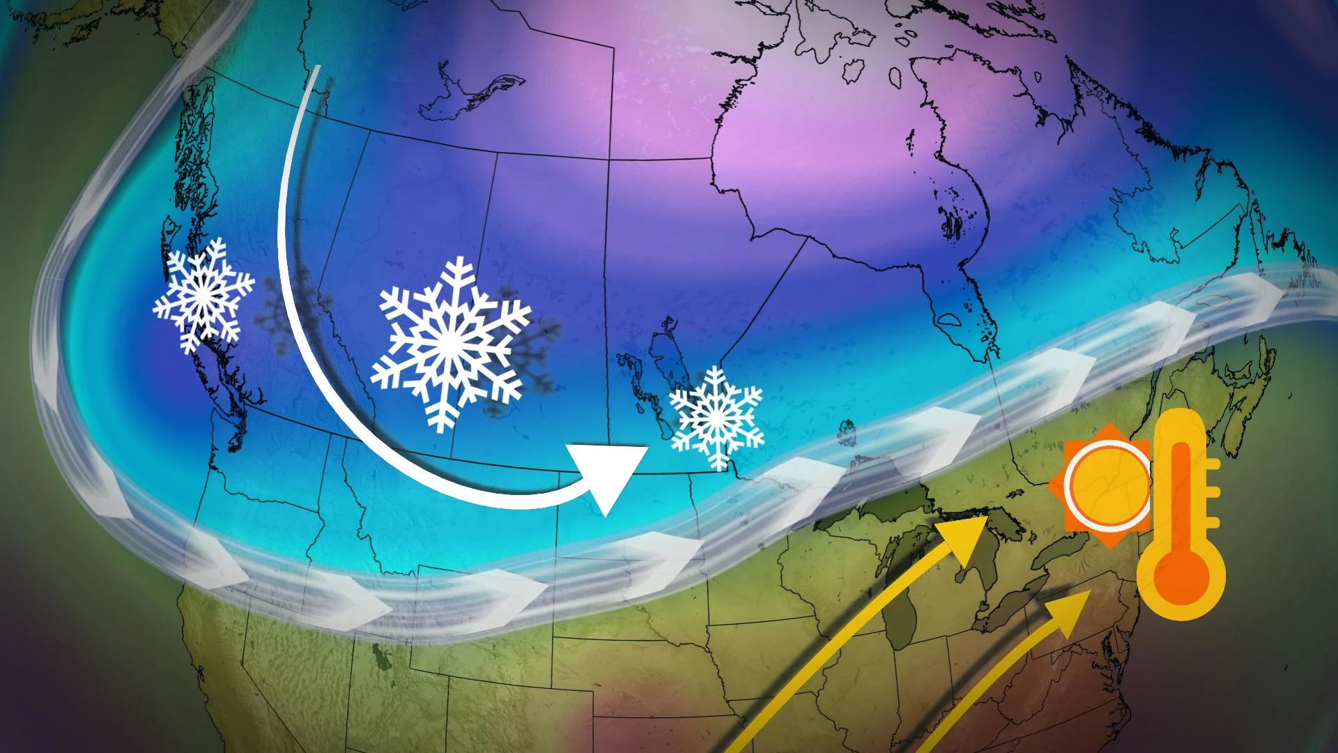
Case in point: Major temperature contrasts are happening across the two halves of the country this week, seemingly starting out as a roller-coaster ride with cold and snow on the bottom in the West and the September-like warmth in the East as the peak of the ride.

We can attribute these roller-coaster temperature rides to the amplified jet stream.
The snow has been prominently featured across Western Canada this week, from the B.C. coast to Manitoba. Snowfall accumulations range from 5-25 cm with uncertainty in exact totals.

If you thought Western Canada was only getting heavy snow, you may want to think again as a pesky high pressure pulls down cold Arctic air across the Prairies, with many cities seeing temperatures ranging from the minus teens to the minus 20s.
Now, we also factor in the wind chill, so throughout the overnight hours it’s going to feel more like the minus 20s to the minus 30s.

A developing ridge across the southeastern United States surges into Eastern Canada, bringing with it tropical moisture. By the end of the week, temperatures could peak into the low 20s, a feat that is rare, but not uncommon across the Great Lakes region.
Across southern Ontario, we could be seeing overnight lows warmer than our average daytime highs for this time of the year. Unfortunately, it’s not all sunny skies with warm temperatures across Eastern Canada. The fall seasons are also known to have excessive amounts of cloud cover.

In the Maritimes, the cold temperatures earlier this week will feel like a thing of the past when daytime highs rise to the high teens and even 20°C, from Wednesday to Saturday.
The conditions are courtesy of the same high-pressure system over the southeastern United States that will also bring warm air into Ontario and Quebec.

While there is the chance for precipitation to move over Eastern Canada in the coming weeks, for now it will remain as rain. However, perhaps, as the ridging pattern breaks down into the last few days of October, some of us may be seeing our first flakes of the season, too.
With files from Rachel Modestino, a meteorologist at The Weather Network.