Why you can't rule out tornadoes during Ontario's cooler months

The Weather Network's Mark Robinson interviews the Northern Tornadoes Project executive director Dr. David Sills about why Ontarians are likely to see an extension of severe weather into the fall.
Shattered pine trees have a distinct smell and a whole backyard full of them made for a day that still lives in my memory. The fact that the tornado tore through Georgetown on November 15, 2020, and that it obliterated those trees in my dad’s backyard also helps with recall.
That tornado wasn’t the first I’d seen happen in the fall and late summer. In fact, Ontario has seen a number of significant tornadoes, including the Dunrobin, EF-3 event that occurred on September 20, 2018. However, it was the Georgetown tornado that really made me ask the question; are we seeing a shift in the timing of the Ontario severe thunderstorm season?
I wasn’t the only one asking this question. Dr. David Sills, director of the Northern Tornadoes Project, and a good friend of mine, has been researching severe weather in Canada for many years. He noticed the same change that I had, but he had the data to really dig into the issue.
As it turns out, our observations have some basis in fact.
“There’s been an urban legend that our big tornadoes happen in the spring and now they occur later, and why is that?,” Dr. Sills said. “So, I thought, now we’ve got the data. We’ve got a dataset for southern Ontario that goes back to 1792. Now is the time to look at this issue.”

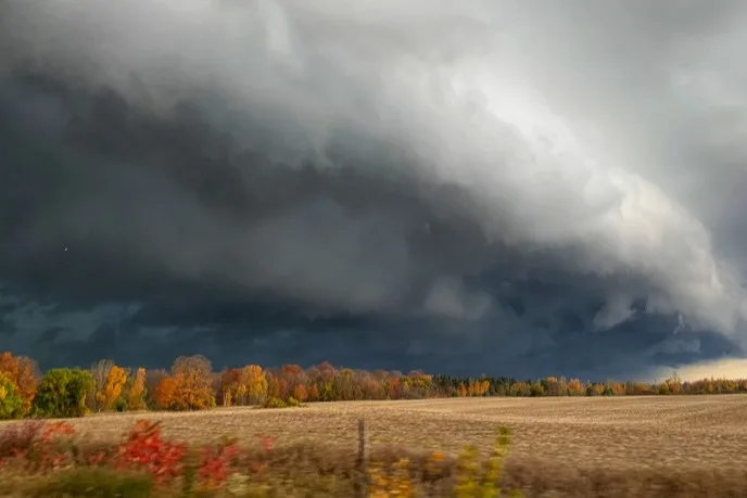
Shelf cloud near Mount Forest, Ont., spotted on October 24, 2020. (Mark Robinson/The Weather Network)
RELATED: Is winter poised for an early arrival in Canada?
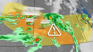
Given the sheer number of thunderstorms, and even weak tornadoes, that Ontario sees in a given summer, Dr. Sills decided that the best way to make sense of the data was to focus on significant tornadoes, those of EF-2 strength and higher.
“We have a big database of tornadoes, and the first thing we did was to look at the numbers of tornadoes,” he explained. “There’s been a distinct increase in tornadoes over time, mostly from finding EF-0 and EF-1’s. Our ability to document these tornadoes has gotten much better over time. So, you have to go to the significant tornadoes, the EF-2’s and above. Even back in the 1800’s would not have been missed.”

Confirmed tornado damage in Strabane area of Hamilton, Ont. October 6, 2020. (Mark Robinson/The Weather Network)
Dr. Sills continued, "What I really wanted to look at was the timing of the strong tornadoes. So, what we found was a statistically significant relationship that show that the stronger tornadoes really are happening later in the season."
"The problem is that our season is extending into September, even October, and some people may not be expecting a big tornado in that period. We have to start thinking of the implications of this given that things are different than the summer; for one, kids are back in school."

Underside of a shelf cloud near Shelburne, Ont., on October 24, 2020. (Mark Robinson/The Weather Network)
SEE ALSO: Why the famous 'Tornado Alley' is on the move
Despite the changes happening in the atmosphere, Dr. Sills' recommendation is to pay attention.
“It means that we have to keep our guard up well into the fall. For example, in 2018, we had that outbreak of tornadoes in the Ottawa region. Some of the damage was EF-3, and as far as we know, that’s the latest in the year that we’ve had a tornado that strong. It’s also getting dark earlier, so we may have more nocturnal events than in the summer.”
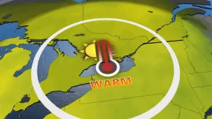
So, why are we seeing this? The question, as always with Ontario weather, has everything to do with the Great Lakes.
“The interesting thing with the study was that we compared it to the tornadoes in our neighbouring states like Michigan and New York to see if they saw a similar trend,” Dr. Sills explained. “As it turns out, they didn’t see that same trend. So, what’s the difference between them and Ontario? The only thing that makes a real difference is the Lakes. And we know that climate change is making the lakes warmer and that may be keeping us in a warmer slot when we get southwest winds. And that’s when we get our severe storms and tornadoes. Those winds will blow over the warm lakes and not be cooled down. We don’t know for sure that it’s climate change, so that’s the next step in the study.”
WATCH BELOW: Tornado-proof your roof with this easy preventative step
RELATED: A glimpse at a dire future for the Great Lakes
Limits on severe thunderstorms do exist though, so we don’t have to worry about tornadoes at Christmas.
“At the end of September, beginning of October, the ingredients for tornadoes really drop off and that’s not going to change anytime soon. But, in the last decade we’ve seen events as late as November.”
The bottom line is: don’t let your guard down and pay attention to weather watches and warnings that are issued by Environment Canada and Climate Change into the autumn season. Thunderstorms are now producing dangerous weather well into pumpkin spice season and I’d rather smell that than the pine aroma of shattered trees.