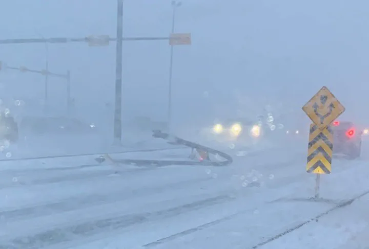
Travel remains dangerous as potent blizzard moves across the Prairies

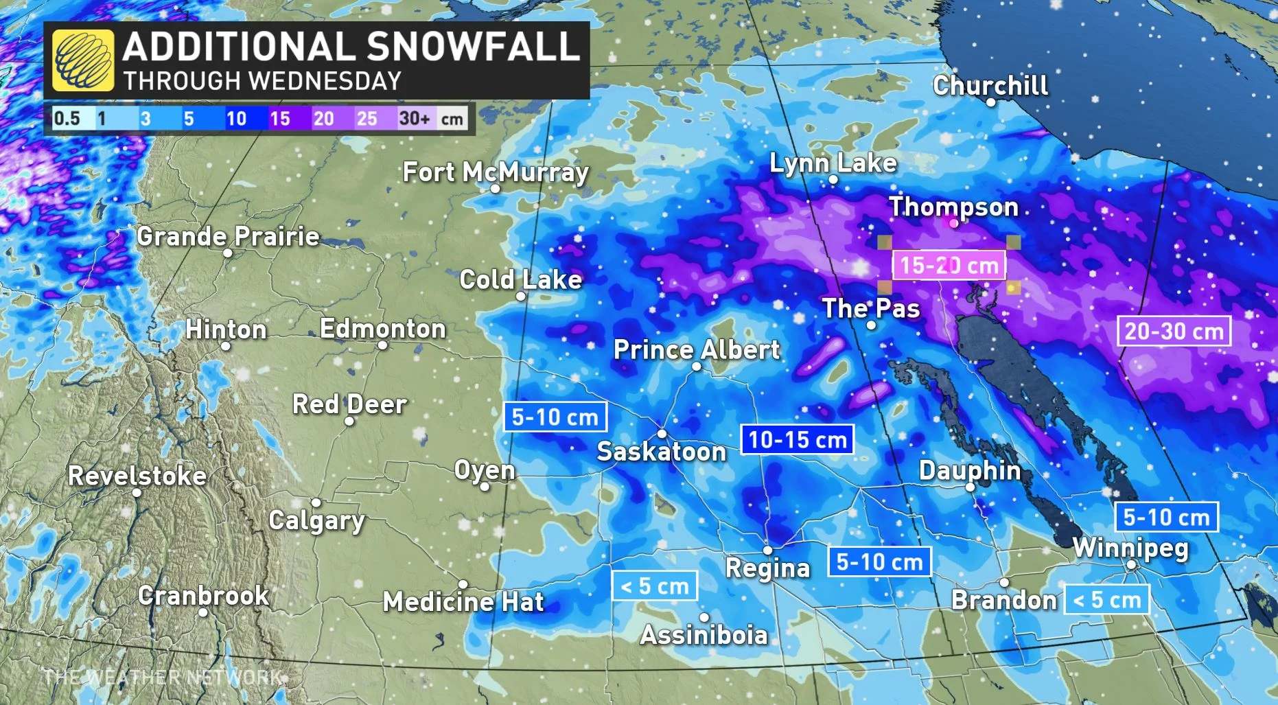
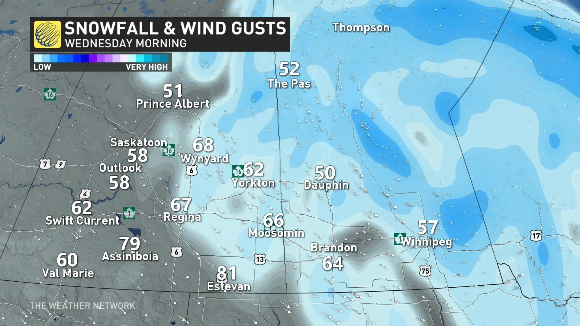
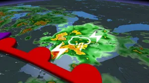
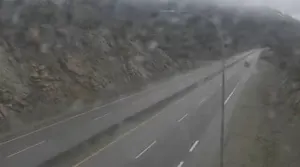
The Prairies' wintry wallop will continue Wednesday, though will begin to improve in Saskatchewan later in the day, as the potent low makes its way east into northwestern Ontario. The storm brought some dangerous whiteout conditions to all three Prairie provinces Tuesday, along with some considerable snowfall amounts. There is still an additional 5-15 cm left to fall over the eastern sections of the region through the course of the day on Wednesday. Travel will once again be hindered by the snow and intense winds for Saskatchewan and Manitoba, along with slicky icy conditions as temperatures plummet. Snowfall, winter storm and blizzard warnings linger, with wind gusts of 60-90+ km/h, in combination with the freshly fallen snow, expected to reduce visibility to near zero at times Wednesday. More on the timing and ongoing impacts, below.
SEE ALSO: Think twice if you're still debating on whether to use winter tires
THIS WEEK: TRAVEL HEAVILY IMPACTED AS HEAVY SNOW AND POTENT WINDS WINDS PUSH THROUGH THE PRAIRIES
It's been a stormy week for much of the Prairies already, thanks to the low-pressure system that unleashed epic rainfall and damaging winds to British Columbia Monday. After Alberta saw the first shot, Saskatchewan and Manitoba bore most of the brunt of the snowfall and blizzard conditions through Tuesday.
Widespread winter weather alerts are now just covering Saskatchewan and Manitoba, including snowfall, wind, winter storm and blizzard warnings, heading into Wednesday.
MUST SEE: Devastation unfolds, 250+ mm of rain washes out roads, forces evacuations
Heavy snow has since departed Alberta and conditions will continue to improve into Wednesday morning as the snow and winds persist through the day in Saskatchewan and Manitoba.
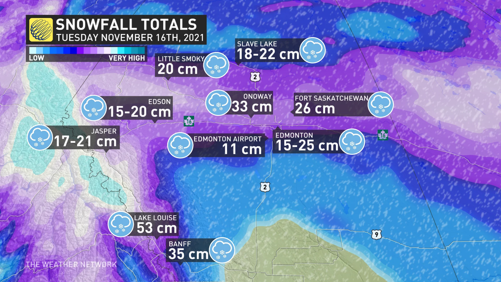
So far, Edmonton airport has reported 11 cm as of Tuesday evening. To the north of it, in southern sections of the city, as much as 20 cm had been tallied. In Fort Saskatchewan, 26 cm was documented as of Tuesday morning, but more has likely fallen since.
Additional snowfall amounts of 15 cm are expected for areas north of the Interlake Region in Manitoba, while another 5-10 cm is anticipated in southern Saskatchewan including Regina and Saskatoon. For Winnipeg, an extra 5 cm is forecast while areas east of the city may pick up an extra 5-10 cm.
Wind gusts of 60-90+ km/h, in combination with the freshly fallen snow, will reduce visibility to near zero at times.
Travel will be extremely dangerous and is not recommended across much of central and southern Saskatchewan, and southwestern Manitoba. The poor road conditions forced several school closures and bus cancellations in the Edmonton area on Tuesday morning.
Limit outdoor activies and non-essential travel through the day on Wednesday.
"Travel is expected to be hazardous due to reduced visibility. Visibility will be suddenly reduced to near zero at times in heavy snow and blowing snow," says Environment and Climate Change Canada. "Protect yourself from wind, cold and disorientation by staying sheltered, indoors or with your vehicle. Limit outdoor activities."
Conditions will begin to improve in Saskatchewan by Wednesday afternoon and then Manitoba by Thursday morning and Thursday evening in northwestern Ontario.
Beyond the system, fair weather will dominate the rest of the week. However, Arctic air is building to the north and a couple shots of it will dive to the south across the region this weekend and early next week.
There will be gusty winds, some snow and blowing snow with the cold fronts, but no major storms are in sight at this point.
Be sure to check back for the latest updates on this Prairies snowstorm.
Thumbnail image courtesy Regina Police/Twitter


