Winter to finally show up in January as El Niño bested by polar vortex

Believe it or not, winter has not been cancelled, despite what transpired in December across Canada. January will look considerably different by comparison as winter finally gets a tighter grip on the country
Winter has felt more like late fall so far across Canada.
While winter officially starts on Dec. 21, across most of Canada, we expect winter weather to dominate throughout December. In many places, even November can be a wintry month.
However, consistent winter weather has been missing across the country.
Below is a look at the temperature anomalies for December 2023, with the various shades of orange, red and brown highlighting warmer-than-normal temperatures across all of Canada, and most of the U.S.

WINTER 2024: El Niño will play a critical role in the weeks ahead
For many locations, from B.C. to northwestern Ontario, it was the warmest December on record, and from southern Ontario to Atlantic Canada, several locales documented their second- or third-warmest December on record.
A strong El Niño is one of the key reasons for the exceptionally mild pattern, which has continued into the beginning of January.
Here is a look at the temperature anomalies that were forecast for the first five days of January:

However, believe it or not, winter has not been cancelled!
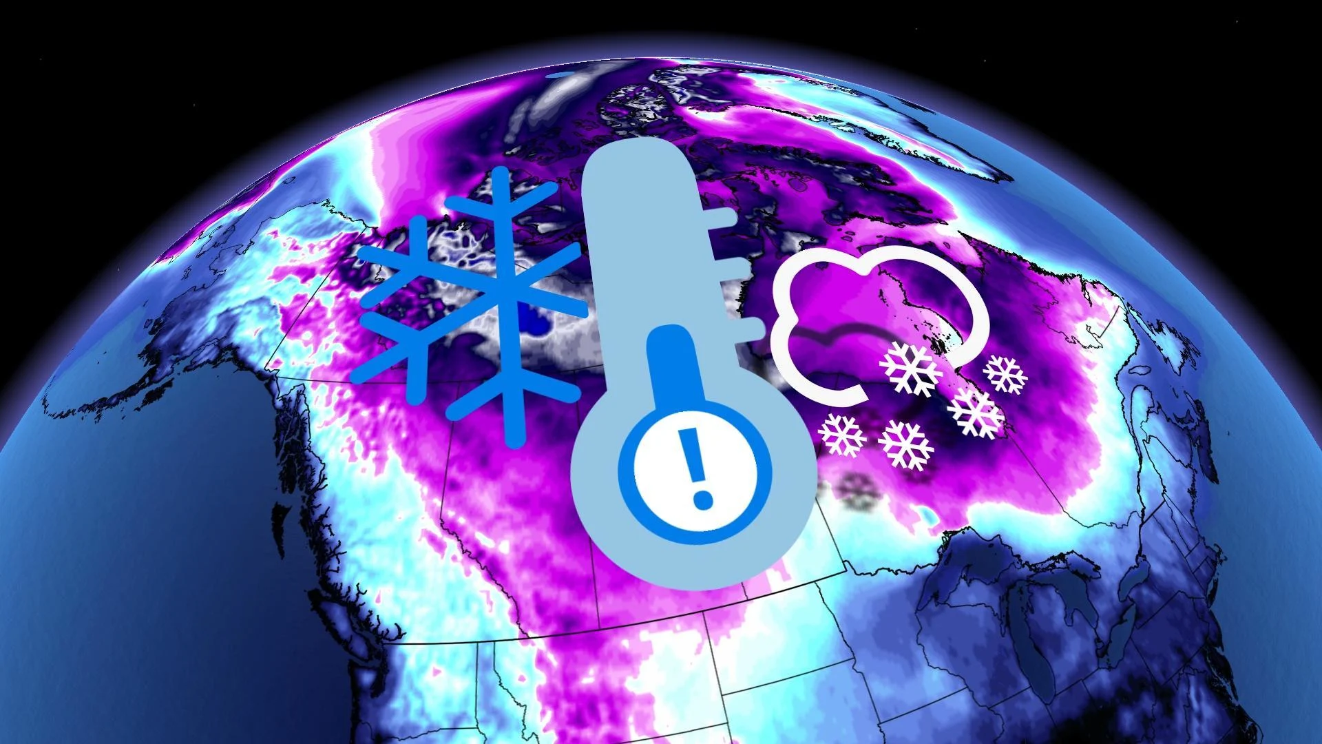
While El Niño is still just as strong, a major change in the jet stream pattern is already underway. One of the keys to the pattern change is the polar vortex which is expected to split into two parts, and one piece is expected to be over Northern Canada through mid-January.
If you look closely at the top of the graphic above, you can see some blue and green colours (representing colder than normal temperatures) are just starting to show up over the Arctic and spilling south into the Yukon and the Northwest Territories. The North was very mild during December, but frigid air is now developing across this region.
As we head into the second week of January, this Arctic air will plunge south across Western and Central Canada, as well as the United States.
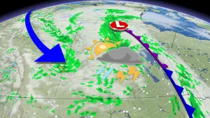
Here is a model forecast for the second week of January:
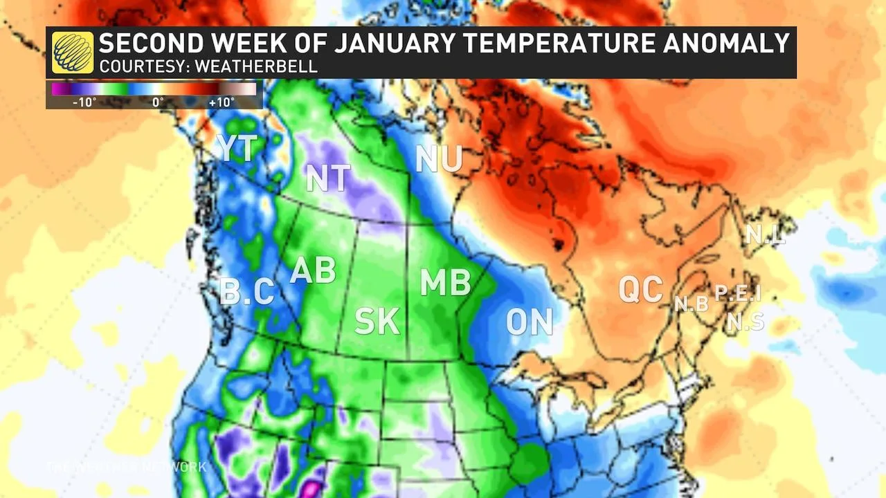
The focus of the coldest weather will be across Western and Central Canada, but the East will trend closer to seasonal, especially later in the week.
Also, keep in mind that we are now approaching the coldest time of year, so heavy snow and ice can still fall with above-normal temperatures. At this point, we expect that the second and third week of January will feature a very active storm track from the Great Lakes to Atlantic Canada.
As we head through mid-January, we are closely watching the potential for the Arctic air to shift east into Ontario and Quebec for several days.
During the second half of January we expect a typical, mid-winter pattern across most of Canada. This means that we will continue to see shots of frigid weather. However, the colder pattern should relax for a while later in the month with the potential for many areas to see a period of milder temperatures –– a traditional January thaw –– before colder weather returns.
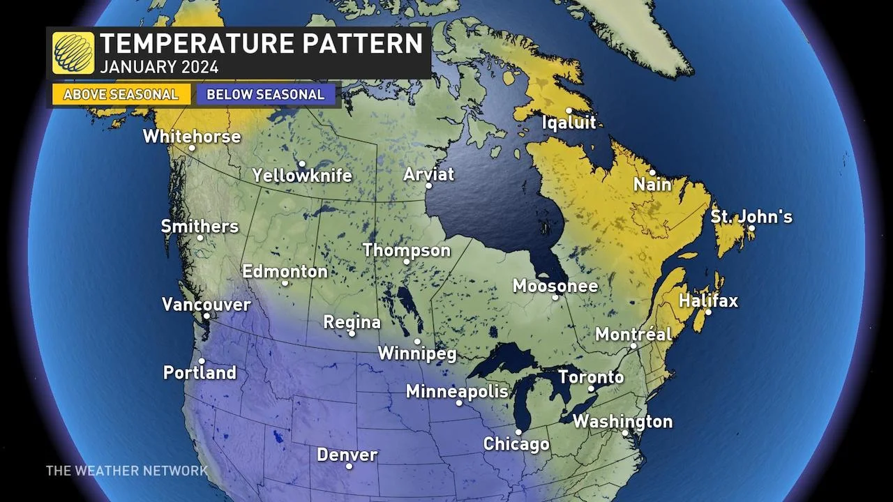
Here is a look at what we expect for the month of January as a whole:
Visit our Complete Guide to Winter for an in-depth look at the Winter Forecast, tips to plan for it and much more!
While we expect near-normal or above-normal temperatures for much of the country, this is still a rather dramatic contrast to what we saw during December, especially since January is the coldest month of the year for most places, so normal is still very cold.
So, for the many Canadians who embrace winter, hang in there. Winter is on the way! And, for everyone else, don’t let your guard down –– keep your warm clothes and shovel handy. While winter was very much delayed, it won’t be denied this year.