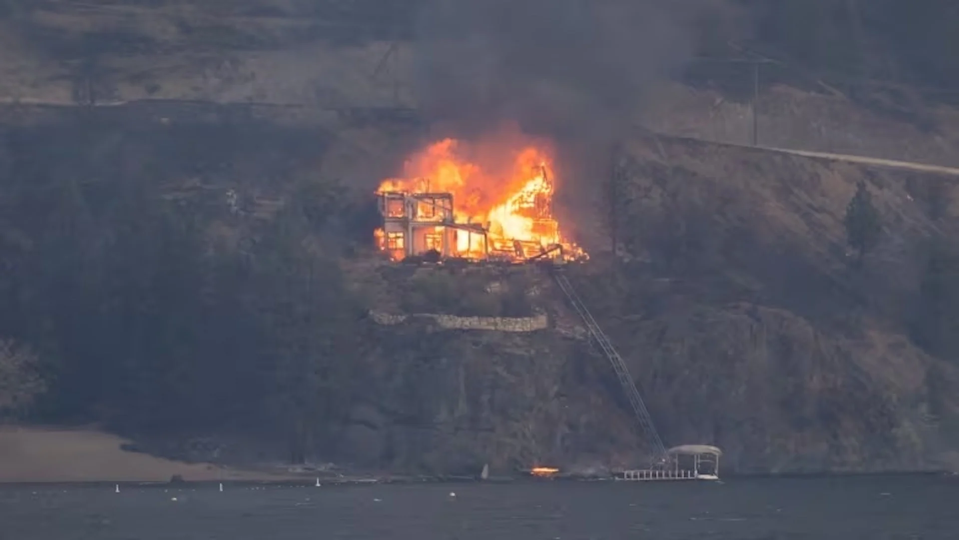
Up to 200 buildings estimated destroyed by Okanagan wildfires, fire chiefs say
Visit The Weather Network's wildfire hub to keep up with the latest on the unprecedented wildfire season across Canada.
BREAKING UPDATE — Aug. 22, 4:40 p.m. PT — Provincial officials announced at a news conference hosted by the premier Tuesday that most wildfire-related travel restrictions in the B.C. Interior will end at midnight Wednesday, with the exception of West Kelowna.
The order had prevented tourists from using hotels, motels, RV parks and other temporary accommodations in Kelowna and West Kelowna, Kamloops, Oliver, Osoyoos, Penticton and Vernon, so they could be utilized by the province.
Emergencies Minister Bowinn Ma said that the order has had its desired effect, with space being made available for first responders, evacuees, and support staff.
THE LATEST:
Latest estimates suggest fewer than 90 structures were destroyed or damaged in West Kelowna and the Westbank First Nation, and fewer than 100 in the North Westside region to the north.
Three homes were lost to fire in Kelowna and another three in neighbouring Lake Country.
The B.C. premier, along with the provincial forests and emergencies ministers, will meet Tuesday with residents of the southern Interior that have had to flee due to wildfires
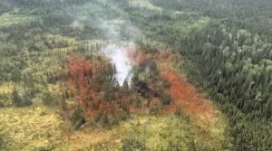
In the Shuswap region, where two major fires combined near Adams Lake and destroyed homes, wildfire fighters say their equipment has been removed or tampered with.
Highway closures remain in place throughout the province because of wildfires, including south of Lytton due to the Kookipi Creek wildfire.
Learn more about how to find the full list of wildfires, highway closures and evacuation orders and alerts.
The latest estimates from fire chiefs in B.C.'s Central Okanagan region suggest that fewer than 200 buildings have been destroyed in aggressive wildfires that swept through West Kelowna and the surrounding area last week.
Fewer than 90 structures in the City of West Kelowna and Westbank First Nation were fully or partially destroyed by an aggressive wildfire that swept into the region last week, and more than 3,000 were unaffected by the flames, residents have learned.
West Kelowna Fire Chief Jason Brolund provided the latest numbers at a news conference on Tuesday morning, saying crews believe fewer than 70 properties were affected within the city and fewer than 20 within the First Nation. However, a full assessment of the damage is still underway.
WATCH: Community steps up to help each other during wildfires in British Columbia
RELATED: B.C. officials look ahead at recovery and rebuilding efforts from wildfires
At the same news conference, North Westside Fire Chief Ross Kotcherofski estimated fewer than 100 structures have been lost to wildfire in his jurisdiction, which lies north of West Kelowna, but stressed that he didn't want to provide more exact numbers while assessments are still being done.
On the east side of Okanagan Lake, wildfires destroyed three homes and two outbuildings in Kelowna, and another three homes in Lake Country to the north of the city, officials confirmed Tuesday.
Brolund warned local residents to prepare themselves to witness the extent of the destruction as wildfire smoke is expected to lift.
"The mountains around our community are going to look different. We haven't seen them since the fire. The difference will be dramatic," Brolund said.

People stand on the pier of Pandosy Waterfront Park in Kelowna, B.C., on Aug. 20. Local officials say firefighters made good progress on the McDougall Creek wildfire which forced thousands out of their homes. (Winston Szeto/CBC)
Brolund said firefighters have made good progress in the past 24 hours on protecting homes from the destructive MacDougall Creek wildfire and working to get it contained.
"We're making progress. Things are getting better. We're going to get this thing across the finish line," he said.
He described Monday night as "calm but very busy" for firefighters, who had to deal with about two dozen spot fires and saved one home from burning after a nearby wood pile caught fire.
The fires in the area have been grouped together as the Grouse Complex wildfires.
Brad Litke, B.C. Wildfire Service's incident commander for the complex, told Tuesday's news conference that lighter winds are expected through the day, but thunderstorms are possible, which could complicate firefighting efforts.
DON'T MISS: Full extent of B.C. wildfire damage still not known, air quality worsens
"It's not lost on us how important it is, when it's safe to do so, to get people back in their homes and businesses open again," Litke said.
He said wildfire smoke is still making it difficult to determine the exact size of the McDougall Creek fire, but the current estimate is 120 square kilometres.
Premier set to visit wildfire areas
The latest update from the Kelowna area comes as B.C. Premier David Eby is set to visit the Shuswap and Okanagan regions of B.C. to meet residents affected by the fires.
There is not yet an official count of how many homes have been destroyed across the province since fire activity dramatically accelerated last week, but officials have acknowledged the damage is "significant."
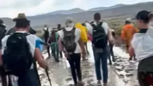
B.C. Emergency Management Minister Bowinn Ma said Monday there are about 27,000 people in the province under an evacuation order due to ongoing wildfires, with another 35,000 people under alert to evacuate on short notice.
A few evacuation orders were downgraded to alerts in West Kelowna, Westbank First Nation and Lake Country on Monday night.
The premier is set to visit that region, along with the Shuswap — where the Bush Creek East wildfire destroyed homes — and survey the damage from wildfires, along with Forests Minister Bruce Ralston and Emergencies Minister Bowinn Ma.
"Our goal is to reassure people that we will be there when the crisis passes," Eby said at a Monday news conference. "To help them rebuild, but also to get information from the front line about what communities need."
Firefighters made good progress on many fires on Monday amid favourable weather conditions.
On Tuesday, a tropical storm that ripped through Mexico and the southwest United States is likely to bring some rain to the province — but will also bring winds that could provide a volatile mixture.
WATCH: Volunteers in overdrive as donations flood in for B.C. wildfire victims
"We're hopeful it will bring some measurable precipitation to areas that really need it," said Sarah Budd, a wildfire information officer with the B.C. Wildfire Service (BCWS), on Monday. "The sort of flipside of that is that it could increase some of the winds and change wind directions through parts of the Okanagan.
"As we always say, we don't have a crystal ball, and that weather pattern is a little uncertain where the winds will be going."
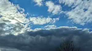
Smoky skies continue to blanket British Columbia due to the wildfires, though rain might help to dissipate some of the haze surrounding communities in southern B.C.
Across B.C., more than 3,500 people are fighting wildland fires, and hundreds of municipal firefighters are helping to protect homes and other buildings, according to the B.C. Wildfire Service.
Another 100 Mexican firefighters and 200 from South Africa are expected to arrive this week.
Travel restrictions, advisories
The province is under a state of emergency, and travel to B.C.'s southern Interior has been restricted, preventing tourists from using hotels, motels, RV parks and other temporary accommodations in Kelowna and West Kelowna, Kamloops, Oliver, Osoyoos, Penticton and Vernon, so they can be utilized for evacuees.
Wildfires are also affecting several travel corridors through B.C. Highway 1 is closed in at least two spots: between Lytton and Hope in the Fraser Canyon and between Chase and Sorrento in the Shuswap.
Other travel advisories:
Highway 97, in both directions, just south of Coldstream to Peachland.
Highway 97, in both directions, six kilometres north of Vernon to three kilometres south of Osoyoos.
Highway 5A, in both directions, between Old Kamloops Road and Roche Lake Road for 13 kilometres south of Kamloops.
DriveBC has a full listing of all road closures and travel advisories.
Anyone placed under an evacuation order should leave the area immediately.
Evacuation centres have been set up throughout the province to assist anyone evacuating from a community under threat from a wildfire.
To find the centre closest to you, visit the EmergencyInfoBC website.
Evacuees are encouraged to register with Emergency Support Services online, whether or not they access services at an evacuation centre.
Thumbnail image courtesy of Ben Nelms/CBC.
This article was originally written by and published for CBC News. With files from Bethany Lindsay, Randi-Marie Adams, and The Canadian Press.