At least 50 West Kelowna structures burned, worst hit areas yet to be surveyed
Visit The Weather Network's wildfire hub to keep up with the latest on the unprecedented wildfire season across Canada.
THE LATEST:
Smoke is blanketing much of the province, prompting air quality advisories and special weather statements.
A provincewide state of emergency is in place in B.C. Here's what it means.
Non-essential travel to the southern Interior has been restricted as 30,000 people are under evacuation orders, around a third of them in the Kelowna area.
Homes have been destroyed and more than 4,000 properties are on evacuation order in the Shuswap region, as two major fires combined near Adams Lake.
The B.C. Wildfire Service says critical equipment has been taken from the area.
Highway 1 remains closed and evacuation orders are still in place in the Fraser Canyon as a result of the Kookipi Creek wildfire.
Many people want to help evacuees. Learn more about how to offer your support.
Find a full list of wildfires, highway closures and evacuation orders and alerts.
Tune in for ongoing coverage of the wildfire situation on CBC Radio One at 88.9 FM in Kelowna, 96.9 FM in Salmon Arm, or by using the CBC Listen app. You can also watch free livestreams on CBC News Network and CBC Gem.
More than 50 structures have been fully or partially destroyed by an aggressive wildfire in West Kelowna, B.C., according to the Okanagan city's fire chief.
Jason Brolund told a news conference Monday morning that crews are trying to systematically survey the areas hit by the McDougall Creek fire to determine the extent of the damage.
"We're not done yet and the most damaged neighbourhoods are still to come," he said.

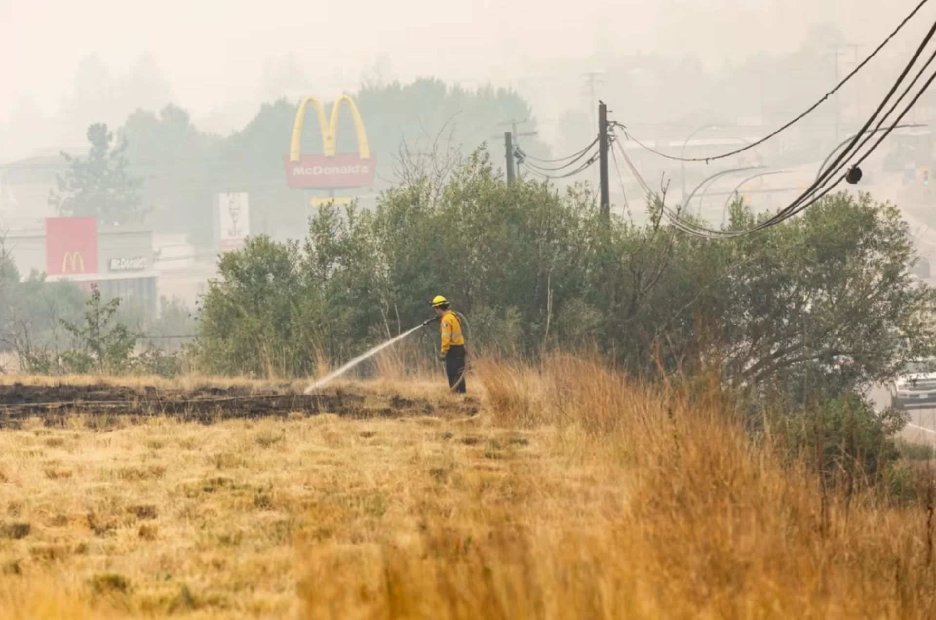
Wildfire firefighters work to put out hotspots from the McDougall Creek wildfire near homes in West Kelowna on Sunday. (Justine Boulin/CBC News)
Brolund said the job of tallying the damage has been challenging because some address markers were destroyed by the fire and street signs have melted, while downed power lines, ruined roads and fallen trees have made it unsafe to enter some areas.
In one neighbourhood, he said, it looked like a hurricane had blown through.
"Trees were ripped out by their roots. The force to make that happen is incredible," Brolund said.
But he reassured residents that no structures have been lost in the Smith Creek, Tallus Ridge, Shannon Lake, Lenz Road Trailer Park and Rose Valley neighbourhoods.

Estimated fire perimeters near Kelowna and West Kelowna as of Aug. 21, 2023 at 6:00 a.m. PT. Source: Natural Resources Canada (CBC)
Brolund added that as conditions have quietened in the last 24 hours, no other structures have been destroyed.
"What's happening out there is the day-to-day grind of firefighting," he said, applauding the work of firefighters from across the province who've come together to protect West Kelowna.
According to Brolund, some West Kelowna firefighters are working back-to-back shifts, taking the usual calls from the fire hall at night before heading out to fight the wildfire in the morning.
He said one firefighter was scheduled to become a Canadian citizen on Monday, and will now have to participate in the ceremony by Zoom from behind the fire lines.
"What an important thing and what a massive sacrifice to make," Brolund said.
The out-of-control McDougall Creek fire was last measured at 110 square kilometres in size, but the B.C. Wildfire Service says smoky conditions have made it difficult to get an up-to-date estimate for the fire.
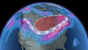
SEE ALSO: Tropical moisture seeps into Canada, but little help for B.C. fires
A total of 9,855 properties remain on evacuation order in the area of the fire, Regional District of Central Okanagan board chair Loyal Woolridge said Monday.
Five structures were destroyed by the fire in Kelowna, while at least two or three were lost in Lake Country, a municipality north of Kelowna, the public heard Monday.
North Westside Fire Chief Ross Kotcherofski said he was not able to provide an estimate for the destruction in his jurisdiction, north of West Kelowna, but most of the structural damage has been in the Traders Cove and Lake Okanagan Resort areas. The resort was destroyed on Friday.
However, Kotcherofski said that a number of his firefighters have lost their own homes in the fire, but have remained on the front lines to help their neighbours.
Smoky skies helping wildfire fight
As the southern quarter of British Columbia is warned about the risk of particulates in the air from wildfire smoke, those battling blazes in the Central Okanagan say the smoke is helping their cause.
A special air quality statement and smoky skies bulletin is in place from Vancouver Island east to the Alberta border, as well as in the central Interior, due to smoke from hundreds of wildfires burning across the province.
An additional air quality advisory remains in place for Metro Vancouver and the Fraser Valley, warning of high concentrations of fine particulate matter in the air.
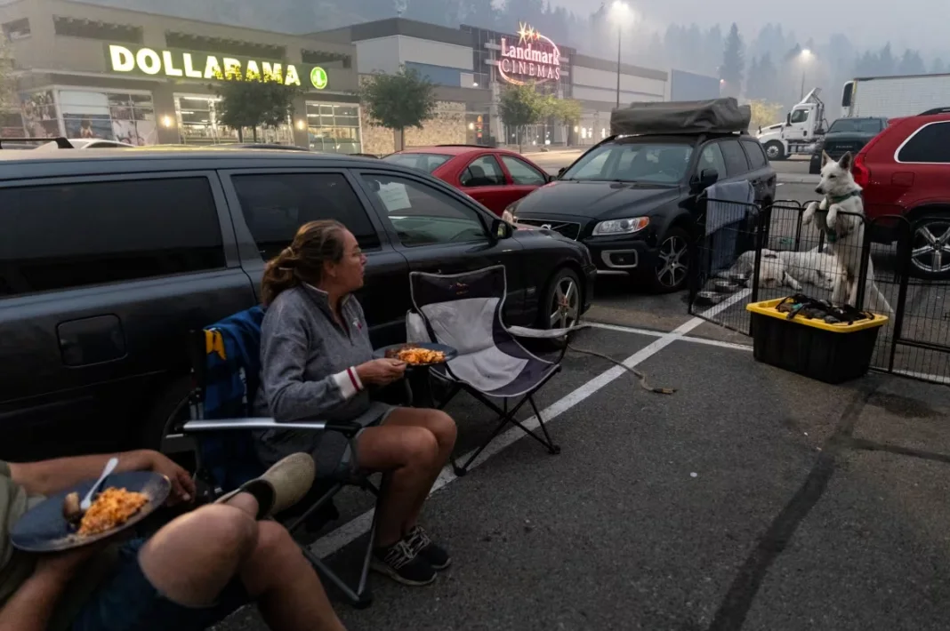
Suzanne Grooters and her husband Andreas with their five dogs at a Kelowna-area mall where they have set up camp after being forced to evacuate their home due to the McDougall Creek wildfire. (Justine Boulin/CBC News)
While the amount of smoke in the air has created harmful conditions for people's health, it's also reducing the sun's intensity, which is helping the fight against wildfires across the province.
"It is effectively another good day to fight fire, apart from the smoke in the air," Jerrad Schroeder of the B.C. Wildfire Service said Monday morning.
In a long string of posts on X, formerly known as Twitter, the B.C. Wildfire Service noted Sunday that rain is in the forecast for late Monday night, which should allow firefighters to gain some ground.
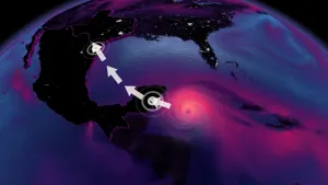
However, the wildfire service also warned that tropical storm Hilary, which is causing flooding in southern California, will bring strong winds all the way up to B.C., with the potential for more extreme fire behaviour.
So far there is no official count of how many homes have been destroyed in B.C. since fire activity dramatically accelerated last week, but officials have acknowledged damage is "significant."
An unknown number of homes have also been destroyed in the Shuswap region east of Kamloops, where the Bush Creek East fire is now burning over 410 square kilometres around Adams Lake and Shuswap Lake.
There are more than 380 active wildfires burning across B.C. as of early Monday, fuelled by wind, drought and hot weather that have left landscapes tinder dry.
CHECK OUT: Essential items for your emergency "grab-and-go" kit
Of those fires, 159 are deemed out of control while 14 are categorized as fires of note, meaning they are particularly visible or threatening to property.
B.C. Emergency Management Minister Bowinn Ma said there are now about 27,000 people in the province under an evacuation order and another 35,000 on evacuation alert.
"We hope that the darkest days are behind us, but the situation is still evolving and the dangers we face are still extreme," she said in an update on Monday.
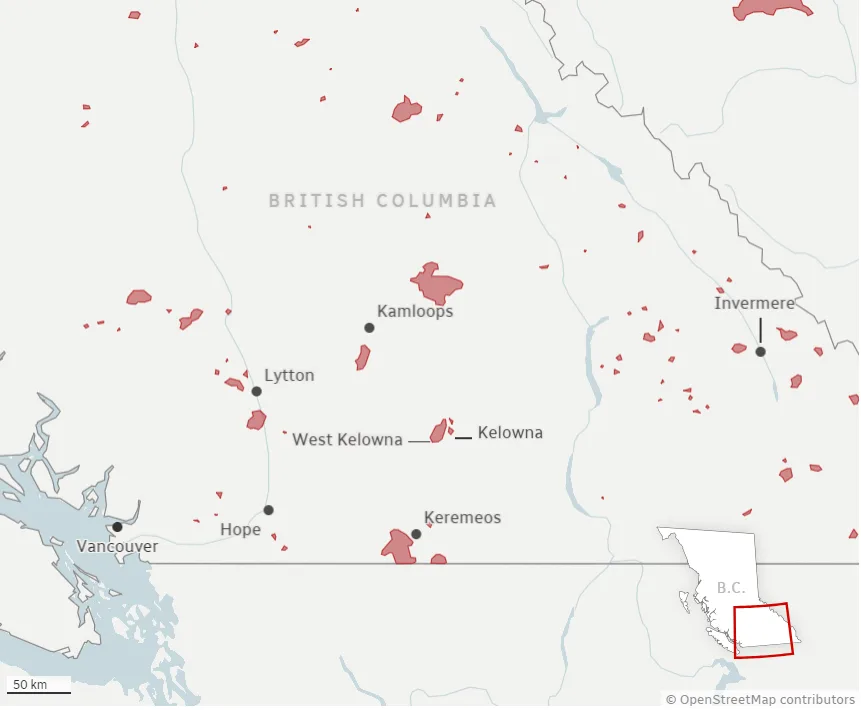
Estimated fire perimeters in southern B.C. as of Aug. 21, 2023 at 6:00 a.m. PT. Source: Natural Resources Canada (CBC)
Premier David Eby announced Monday that he, Ma and Forests Minister Bruce Ralston all plan to travel to fire-affected areas on Tuesday to show that "we will be there when the crisis passes to rebuild," and to gather information about what is needed.
Across B.C., more than 3,500 people are fighting wildland fires, and hundreds of municipal firefighters are helping to protect homes and other buildings, according to the B.C. Wildfire Service.
Another 100 Mexican firefighters and 200 from South Africa are expected to arrive this week.
Travel restrictions, advisories
The province is under a state of emergency, and travel to B.C.'s southern Interior has been restricted, preventing tourists from using hotels, motels, RV parks and other temporary accommodations in Kelowna and West Kelowna, Kamloops, Oliver, Osoyoos, Penticton and Vernon, so they can be utilized for evacuees.
Wildfires are also affecting several travel corridors through B.C. Highway 1 is closed in at least two spots: between Lytton and Hope in the Fraser Canyon, and between Chase and Sorrento in the Shuswap.
Other travel advisories:
Highway 97, in both directions, just south of Coldstream to Peachland.
Highway 97, in both directions, six kilometres north of Vernon to three kilometres south of Osoyoos.
Highway 5A, in both directions, between Old Kamloops Road and Roche Lake Road for 13 kilometres south of Kamloops.
DriveBC has a full listing of all road closures and travel advisories.
WATCH: Wildfire smoke causes dangerous air quality for British Columbia
Evacuees
An estimated 30,000 people are under evacuation orders in the province because the blazes, around a third of them in the Kelowna area, as the McDougall Creek wildfire burns on both sides of Okanagan Lake.
Seagun Laboucane, a West Kelowna resident who was forced to flee her home, said coping with the uncertainty related to the fires is difficult — particularly "trying to navigate the emotions that come along with it and also staying strong and moving forward," she said.
Suzanne and Andreas Grooters have set up camp at a Kelowna-area strip mall parking lot with their five dogs after being forced to flee the McDougall Creek wildfire. It's the third time in their lives they've been forced to evacuate their home due to wildfires.
DON'T MISS: Full extent of B.C. wildfire damage still not known, air quality worsens
"It could be worse. We have each other and we have our dogs," Suzanne Grooters said.
The province announced Sunday it is providing support — including accommodation, food and clothing — to evacuees across the province through its Emergency Support Services. Those who require support should follow directions provided by their local authority or First Nation about how to register.
Ottawa has approved a request from the B.C. government for additional support in managing the wildfire situation and the federal government is sending military assets and other resources to assist with evacuations and other logistical tasks.
All evacuees are also asked to register through a provincial portal.
Anyone placed under an evacuation order should leave the area immediately.
Evacuation centres have been set up throughout the province to assist anyone evacuating from a community under threat from a wildfire.
To find the centre closest to you, visit the EmergencyInfoBC website.
Evacuees are encouraged to register with Emergency Support Services online, whether or not they access services at an evacuation centre.
Thumbnail image courtesy of Justine Boulin/CBC News.
This article was originally written by and published for CBC News. With files from The Canadian Press and Justine Boulin.