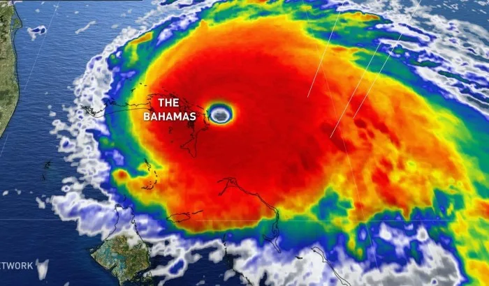
Hurricane Dorian makes landfall in Bahamas as record-breaking storm

Air Force Reserve Hurricane Hunter aircraft had measured a maximum sustained wind speed of 295 km/h at the time of landfall
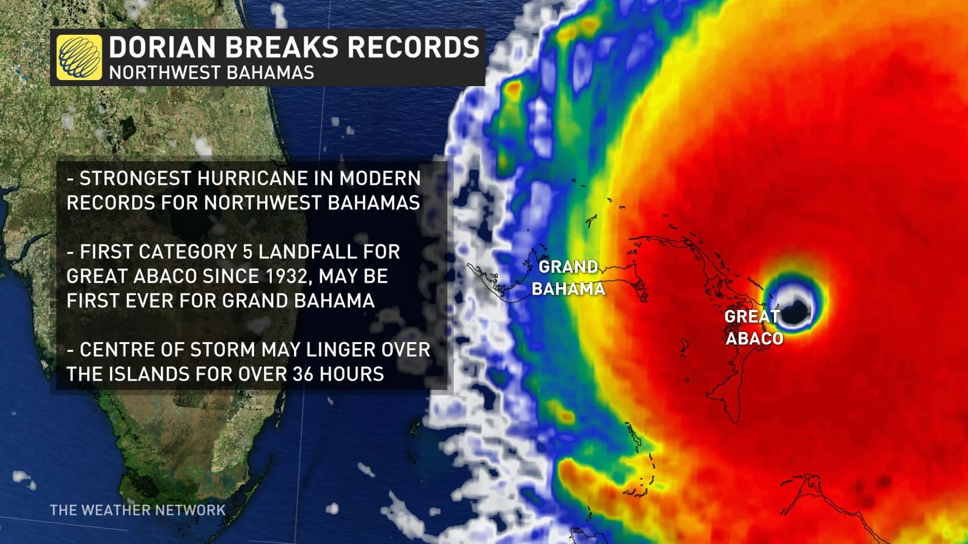
Hurricane Dorian, now a Category 5 storm, is being called the strongest hurricane in modern records for the northwestern Bahamas and is expected to bring "catastrophic" conditions to the Abaco Islands.
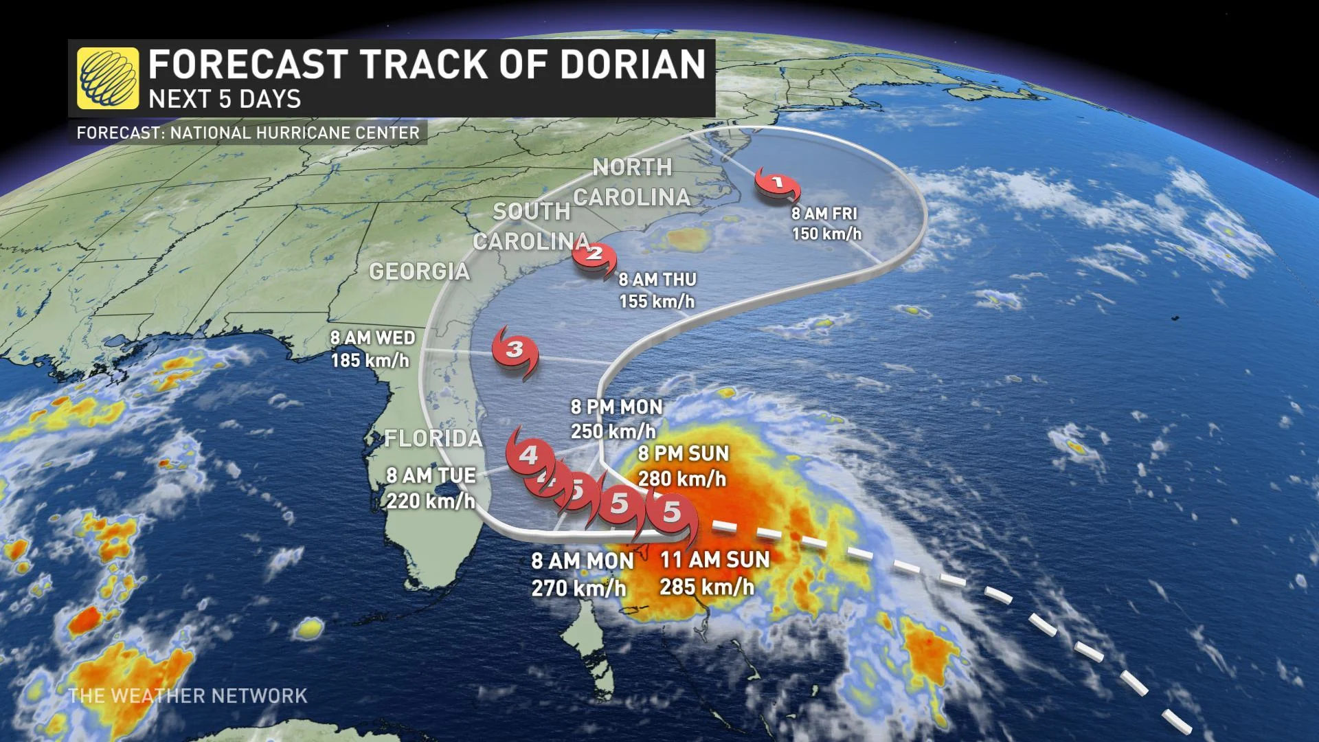
The eye of the hurricane is crawling over the Abaco Islands and is aiming toward Grand Bahama, where it could make landfall either Sunday evening or early Monday.
This is according to the U.S. National Hurricane Center, which issued its latest update Sunday afternoon. The storm made landfall in Elbow Cay in Great Abaco Island at 5:40 p.m. EDT with Category 5 strength. It is expected to bring a life-threatening storm surge, damaging winds and extreme amounts of rainfall.
Air Force Reserve Hurricane Hunter aircraft had measured a maximum sustained wind speed of 295 km/h at the time of landfall. This would tie a record wind intensity (with the 1935 Labour Day hurricane) in the Atlantic basin when it came ashore, although this measurement is preliminary and is subject to change when re-analysis is done by the U.S. National Hurricane Center.
Dorian is currently moving west at 7 km/h. A slower westward direction should continue for the next day or two, followed by a gradual turn toward the northwest. Dorian is expected to remain a powerful hurricane during the next few days.
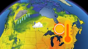
The Canadian government has issued several travel advisories due to the impacts of Dorian. Canadians are urged to avoid all travel to the Bahamas and all non-essential travel to Florida.
WATCH BELOW: DORIAN SLAMS INTO BAHAMAS AS A CATEGORY 5 HURRICANE
A hurricane warning has been issued for the northwestern Bahamas excluding Andros Island, where a hurricane watch is in effect. Jupiter Inlet to the Volusia/Brevard County Line is also under a hurricane warning.
Hurricane watches have been extended to parts of Florida's east coast from north of Deerfield Beach to Jupiter Inlet and Volusia/Brevard County Line to the Flagler/Volusia County Line.
According to Weather Network meterologist Daniel Liota, this is the first Category 5 hurricane to make landfall on the island of Great Abaco since 1932 and could be the first to directly hit Grand Bahama.
"The slow-moving nature of Dorian will make this storm particularly destructive as its centre may spend more than 36 hours traversing these islands of the northwest Bahamas, bringing life-threatening flash flooding and storm surge, as well as catastrophic winds," said Liota.
In Florida a state of emergency was declared last week due to the expected dangerous surf, damaging winds, and potential for life-threatening flash floods.
A mandatory evacuation was ordered for Brevard County’s barrier Island and is set to take effect at 8 a.m. on Monday as Dorian approaches. A state of emergency is also in effect for North Carolina, South Carolina and several counties in Georgia.
“On this track, the core of extremely dangerous Hurricane Dorian will continue to move over Great Abaco and move near or over Grand Bahama Island later tonight and Monday. The hurricane should move closer to the Florida east coast late Monday through Tuesday night,” the U.S. National Hurricane Center says.
CATEGORY 5 DORIAN WILL IMPACT BAHAMAS SUNDAY WITH LIFE-THREATENING STORM SURGE, FLASH FLOODS
In the Abaco and Grand Bahama islands, as well as surrounding regions, a life-threatening storm surge will raise water levels between 5.5 to 7 metres. Near the coast, the surge will be accompanied by large and destructive waves.
"Do not be foolish and try to brave out this hurricane," Bahamanian Prime Minister Hubert Minnis said at a press conference Friday. "The price you may pay for not evacuating is your life."
WATCH BELOW: SIGNIFICANT RAINFALL TOTALS FOR BAHAMAS, LOWER AMOUNTS IN U.S.
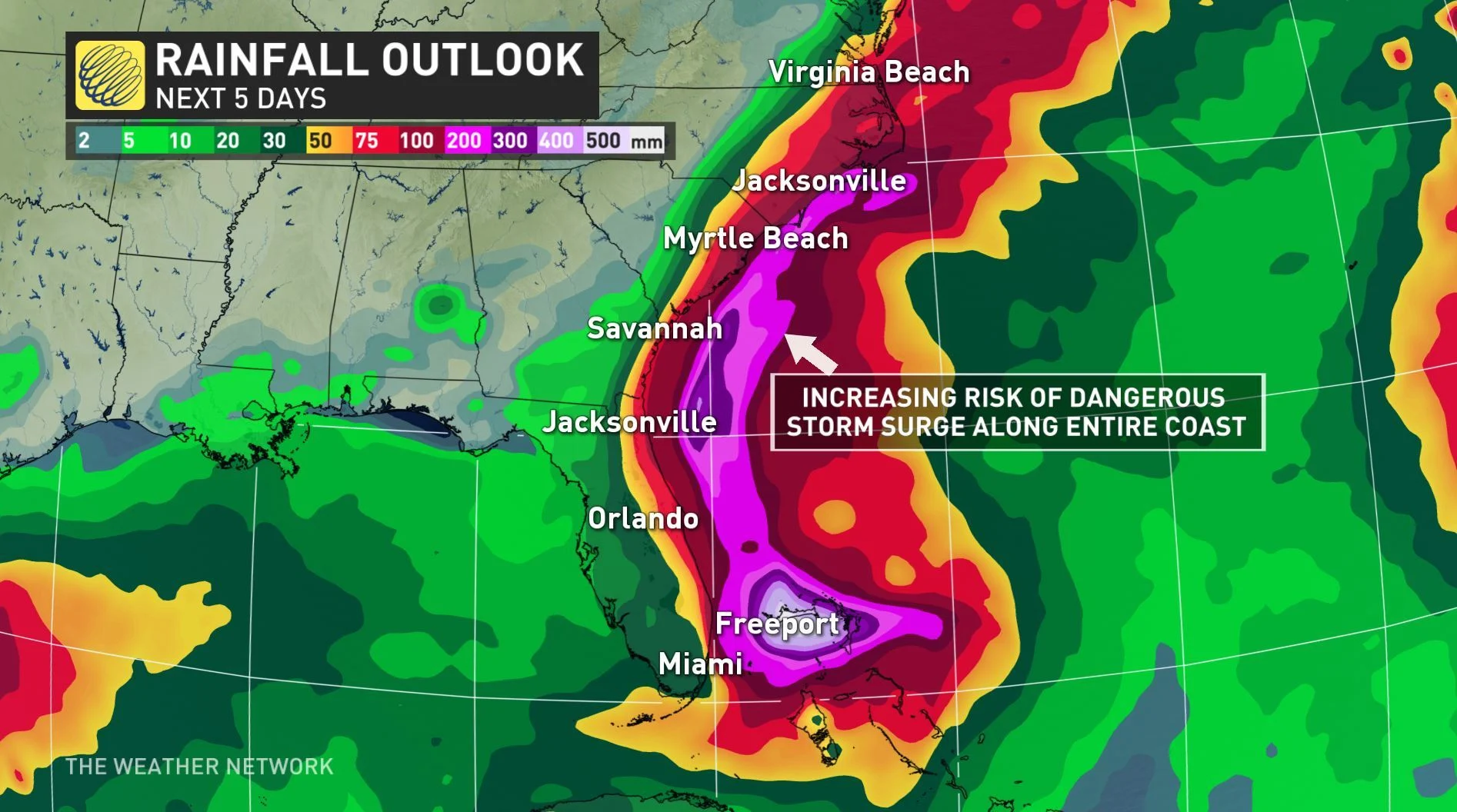
The northwestern portions Bahamas are now looking at possible rainfall amounts between 300 to 600 mm or more, with isolated regions seeing totals exceeding 750 mm. This significant rainfall has the potential to result in life-threatening flash flooding and cause extensive damage to roads and property.
In the U.S., rainfall amounts will be significantly lower in comparison, with 50 to 100 mm expected for the Atlantic coast from the Florida peninsula through Georgia. Isolated areas could see as much as 150 mm.
"Some fluctuations in intensity are likely, but Dorian is expected to remain a powerful hurricane during the next few days," the U.S. National Hurricane Center says.

The Weather Network's Mark Robinson and Jaclyn Whittal, along with storm chaser George Kourounis, will be in Florida this weekend to capture the impacts of Hurricane Dorian as it approaches and makes landfall. Follow them on Twitter as they post live updates.
SEE ALSO: Wildlife center seeks foster homes for hundreds of animals ahead of Dorian
UNCERTAINTY OVER FORECAST TRACK REMAINS
There is still some uncertainty in Dorian’s forecast track. Some of the possible forecast scenarios include Dorian tracking towards the coast of Florida or a track farther to the north, which would further impact Georgia and the Carolinas. At this point, there is increasing confidence that Dorian will remain offshore and skim the coast.
Why isn't this a straight forward forecast? Dorian's track relies on several factors including the position of the high-pressure system over the Atlantic Ocean, just off the U.S. east coast.
This high-pressure system essentially controls the track of Hurricane Dorian and subtle position and strength changes in that high pressure system will result in slight shifts to Dorian's path. These slight changes in movement are what forecasters need to determine in order to know where Dorian will impact.
Due to the fact that we don't know exactly what path Dorian will take, it is important that anyone along the U.S. southeast coast from Florida to the Carolinas continue to monitor forecasts closely. Forecasters are confident Dorian will remains a major hurricane through the coming days.