Officials order 14 more properties to evacuate from fire north of Fort St. John
Visit The Weather Network's wildfire hub to keep up with the latest on the active start to wildfire season across Canada.
Emergency authorities in the Peace region added 14 more properties to those ordered to evacuate from a massive, out-of-control wildfire on Sunday night.
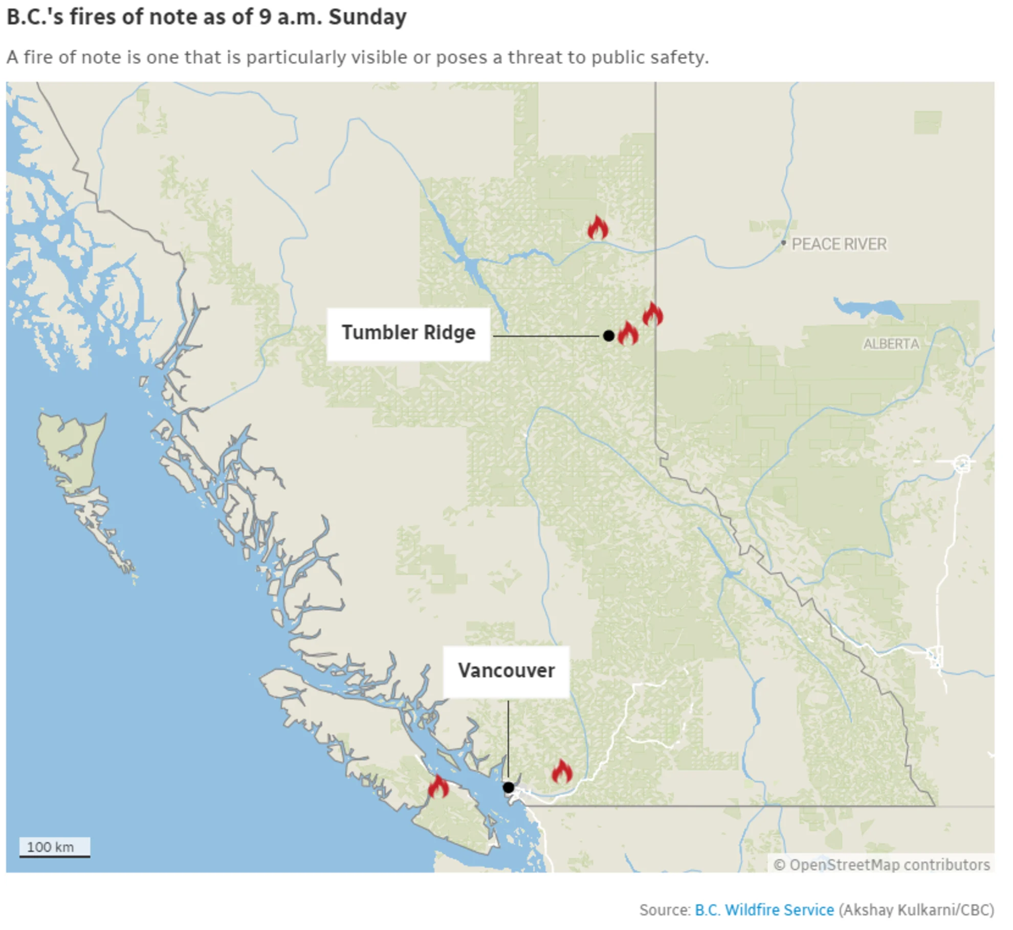
They are the latest evacuation orders from the district related to the massive Donnie Creek fire, which is one of the largest recorded in B.C. at 4,050 square kilometres in size.
They are the latest such orders in the province, which as of Sunday had 82 active fires, nearly half of them classified as out of control.
Wildfires continue to upend life for many British Columbians. On Saturday, the Northern Rockies Regional Municipality issued evacuation orders in northern B.C. due to a fire in the Ittsi Creek and Maxhamish Lake area, covering portions of Maxhamish Lake Provincial Park in B.C.'s far north.
The wildfire that prompted those orders is currently burning west of the provincial park and had grown Sunday to 22 square kilometres, more than doubling in size overnight.
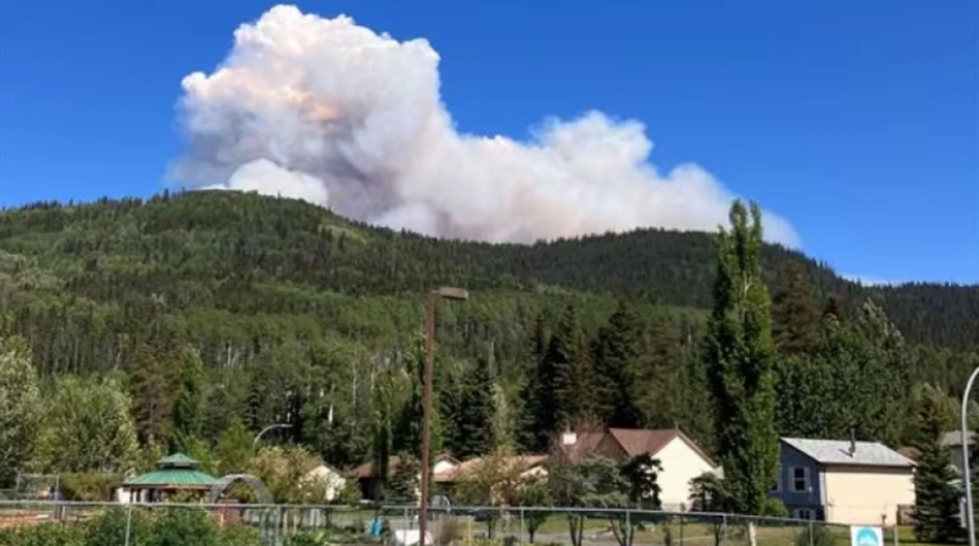
In Tumbler Ridge, in the province's northeast, evacuation orders and alerts have remained in place for the 2,400 residents of the town due to the West Kiskatinaw River wildfire, which was within three kilometres of the townsite earlier in the week.
While the large fire — burning over an area of 197 square kilometres — led to concern for the town, located in a UNESCO Global Geopark, fire officials said they hoped cooler conditions and a wind shift on Saturday would aid them throughout the weekend.
"Weather prediction is for calm and clear conditions [Sunday] morning, which will help crews continue to work on establishing guards and containment lines to protect Tumbler Ridge," read a status update from the town.
WATCH: Wildfire engulfs Tumbler Ridge, B.C.
The nearby Peavine Creek blaze continues to burn close to Highway 52, which has meant the indefinite closure of the route near the B.C.-Alberta border.
An evacuation alert means residents should prepare to evacuate their homes, possibly with little to no notice. An evacuation order means a resident should leave immediately.
Vancouver Island highway remains shut
The Cameron Bluffs wildfire continues to burn near Port Alberni on Vancouver Island, covering a small area just south of Cameron Lake. The wildfire is right next to Highway 4, prompting the closure of the major east-west route on Tuesday.
A detour, which extends travel time by four more hours, was set up using logging roads earlier in the week, with officials saying only essential travel should be undertaken due to the treacherous nature of the route. It features rough roads and some single-lane bridges. There is no cellphone service along the stretch.
In a statement on Saturday, the province said four convoys of commercial vehicles will be guided along the route daily beginning Sunday morning. The convoys are set to carry essential goods morning and evening until further notice.
"Commercial vehicles will also be permitted to travel outside of these windows, however, there will be no pilot vehicles at those times," the statement read. "Other drivers will be placed behind the convoys because the priority is the movement of essential supplies, such as fuel and food."
The first convoy left from Lake Cowichan, on the other end of the long detour, at 5 a.m. Sunday.
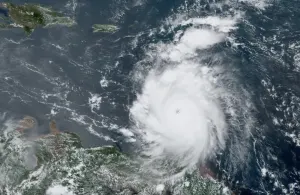
Thumbnail image courtesy: B.C. Wildfire Service
The article was originally published by CBC News