Evacuation order lifted in northeast B.C. as fire conditions ease
The latest:
An evacuation order for the District of Chetwynd and surrounding area has been lifted.
Evacuation alerts remain in place for properties that were previously under the evacuation order, with residents told to be ready to leave at a moment's notice.
The B.C. Wildfire Service says the fire did not grow significantly overnight, and calmer winds combined with precipitation are encouraging signs that no further evacuations will be ordered.
Highway 97 between Chetwynd and Prince George has been reopened to single-lane alternating traffic.
CANADA'S WILDFIRES: Visit The Weather Network's wildfire hub to keep up with the latest on the active start to wildfire season across Canada.
Earlier story:
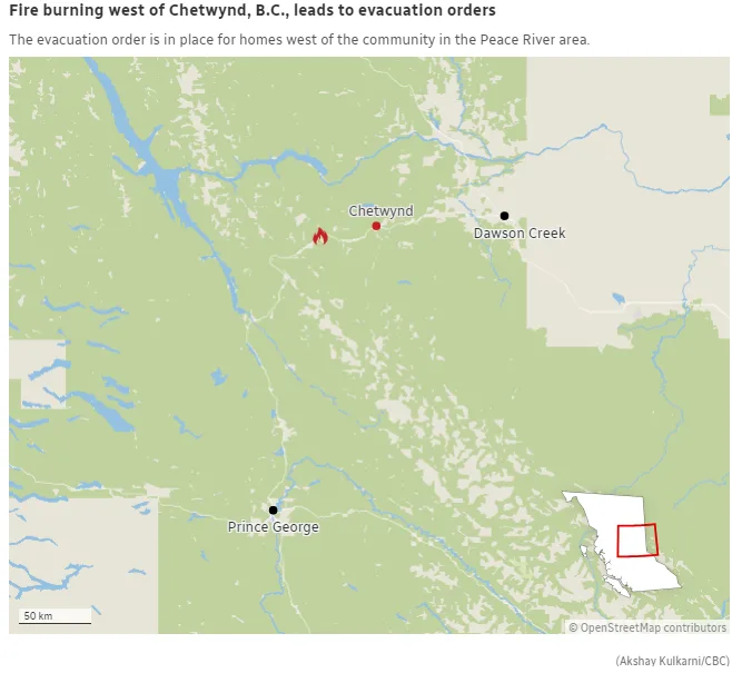
Highway 97 between Chetwynd and Prince George, B.C., was closed and evacuations of some neighbourhoods in the District of Chetwynd ordered as a wildfire in the region grew rapidly on Wednesday.
The B.C. Wildfire Service says ground crews and air tankers are responding to the Wildmare Creek wildfire that grew to 0.5 square kilometres on Wednesday.
Fire information officer Sharon Nickel said the blaze was discovered around 4 p.m. PT, and is burning around 10 kilometres southwest of Chetwynd. The community is around 720 km northeast of Vancouver, and 210 km northeast of Prince George.
"The area is experiencing sustained winds and those are coming from the southwest," she told CBC News Wednesday evening. "That's sort of pushing any kind of fire growth that we're seeing towards the north-northeast ... in the direction of Chetwynd."
The Peace River Regional District issued an evacuation order for the Pine River area, along with an evacuation alert for properties northeast of that area.
The order extends to an area directly west of Bisset Creek, south to the Pine River, and east to Wildmare Creek, including all properties on the north side of the highway, the order says.
Everyone covered by the evacuation order has to leave immediately due to the risk to life and property. It is not clear how many properties are included in the evacuation order.
DriveBC said Highway 97 is closed from the Stone Creek subdivision to the Kurjata subdivision, which is just four kilometres south of Chetwynd.
Highway 97 is the primary route connecting Chetwynd, and other areas of B.C.'s Peace region, to Prince George and the rest of the province.
The B.C. Wildfire Service says the blaze appears to have been human-caused, a broad category that applies to all wildfires not sparked by lightning.
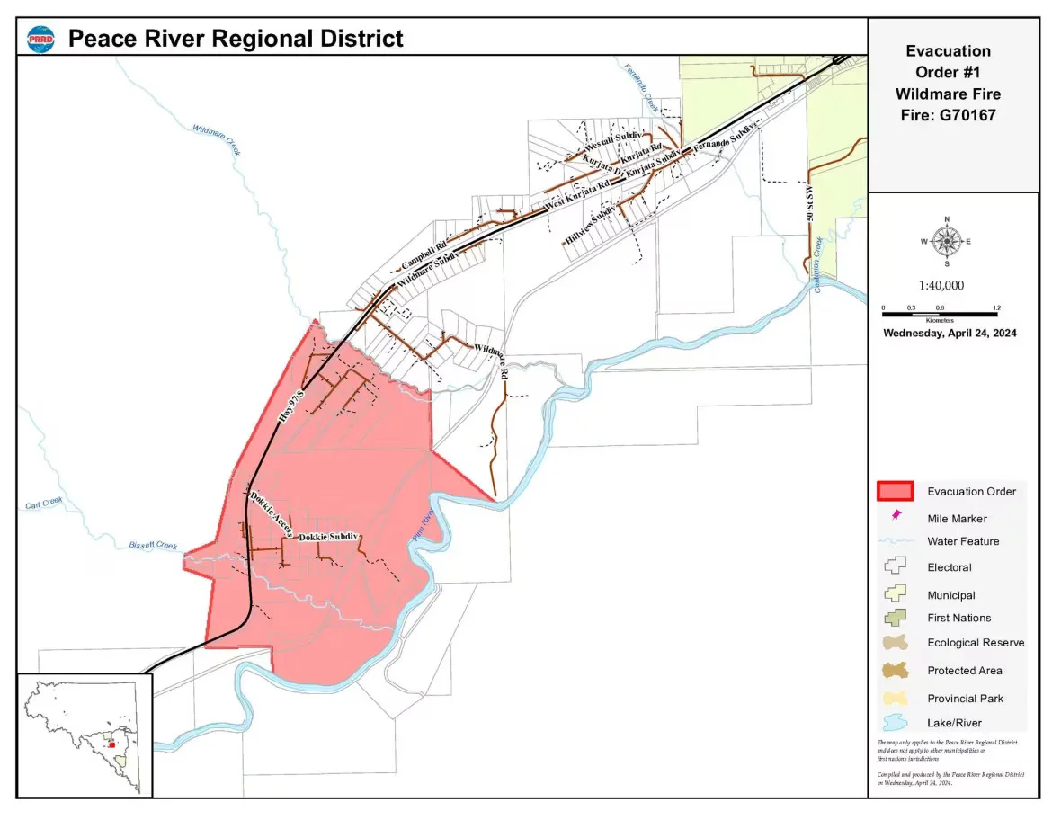
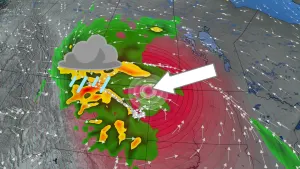
The area highlighted in red is under an evacuation order by the Peace River Regional District due to the out-of-control Wildmare Creek wildfire. (Peace River Regional District)
RELATED: Your guide to B.C. wildfires: Maps, evacuation alerts, air quality and more
Chetwynd Mayor Allen Courtoreille said the community of around 2,500 people was standing by and an evacuation office was ready for anyone leaving their homes.
"It's pretty disturbing that we were thinking this way, but facts and reality [is] that we don't have that groundwater to suppress any of the ... sparks that might hit the ground," Courtoreille told CBC News. "We've been worried about this since last year when we were in the drought state."
Nickel said persistent drought conditions have been observed throughout the Peace region.
"Every bit of fuel that is available there is quite dry," she said. "It is a high grass fire hazard and ... grass fires are quite common in the Peace this time of year."
Nickel says more resources would be arriving to fight the fire going into Thursday, and anyone seeking to travel in the area should check DriveBC and avoid the area if possible.
"[Highway 97] is closed because, obviously, the fire is in close proximity to the highway," the information officer said.
"In the interest of public safety, general areas will be closed so that we can undertake those suppression actions," she added.
Dry, dangerous conditions
Open burning bans are in place for the region as drought conditions still cover much of B.C.
Fire officials are worried about another challenging season after last year's record destruction, when fires scorched more than 28,000 square kilometres, destroyed hundreds of homes and displaced thousands of people.
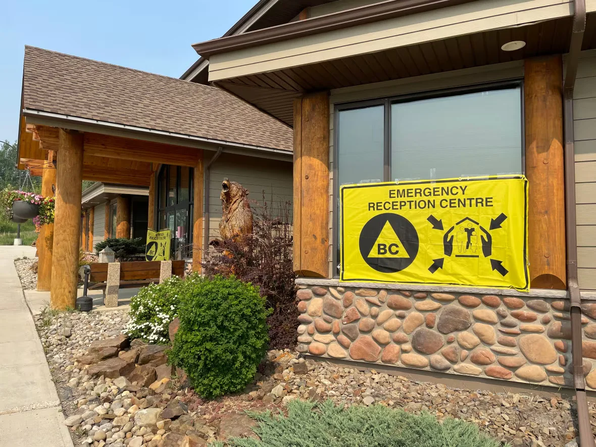
An emergency reception centre in Chetwynd, B.C., during the 2023 wildfire season. (Nicole Oud/CBC)
SEE ALSO: How to fight wildfires from the air
A wildfire evacuation alert issued in the tiny town of Endako, northwest of Prince George, has been rescinded, while another alert for the Burgess Creek wildfire in the Cariboo remains in place, with residents told to be ready to leave on short notice.
The 118-square-kilometre Burgess Creek fire about 600 kilometres north of Vancouver continues to burn out of control, according to the wildfire service website, while the 25-hectare blaze that had been threatening Endako, a further 400 kilometres northwest, has now been contained.
There have been 177 fires in B.C. this year, burning 20.55 square kilometres. Of the 115 now burning, 44 started in the third week of April.
Nickel said anyone seeking to access the backcountry, heading into camping season, should ensure they have spark arrestors if they are using all-terrain vehicles or quad bikes.
WATCH NOW: How Canada is investing in the fight against wildfires
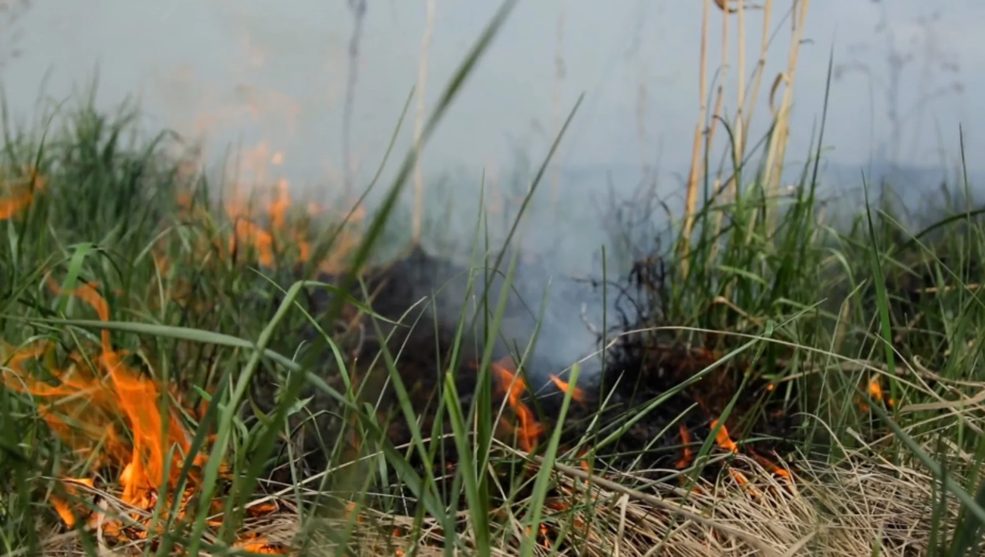
This article wwas originally published for CBC News.. Header image: File photo for illustration purposes only. Courtesy: Storyblocks.