Evacuation orders downgraded, but Pemberton residents warned to be prepared
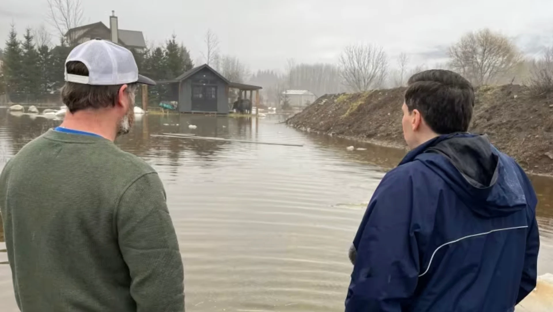
Evacuation orders for six properties in the Pemberton, B.C., area were downgraded Wednesday even as residents brace for another round of heavy rain and flooding.
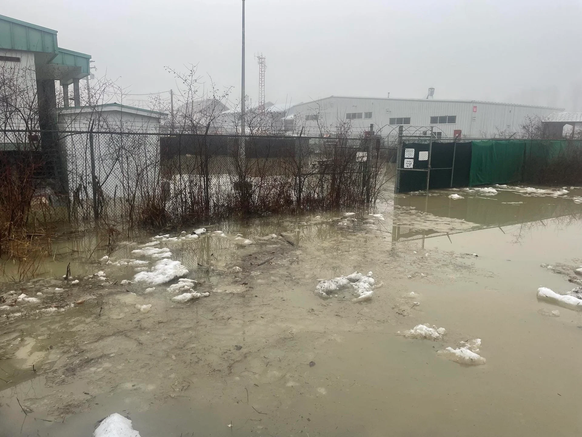
More than 50 properties are on evacuation alert in the Squamish-Lillooet Regional District due to flooding near the village, which is about 150 kilometres north of Vancouver. This includes six properties that were placed on evacuation order on Tuesday.
The village remains under a state of local emergency.
RELATED: Animals rescued after flooding hits B.C. shelter, support welcome
The evacuation alert, which says residents have to be prepared to leave at a moment's notice, covers properties located adjacent to the Arm Canal and Pemberton Creek in the village, as well as properties near the Lillooet River further southeast.
Hobby farms on Collins Road at the north end of the village were also covered by the evacuation alert. Goats, horses and chickens took cover Wednesday as their pastures turned into flooded swamps.

Days of heavy rain and snowmelt from record-high temperatures have pushed rivers over their banks and prompted flooding and warnings across southwestern B.C. Environment Canada said the Howe Sound region, which includes Pemberton and Squamish, will see about about 50 millimetres of rain before precipitation slows down on Thursday.
Jonathan Rollins, a resident of the area, said there was a "knock on the door" early Tuesday, when officials told him he had to leave his home along Airport Road. That evacuation order has since been downgraded to an alert.
Drainage ditches in Pemberton were so flooded late Tuesday, Rollins and his roommates used them to water-ski.
"We normally like to ski, but it's raining so much on the hill we can't ski 'cause there's no snow," Rollins said. "So we took our skis and a rope and we went out and found a ditch full of water and we just skied down the ditch ... being towed by the truck."

A bulletin from B.C.'s River Forecast Centre said a gauge along the Lillooet River recorded flows reaching levels seen once every five to 10 years. It states that rainfall since Friday has ranged from 70 to more than 500 millimetres across the region, while the warmth has added between 75 and 150 millimetres of snowmelt over the last three days.
The centre is maintaining flood warnings for the Lillooet, Squamish and Cheakamus rivers, saying flows were expected to rise through Friday.
SEE ALSO: Snowmobiler killed in avalanche in northeastern B.C.: Avalanche Canada
The District of Squamish said Wednesday some homes in the Northyards neighbourhood have seen "localized flooding" from the heavy rain and snowmelt, but river levels are dropping quickly and crews ran pumps last night in anticipation of more rain.
"We're not out of the woods yet," said angling guide Clint Goyette, a resident of the Brackendale area of Squamish, B.C. "This is pretty crazy how much water is coming down."
Volunteers save dogs from flooding, society says
The Pemberton Animal Wellbeing Society said on social media that staff with Blackcomb Helicopters had broken into the shelter to rescue five puppies and their mother from what it described as "dangerous rising floodwaters."
"Their swift and decisive actions saved lives and we are profoundly thankful," said the statement posted Tuesday afternoon.
A dedicated volunteer also "braved the icy floodwaters" to rescue additional animals and retrieve essential supplies, the society said.
(Pemberton Animal Wellbeing Society/Submitted)
Flood watches are in effect across the rest of the South Coast, including Vancouver Island, while high streamflow advisories cover the central and north coasts.
The province is shutting down Highway 101 at Trout Lake, just east of Halfmoon Bay on the Sunshine Coast, between 7:30 a.m. and 6 p.m., so crews can improve culverts to reduce flood risk. A statement said a detour will be available through Redrooffs Road.
WATCH: Water levels running high on the Capilano River
Thumbnail courtesy of James Mulleder/CBC.
The story was originally written and published for CBC News. It contains files from Liam Britten and The Canadian Press .