Flood watch issued for parts of B.C. already dealing with wildfires
The B.C. River Forecast Centre has issued flood watches for several parts of B.C. including the northeast Peace region, which is already dealing with out-of-control wildfires.
A flood watch was issued Sunday for rivers and tributaries around Fort St. John, Taylor, Chetwynd, Moberly Lake, Pine Pass, Hudson's Hope and Dawson Creek.
Visit The Weather Network's wildfire hub to keep up with the latest on the active start to wildfire season across Western Canada.
The river forecast centre says unseasonably hot weather over the past few weeks has led to heavy snowfall melts, which means the region is vulnerable to significant flooding as water levels rise.
It is comparing the current conditions to those of 2011 and 2016, when flooding forced people from their homes, stranded entire communities and ripped apart roads that took months to fully repair.
Environment Canada says heavy rain is expected Monday through Tuesday, with 50 to 75 mm expected in the southern Fort Nelson region though the North Peace region, and up to 100 mm expected in the South Peace region, including Tumbler Ridge.
The agency is warning of flash flooding, pooling and possible debris flow.
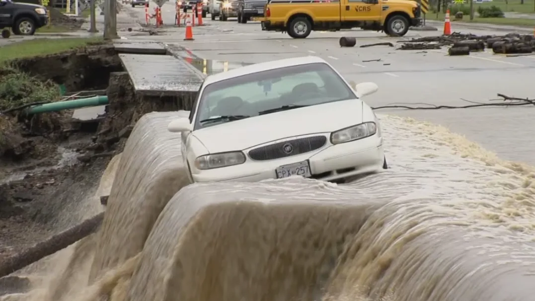
A white sedan teeters on the edge of a flooded street in Dawson Creek, B.C., in 2016. The B.C. River Forecast Centre has issued a flood warning for the city, saying weather and water conditions are similar to those that led to catastrophic flooding in northeastern B.C. seven years ago. (Brett Hyde/CBC)
In addition to the Peace region, the B.C. River Forecast Centre has issued flood watches for the Boundary, Kootenays and Columbia regions in the southeast, the Shuswap, Thompson, Bonaparte and Okanagan regions in the southern Interior and for the upper and middle Fraser River around Prince George and Quesnel.
Multiple thunderstorm watches are in effect with heavy rain forecast through Tuesday by Environment Canada.
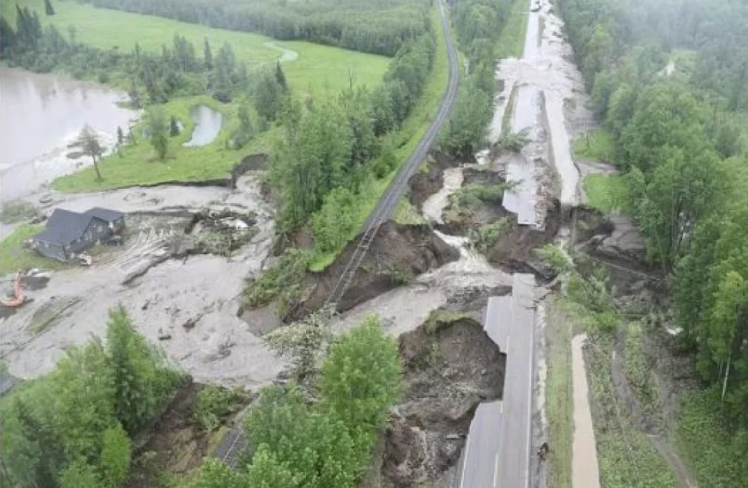
The damage from the 2016 floods took months to repair, with entire communities cut off as roads were destroyed and washed away. (B.C. Ministry of Transportation)
RELATED: Substantial rainfall lends helping hand to wildfire efforts in B.C. and Alberta
Dangers to the public
Officials say it is important to avoid rivers and streams that are under flood watches and warnings.
Swimming, fishing, boating and hiking near these rivers and streams is also discouraged.
On Friday evening, a man drowned trying to rescue a dog that had been swept away by high, fast-moving waters in West Vancouver's Cypress Falls Park, prompting a warning for pet owners, as well.
"If you are close to bodies of water, keep your dog on a leash," said Paul Markey, who led North Shore Rescue's response to the call. "And if the dog does go in, absolutely do not follow the dog in there and try not to get close to the water."
WATCH: The Science Behind: Flash flooding
Storms could help — or hinder — wildfire fight
The warning comes as the region is already dealing with several out-of-control wildfires that continue to force hundreds of people from their homes.
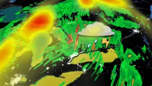
As of Sunday evening, there are more than 90 wildfires burning across the province with the majority of them in the Peace River region, including three wildfires that pose a threat to property.
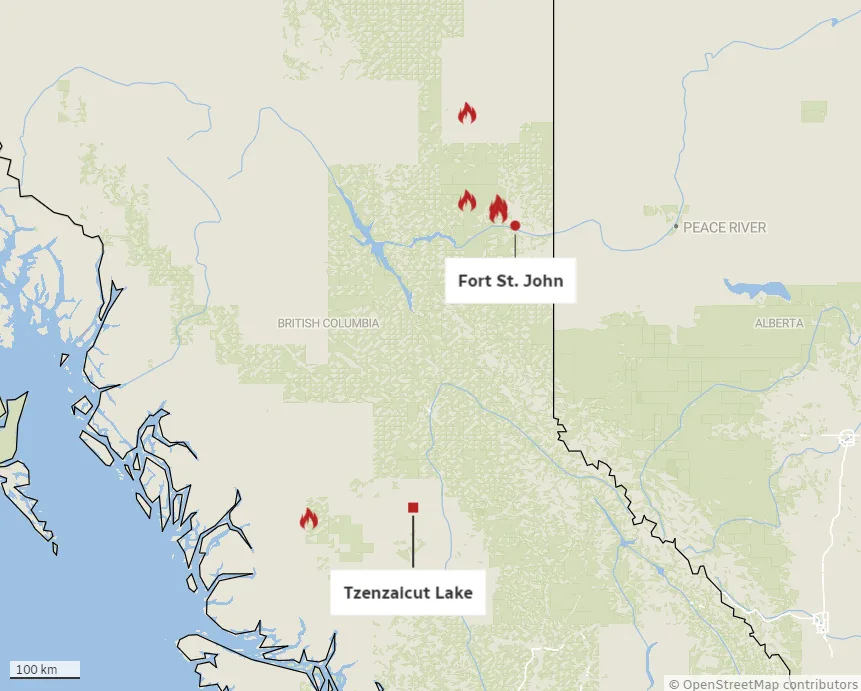
B.C.'s major fires and evacuation orders, May 21. Source: B.C. Wildfire Service (Akshay Kulkarni/CBC)
Forrest Tower, a fire information officer with the province, said there is hope the forecasted rain could help bring some of those fires — such as Red Creek and Cameron River — under control.
However, the fire service is also monitoring any lightning strikes, which could cause new fires, as the rain arrives.
"The timeline, at this point, is just when we start receiving that precipitation," he said.
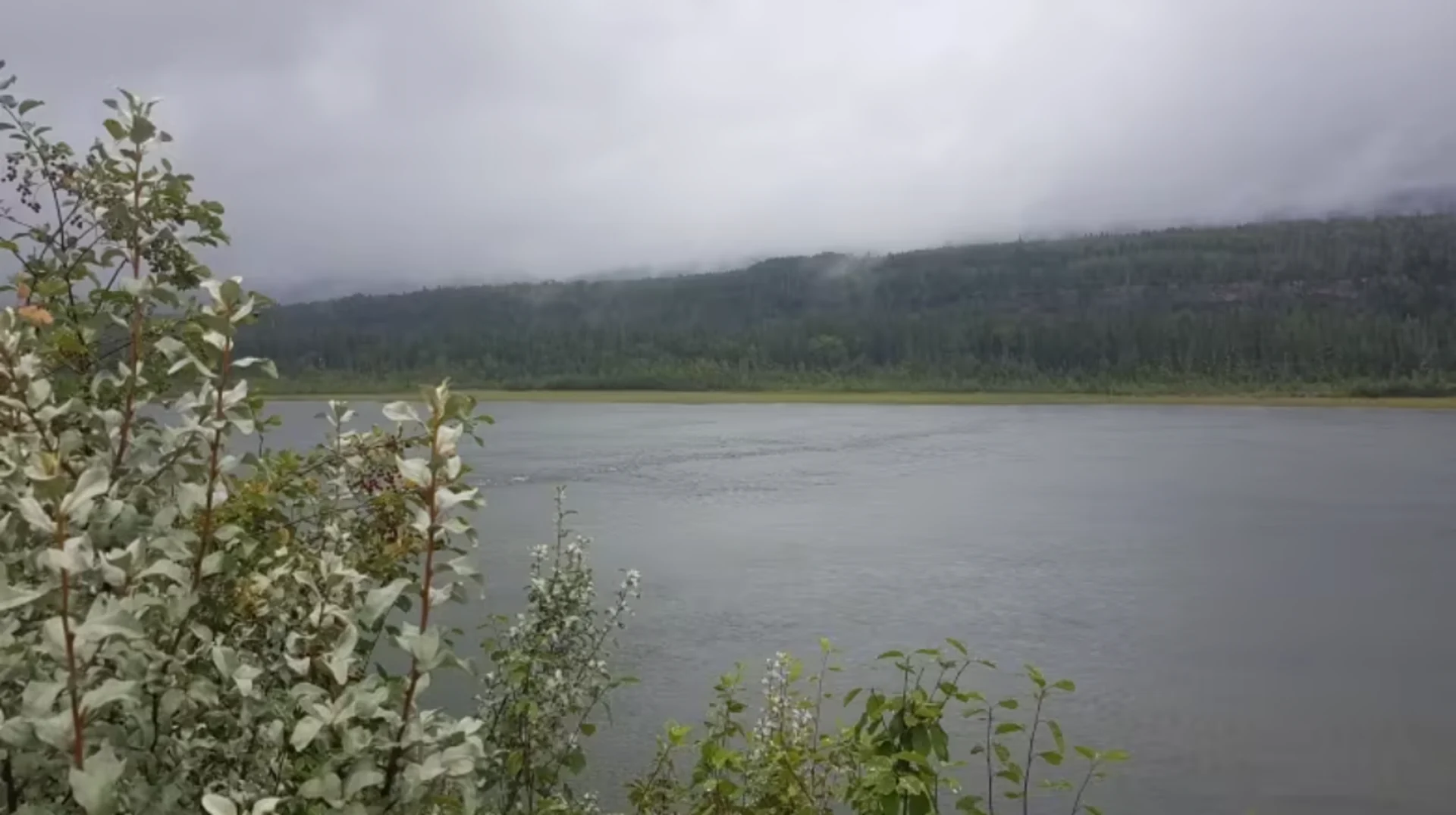
Thumbnail image courtesy of Andrew Kurjata/CBC.
This article was originally published by CBC News.