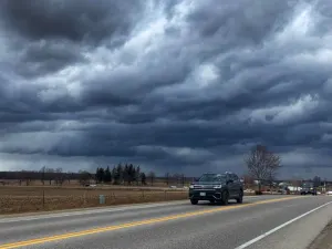
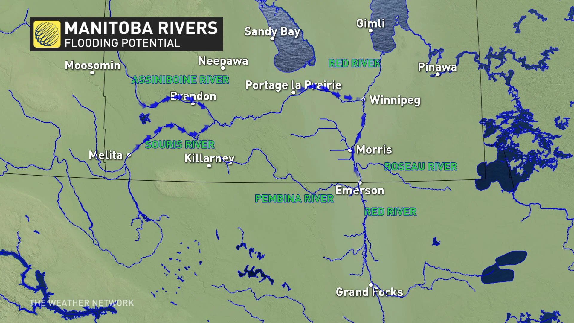
Red River to crest this week in Manitoba

A LONG WINTER, CATASTROPIC FLOODING IN THE NORTHERN PLAINS
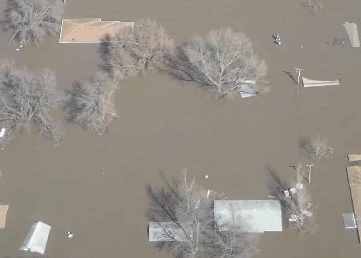
After a long winter with plenty of snow, the Northern Plains have seen their share of Spring flooding so far. In mid March the Missouri River overcame its levees after a rapid snowmelt along with heavy rain. On the Niobrara River, the Spencer Dam collapsed and the unregulated flooding destroyed three bridges downstream.
In east central Nebraska, residents along the flooded Missouri, Platte and Elkhorn Rivers were forced to evacuate as some locals experienced all-time record flooding. The Platte and Elkhorn Rivers had overflowed their levees in the greater Omaha, Nebraska region and communities were under a mandatory evacuation order, which is still in effect.
__THE RED RIVER HAS CRESTED, NOW WHAT? __
The Red River has officially crested at 35 feet on April 8 in Fargo, North Dakota. This was near record heights that were last seen in 2009. Usually this means that north of the border in Canada, we will see the Red River crest approximately two weeks later. The flooding may not be as bad as initially feared in Manitoba as less snow has fallen there over the last month and there has been an ideal gradual melt. This is great news for Canadians that live along the Red River. However, there are still sandbags being given out by local authorities and if conditions turn unfavourable, meaning more snow for either side of the border, more flooding could occur.

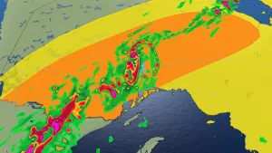
__THE FORECAST, 2 FEET OF SNOW COMING SOUTH OF THE BORDER __
A blizzard will be tracking across the Northern Plains and the Upper Midwest for Thursday. This means that we could see an additional 2 ft of snow for parts of the Red River basin stateside. If this storm happened a few weeks ago this could have led to catastrophic flooding, the timing is favourable.
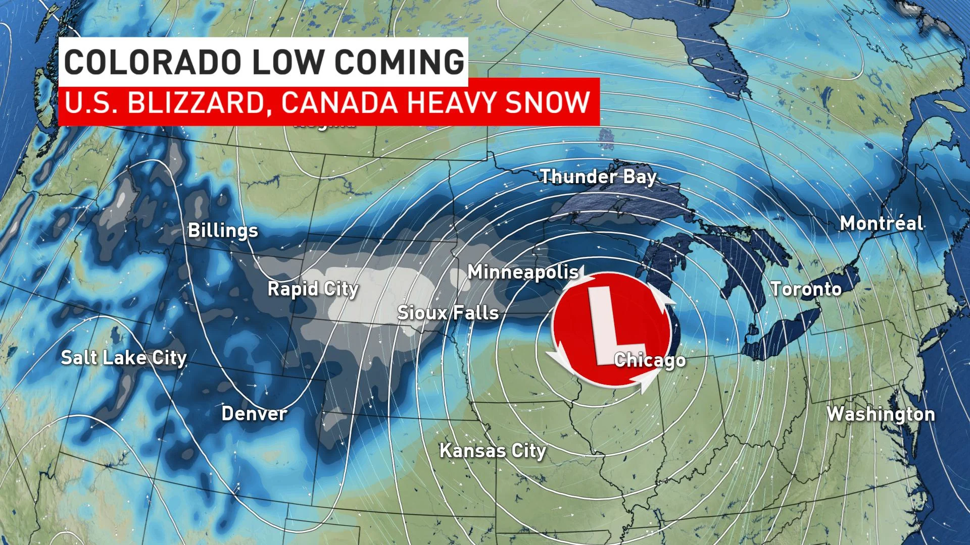
The good news is that the Red River in North Dakota will be receding already by the time the heavy snow falls. We still need to monitor areas North of Fargo for later crests in Grand Forks, ND and Emerson, MB over the coming weeks. It is possible that we see a second crest and even a "bump" in river heights after the precipitation falls over the next few days. As Canadians, we need to watch closely as all this water needs to go somewhere, and it travels from South to North.
Stay tuned to The Weather Network for the latest flooding information over the coming weeks in Canada