Hot, humid air continues to feed southern Ontario thunderstorm chances
Another day of thunderstorm opportunity appears in southern Ontario on Thursday as the intense heat and humidity continues to be a fuel for the risk
Summer has officially arrived, and the season started with quite the bang. You likely didn't need an alarm clock early Thursday morning, as strong thunderstorms brought rounds of heavy rain, rumbles of thunder and cracks of lightning through the overnight hours.
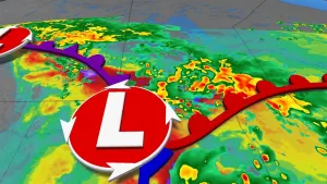
High heat and humidity are two primary drivers for thunderstorm chances, and with the ongoing heat dome parked over the Great Lakes region, the risk for thunderstorms will spill into Thursday, and continue well into the weekend across southern Ontario, as well.
MUST SEE: Storms threaten Ontario's first weekend of summer, a look into early July
Thursday
The atmosphere will remain in an unstable state on Thursday, so additional thunderstorm activity is possible, with more organized storms inland developing into the afternoon. Pockets of uneven heating throughout the day, as well as convergence, will favour some areas for storm activity over others.

If they do come to fruition, however, some of the thunderstorms could become severe due to the threat of torrential rainfall and locally gusty winds.
The atmosphere has ample amounts of moisture, so the greatest risk with these storms is the heavy rain, especially since the storms will slowly drop a lot of rain in the same location.
Regions that see sustained thunderstorm activity are capable of accumulating over 50 mm of rainfall in just a couple of hours.

RELATED: Watch? Warning? How we communicate severe weather in Canada
Another round of thunderstorm activity will be possible throughout the evening and overnight hours.
There will be the potential for localized flooding as storms move slowly across, dropping lot of rain over the same location, especially in urban areas where flash flooding is a possibility.
Widespread heat warnings remain in effect, as well, as temperatures soar well into the 30s, feeling closer to 40 with the humidex.
Friday through Saturday
The risk of storms continue into the weekend.
A higher chance of widespread storms may be possible late Friday night through the overnight hours, but with less heat and humidity in the atmosphere, there is some uncertainty if the system can sustain its strength through the night.

RELATED: Feels like 40: Days of extreme heat hit Ontario and Quebec hard
WATCH BELOW: Find out what sets this heat wave apart from the rest in Ontario & Quebec
Stay tuned to The Weather Network for more weather updates across southern Ontario.


