Hurricane Fiona, one year later: Could it happen again?

It’s been one year since historic Hurricane Fiona lashed Atlantic Canada. Could we see more storms like Fiona with the rise of climate change?
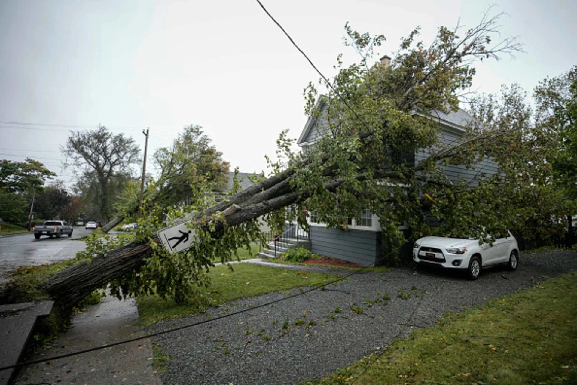
Hurricane Lee’s damaging winds and soaking rains arrived in the Maritimes almost exactly a year after Hurricane Fiona slammed the region with historic intensity, leaving such a mark that communities are still picking up the pieces today.
Fiona, often described as a once-in-a-hundred-year storm, washed away entire houses and left nearly a million people without power for days and even weeks.
One year later, we look at the circumstances that created this formidable force and seek to answer an important question for residents still weary of recent storms: Given the region’s history and the rise of climate change, could we see more storms like Fiona in the future? It’s been one year since historic Hurricane Fiona lashed Atlantic Canada. Could we see more storms like Fiona with the rise of climate change?
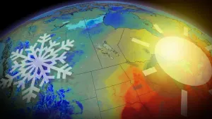
RELATED: How climate change is fuelling hurricanes
An unprecedented hurricane
Fiona was the first major storm of the 2022 Atlantic hurricane season.
The hurricane reached impressive Category 4 status with winds of more than 220 km/h after pounding island nations in the Caribbean with deadly flash flooding and damaging winds.
Several days later, Fiona arrived in Atlantic Canada under the cover of darkness on the morning of September 24, 2022.
“Everything aligned in the atmosphere to produce a once-in-one-hundred-year storm with Hurricane Fiona as it tracked over eastern Nova Scotia,” said meteorologist Tyler Hamilton. “We had an upper trough over Ontario and Quebec and these storms merged absolutely perfectly and that really allowed that pressure to fall.”

Damage in P.E.I. after Fiona (Jaclyn Whittal/The Weather Network)
While even the strongest storms tend to weaken as they race north toward Atlantic Canada, this setup made Fiona an exception to the rule. The storm transitioned into a post-tropical system as it approached Nova Scotia, allowing it to feed energy from the jet stream instead of warm ocean water.
This transition changed the inner structure of the system as it neared Canadian shores, growing its power and expanding its reach to cover almost all of the Atlantic provinces.
Fiona left a historic mark on Atlantic Canada
The sprawling storm made landfall in southeastern Nova Scotia with winds as strong as a Category 2 hurricane. Sydney, Nova Scotia, saw a wind gust of 148 km/h at the height of the storm, while Charlottetown, P.E.I., endured gusts as high as 133 km/h.
At the centre of the storm, an extraordinarily low atmospheric pressure broke the record for the lowest pressure ever recorded during a storm on Canadian soil, with a minimum pressure of 931 mb at landfall.
Fiona cemented its status as the most expensive extreme weather event in Atlantic Canada's history, causing $660 million in insured damages.
The devastating storm surge eroded and altered thousands of kilometres of coastline, felled tens of thousands of trees, and knocked out power to nearly one million people.
WATCH: Returning to Port Aux Basques nearly a year after Hurricane Fiona
The town of Port aux Basques, Newfoundland, was hit especially hard by high waves and storm surge. Around 100 houses were deemed totally inhabitable, many completely washed out to sea by Fiona’s fury.
Not many areas were spared from damage. Fiona lashed every Atlantic province with fierce winds and massive storm surge, smashing hydro towers like dominoes. In addition to southwestern Newfoundland, other areas that saw devastation included mainland Nova Scotia, Cape Breton, P.E.I., and eastern New Brunswick.
Surge suddenly rises on Cape Breton
Our trained team of meteorologists and reporters braved the elements to cover the sizable storm safely and provide up-to-the-minute information for affected residents. One year later, they look back on their most memorable moments, including trying to navigate the power outages, as well as flight and ferry cancellations.
The Weather Network meteorologist and storm hunter Mark Robinson was on the docks in Louisbourg on Nova Scotia’s Cape Breton as Fiona made landfall nearby. He recounted the moments the surge started to come in around him while he was live on-air.
WATCH: Storm surge comes 'out of nowhere' on Cape Breton
“Fiona brought in a ton of water because of the direction it was coming in [from]. It drove a huge amount of surge," Robinson recalled. "I remember we were up on top of the dock, and realized that I needed to get off the dock fairly quickly and we could see the surge starting to come in and cut us off.”
He continued: “I said 'we have to go right now, I can see the surge coming in'... And we were live on-air and they said ‘go go go go’. It was a long-term kind of surge event that kind of stayed there, it really did feel like a Deep South hurricane. The destruction that we saw in that hurricane was definitely more than any hurricane I've ever been through in the Maritimes.”
Century-old trees fall on Prince Edward Island
Jaclyn Whittal, another meteorologist and storm chaser at The Weather Network, covered the storm from Charlottetown, Prince Edward Island.
Whittal and her team were able to drive around at first, but the winds quickly picked up and made conditions too unsafe to stay on the roads.

Downed tree in Carlottetown, P.E.I., following Fiona. (Jaclyn Whittal/The Weather Network)
“It became kind of scary and we decided to take shelter until it eased. The next morning there were so many oak trees and maple trees in downtown Charlottetown that had been there for hundreds of years. It was very sad.”
A day after the storm, Whittal encountered something remarkable while touring Cavendish on the north side of the island.
“The ocean was churned up so much because of the storm surge and winds, and because of the red soil on P.E.I., the ocean became a sea of orange. Literally, the ocean turned orange,” she recounted.
It wasn’t long before the scope of Fiona’s damage became clear.
“The storm surge damage on the north shore of P.E.I. was awful,” Whittal said. “So many people lost their homes, and a lot of these areas are on flood plains and they don’t have flood insurance. It was an awful situation there.”

Damage on the north shore of P.E.I. following Fiona (Jaclyn Whittal/The Weather Network)
Whittal also recounted how much Fiona’s immediate aftermath affected basic infrastructure across P.E.I. “The airport was shut down in Charlottetown, we had to find a way over the Confederation Bridge. There was no gas on the island...it was very difficult to find gas.”
Halifax loses power in the wind-driven rains
The Weather Network reporter Nathan Coleman lives in Halifax and reported from the damage around mainland Nova Scotia. He was live on-air all night as Fiona bore down on the province.
“Winds were picking up, branches were down, whole trees were coming down, the power was out, and everything was completely dark,” Coleman said. “The rain was non-stop. I was getting completely soaked.”
WATCH: Tree carnage scatters Halifax streets following Fiona
Coleman recounted how difficult it was to film during the height of the storm in Halifax.
“I was trying to cover my camera as best I could but I was completely soaked—it was near impossible. I ended up going live from midnight to 4 a.m. When I got up, my own home had no power. And there was no signal. I had no way of contacting the producers, no way of contacting power companies with all the trees down on lines. There was no signal.”
“This was a big problem if you’re in an emergency situation and you want to call 911.”
Nathan Coleman reported from a causeway completely destroyed by Fiona, leaving no access to a Nova Scotia community:
The devastating aftermath
In the days after Fiona, multiple states of emergency were called throughout the region. Military and federal assistance was requested as displaced residents filled shelters and roads were unsafe to travel on. Some residents and businesses were without power for weeks.
The storm’s extreme toll across the Caribbean and Atlantic Canada forced meteorologists to retire the name Fiona, meaning it won’t be used again to name tropical storms or hurricanes in the Atlantic basin.
When the time comes for 2022's hurricane names to be used again, 'Fiona' will be replaced by 'Farrah'.
Climate change could bring future storms at Fiona’s level
Fiona underscores the need for future planning and resilient infrastructure with the possibility of climate change bringing severe weather like this more frequently, along with all the new challenges associated with a heating world.
RELATED: What the science says about hurricanes and climate change
The Weather Network meteorologist Tyler Hamilton reiterated Atlantic Canada’s vulnerability to extreme weather with regard to sea level rise. As land sinks across Atlantic Canada, storm surge will become an advanced threat in the years ahead due to sea level rise—which could be as high as 1 metre by the end of the century.
Hamilton also pointed out that we could see more frequent opportunities for strong storms to develop across the Atlantic basin, increasing the risk to communities across the East Coast.
“The threat of flooding and flash flooding with hurricanes will go up as we warm the atmosphere, and so will the intensity,” Hamilton said. “We’re noticing the threat of rapid intensification increase—that means hurricanes that really throttle up their intensity with little notice, or on the other hand, storms that weaken but still hold their storm surge potential.”
WATCH: Hurricanes are growing more intense, and climate change is probably to blame
What five historic Atlantic storms all have in common
Fiona is another entry in Atlantic Canada’s storied history of intense storms sweeping across the region.
We’ve seen five noteworthy tropical systems hit the region over the past 20 years, including Juan in 2003, Igor in 2010, Dorian in 2019, Fiona in 2022, and Lee in 2023.
All five storms caused significant power outages across the region. Lee knocked out electricity to nearly a quarter of a million people across the Maritimes in September 2023, though most service was restored soon after the storm.
Dorian left its mark as the most destructive storm and the most power outages ever recorded in a storm when it struck in September 2019. That record stood for just three years until Fiona swept through the region.
Hurricane Igor hit Newfoundland particularly hard nearly a decade earlier in September 2010, and Hurricane Juan pushed a storm surge of 2 metres into Nova Scotia back in September 2003.
Notice the trend? All five storms occurred in September, which is the peak of Atlantic hurricane season. The changing seasons help to steer some of that bustling tropical activity toward Canadian soil.
“Cool air masses coming down from Canada scoop up these hurricanes that are meandering around the Atlantic basin,” explained Hamilton. The ocean is at its warmest this time of year, as well. Water like a bathtub will slingshot the threat of hurricanes around Atlantic Canada in September.”
Hamilton added that major storms hitting in the late summer and early fall can even cause more damage than a powerful winter storm.
“In September, you have to be on the lookout for more significant power outages. All the trees have their foliage. That means you’re more vulnerable to outages, and that’s exactly what we saw with Fiona.”
(Thumbnail credit: Photo by Drew Angerer/Getty Images shot on September 24, 2022 in Sydney, Nova Scotia on Cape Breton Island, Canada. Editorial #: 1243482219).